Safety Score: 3,0 of 5.0 based on data from 9 authorites. Meaning we advice caution when travelling to United Kingdom.
Travel warnings are updated daily. Source: Travel Warning United Kingdom. Last Update: 2024-04-19 08:03:45
Delve into Gainsborough
The district Gainsborough of Ipswich in Suffolk (England) is a district located in United Kingdom about 67 mi north-east of London, the country's capital town.
In need of a room? We compiled a list of available hotels close to the map centre further down the page.
Since you are here already, you might want to pay a visit to some of the following locations: Tiptree, Snetterton, Shropham, Hellington and Rockland Saint Mary. To further explore this place, just scroll down and browse the available info.
Local weather forecast
Todays Local Weather Conditions & Forecast: 8°C / 46 °F
| Morning Temperature | 4°C / 38 °F |
| Evening Temperature | 7°C / 45 °F |
| Night Temperature | 2°C / 36 °F |
| Chance of rainfall | 0% |
| Air Humidity | 59% |
| Air Pressure | 1028 hPa |
| Wind Speed | Moderate breeze with 13 km/h (8 mph) from South |
| Cloud Conditions | Overcast clouds, covering 97% of sky |
| General Conditions | Overcast clouds |
Sunday, 21st of April 2024
8°C (47 °F)
3°C (37 °F)
Overcast clouds, moderate breeze.
Monday, 22nd of April 2024
10°C (49 °F)
4°C (40 °F)
Light rain, gentle breeze, overcast clouds.
Tuesday, 23rd of April 2024
10°C (49 °F)
3°C (37 °F)
Light rain, moderate breeze, scattered clouds.
Hotels and Places to Stay
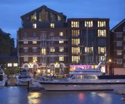
Salthouse Harbour
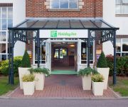
Holiday Inn IPSWICH - ORWELL
Novotel Ipswich Centre
Lattice Lodge
pentahotel Ipswich
Innocence Rooms East
Belstead Brook Muthu Hotel
Best Western Claydon Country House
Holiday Inn IPSWICH
The Station Hotel
Videos from this area
These are videos related to the place based on their proximity to this place.
Staghorn Beetles in Ipswich
Staghorn beetles Spring 2007 in my garden, Ipswich Suffolk UK. Good close-up footage, and iffy flying footage trying to follow something which can't control itself in the air at all.
Sim City Episode 15
Control Net is a tricky thing to get right... which is a problem in itself, but I make this much harder when I use it alone to deal with a smelly problem...
Bridget Keevil and Travel Stop
Video shot for Bridget's nomination for Businesswoman of the year award.
SuffolkBlue plays: Cities Skyline (Ep 01)
Cities Skylines is a fantastic city building game available on Steam. With fantastic graphics, challenging real city issues and mountains of city micromanagement - join me as I create my very...
SuffolkBlue plays: Cities Skyline (Ep 02)
Cities Skylines is a fantastic city building game available on Steam. With fantastic graphics, challenging real city issues and mountains of city micromanagement - join me as I create my very...
SuffolkBlue plays SimCity - Episode 16
Right... I think I have got this Control Net thingy sorted out... We prepare for our next city in the region by expanding out electronics industry yet further.
SuffolkBlue plays: Cities Skyline (Ep 04)
Our city is expanding - so I decide to push on and create a new district called Victoria. I also show you the three new mods I have added for trees, city stats and the all important 1st person view!
Sam Newman ('96) Drops 30 Points in First Quarter WITHOUT A MISS! 7/7 thees
Subscribe NOW to be the first to see our new vids! Click here to subscribe - http://bit.ly/OTsub Copleston's Sam Newman goes OFF in the EABL, dropping 30 points in the first quarter without...
Bristol Lodekka departure
An Eastern Counties Bristol Lodekka departs Ipswich Transport Museum for a trip during the museum's 'Come and ride on our buses' event.
Snowy Commute
It has snowed around where I live and where I work, although we have got off pretty lightly compared to other parts of the country. It's all very pretty, but it adds a lot of time to my daily...
Videos provided by Youtube are under the copyright of their owners.
Attractions and noteworthy things
Distances are based on the centre of the city/town and sightseeing location. This list contains brief abstracts about monuments, holiday activities, national parcs, museums, organisations and more from the area as well as interesting facts about the region itself. Where available, you'll find the corresponding homepage. Otherwise the related wikipedia article.
Christchurch Mansion
Christchurch Mansion is a substantial Tudor brick mansion house within Christchurch Park on the edge of the town centre of Ipswich, Suffolk, England. It is now owned by the town and since 1895 has formed one of the two principal venues of the Ipswich Corporation Museums, now part of the Colchester and Ipswich Museum Service.
Ravenswood, Ipswich
Ravenswood is a district within Ipswich, Suffolk, UK. It is sited on the old Ipswich Airport to the south-east of the town. The area is one experiencing rapid growth in housing numbers from private housing developers. In total, 1,250 houses and apartments are likely to be built with an affordable housing ratio of 30%.
Derby Road railway station
Derby Road railway station serves the Rose Hill area of Ipswich in Suffolk, England. It is on the Felixstowe Branch Line,6.10 miles from Ipswich railway station at milepost 74¾. The railway station was opened by the Felixstowe Railway and Pier Company in 1877. Passenger trains in 2012 are operated by Greater Anglia but the line also carries numerous freight trains to the Port of Felixstowe which are operated by DB Schenker, Freightliner and GB Railfreight.
Ipswich (UK Parliament constituency)
Ipswich Listen/ˈɪpswɪtʃ/ is a constituency represented in the House of Commons of the UK Parliament since 2010 by Ben Gummer, a Conservative.
Clifford Road Air Raid Shelter
The Clifford Road Air Raid Shelter, located under the playground of Clifford Road Primary School in Ipswich was built during the first months of World War II. It was an unusually solid construction, capable of holding several hundred people. After the war, it was sealed up and largely forgotten. In 1989, workmen digging a pond in the school grounds discovered one of the original stairways leading into the shelter. The structure had survived with little more than a few leaks.
Orwell Bridge
The Orwell Bridge was opened to road traffic in 1982 and carries the A14 (then A45) over the River Orwell just south of Ipswich in Suffolk, England. The main span is 190 metres which, at the time of its construction, was the longest pre-stressed concrete span in use. The total length is 1,287 metres from Wherstead to the site of the former Ipswich Airport. The width is 24 metres with an air draft of 43 metres. Pilings were sunk 40 metres into the river bottom.
Ipswich Martyrs
The Ipswich Martyrs were nine people burnt at the stake for their Protestant beliefs around 1538-1558. The executions were mainly carried out in the centre of Ipswich, Suffolk on The Cornhill, the square in front of Ipswich Town Hall. At that time the remains of the medieval church of St Mildred were used for the town's Moot Hall. Later, in 1644 Widow Lackland was executed on the same site on the orders of Matthew Hopkins the notorious Witchfinder General.
University Campus Suffolk
University Campus Suffolk (UCS) is an educational institution located in the English county of Suffolk. UCS is a collaboration between the University of Essex and the University of East Anglia which sponsored its formation and validate its degrees. UCS accepted its first students in September 2007. Until then Suffolk was one of only four counties in England which did not have a University campus. UCS operates at six sites with its central hub in Ipswich.
Freston Tower
Freston Tower is a six-story red brick folly south of Ipswich, Suffolk in the village of Freston. It stands on the banks of the River Orwell.
Alexandra Park, Ipswich
Alexandra Park, Ipswich is a moderately sized public park situated between Grove Lane, Kings Avenue and Back Hamlet, Ipswich.
Regent Theatre (Ipswich)
The Regent Theatre is a theatre and concert venue located in St Helen's Street in Ipswich, Suffolk. The auditorium was recently refurbished and now holds 1,551 people, having lost around 150 seats. It is East Anglia's largest theatre. It has also been known as the Gaumont and Odeon theatres.
Ipswich Racecourse
The Ipswich Racecourse is an area of Ipswich that was formerly a racecourse.
Cliff Brewery
The Cliff Brewery is a former English brewery located on Cliff Lane, near the Ipswich wet dock. It was founded in 1746. The brewery ceased operations in 2002, when the Tolly Cobbold company merged with Ridley's brewery. The business that became CLIFF BREWERY was started in 1723 (Harwich, in Kings Quay Street) by Thomas Cobbold and is believed to be the second oldest independent brewery in England. It stood above the quays of the River Orwell at Ipswich, since 1746.
A1156 road
The A1156 road runs through the centre of Ipswich, Suffolk, England. Formerly part of the A45, the road connects the A14 to the north-west of Ipswich to the A14 (again) and the A12 to the south-east of Ipswich at the Seven Hills junction.
Holywells Park, Ipswich
Holywells Park is a 67-acre public park in Ipswich, England situated between Nacton Road and Cliff Lane, near to Ipswich dock. Previously private land, it was opened to the public in 1936. The park contains a Grade II listed orangery, built in the late 19th century The park contains a children's play area, a bowling green, woodland, ponds and natural streams.
Leighton Road Evangelical Church, Ipswich
Leighton Road Evangelical Church is a nonconformist independent evangelical church located on the Gainsborough estate, Ipswich in the English county of Suffolk. Gainsborough estate is an urban priority area council housing estate on the south east side of Ipswich. The church building was erected on land bought from Ipswich Borough Council in 1935. Of local interest is a large oak tree, around 400 years old, at the front of the church.
Ipswich Hospital
For the Ipswich Hospital in Australia see Ipswich Hospital, Queensland The Ipswich Hospital Ipswich Hospital NHS Trust File:Ipswich hospital 10s07. JPGIpswich Hospital South EntranceGeographyLocation Heath RoadIpswichSuffolk, EnglandOrganisationCare system NHS EnglandHospital type District GeneralAffiliated university University of East Anglia University of Cambridge Medical SchoolServicesEmergency department YesBeds 800 (approx)HistoryFounded 1910 (approx)LinksWebsite http://www.
St Pancras Church, Ipswich
Saint Pancras is an active Roman Catholic parish church covering the town center of Ipswich, England. The neo-gothic church was built as part of the British Catholic revival in the Nineteenth Century and was the target of anti-Catholic riots soon after completion. It is a grade II listed building.
Ipswich Transport Museum
The Ipswich Transport Museum is a museum in Ipswich, Suffolk, England devoted principally to the history of road vehicles as represented by those used or built in its local area. The museum collection was commenced by the Ipswich Transport Preservation Group in 1965. In 1988 it obtained use of its present premises, the old Priory Heath trolleybus depot in Cobham Road, and has been opened to the public since 1995.
Gainsborough, Ipswich
The Gainsborough Estate is an urban priority area council housing estate on the South East side of Ipswich in the English county of Suffolk. Ipswich Borough Council also sell on the estate for as little as £55,000 for a 2 bedroom semi with front and back garden.
Morpeth House
Morpeth House is a large house in the centre of Ipswich. It is situated on Lacey Street near the old Odeon. The grounds are about 3/4 of an acre and have many old trees and interesting features.
Sandlings Walk
The Sandlings Walk is a long-distance path in Suffolk, England. It runs through an area of lowland heath, Britain's rarest wildlife habitat, and the Suffolk Coast and Heaths Area of Outstanding Natural Beauty. Starting on the outskirts of Ipswich, the route passes through Rushmere Common, Sutton Heath, Rendlesham Forest, Butley Corner, Tunstall Forest, Friston, North Warren, Thorpeness, Sizewell, Minsmere, Dunwich Heath, Dunwich Forest, the Suffolk Coast National Nature Reserve and Southwold .
Martin & Newby
Martin & Newby was the oldest shop in Ipswich, Suffolk until it closed down in June 2004. The business was established in 1873 and was based around 5 departments: Ironmongery, Electrical, Domestic, Gardening and Tools. The shop gave a very traditional personal service, it was reported by local press that the shop closed down because they could not compete with DIY Superstores such as B&Q and the increasing range of products offered by supermarkets.
Ipswich Gymnastics Centre
Ipswich Gymnastics Centre in Ipswich is one of only three fully London Organising Committee for the Olympic Games (LOCOG) accredited gymnastics facilities in the United Kingdom and was used for training sessions in the run up to the 2004 Olympic Games by the Romanian gymnastics team.
Alnesbourne Priory
Alnesbourne Priory, also known as Alnesbourn Priory was a small Augustinian monastic house in the English county of Suffolk. It was located near Nacton to the south-east of Ipswich near to the River Orwell and the current route of the A14. The priory was probably founded in the 13th century by Albert de Neville, possibly as a satellite of Woodbridge Priory. It was annexed by the monks of Woodbridge at some point in the 15th Century, possibly 1466.


