Safety Score: 3,0 of 5.0 based on data from 9 authorites. Meaning we advice caution when travelling to United Kingdom.
Travel warnings are updated daily. Source: Travel Warning United Kingdom. Last Update: 2024-04-18 08:12:24
Discover Warmley
Warmley in South Gloucestershire (England) is a place in United Kingdom about 101 mi (or 163 km) west of London, the country's capital city.
Current time in Warmley is now 11:00 PM (Thursday). The local timezone is named Europe / London with an UTC offset of one hour. We know of 9 airports near Warmley, of which 5 are larger airports. The closest airport in United Kingdom is Bristol Filton Airport in a distance of 6 mi (or 10 km), North-West. Besides the airports, there are other travel options available (check left side).
There are several Unesco world heritage sites nearby. The closest heritage site in United Kingdom is Blaenavon Industrial Landscape in a distance of 29 mi (or 46 km), North-West. Also, if you like playing golf, there are a few options in driving distance. We encountered 1 points of interest in the vicinity of this place. If you need a hotel, we compiled a list of available hotels close to the map centre further down the page.
While being here, you might want to pay a visit to some of the following locations: Siston, Bitton, Pucklechurch, Saltford and Winterbourne. To further explore this place, just scroll down and browse the available info.
Local weather forecast
Todays Local Weather Conditions & Forecast: 11°C / 51 °F
| Morning Temperature | 2°C / 35 °F |
| Evening Temperature | 9°C / 47 °F |
| Night Temperature | 9°C / 48 °F |
| Chance of rainfall | 0% |
| Air Humidity | 60% |
| Air Pressure | 1024 hPa |
| Wind Speed | Moderate breeze with 11 km/h (7 mph) from East |
| Cloud Conditions | Scattered clouds, covering 35% of sky |
| General Conditions | Scattered clouds |
Friday, 19th of April 2024
12°C (53 °F)
6°C (43 °F)
Light rain, moderate breeze, overcast clouds.
Saturday, 20th of April 2024
11°C (51 °F)
5°C (41 °F)
Scattered clouds, gentle breeze.
Sunday, 21st of April 2024
8°C (47 °F)
4°C (40 °F)
Broken clouds, moderate breeze.
Hotels and Places to Stay
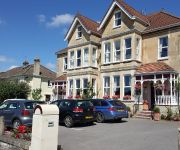
Grasmere Court Hotel - Guest house
Mercure Bristol North the Grange Hotel
2 Crescent Gardens
Aquae Sulis Guest House
Cranleigh
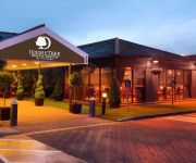
DoubleTree by Hilton Bristol North
Orchard Apartments
Holiday Inn BRISTOL - FILTON
A4 Hotel
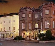
Arnos Manor
Videos from this area
These are videos related to the place based on their proximity to this place.
Ebenezer Chapel holiday accommodation Bath
http://www.holidaycottages-bath.co.uk - Delightfully converted former Chapel consists of 3 three separate but interconnecting (if required) properties a 10 -- 15 minute drive from Bath or 15...
Bath Ales Brewery Tour - The making of your pint.
A film preview of the brewery tour at Bath Ales. Produced, directed, filmed and edited by Rob Wicks at Eat Pictures. These clips are taken from a short documentary following the production...
Lawrence Weston Saltmarsh Drive & The English Rose Bristol 1998.mpg
Lawrence Weston 1998, featuring Saltmarsh Drive where I grew up over 21 years and The English Rose pub (renamed The Rose) Why? pulled down in about 2008 by the looks of Google Earth, now ...
Williams Christmas 1998
I was going through some old family video tapes and discovered this very short but brilliant christmas footage.
Halo Comedy - Mr. Elite and Master Chef. - Episode One
The completly stupid and very dim Elite soldier, Mr. Elite finds himself in his first little predicament with his friend, Master Chef. Mr. Elite is told that he has to kill his target inside...
Mangotsfield Bristol fireworks display 2011 salute finale
A firework display i fired in Mangotsfield.
Go-Peds on Bristol-Bath path
Go-Peds on the Bristol-Bath cyclepath. I'm trying to decide whether there's any point reporting this to the police - if they were proper, legally registered motorbikes that the police could...
Horse on Bristol-Bath Railway Path
The exchange at the end with the other cyclists is: "Are they allowed along here?" "No." "What a day to pick as well."
Bristol - Bath Railway (Cycle) Path: the (nearly) half-way point
http://bluemeanie.org/?/weblog/comments/half-way-on-the-bristol-to-path-railway-cycle-path/ We stopped at this point on the cycle ride from Bath to Bristol, reckoning that it was about half-way...
Kingswood Locality Hub Timelapse.wmv
Time-lapse photography over the winter of 2010-2011 recording the erection of the solid cross laminated timber structure of the new Kingswood Children and Young Persons Locality Hub designed...
Videos provided by Youtube are under the copyright of their owners.
Attractions and noteworthy things
Distances are based on the centre of the city/town and sightseeing location. This list contains brief abstracts about monuments, holiday activities, national parcs, museums, organisations and more from the area as well as interesting facts about the region itself. Where available, you'll find the corresponding homepage. Otherwise the related wikipedia article.
Barrs Court
Barrs Court is a suburb on the east side of Bristol, located near Longwell Green and Kingswood. Barrs Court is a new housing estate, but has some previous history surrounding its local moat, a 2-acre site designated as an ancient monument. Barrs Court has one school (Barrs Court Primary), a large Asda Hypermarket and a leisure area called Aspects with a multiplex Vue cinema, Bowlplex centre, gym, four restaurants and two pubs.
Bridgeyate
Bridgeyate is a hamlet in South Gloucestershire, England, between the cities of Bristol and Bath. The increase in housebuilding in the area has seen Bridgeyate become attached to the nearby villages of Warmley and North Common, but it still retains it own identity with a large common and three public houses, The Griffin, The White Hart and The Hollybush. The Hollybush is currently undergoing renovation and extension after being purchaed by Bath Ales.
Warmley
Warmley is a village in South Gloucestershire, England, to the east of Kingswood on the outskirts of Bristol. In the mid 18th century it contained the Warmley Works of William Champion. It is the home of two football teams, Warmley F.C. and Warmley United, and the brewery Bath Ales. The Bristol & Bath Railway Path passes through Warmley.
North Common, South Gloucestershire
North Common is a village just outside of Warmley, Bristol, in South Gloucestershire, England. Historically this was a rural hamlet surrounded by farmland. In recent years the area has seen several major housing developments. The village is on the eastern outskirts of Bristol and approximately half-way between Bristol city centre and the neighbouring city of Bath. North Common is adjacent to the villages of Warmley, Oldland Common and Bridgeyate and the nearby Cadbury Heath housing estate.
The Grange Community School
The Grange Community School & Sports College is a mixed-gender comprehensive secondary school for 11–18-year-olds in Warmley, South Gloucestershire, England. Commonly known as just 'The Grange', it was upgraded to a Community School in 1999 and in 2002 was designated as a Sports College. The Grange also has a Sixth Form for 16 to 18-year-olds. The sports centre, consisting of a main sports hall, a gym, and a smaller sprung-floor sports hall, is available for hire to the general public.
Mangotsfield railway station
Mangotsfield railway station was a station on the Midland Railway Bristol and Gloucester main line and was situated about five miles to the north east of Bristol in what is now the suburb of Mangotsfield. The station was the junction for the Mangotsfield and Bath Branch Line that led to Bath Green Park railway station and on southwards over the Somerset and Dorset Joint Railway to Bournemouth.
Siston Hill Colliery
The sinking date for Siston Hill Colliery, Siston, Bristol is unknown, but was probably in the late 1790s or early 19th century. There is a surviving accident report dated 1804. This names the colliery owner as a Mrs. Peterson. By 1831 the colliery was under the ownership of Toghill & Company. The 1880 List of Mines names the owner of the pit as S. H. Hadley. The pit was put up for sale in 1889 and the prospectus states that it had four shafts, two of which were sunk to a depth of 570 ft.
Warmley railway station
Warmley was a small railway station just south of Mangotsfield on the Midland Railway Mangotsfield and Bath Branch Line. The station was sited just north of a level crossing on the A420 road through the town. It had wooden buildings: the shelter on the down platform (towards Bath) survives and is used on occasion as a refreshment stop on the Bristol & Bath Railway Path, which follows the route of the railway.
Bath Ales
Bath Ales is a brewery located in the town of Warmley, Bristol, north-west of Bath, England.


