Safety Score: 3,0 of 5.0 based on data from 9 authorites. Meaning we advice caution when travelling to United Kingdom.
Travel warnings are updated daily. Source: Travel Warning United Kingdom. Last Update: 2024-04-25 08:17:04
Discover Bird End
Bird End in Sandwell (England) is a place in United Kingdom about 106 mi (or 171 km) north-west of London, the country's capital city.
Current time in Bird End is now 11:21 PM (Thursday). The local timezone is named Europe / London with an UTC offset of one hour. We know of 8 airports near Bird End, of which 5 are larger airports. The closest airport in United Kingdom is Birmingham International Airport in a distance of 11 mi (or 18 km), South-East. Besides the airports, there are other travel options available (check left side).
There are several Unesco world heritage sites nearby. The closest heritage site in United Kingdom is Pontcysyllte Aqueduct and Canal in a distance of 49 mi (or 79 km), North-West. Also, if you like playing golf, there are a few options in driving distance. We encountered 1 points of interest in the vicinity of this place. If you need a hotel, we compiled a list of available hotels close to the map centre further down the page.
While being here, you might want to pay a visit to some of the following locations: Walsall, Oldbury, Birmingham, Dudley and Wolverhampton. To further explore this place, just scroll down and browse the available info.
Local weather forecast
Todays Local Weather Conditions & Forecast: 10°C / 50 °F
| Morning Temperature | 3°C / 38 °F |
| Evening Temperature | 7°C / 45 °F |
| Night Temperature | 4°C / 39 °F |
| Chance of rainfall | 0% |
| Air Humidity | 61% |
| Air Pressure | 1002 hPa |
| Wind Speed | Gentle Breeze with 7 km/h (5 mph) from South-East |
| Cloud Conditions | Broken clouds, covering 52% of sky |
| General Conditions | Light rain |
Friday, 26th of April 2024
9°C (47 °F)
5°C (40 °F)
Overcast clouds, gentle breeze.
Saturday, 27th of April 2024
6°C (43 °F)
5°C (41 °F)
Light rain, moderate breeze, overcast clouds.
Sunday, 28th of April 2024
6°C (43 °F)
5°C (41 °F)
Moderate rain, moderate breeze, overcast clouds.
Hotels and Places to Stay
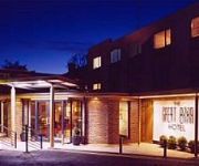
The Great Barr Hotel and Conference Center
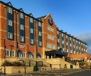
VILLAGE BIRMINGHAM WALSALL
Collection Hotel Birmingham
ibis Styles Birmingham Hagley Road
The Woodlands Hotel
Travellers Inn
RAMADA OLDBURY BIRMINGHAM
JCT.10 Holiday Inn BIRMINGHAM - WALSALL M6
M5 J1 Park Inn By Radisson Birmingham West
Edgbaston Palace
Videos from this area
These are videos related to the place based on their proximity to this place.
Walsall goal against Bristol Rovers 29/01/2011
Walsall score from a corner to make it 6-1 to Walsall. The full time score was 6-1.
Walsall vs Huddersfield - Final minutes Walsall survive!
Walsall survive to play another season in League 1 after drawing 1-1 with Huddersfield and Wycombe losing 3-2 to Notts County Last few minuets and Pitch invasion.
West Bromwich high street post arrest
Just off the high street in West Bromwich, West midlands a crowd makes comments towards the police after the arrest of a person. May 2012. Just Look at many police are there or turn up! Note...
Nirvair Khalsa Jatha - Bhai Harinder Singh Ji @ West Bromwich, UK
Nirvair Khalsa Jatha - Bhai Harinder Singh Ji @ West Bromwich, UK Recorded on Sunday 29 April 2012.
Driving On The M5 Motorway & Onto The M6 J8 West Bromwich, West Midlands, England
Driving on the M5 motorway from junction 2 (A4123 Dudley, Wolverhampton, Sandwell) to the M6 junction J8 West Bromwich, West Midlands, England Videoed on Tuesday, 3rd April 2012 Playlist: ...
Driving On The M5 From M6 Interchange To M5 J1, West Bromwich, England 5th April 2012
Driving on the M5 motorway from J0 (M5 M6 Interchange) to junction 1 (A41 West Bromwich Sandwell Birmingham), West Bromwich, West Midlands, England Videoed on Thursday, 5th April 2012 ...
Andy Wild Vs Danny Chase - Combat Zone Street Fight - West Bromwich
The first match to be added to the Phoenix Pro Wrestling Youtube channel features two upcoming talents in the UK. Andy Wild had just came back from a tour in America where he wrestled for...
simply Jeet Kune Do (Birmingham, West Bromwich, Walsall, Woverhampton, Leicester, staffordshire
Jeet Kune Do (Chinese: 截拳道 Cantonese: Jitkyùndou lit. "Way of the Intercepting Fist," also "Jeet Kun Do","JKD," or "Jeet Kune Do") is a hybrid fighting system and life philosophy founded...
Fireworks from Dartmouth Park, West Bromwich
Fireworks from Dartmouth Park, live from the office window.
Flat to rent West Bromwich
2 bedroom flat to rent Camberley, Beaconview Road, West Bromwich. This unfurnished, 6th floor flat has been newly decorated, new carpets throughout, electric heated and double glazed windows...
Videos provided by Youtube are under the copyright of their owners.
Attractions and noteworthy things
Distances are based on the centre of the city/town and sightseeing location. This list contains brief abstracts about monuments, holiday activities, national parcs, museums, organisations and more from the area as well as interesting facts about the region itself. Where available, you'll find the corresponding homepage. Otherwise the related wikipedia article.
M5 motorway
The M5 is a motorway in England. It runs from Junction 8 of the M6 at West Bromwich near Birmingham to Exeter in Devon. Heading south-west, the M5 runs east of West Bromwich and west of Birmingham through Sandwell Valley. The road continues past Bromsgrove, Droitwich Spa, Worcester, Tewkesbury, Cheltenham, Gloucester, Bristol, Weston-super-Mare, Burnham-on-Sea, Bridgwater and Taunton on its way to Exeter, ending at Junction 31. It is the primary gateway to South West England.
Sandwell Valley
Sandwell Valley is an area of green belt in the West Midlands of England, on the border of Birmingham and West Bromwich, with Walsall at its northern end. It is a valley on the River Tame of which 720 hectares are owned by Sandwell Metropolitan Borough Council, with the RSPB leasing 25 acres as RSPB Sandwell Valley nature reserve.
Sandwell Valley Country Park
Sandwell Valley Country Park is a country park, run by Sandwell Metropolitan Borough Council, in Sandwell Valley, on the River Tame in the middle of the urban conurbation between Birmingham and West Bromwich in the West Midlands of England.
West Bromwich East (UK Parliament constituency)
West Bromwich East is a borough constituency represented in the House of Commons of the Parliament of the United Kingdom. It elects one Member of Parliament (MP) by the first past the post system of election.
Sandwell General Hospital
Sandwell General Hospital is a busy acute teaching hospital of the Sandwell and West Birmingham Hospitals NHS Trust in West Bromwich, England and provides an extensive range of general and specialist hospital services. Sandwell General Hospital provides a comprehensive range of medical and nursing services including general medicine, surgery, urology, plastic surgery, orthopaedics, gastroenterology, rheumatology, interventional cardiology, maternity and paediatrics.
Sandwell Hospital
Sandwell Hospital in West Bromwich, England is also known as Sandwell General Hospital and was called Hallam Hospital. Hallam Hospital in Hallam Street originated as an infirmary added to the West Bromwich union workhouse in 1884. Improvements were begun in 1925, when the infirmary then became a separate institution named Hallam Hospital. After the creation of the National Health Service and rebuilding in the 1970s, the hospital was renamed Sandwell General Hospital.
Charlemont and Grove Vale
Charlemont and Grove Vale is a political ward in the Metropolitan Borough of Sandwell, in the English Midlands constituency of West Bromwich East. The ward is made up of several neighbourhoods including, Charlemont Farm, Bustlehome Mill, Church Vale, and the leafier neighbourhoods of Charlemont, Bird End, Wigmore and Grove Vale. It also covers part of the Sandwell Valley. The ward currently has three Conservative councillors and is Sandwell's only all Conservative ward.
West Bromwich Manor House
West Bromwich Manor House, Hall Green Road, West Bromwich, B71 2EA, is an important, Grade I listed, medieval domestic building built by the de Marnham family in the late thirteenth century as the centre of their agricultural estate in West Bromwich. Only the Great Hall survives of the original complex of living quarters, agricultural barns, sheds and ponds.


