Safety Score: 3,0 of 5.0 based on data from 9 authorites. Meaning we advice caution when travelling to United Kingdom.
Travel warnings are updated daily. Source: Travel Warning United Kingdom. Last Update: 2024-04-25 08:17:04
Delve into Stoke
Stoke in Plymouth (England) is a city located in United Kingdom about 192 mi (or 309 km) south-west of London, the country's capital town.
Current time in Stoke is now 09:46 AM (Thursday). The local timezone is named Europe / London with an UTC offset of one hour. We know of 11 airports closer to Stoke, of which 5 are larger airports. The closest airport in United Kingdom is Plymouth City Airport in a distance of 4 mi (or 6 km), North-East. Besides the airports, there are other travel options available (check left side).
There are two Unesco world heritage sites nearby. The closest heritage site in United Kingdom is Cornwall and West Devon Mining Landscape in a distance of 27 mi (or 43 km), South-West. Also, if you like playing golf, there are some options within driving distance. In need of a room? We compiled a list of available hotels close to the map centre further down the page.
Since you are here already, you might want to pay a visit to some of the following locations: Plymouth, Millbrook, Pillaton, South Hill and North Hill. To further explore this place, just scroll down and browse the available info.
Local weather forecast
Todays Local Weather Conditions & Forecast: 10°C / 51 °F
| Morning Temperature | 6°C / 43 °F |
| Evening Temperature | 9°C / 48 °F |
| Night Temperature | 8°C / 46 °F |
| Chance of rainfall | 0% |
| Air Humidity | 84% |
| Air Pressure | 1006 hPa |
| Wind Speed | Moderate breeze with 11 km/h (7 mph) from South-East |
| Cloud Conditions | Overcast clouds, covering 100% of sky |
| General Conditions | Light rain |
Friday, 26th of April 2024
7°C (45 °F)
7°C (44 °F)
Moderate rain, gentle breeze, overcast clouds.
Saturday, 27th of April 2024
9°C (49 °F)
9°C (48 °F)
Light rain, fresh breeze, overcast clouds.
Sunday, 28th of April 2024
12°C (53 °F)
9°C (49 °F)
Light rain, fresh breeze, broken clouds.
Hotels and Places to Stay
Copthorne Plymouth
Gallery Guesthouse
Langdon Court
The Firs Guest House
Edgcumbe Guest House
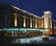
Crowne Plaza PLYMOUTH
Royal William Yard Apartments
Jurys Inn Plymouth
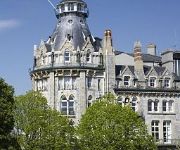
Best Western Duke Of Cornwall
Future Inn Plymouth
Videos from this area
These are videos related to the place based on their proximity to this place.
Plymouth Albion RFC Training at Plymouth Performance Gym
The lads from Plymouth Albion RFC going through their first training session at PPG www.plymouthperformancegym.co.uk.
Shopping in Plymouth 25th Jan 2014
A trip through the shopping mall city centre shopping of Plymouth on January 25th 2014, a cool but busy time in the city centre.
Plymouth Fireworks - British Firework Championships Day 2 - 13/08/2014 - FULL HD
Thank you for viewing my video. Plymouth Fireworks British Championships Day 2 13/08/2014. Also included videos of the Funfair Rides. Hope you all enjoy this video and please like and Subscribe...
road rage Plymouth UK two guys attack motorcyclist WG12 CXR. incident starts at 4 mins
road rage uk two guys attack motorcyclist WG12 CXR. incident starts at 4 mins.
British firework championship 2014 Plymouth
Shellcape Pyrotechnics perfomance on British firework championship 2014 at Plymouth Hoe.
Dr. Sarah Keast (Plymouth University): 'It's all just a game.'. DHS Economics Society Talk.
Dr. Sarah Keast from Plymouth University speaks at the Economics Society, Devonport High School for Boys.
Professional Removals Company in Plymouth
Removals company in Plymouth offering complete domestic, commercial, office even business removals service with experts and cheapest way. Visit http://officeremovalsplymouth.co.uk/services/...
Having heart attack (MI - Myocardial Infarction) treatment , Derriford Hospital - Plymouth
Fascinating patient testimony from a patient at Derriford Hospital, Plymouth recorded less than 24 hours after suffering an MI (myocardial infarction) - heart attack. Dr Ian Cox, Consultant...
A Martial Arts Journey | Marc Doyle Testimonial | MMA Plymouth
Marc has had an amazing Martial arts journey that has led him to train all around the world and most recently win his first Mixed Martial Arts title. Find out the positive benefits martial...
Videos provided by Youtube are under the copyright of their owners.
Attractions and noteworthy things
Distances are based on the centre of the city/town and sightseeing location. This list contains brief abstracts about monuments, holiday activities, national parcs, museums, organisations and more from the area as well as interesting facts about the region itself. Where available, you'll find the corresponding homepage. Otherwise the related wikipedia article.
Millbridge, Plymouth
Millbridge is a small neighbourhood of Plymouth, on the boundary of what used to be the towns of Plymouth and Devonport, in the English county of Devon. What was originally a self-standing village (which has now been subsumed within the city) lies to the north of the toll bridge, originally built by Sir Piers Edgcumbe in 1525, that crossed what used to be the Deadlake or Stonehouse Creek, to the west of Pennycomequick, the south of Stoke village and to the east of Stoke Church.
Ford Park Cemetery
Ford Park Cemetery is a 34.5-acre cemetery in central Plymouth, England, established by the Plymouth, Stonehouse & Devonport Cemetery Company in 1846 and opened in 1848. At the time it was outside the boundary of the Three Towns and was created to alleviate the overcrowding in the churchyards of the local parish churches. Its official name at the time of inception was The Plymouth, Devonport and Stonehouse (Ford Park) Cemetery, although it is now seldom referred to by that title.
Stonehouse Creek
Stonehouse Creek, in Plymouth (England), is also known as Stonehouse Lake (on many maps) and Tinkies by the local people. The upper reaches of Stonehouse Creek, now Victoria Park, were formerly known as the Deadlake and it is frequently marked as such on early maps of the locality. This area was filled in to celebrate the 60 year reign of Queen Victoria.
Union Street, Plymouth
Union Street in Plymouth, Devon, is a long straight street connecting the city centre to Devonport, the site of Plymouth's naval base and docks. Originally the home of wealthy people, it later became an infamous red-light district and the location of most of the city's night-life.
Home Park
Home Park is an all-seater football stadium in the Central Park area of Plymouth, England, and is the home of Football League Two club Plymouth Argyle. The ground, given the nickname the Theatre of Greens by the club's supporters, has been Argyle's permanent residence since 1901. After undergoing considerable development in the 1920s and 1930s the ground suffered heavy damage during the Second World War.
Devonport High School for Boys
Devonport High School for Boys is a grammar school and Academy, for boys aged 11 to 18, in Plymouth, Devon, England. It has around 1,135 pupils. Its catchment area includes southwest Devon and southeast Cornwall as well as Plymouth. Pupils are accepted on the basis of academic aptitude.
Stoke Military Hospital
Stoke Military Hospital in Plymouth, England, was completed in 1797. It was built for the British Army on the north side of Stonehouse Creek, to match the Royal Naval hospital on the south side. The workforce was made up of Napoleonic prisoners of war who were housed in prison ships on the Hamoaze. The Stonehouse Creek was later filled in during the 1960s to become Victoria Park, The Stonehouse Sharks Junior Rugby Team's grounds and The playing fields of Devonport High School for Boys.
Cornwall Railway viaducts
The Cornwall Railway company constructed a railway line between Plymouth and Truro, England, opening in 1859, and extended it to Falmouth in 1863. The topography of Cornwall is such that the route, which is generally east-west, cuts across numerous deep river valleys that generally run north-south. At the time of construction of the line, money was in short supply due to the collapse in confidence following the railway mania, and the company sought ways of reducing expenditure.
Central Park, Plymouth
Plymouth's Central Park is a large centralised park situated to the north of Plymouth city centre in south west Devon, England, stretching north from the railway station to Pounds House, Peverell and west from Ford Park Cemetery to the A386 (Outland Road and Alma Road). Central Park is trust land, which explains why it has not been built on in the middle of the city.
Plymouth Citybus
Plymouth Citybus is one of the principal bus operators serving the City of Plymouth, England, and the surrounding area. Plymouth Citybus's route network serves almost exclusively the boroughs and inner-city areas of Plymouth, with the majority of rural services handled by First Devon and Cornwall.
Mayflower Centre
The Mayflower Centre is a leisure centre in the city of Plymouth, Devon, England. It is situated in Central Park, close to Plymouth Argyle Football Club. The centre was originally built in 1971 as an exhibition centre for the 350th anniversary of the sailing of the Mayflower; since then it has been extended several times. In 1973 a four rink indoor bowls facility was built; this facility is now home to one of the largest bowls clubs in the area.
Victoria Park, Millbridge, Plymouth
Victoria Park in Millbridge in Plymouth is a small recreational area. It extends at the eastern end from the bowling green beneath what was once a railway viaduct to what is now the merging of Molesworth Road and Eldad Hill, and which once was a toll bridge, and an important thoroughfare between Devonport and Plymouth.


