Safety Score: 3,0 of 5.0 based on data from 9 authorites. Meaning we advice caution when travelling to United Kingdom.
Travel warnings are updated daily. Source: Travel Warning United Kingdom. Last Update: 2024-04-25 08:17:04
Delve into Northend
Northend in Oxfordshire (England) is a town located in United Kingdom about 36 mi (or 58 km) west of London, the country's capital town.
Time in Northend is now 04:05 PM (Thursday). The local timezone is named Europe / London with an UTC offset of one hour. We know of 11 airports closer to Northend, of which 5 are larger airports. The closest airport in United Kingdom is RAF Benson in a distance of 7 mi (or 11 km), West. Besides the airports, there are other travel options available (check left side).
There are several Unesco world heritage sites nearby. The closest heritage site in United Kingdom is Blenheim Palace in a distance of 20 mi (or 32 km), North-East. Also, if you like the game of golf, there are some options within driving distance. We saw 1 points of interest near this location. In need of a room? We compiled a list of available hotels close to the map centre further down the page.
Since you are here already, you might want to pay a visit to some of the following locations: Remenham, Wargrave, Hurley, Sonning and Twyford. To further explore this place, just scroll down and browse the available info.
Local weather forecast
Todays Local Weather Conditions & Forecast: 7°C / 44 °F
| Morning Temperature | 4°C / 39 °F |
| Evening Temperature | 7°C / 44 °F |
| Night Temperature | 6°C / 44 °F |
| Chance of rainfall | 1% |
| Air Humidity | 84% |
| Air Pressure | 1005 hPa |
| Wind Speed | Gentle Breeze with 9 km/h (5 mph) from East |
| Cloud Conditions | Overcast clouds, covering 95% of sky |
| General Conditions | Light rain |
Friday, 26th of April 2024
10°C (50 °F)
6°C (43 °F)
Overcast clouds, gentle breeze.
Saturday, 27th of April 2024
8°C (46 °F)
9°C (49 °F)
Moderate rain, moderate breeze, overcast clouds.
Sunday, 28th of April 2024
12°C (54 °F)
9°C (48 °F)
Moderate rain, fresh breeze, overcast clouds.
Hotels and Places to Stay
Mercure Thame Lambert Hotel
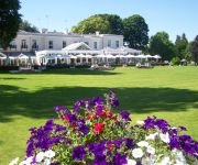
Phyllis Court Club
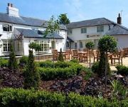
Fox Country Inn
Fox Country Hotel Main Road
Kings
TREE AT CADMORE
Videos from this area
These are videos related to the place based on their proximity to this place.
Pishill Church Beautiful Location, Dedication Unknown
Usually churches are named St Peter or St Mary or something this church has no-dedication. Self-Service Coffee or Tea is available in the Porch for a volunta...
Fawley Hill Railway June 2012
Sir William McAlpine's standard gauge Fawley Hill Railway, UK. 3rd June 2012. An acknowledged railway enthusiast, he returned to Hayes depot during the Beeching Axe to find that the company's...
Valentine Gift for him 2014 -- DIY flipping book
I came out with this random thought to DIY a flipping book for my boyfriend this year:) Hope you like it and wish us a HAPPY VALENTINE 2014(n so on)!:)
Ibstone XC MTB
Ibstone (Chilterns) XC MTB, Hanger Wood Descent, Hatchet Wood Descent & Gravelly Wood Descent. http://app.strava.com/activities/49938702.
An 0-6-0 tank engine giving some serious thrash at the Fawley Museum
0-6-0 tank engine thrashing its way up the hill at the Fawley Museum.
Pats MTB Splat
Biking Karma 12 months from last XC MTB run from Christmas Common upon which I crashed on what my riding partner, Pat, described as a "leafy gully".......we were back. This is the exact same...
Count the potholes!
Taken during a Sportive this year (2010, ignore the camera date!), this stretch of road from Christmas Common to Stokenchurch in Oxfordshire was rutted with lethal potholes! The rear-facing...
Chiltern Valley Vintage Tractor Run 2012
On a lovely weekend in May, 58 Tractors took part to do a 24 mile trip through 6 Estates in the Chiltern Hills to raise money for the Thames Valley and Chiltern Air Ambulance, we raised in...
Videos provided by Youtube are under the copyright of their owners.
Attractions and noteworthy things
Distances are based on the centre of the city/town and sightseeing location. This list contains brief abstracts about monuments, holiday activities, national parcs, museums, organisations and more from the area as well as interesting facts about the region itself. Where available, you'll find the corresponding homepage. Otherwise the related wikipedia article.
Chiltern Hills
The Chiltern Hills form a chalk escarpment in South East England. They are known locally as "the Chilterns". A large portion of the hills was designated officially as an Area of Outstanding Natural Beauty in 1965.
Wormsley Park
Wormsley Park is a 2,500 acre (10 km²) estate and 18th century country house between Stokenchurch and Watlington in the Chiltern Hills of Buckinghamshire, England. It is the former home of the philanthropist Sir Paul Getty who moved to Wormsley in 1986. He undertook a restoration which lasted until 1991, and lived there until his death in 2003. It is now the home of Mark Getty and his family and the site of the cricket field known as Sir Paul Getty's Ground.
Stokenchurch BT Tower
Stokenchurch BT Tower is a telecommunication tower built of reinforced concrete at Stokenchurch, Buckinghamshire, England. It is one of the few British towers built of reinforced concrete. Located 242 metres above sea level, it dates from 1963 and is 97.5 metres tall. There are four platforms at the top that are used to attach microwave transmission drums and other antennas.
Stokenchurch Gap
The Stokenchurch Gap, also known as the Aston Rowant Cutting or Aston Hill cutting (from the nearby village of Aston Rowant), or locally "The Canyon" is a steep chalk cutting, constructed through the Chiltern Hills in Oxfordshire, England during the early 1970s for the M40 motorway. It is 1,200 metres long and a maximum of 47 metres deep, and is located approximately eight miles (13 km) from High Wycombe and close to the village of Stokenchurch.
Stonor Park
Stonor Park is an historic country house and private deer park situated in a valley in the Chiltern Hills at Stonor, about 4 miles north of Henley-on-Thames in Oxfordshire, England, close to the county boundary with Buckinghamshire. The house has a 12th century private chapel. The remains of a prehistoric stone circle are in the grounds. It is the ancestral home of the Stonor family and Baron Camoys. The current Lord Camoys is Ralph Stonor, 7th Baron Camoys.
Lewknor Bridge Halt railway station
Lewknor Bridge Halt railway station was a halt on the Watlington and Princes Risborough Railway which the Great Western Railway opened in 1906 to serve the Oxfordshire village of Lewknor. The opening of the halt was part of a GWR attempt to encourage more passengers on the line at a time when competition from bus services was drawing away patronage.
Pishill with Stonor
Pishill with Stonor is a civil parish in South Oxfordshire. It includes the villages of Pishill (Ordnance Survey grid reference SU727899) and Stonor (OS Grid ref. SU737886), and the hamlets of Maidensgrove and Russell's Water. Pishill with Stonor was formed by the merger of the separate civil parishes of Pishill and Stonor (until 1896 a detached part of the parish of Pyrton) in 1922.
Aston Rowant NNR
Aston Rowant Nature Reserve is located on the western escarpment of the Chiltern Hills near Stokenchurch on the Oxfordshire - Buckinghamshire border in the Chilterns Area of Outstanding Natural Beauty The reserve is in several sections, divided by the M40 motorway in the Aston Rowant Cutting. Most of the reserve is in the parishes of Aston Rowant and Lewknor in Oxfordshire; smaller sections are in the parish of Stokenchurch in Buckinghamshire.


