Safety Score: 3,0 of 5.0 based on data from 9 authorites. Meaning we advice caution when travelling to United Kingdom.
Travel warnings are updated daily. Source: Travel Warning United Kingdom. Last Update: 2024-04-20 08:25:34
Discover Marston
Marston in Oxfordshire (England) is a city in United Kingdom about 52 mi (or 83 km) west of London, the country's capital city.
Local time in Marston is now 01:37 PM (Saturday). The local timezone is named Europe / London with an UTC offset of one hour. We know of 11 airports in the vicinity of Marston, of which 5 are larger airports. The closest airport in United Kingdom is Oxford (Kidlington) Airport in a distance of 5 mi (or 8 km), North-West. Besides the airports, there are other travel options available (check left side).
There are several Unesco world heritage sites nearby. The closest heritage site in United Kingdom is Blenheim Palace in a distance of 26 mi (or 42 km), East. Also, if you like golfing, there are a few options in driving distance. Looking for a place to stay? we compiled a list of available hotels close to the map centre further down the page.
When in this area, you might want to pay a visit to some of the following locations: Oxford, Frilford, Farnborough, Upper Basildon and Hanwell. To further explore this place, just scroll down and browse the available info.
Local weather forecast
Todays Local Weather Conditions & Forecast: 10°C / 49 °F
| Morning Temperature | 1°C / 34 °F |
| Evening Temperature | 9°C / 48 °F |
| Night Temperature | 2°C / 36 °F |
| Chance of rainfall | 0% |
| Air Humidity | 57% |
| Air Pressure | 1030 hPa |
| Wind Speed | Moderate breeze with 9 km/h (6 mph) from South |
| Cloud Conditions | Scattered clouds, covering 34% of sky |
| General Conditions | Scattered clouds |
Sunday, 21st of April 2024
9°C (48 °F)
2°C (35 °F)
Overcast clouds, moderate breeze.
Monday, 22nd of April 2024
7°C (44 °F)
4°C (39 °F)
Light rain, light breeze, overcast clouds.
Tuesday, 23rd of April 2024
8°C (47 °F)
3°C (37 °F)
Light rain, moderate breeze, overcast clouds.
Hotels and Places to Stay
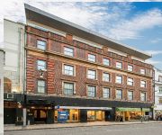
Old Bank
George Street Hotel
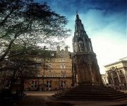
Macdonald Randolph
Hill Farm
Jurys Inn Oxford
Ethos
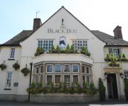
The Black Boy Pub & Hotel
The Head of the River
Malmaison Oxford
Vanbrugh House Hotel
Videos from this area
These are videos related to the place based on their proximity to this place.
Museum of Natural History, Oxford University
March 25, 2010 trip to the Museum of Natural History at Oxford University.
Harry Potter Filming locations Tour: London, Lacock, Oxford
I wish you could have seen the puzzled faces staring at my wizarding robes...
Oxford professor on Transcendence: how could you get a machine intelligence?
http://www.amazon.com/Superintelligence-Dangers-Strategies-Nick-Bostrom/dp/0199678111 Professor Nick Bostrom at the University of Oxford discusses the different paths to machine intelligence....
Tolkien Reading Day 2015: Dr Dimitra Fimi
Dr Dimitra Fimi, author of Tolkien, Race and Cultural History, reads a passage from "A Journey in the Dark" in The Fellowship of the Ring for Tolkien Reading Day 2015. To learn more about...
Tolkien Reading Day 2015: Daniel Helen
Daniel Helen, a trustee of the Tolkien Society, reads a passage from "The Return Journey" in "The Hobbit" for Tolkien Reading Day. To learn more about Tolkien Reading Day, visit the Tolkien...
50KW Fast Charging for FREE!! - Nissan Leaf UK - Thanks to Ecotricity.com
Video of my travel to and charging of my new Nissan Leaf using the fantastic and free fast charger provided by ecotricity, so easy to use, apply on the ecotricity.com website and they will...
Oxford Cutteslowe Park Miniature Railway
A visit to City of Oxford Society of Model Engineer's track at Cutteslowe Park. A lovely railway in a pleasant park setting, there is a ground level and a raised track to ride. Why not pay...
PUNTING AT OXFORD
DURING A RECENT TRIP I TRIED PUNTING AT WOLFSON COLLEGE OXFORD. IT WAS A FIRST TIME EXPERIENCE & A MEMORABLE ONE.
David Scott FitzGerald: Refining the Political Sociology of International Migration
About this event: http://www.imi.ox.ac.uk/projects/demig/2014-conference David Scott FitzGerald presents his paper 'Refining the Political Sociology of International Migration: Mechanisms...
Videos provided by Youtube are under the copyright of their owners.
Attractions and noteworthy things
Distances are based on the centre of the city/town and sightseeing location. This list contains brief abstracts about monuments, holiday activities, national parcs, museums, organisations and more from the area as well as interesting facts about the region itself. Where available, you'll find the corresponding homepage. Otherwise the related wikipedia article.
Wolfson College, Oxford
Wolfson College is a constituent college of the University of Oxford in England. Located in north Oxford along the River Cherwell, Wolfson is an all-graduate college with over sixty governing body fellows, in addition to both research and junior research fellows. It caters to a wide range of subjects, from the humanities to the social and natural sciences.
Oxford High School (Oxford)
Oxford High School is an independent day school for girls in Oxford, England. It was founded by the Girls' Day School Trust in 1875, making it the city's oldest girls' school.
Cutteslowe Park, Oxford
Cutteslowe Park is a public park in Cutteslowe in North Oxford, England. It was established in 1935 when Oxford City Council acquired land of the former Cutteslowe Manor farm, whose house still stands at its centre. More land was acquired in 1937. The original manor house dates from at least the mid-17th century, being shown on a 1670s map by Michael Burghers. In 2006 Oxford City Council united the park with Sunnymead Park, just to the south and of the Oxford Northern Bypass.
Belbroughton Road
Belbroughton Road is a residential road in the suburb of North Oxford, England. The road runs east from Banbury Road. At the other end is Oxford High School, a girls' school. South from the road about halfway along is Northmoor Road, where J.R.R. Tolkien lived for a while in the 1930s. At the eastern end is Charlbury Road. The road includes some large notable detached houses. Amongst them are houses designed by Christopher Wright in the neo-Georgian style. For example, No.
Oxford Ring Road
The Oxford ring road is a ring road around the city of Oxford, England. It is a dual carriageway for most of its length apart from a short section to the north between the Woodstock and Banbury Roads. To the west, the road is part of the A34. To the north, it is part of the A40. To the east and south, it becomes the A4142.
Marston Ferry Road
Marston Ferry Road is a link road in north Oxford, England. It is named after the ferry that used to cross the River Cherwell at the village of Marston from at least 1279. The road links the Banbury Road in North Oxford just south of Summertown, continuing as Moreton Road to the Woodstock Road, with Cherwell Drive in Marston, continuing as Headley Way to Headington to the southeast. It is a modern link road with a bridge over the River Cherwell about halfway along, opened on 12 November 1971.
Cherwell Boathouse
The Cherwell Boathouse (also "Boat House") is a boathouse and restaurant on the River Cherwell in Oxford, England. It is located down a small lane off the junction between Chadlington Road and Bardwell Road, which itself is off the Banbury Road in North Oxford. The land was leased by the Oxford University Boat Club waterman Tom Tims from St John's College, Oxford for a landing stage for punts in 1901. The boathouse was built in 1904 and was known as Tims's for the first forty years.
Linton Road
Linton Road is a road in North Oxford, England.
Charlbury Road
Charlbury Road is a road in North Oxford, England, running to the east of and parallel with the Banbury Road. At the southern end of the road there is a junction with Bardwell Road, close to the Dragon School. 5 Charlbury Road is one of the Dragon School boarding houses. Linton Road crosses Charlbury Road about halfway up. Garford Road leads east off the road. At the northern end is a junction with Belbroughton Road to the west.
Chadlington Road
Chadlington Road is a road in North Oxford, England.
Garford Road
Garford Road is a residential road in North Oxford, England. The road is a cul-de-sac and leads east off Charlbury Road. To the south is Linton Road and Wolfson College, Oxford, which has residences in the road. The houses on the road were mostly leased from St John's College in 1928–30, largely designed by Christopher Wright, who also designed houses in Belbroughton Road to the north. One of the houses is known as Garford House.
Victoria Arms, Marston
The Victoria Arms (known locally as the Vicky Arms) is a public house on the eastern bank of the River Cherwell at the end of Mill Lane close to Old Marston, northeast of Oxford, England. There was once a ford across the Cherwell here, in use since the 12th century. An inn was originally constructed during the 17th century and was then rebuilt in 1840. It was closed in 1958 and bought by the Oxford Preservation Trust in 1961.


