Safety Score: 3,0 of 5.0 based on data from 9 authorites. Meaning we advice caution when travelling to United Kingdom.
Travel warnings are updated daily. Source: Travel Warning United Kingdom. Last Update: 2024-04-25 08:17:04
Explore Ipsden
Ipsden in Oxfordshire (England) is located in United Kingdom about 41 mi (or 66 km) west of London, the country's capital.
Local time in Ipsden is now 05:24 PM (Thursday). The local timezone is named Europe / London with an UTC offset of one hour. We know of 11 airports in the wider vicinity of Ipsden, of which 5 are larger airports. The closest airport in United Kingdom is RAF Benson in a distance of 4 mi (or 6 km), North. Besides the airports, there are other travel options available (check left side).
There are several Unesco world heritage sites nearby. The closest heritage site in United Kingdom is Blenheim Palace in a distance of 27 mi (or 44 km), North-East. Also, if you like golfing, there are multiple options in driving distance. If you need a place to sleep, we compiled a list of available hotels close to the map centre further down the page.
Depending on your travel schedule, you might want to pay a visit to some of the following locations: Upper Basildon, Tilehurst, Reading, Remenham and Sonning. To further explore this place, just scroll down and browse the available info.
Local weather forecast
Todays Local Weather Conditions & Forecast: 11°C / 51 °F
| Morning Temperature | 5°C / 41 °F |
| Evening Temperature | 9°C / 47 °F |
| Night Temperature | 6°C / 42 °F |
| Chance of rainfall | 1% |
| Air Humidity | 65% |
| Air Pressure | 1011 hPa |
| Wind Speed | Moderate breeze with 9 km/h (6 mph) from East |
| Cloud Conditions | Broken clouds, covering 75% of sky |
| General Conditions | Light rain |
Friday, 26th of April 2024
10°C (51 °F)
6°C (43 °F)
Broken clouds, gentle breeze.
Saturday, 27th of April 2024
7°C (45 °F)
6°C (43 °F)
Moderate rain, moderate breeze, overcast clouds.
Sunday, 28th of April 2024
5°C (42 °F)
6°C (44 °F)
Moderate rain, moderate breeze, overcast clouds.
Hotels and Places to Stay
The Miller of Mansfield
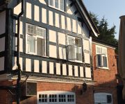
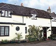
Little Gables Bed and Breakfast
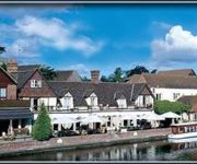
The Swan at Streatley
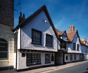
GEORGE HOTEL
The Chilterns View
Elephant
Shillingford Bridge
The George Relaxinnz
Videos from this area
These are videos related to the place based on their proximity to this place.
Anglo-Saxon Wallingford 3.wmv
Part of a video made by the University of Oxford for the online course Vikings: Raiders, Traders and Settlers. http://www.archaeology.eu.com/vikings/online.html.
Anglo-Saxon Wallingford 2.wmv
Part of a video made by the University of Oxford for the online course Vikings: Raiders, Traders and Settlers. http://www.archaeology.eu.com/vikings/online.html.
Baby Jogger City Mini GT pushchair from Pushchairsandcarseats.co.uk
Pushchairs and Car seats, baby jogger city mini GT pushchair product video.
Anglo-Saxon Wallingford 1.wmv
Part of a video made by the University of Oxford for the online course Vikings: Raiders, Traders and Settlers. http://www.archaeology.eu.com/vikings/online.html.
Thames Raid Day 4. Abingdon to Wallingford.
Day 4. after a semi reasonable start to the day the rain and wind closed in shortly after lunch. The deluge persisted most of the afternoon and let up only briefly so we could partake in our...
River Thames Floods - Wallingford Bridge
I took this video whilst visiting Wallingford on 31st December 2012. Rain was forecast for the rest of the day but clearing up towards the end of the week.
Anglo Saxon Wallingford 4
Part of a video made by the University of Oxford for the online course Vikings: Raiders, Traders and Settlers. http://www.archaeology.eu.com/vikings/online.html.
Anglo Saxon Wallingford 5
Part of a video made by the University of Oxford for the online course Vikings: Raiders, Traders and Settlers. http://www.archaeology.eu.com/vikings/online.html.
Wallingford Sculls
Saturday 27 September. 4000 meters S2 4x- [352] Dart-Totnes - Heming J18 4x- [353] Hampton School - Thomas S2 4x- [350] Hampton School - Provin J18 4x- [355] Pangbourne College - A...
Anglo-Saxon Wallingford 6.wmv
Part of a video made by the University of Oxford for the online course Vikings: Raiders, Traders and Settlers. http://www.archaeology.eu.com/vikings/online.html.
Videos provided by Youtube are under the copyright of their owners.
Attractions and noteworthy things
Distances are based on the centre of the city/town and sightseeing location. This list contains brief abstracts about monuments, holiday activities, national parcs, museums, organisations and more from the area as well as interesting facts about the region itself. Where available, you'll find the corresponding homepage. Otherwise the related wikipedia article.
Carmel College (Oxfordshire)
Carmel College was a predominantly Jewish co-educational boarding school in England operating between 1948 and 1997. It was first situated at Greenham Common near Newbury and then at Mongewell Park near Wallingford, Oxfordshire. It was Europe's only Jewish boarding school. It also had a very small number pupils who were not of Jewish descent as day pupils. Typical boarding fees in 1996 were £10,000 per school term (i.e. £30,000 per year).
Crowmarsh Rural District
Crowmarsh was a rural district in Oxfordshire, England from 1894 to 1932. It was created under the Local Government Act 1894 from the part of the Wallingford rural sanitary district in Oxfordshire. The remainder of the sanitary district was in Berkshire and became the Wallingford Rural District. Crowmarsh Rural District continued to be administered from Wallingford, with meetings held in the workhouse in the town.
A4130 road
The A4130 is a British A road which runs from a junction with the A404 at Burchetts Green, Berkshire to the A417 at Rowstock in Oxfordshire. It passes through Henley-on-Thames, and Nettlebed, and bypasses Wallingford and Didcot. Until the 1970s the road ended at a junction with the A417 at Harwell. When the A34 was upgraded in the 1970s, the A4130 was extended north from Rowstock along the old line of the A34 to an interchange with the new A34 at Milton Heights, near Milton Park.
Braziers Park
Braziers Park is a country house and Grade II* listed building located near Wallingford, Oxfordshire, England. The house is owned and operated by a charitable trust as a residential adult education college, and centre for the School of Integrative Social Research.
Wood (festival)
Wood is an annual small early summer folk and roots music festival and environmental gathering, which takes place in Braziers Park, Ipsden near Wallingford, Oxfordshire, UK. Its indepdendent organisers, Robin and Joe Bennett, also arrange the Truck Festival.
Langtree School
Langtree School is a secondary school with academy status for students aged 11–16 in the village of Woodcote, South Oxfordshire, England. It became a DfES Specialist Performing Arts College in 2006. The school was inspected by Ofsted in 2010, and was graded outstanding.. The nearest railway station is Goring & Streatley.
Ipsden Heath
Ipsden Heath is a 32-acre (13-hectare) woodland in the English county of Oxfordshire, within the Chiltern Area of Outstanding Natural Beauty.
St Peter and St Paul, Checkendon
St Peter and St Paul is an Anglican church in Checkendon, a small village in the English county of Oxfordshire. It is an active parish church in the Diocese of Oxford and the archdeaconry of Oxford. It’s earliest parts date from Norman times. It has been designated Grade I listed. The church is a 12th century building.


