Safety Score: 3,0 of 5.0 based on data from 9 authorites. Meaning we advice caution when travelling to United Kingdom.
Travel warnings are updated daily. Source: Travel Warning United Kingdom. Last Update: 2024-04-19 08:03:45
Discover Lound
Lound in Nottinghamshire (England) with it's 471 citizens is a place in United Kingdom about 133 mi (or 214 km) north of London, the country's capital city.
Current time in Lound is now 05:38 AM (Saturday). The local timezone is named Europe / London with an UTC offset of one hour. We know of 10 airports near Lound, of which 4 are larger airports. The closest airport in United Kingdom is Robin Hood Doncaster Sheffield Airport in a distance of 8 mi (or 13 km), North. Besides the airports, there are other travel options available (check left side).
There are several Unesco world heritage sites nearby. The closest heritage site in United Kingdom is Liverpool – Maritime Mercantile City in a distance of 3 mi (or 5 km), North-West. Also, if you like playing golf, there are a few options in driving distance. If you need a hotel, we compiled a list of available hotels close to the map centre further down the page.
While being here, you might want to pay a visit to some of the following locations: Rossington, Cantley, Tickhill, Hatfield and Stainton. To further explore this place, just scroll down and browse the available info.
Local weather forecast
Todays Local Weather Conditions & Forecast: 10°C / 50 °F
| Morning Temperature | 3°C / 37 °F |
| Evening Temperature | 8°C / 46 °F |
| Night Temperature | 3°C / 37 °F |
| Chance of rainfall | 0% |
| Air Humidity | 51% |
| Air Pressure | 1030 hPa |
| Wind Speed | Moderate breeze with 10 km/h (6 mph) from South |
| Cloud Conditions | Broken clouds, covering 68% of sky |
| General Conditions | Broken clouds |
Sunday, 21st of April 2024
11°C (51 °F)
4°C (40 °F)
Broken clouds, gentle breeze.
Monday, 22nd of April 2024
7°C (44 °F)
8°C (46 °F)
Light rain, gentle breeze, overcast clouds.
Tuesday, 23rd of April 2024
6°C (43 °F)
4°C (39 °F)
Light rain, fresh breeze, overcast clouds.
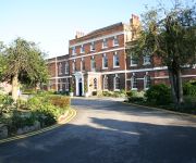
Hotels and Places to Stay
Ye Olde Bell
The Lawns Guest House
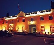
Crown Bawtry
Best Western Plus West Retford Hotel
Videos from this area
These are videos related to the place based on their proximity to this place.
Retford Railways 1997
1997 was a year of transition on the East Coast Mainline as GNER took over the running of trains between London and The North. The very attractive BR InterCity livery was replaced by, some...
Retford Charter Day 2008 Part 1
Scenes from Retford Charter Day, 5 May 2008. Featuring walkabouts through the funfair in Retford's Market Square, and the charity stalls in Retford's town centre.
Trains through Retford August 5th 2011
Video Recorded 5th august 2011.I Had an hour at retford (Between 1pm and 2pm) waiting for the train back home to sheffield,and whilst there was nothing spectacular it was nice to see a top...
Retford Charter Day 2008 Part 6
Scenes from Retford Charter Day, 5 May 2008. Featuring the Retford Lions' Charity Duck Race on the River Idle, with 2000 plastic ducks.
fat to fit 1
www.fattofit.co.uk - weight loss and fitness videos and photos of Eric Walton. Retford. Fat to Fit . Retford Leisure centre.
60019 Bittern The White Rose 13/11/2010
Bittern heading to York passing Babworth DL Bittern was scheduled to stop for 7 minutes in the diversion Line an Ideal spot for taking stills and movies. However when she was running a few...
60019 Bittern The White Rose 13/11/2010
Bittern heading to York passing Babworth DL Bittern was scheduled to stop for 7 minutes in the diversion Line an Ideal spot for taking stills and movies. However when she was running a few...
Cam Ping - In Whitby lad.
Just a few shots of our camping trip by the sea. No homebrew in this one I'm afraid.
How to make Ricotta Cheese from Whey
The whey from 15 litres of raw milk, that was used to make a Caerphilly cheese, also gives us 350 g of Ricotta cheese using an old Italian method.
Videos provided by Youtube are under the copyright of their owners.
Attractions and noteworthy things
Distances are based on the centre of the city/town and sightseeing location. This list contains brief abstracts about monuments, holiday activities, national parcs, museums, organisations and more from the area as well as interesting facts about the region itself. Where available, you'll find the corresponding homepage. Otherwise the related wikipedia article.
Bassetlaw
Bassetlaw is the northernmost district of Nottinghamshire, England, with a population according to the 2001 UK census of 107,713. The borough is predominantly rural, with two towns: Worksop, site of the borough offices, and Retford. The district was formed on 1 April 1974 by the merger of the boroughs of Worksop and East Retford and most of Worksop Rural District and most of East Retford Rural District. It is named after the historic Bassetlaw wapentake of Nottinghamshire.
Bassetlaw (UK Parliament constituency)
Bassetlaw /ˈbæsɨtˌlɔː/ is a constituency in Nottinghamshire represented in the House of Commons of the UK Parliament since 2001 by John Mann of the Labour Party.
ROF Ranskill
The Royal Ordnance Factory (ROF) Ranskill was a UK Ministry of Supply, World War II, Explosive ROF. It was located adjacent to what is now known as the East Coast Main Line railway at Ranskill, Nottinghamshire, just north of the town of Retford. Its construction was approved in 1940 and it was built, with the Ministry of Works acting as Agents, as an almost self-contained, explosive factory producing Cordite, with its own acids plant.
East Retford Rural District
East Retford was a rural district in Nottinghamshire, England from 1894 to 1974. It was formed under the Local Government Act 1894 from East Retford rural sanitary district. It entirely surrounded Retford, which was a municipal borough itself. In 1935 it took in the area of the Misterton Rural District under a County Review Order. The district survived until 1974 when it was abolished under the Local Government Act 1972.


