Safety Score: 3,0 of 5.0 based on data from 9 authorites. Meaning we advice caution when travelling to United Kingdom.
Travel warnings are updated daily. Source: Travel Warning United Kingdom. Last Update: 2024-04-23 08:18:23
Discover Seaton Delaval
Seaton Delaval in Northumberland (England) with it's 9,350 citizens is a town in United Kingdom about 253 mi (or 407 km) north of London, the country's capital city.
Current time in Seaton Delaval is now 10:31 AM (Tuesday). The local timezone is named Europe / London with an UTC offset of one hour. We know of 10 airports near Seaton Delaval, of which 5 are larger airports. The closest airport in United Kingdom is Newcastle Airport in a distance of 7 mi (or 11 km), West. Besides the airports, there are other travel options available (check left side).
There are several Unesco world heritage sites nearby. The closest heritage site is Frontiers of the Roman Empire in Germany at a distance of 7 mi (or 12 km). The closest in United Kingdom is Durham Castle and Cathedral in a distance of 48 mi (or 12 km), South-East. Also, if you like playing golf, there are a few options in driving distance. We discovered 1 points of interest in the vicinity of this place. Looking for a place to stay? we compiled a list of available hotels close to the map centre further down the page.
When in this area, you might want to pay a visit to some of the following locations: Blyth, Cramlington, Wallsend, Ashington and South Shields. To further explore this place, just scroll down and browse the available info.
Local weather forecast
Todays Local Weather Conditions & Forecast: 7°C / 45 °F
| Morning Temperature | 5°C / 41 °F |
| Evening Temperature | 7°C / 44 °F |
| Night Temperature | 4°C / 39 °F |
| Chance of rainfall | 0% |
| Air Humidity | 67% |
| Air Pressure | 1026 hPa |
| Wind Speed | Moderate breeze with 11 km/h (7 mph) from South |
| Cloud Conditions | Overcast clouds, covering 100% of sky |
| General Conditions | Light rain |
Wednesday, 24th of April 2024
7°C (44 °F)
3°C (38 °F)
Overcast clouds, moderate breeze.
Thursday, 25th of April 2024
11°C (51 °F)
7°C (44 °F)
Light rain, gentle breeze, overcast clouds.
Friday, 26th of April 2024
8°C (46 °F)
7°C (44 °F)
Light rain, gentle breeze, overcast clouds.
Hotels and Places to Stay
Village Hotel Newcastle
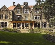
Jesmond Dene House Hotel
York House Hotel
Park Lodge
Oaktree Lodge
The Kenilworth
New Northumbria Hotel
The Adelphi
The Avenue
Cairn
Videos from this area
These are videos related to the place based on their proximity to this place.
Blyth Battery Goes To War 2014
The re-enactment of the D-Day landings held on South Beach, Blyth, Northumberland by the volunteers of Blyth Battery. Blyth Battery is a coastal defence battery and now, after extensive renovation...
Tyne and Wear Metro-Metrocars 4029 and 4010 departing Shiremoor
Tyne and Wear Metro-Metrocars 4029 and 4010 departing Shiremoor.
Tyne and Wear Metro-Metrocars 4090 and 4049 passing Bridge 1126 (Shiremoor)
Tyne and Wear Metro-Metrocars 4090 and 4049 passing Bridge 1126 (Shiremoor)
Tyne and Wear Metro-Metrocars 4002 and 4084 passing Bridge 1126 (Shiremoor)
Tyne and Wear Metro-Metrocars 4002 and 4084 passing Bridge 1126 (Shiremoor)
Tyne and Wear Metro-Metrocars 4026 and 4069 passing Bridge 1123 (Shiremoor)
Tyne and Wear Metro-Metrocars 4026 and 4069 passing Bridge 1123 (Shiremoor)
Tyne and Wear Metro-Metrocars 4056 and 4071 passing Bridge 1126 (Shiremoor)
Tyne and Wear Metro-Metrocars 4056 and 4071 passing Bridge 1126 (Shiremoor)
Tyne and Wear Metro-Metrocars 4064 and 4086 passing Bridge 1126 (Shiremoor)
Tyne and Wear Metro-Metrocars 4064 and 4086 passing Bridge 1126 (Shiremoor)
Tyne and Wear Metro-Metrocars 4051 and 4007 passing Bridge 1126 (Shiremoor)
Tyne and Wear Metro-Metrocars 4051 and 4007 passing Bridge 1126 (Shiremoor)
Tyne and Wear Metro-Metrocars 4057 and 4074 departing Shiremoor
Tyne and Wear Metro-Metrocars 4057 and 4074 departing Shiremoor.
Videos provided by Youtube are under the copyright of their owners.
Attractions and noteworthy things
Distances are based on the centre of the city/town and sightseeing location. This list contains brief abstracts about monuments, holiday activities, national parcs, museums, organisations and more from the area as well as interesting facts about the region itself. Where available, you'll find the corresponding homepage. Otherwise the related wikipedia article.
Seaton Delaval Hall
Seaton Delaval Hall is a Grade I listed country house in Northumberland, England. It is near the coast just north of Newcastle upon Tyne. Located between Seaton Sluice and Seaton Delaval, it was designed by Sir John Vanbrugh in 1718 for Admiral George Delaval and is now owned by the National Trust. Since completion of the house in 1728, it has had an unfortunate history.
Shiremoor Metro station
Shiremoor Metro station is on the Yellow Line of the Tyne and Wear Metro, serving the village of Shiremoor, in North Tyneside, England. The station opened in 1980, as part of the first stage of the Metro system. It was a brand-new station, and replaced Backworth. In the 2008-9 period the station was used by around 375,000 passengers.
Seaton Valley Urban District
Seaton Valley was an urban district in Northumberland, England, from 1935 to 1974, when it was split between the districts of North Tyneside and Blyth Valley. It was created by a County Review Order in 1935 from various urban districts near the North Sea coast, particularly Cramlington, most of Earsdon, Seaton Delaval, and Seghill.
Northumberland Park Metro station
Northumberland Park Metro station is a station on the Tyne and Wear Metro Yellow Line. It serves a new housing development known as Northumberland Park. It is situated between Palmersville and Shiremoor, close to where the single-track freight-only Network Rail line diverges northwards towards Ashington. The station has proved popular with over 320,000 passengers using the station in the 2008-9 period.
Hartley Colliery Disaster
The Hartley Colliery Disaster (also known as the Hartley Pit Disaster) was a disastrous mining accident in Northumberland, England in 1862 in which 220 lives were lost. The disaster arose from a combination of the mine having a single shaft; and the fracture of a metal steam engine beam, blocking the shaft.
Tynemouth Rural District
Tynemouth was a rural district in the English county of Northumberland. It was created by the Local Government Act 1894 based on the Tynemouth rural sanitary district. It initially contained the following parishes: Backworth Bebside Burradon Earsdon East Hartford Hartley Holywell Horton Longbenton Murton Seaton Delaval West Hartford Willington In 1897 the parishes of Backworth, Earsdon, Holywell and Murton became an Earsdon Urban District.
Backworth railway station
Backworth railway station served part of Newcastle in the English county of Northumberland, later part of Tyne and Wear. The station opened as Hotspur, replacing another Backworth station on the line to Morpeth which had been opened as Holywell.
List of United Kingdom locations: Is-Ix


