Safety Score: 3,0 of 5.0 based on data from 9 authorites. Meaning we advice caution when travelling to United Kingdom.
Travel warnings are updated daily. Source: Travel Warning United Kingdom. Last Update: 2024-04-23 08:18:23
Explore Mears Ashby
Mears Ashby in Northamptonshire (England) is a city in United Kingdom about 61 mi (or 98 km) north-west of London, the country's capital.
Local time in Mears Ashby is now 01:36 PM (Tuesday). The local timezone is named Europe / London with an UTC offset of one hour. We know of 12 airports in the vicinity of Mears Ashby, of which 5 are larger airports. The closest airport in United Kingdom is Sywell Aerodrome in a distance of 1 mi (or 2 km), North-West. Besides the airports, there are other travel options available (check left side).
There are several Unesco world heritage sites nearby. The closest heritage site in United Kingdom is Blenheim Palace in a distance of 32 mi (or 51 km), South. Also, if you like golfing, there are multiple options in driving distance. We found 1 points of interest in the vicinity of this place. If you need a place to sleep, we compiled a list of available hotels close to the map centre further down the page.
Depending on your travel schedule, you might want to pay a visit to some of the following locations: Northampton, Warrington, Ravenstone, Weston Underwood and Podington. To further explore this place, just scroll down and browse the available info.
Local weather forecast
Todays Local Weather Conditions & Forecast: 9°C / 47 °F
| Morning Temperature | 5°C / 41 °F |
| Evening Temperature | 7°C / 44 °F |
| Night Temperature | 2°C / 35 °F |
| Chance of rainfall | 1% |
| Air Humidity | 71% |
| Air Pressure | 1023 hPa |
| Wind Speed | Moderate breeze with 12 km/h (7 mph) from South |
| Cloud Conditions | Overcast clouds, covering 100% of sky |
| General Conditions | Light rain |
Wednesday, 24th of April 2024
6°C (43 °F)
0°C (33 °F)
Overcast clouds, moderate breeze.
Thursday, 25th of April 2024
10°C (50 °F)
6°C (43 °F)
Light rain, gentle breeze, overcast clouds.
Friday, 26th of April 2024
10°C (50 °F)
6°C (42 °F)
Light rain, gentle breeze, overcast clouds.
Hotels and Places to Stay
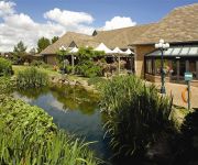
Kettering Park Hotel and Spa
ibis Wellingborough
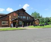
TRAVELODGE NORTHAMPTON ROUND SPINNEY
Northampton Gt Billing/A45
Videos from this area
These are videos related to the place based on their proximity to this place.
EV-97 Landing at Sywell Aerodrome, Aero Expo May 2012
A flight from City Airport (Barton) to Sywell Aerodrome to visit Aero Expo on 26th May 2012. The headwind en-route added an extra 20 minutes to the flight which routed via the Manchester Low...
The Great War Display Team - Sywell Museum Opening 19/04/2014
The Great War Display Team displaying at the Sywell Museum opening 2014. http://www.greatwardisplayteam.com/ Aircraft include -Sopwith Triplane -Fokker Dr1 Triplane x2 -Royal Aircraft Factory...
Hawker Hurricane Mk IIB BE505 - Sywell Museum Opening 19/04/2014
Peter Teichman displays his Hawker Hurricane at the 2014 Sywell Museum Opening. marked XP-L http://www.hangar11.co.uk/index.html Subscribe for more Aircraft videos. This is my first recording...
The Blades Air Display At Sywell Aerodrome
The Blades Air Display, Sywell Aerodrome, 01/05/13 http://www.theblades.com/
Sywell Pistons & Props 2014 - Group B Cars
9 minutes of Group B rally cars (Audi Sport Quattro, Renault 5 Maxi Turbo, Lancia Beta, Peugeot 205 T16 & Ford Escort RS200) playing around on the taxiway at Sywell Aerodrome during Props and...
UNKNOWN AIRCRAFT TYPE - Shocking display - Sywell Aerodrome 30/05/2014 (2)
Anyone who was at Sywell Aerodrome on Friday, can you help me identify the aircraft type in this video? I have reason to believe it is a Pilatus but I may be wrong. All I remember is it had...
Clicking at Barker's Shoes in Earls Barton
Philip remembers working at Barkers Shoes in Earls Barton during the winter and building the M1 motorway in the summer. He also got to speak to the Queen Mother when she opened the new factory...
Summer Sunset Time Lapse Collection Part 1 taken in Earls Barton, Northamptonshire
A collection of photos taken over several hours made into a video to create this stunning collection of time lapse videos. The photos were taken in Earls Bar...
Videos provided by Youtube are under the copyright of their owners.
Attractions and noteworthy things
Distances are based on the centre of the city/town and sightseeing location. This list contains brief abstracts about monuments, holiday activities, national parcs, museums, organisations and more from the area as well as interesting facts about the region itself. Where available, you'll find the corresponding homepage. Otherwise the related wikipedia article.
A43 road
The A43 is a primary route in the English Midlands, that runs from the M40 motorway near Ardley in Oxfordshire to Stamford in Lincolnshire. Through Northamptonshire it bypasses the towns of Northampton, Kettering and Corby which are the three principal destinations on the A43 route. The A43 also links to the M1 motorway. The section of the road between the M40 and M1 is designated a trunk road, managed and maintained by the Highways Agency.
Sywell Country Park
Sywell Country Park exists on the site of a former drinking water reservoir near the village of Sywell in East Northamptonshire, England. The reservoir was built at the turn of the 20th century to supply water to the Higham Ferrers and Rushden areas. It operated between 1906 and 1979 and is now a country park run by Northamptonshire County Council. It has an area of 280,000 square metres. The land for the reservoir was purchased from the Stockdale family estate at adjoining Mears Ashby.
All Saints' Church, Earls Barton
After the Danish raids on England, Medehampstede Abbey, a few miles away from Earls Barton, Northamptonshire, was rebuilt in about AD 970 to become Peterborough. It is generally accepted that All Saints' Church, Earls Barton was built around this period at the end of the tenth century. Even though only the tower survives from the original church at Earls Barton, this is one of the best examples of later Anglo-Saxon architecture.


