Safety Score: 3,0 of 5.0 based on data from 9 authorites. Meaning we advice caution when travelling to United Kingdom.
Travel warnings are updated daily. Source: Travel Warning United Kingdom. Last Update: 2024-04-25 08:17:04
Delve into Stillingfleet
Stillingfleet in North Yorkshire (England) is a city located in United Kingdom about 168 mi (or 270 km) north of London, the country's capital town.
Current time in Stillingfleet is now 12:15 AM (Friday). The local timezone is named Europe / London with an UTC offset of one hour. We know of 11 airports closer to Stillingfleet, of which 5 are larger airports. The closest airport in United Kingdom is RAF Linton-On-Ouse in a distance of 14 mi (or 23 km), North-West. Besides the airports, there are other travel options available (check left side).
There are several Unesco world heritage sites nearby. The closest heritage site in United Kingdom is Studley Royal Park including the Ruins of Fountains Abbey in a distance of 32 mi (or 52 km), North-East. Also, if you like playing golf, there are some options within driving distance. In need of a room? We compiled a list of available hotels close to the map centre further down the page.
Since you are here already, you might want to pay a visit to some of the following locations: Bishopthorpe, Deighton, Fulford, York and Heslington. To further explore this place, just scroll down and browse the available info.
Local weather forecast
Todays Local Weather Conditions & Forecast: 7°C / 45 °F
| Morning Temperature | 4°C / 39 °F |
| Evening Temperature | 7°C / 44 °F |
| Night Temperature | 2°C / 35 °F |
| Chance of rainfall | 1% |
| Air Humidity | 66% |
| Air Pressure | 1003 hPa |
| Wind Speed | Moderate breeze with 9 km/h (6 mph) from South |
| Cloud Conditions | Overcast clouds, covering 100% of sky |
| General Conditions | Light rain |
Friday, 26th of April 2024
8°C (46 °F)
2°C (35 °F)
Light rain, gentle breeze, overcast clouds.
Saturday, 27th of April 2024
10°C (50 °F)
4°C (39 °F)
Light rain, gentle breeze, overcast clouds.
Sunday, 28th of April 2024
8°C (47 °F)
5°C (41 °F)
Moderate rain, moderate breeze, overcast clouds.
Hotels and Places to Stay
York Marriott Hotel
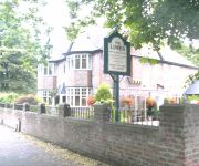
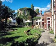
The Limes
Parsonage Hotel & Spa
Holiday Inn YORK
Best Western York Pavilion
Videos from this area
These are videos related to the place based on their proximity to this place.
York parkrun #139 17/01/2015
Horse racecourse - great for PB's. http://www.parkrun.org.uk/york/results/weeklyresults/?runSeqNumber=139.
East Coast Deltic - Doncaster to York (part 2)
In part 2 we finish the journey to York from Colton junction. You might want to turn up your speakers for the napier thrash!! I hope you have enjoyed parts 1/2 and look out for the next...
The Great Britain III: 6201 & 60019 at speed, 14/4/10
April 14th was the final day of the extravagant Great Britain III railtour. That piece of Stanier elegance 6201 'Princess Elizabeth' is seen near milepost 5 north of York and later, 60019...
The Shambles Railtour passing Copmanthorpe
UK Railtours The Shambles 08:35 Shenfield to York passing through Copmanthorpe on Saturday 26th May 2012 at 12:03. Greater Anglia Class 317/6 317661+317672 emu.
Riding home fast to beat the sunset.
Last leg of the bike ride, towards Naburn, with the sunset flashing through the trees. Going fast now.
Copmanthorpe 3.6.12 including GC HST!
A very wet morning at Copmanthorpe foot crossing near York Station, recorded the day after my visit to Railfest. Apologies for both the rain noise and the water marks on the lens. Trains in...
late summer balloon launch
Naburn Lock, just south of York hosts a small gathering of balloon enthusiasts and pilots each year. Here the last balloon of the evening takes off against t...
Finding Fulford, The forgotten battle of 1066
[Latest version] A gallop through a decade of work that set out to find and then to firmly locate the actions described in the literature on the modern surface. The landscape archeology is...
Videos provided by Youtube are under the copyright of their owners.
Attractions and noteworthy things
Distances are based on the centre of the city/town and sightseeing location. This list contains brief abstracts about monuments, holiday activities, national parcs, museums, organisations and more from the area as well as interesting facts about the region itself. Where available, you'll find the corresponding homepage. Otherwise the related wikipedia article.
Bishopthorpe Rural District
Bishopthorpe was a rural district in the West Riding of Yorkshire from 1894 to 1937. It was formed under the Local Government Act 1894 from that part of the York Rural Sanitary District which was in the West Riding. It included the parishes of Acaster Malbis, Askham Richard, Bishopthorpe, Copmanthorpe, Dringhouses Without and Middlethorpe Without. It was abolished in 1937 by a County Review Order.
Cawood Bridge
Cawood Bridge is a swing bridge which spans the River Ouse (York) in North Yorkshire, England. Construction was authorized in 1870, with the formation of the Cawood Bridge bridge company. It was opened on 31 July 1872 to replace the ferry, and is located about half way between Naburn and Selby. It is the only bridge from the village of Cawood that crosses the river. The bridge is the responsibility of North Yorkshire County Council
Acaster South Ings
Acaster South Ings is a 38.3 hectares biological Site of Special Scientific Interest (SSSI) adjacent to the River Ouse and approximately 4 miles south of York. The SSSI was first notified in 1988 and is due to grasslands containing rare plant life.
RAF Acaster Malbis
RAF Acaster Malbis was a Royal Air Force station located 5.9 miles south of York city centre and 5.7 miles east of Tadcaster, North Yorkshire, England. It was developed from a small grass airfield at the beginning of the Second World War and its main use was as a training base for RAF Bomber Command before being used by RAF Maintenance Command from 1944 until 1957.


