Safety Score: 3,0 of 5.0 based on data from 9 authorites. Meaning we advice caution when travelling to United Kingdom.
Travel warnings are updated daily. Source: Travel Warning United Kingdom. Last Update: 2024-04-25 08:17:04
Explore Lulsgate Bottom
Lulsgate Bottom in North Somerset (England) is located in United Kingdom about 111 mi (or 179 km) west of London, the country's capital.
Local time in Lulsgate Bottom is now 08:16 PM (Thursday). The local timezone is named Europe / London with an UTC offset of one hour. We know of 10 airports in the wider vicinity of Lulsgate Bottom, of which 5 are larger airports. The closest airport in United Kingdom is Bristol International Airport in a distance of 1 mi (or 1 km), South-West. Besides the airports, there are other travel options available (check left side).
There are several Unesco world heritage sites nearby. The closest heritage site in United Kingdom is Blaenavon Industrial Landscape in a distance of 28 mi (or 45 km), North. Also, if you like golfing, there are multiple options in driving distance. We found 2 points of interest in the vicinity of this place. If you need a place to sleep, we compiled a list of available hotels close to the map centre further down the page.
Depending on your travel schedule, you might want to pay a visit to some of the following locations: Butcombe, Winford, Blagdon, Brockley and Dundry. To further explore this place, just scroll down and browse the available info.
Local weather forecast
Todays Local Weather Conditions & Forecast: 11°C / 51 °F
| Morning Temperature | 4°C / 40 °F |
| Evening Temperature | 10°C / 49 °F |
| Night Temperature | 5°C / 41 °F |
| Chance of rainfall | 0% |
| Air Humidity | 80% |
| Air Pressure | 1003 hPa |
| Wind Speed | Moderate breeze with 11 km/h (7 mph) from East |
| Cloud Conditions | Overcast clouds, covering 100% of sky |
| General Conditions | Light rain |
Friday, 26th of April 2024
10°C (50 °F)
7°C (44 °F)
Light rain, gentle breeze, overcast clouds.
Saturday, 27th of April 2024
6°C (44 °F)
6°C (43 °F)
Moderate rain, moderate breeze, overcast clouds.
Sunday, 28th of April 2024
9°C (48 °F)
6°C (43 °F)
Moderate rain, moderate breeze, overcast clouds.
Hotels and Places to Stay
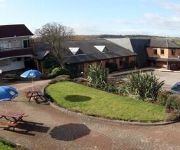
Ring O Bells
Acorns Guest House
Hampton by Hilton Bristol Airport
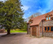
Winford Manor Bristol Airport
Meadow Cottage
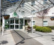
Holiday Inn BRISTOL AIRPORT
The Town and Country Lodge
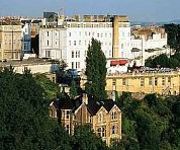
Avon Gorge
The Rodney Clifton
The Rising Sun
Videos from this area
These are videos related to the place based on their proximity to this place.
LANDING AT BRISTOL INTERNATIONAL AIRPORT TCX725 THOMAS COOK AIRLINES FROM MONASTIR TUNISIA.MP4
Landing at Bristol International Airport on Thomas Cook Flight TCX725 on 5th May 2010 at 12.50pm from Monastir Airport Tunisia.(excuse the condensation on the plane window).
Jet Ranger cockpit view
Cocokpit view of a Jet Ranger take off from Bristol Airport 7th Feb 2009 Off to do Emergency Electricity patrols after the snow storm.
Cardiff to Bristol Airport in 4min 40sec
Fast driving from Cardiff to Bristol Airport Time Lapse video - 1hr20min driving in 4min40sec.
Bristol Airport - 17/10/2014 - PART II - EVENING
Bristol International Airport (EGGD) - 17/10/2014 (evening spotting). Landings and take-offs on International Airport in Bristol.
Landing at Bristol Airport, Scandinavian Airlines Boeing B737-600
Route: Stockholm, Sweden (ARN) to Bristol, United Kingdom (BRS) Flight Number: SK2917 Airline: Scandinavian Airlines Aircraft: Boeing B737-600 (LN-RRY) Seat number/Class: 12F (Economy) Date.
Easyjet planes in Bristol Intl Airport (EGGD)
Taxi, take offs and landing in Bristol Intl Airport (EGGD/BRS) by Easyjet. 21/02/2015.
Bristol Airport - 08/10/2014
Landings and take-offs from Bristol International Airport (EGGD) with crosswind. 08 Oct 2014 I'm sorry for shaking but wind was very strong. Enjoy !!!
Bristol Airport, Britannia Boeing 757, Majorca Palma Airport & Footballers in Pueto Pollensa
Driving past the wicker man in Bridgewater, onwards to Bristol International Airport, and on the Britannia Boeing plane - we're sat right on the wing. There are some in-flight views, and then...
GOPRO HD: Airbus A319 Takeoff from Bristol International EGGD
Morning departure from Bristol International Airport (EGGD) runway 09 bound for Schiphol, Amsterdam. EasyJet Airbus A319. Captured with GoPro Hero 3+ Black, 1080p @ 60fps.
Videos provided by Youtube are under the copyright of their owners.
Attractions and noteworthy things
Distances are based on the centre of the city/town and sightseeing location. This list contains brief abstracts about monuments, holiday activities, national parcs, museums, organisations and more from the area as well as interesting facts about the region itself. Where available, you'll find the corresponding homepage. Otherwise the related wikipedia article.
Long Ashton Research Station
Long Ashton Research Station (LARS) was an agricultural and horticultural government research centre in the village of Long Ashton near Bristol, UK. It was created in 1903 to study and improve the West Country cider industry, expanded into fruit research, and was redirected in the 1980s to work on arable crops and aspects of botany. It closed in 2003.
Fairy Toot
The Fairy Toot is an extensive oval barrow in the village of Nempnett Thrubwell, Somerset, England. It is an example of the Severn-Cotswold tomb type which consist of precisely-built, long trapezoid earth mounds covering a burial chamber. Because of this they are a type of chambered long barrow. Fairy Toot was formerly a chambered cairn which is a Scheduled Ancient Monument, on the national monument register as '198102'.
Barrow Gurney Reservoirs
Barrow Gurney Reservoirs (also known as Barrow Gurney Tanks or Barrow Tanks) are three artificial reservoirs for drinking water near the village of Barrow Gurney, which lies southwest of Bristol, England. They are known by their numbers rather than names. They are fed by several springs including one which becomes the Land Yeo. Some of the outfall is also used to feed the river which flows to the Bristol Channel.
Lulsgate Plateau
Lulsgate Plateau is the name given to the Carboniferous Limestone hills which form a northern outlier of the Mendip Hills, southwest of Bristol, England, approximately 600 feet above sea level, which has been occupied since prehistoric times. 40x40px Look up coombe in Wiktionary, the free dictionary. The major feature on the plateau is Bristol International Airport.
Flax Bourton railway station
Flax Bourton railway station was a railway station on the Bristol to Exeter Line, 5 miles 49 chains from Bristol Temple Meads, serving the village of Flax Bourton in North Somerset. It opened in 1860, and was closed by the Beeching Axe in 1964.
Lulsgate Aerodrome
Lulsgate Aerodrome is an ex-RAF airfield that was turned into a racing circuit in 1949. Lulsgate hosted two race meetings in 1949 and 1950. The circuit mainly hosted sports car events, however a Formula III race featured in both 1949 and 1950.
Barrow Gurney Nunnery
Barrow Gurney Nunnery (also called Minchin Barrow) was established around 1200 in Barrow Gurney Somerset, England. The Benedictine nunnery was founded by one of the Fitz-Hardinges (or Fitzhardinge), and in 1212, was left 10 marks in the will of Hugh de Wells. The nunnery also received a pension on the church of Twerton by the time of the Taxatio in 1291. Several other donations of money and land had been received by the Valor of 1535 when the property was assessed as worth £29 6s. 8½d.
Stancombe Quarry
Stancombe Quarry is a quarry at Flax Bourton near Backwell in the North Somerset district of Somerset, England. The quarry was first built in 1952 and nearly destroyed Backwell Hillfort in the process. Today, the quarry which is operated by Tarmac produces Carboniferous Limestone, which is mainly for use on the roads, after crushing on site. The site has a expect output of 28 million tonnes over a 25-year period.


