Safety Score: 3,0 of 5.0 based on data from 9 authorites. Meaning we advice caution when travelling to United Kingdom.
Travel warnings are updated daily. Source: Travel Warning United Kingdom. Last Update: 2024-04-19 08:03:45
Explore Failand
Failand in North Somerset (England) with it's 691 inhabitants is located in United Kingdom about 110 mi (or 178 km) west of London, the country's capital.
Local time in Failand is now 04:35 AM (Saturday). The local timezone is named Europe / London with an UTC offset of one hour. We know of 10 airports in the wider vicinity of Failand, of which 5 are larger airports. The closest airport in United Kingdom is Bristol International Airport in a distance of 4 mi (or 7 km), South. Besides the airports, there are other travel options available (check left side).
There are several Unesco world heritage sites nearby. The closest heritage site in United Kingdom is Blaenavon Industrial Landscape in a distance of 25 mi (or 40 km), North-West. Also, if you like golfing, there are multiple options in driving distance. We found 2 points of interest in the vicinity of this place. If you need a place to sleep, we compiled a list of available hotels close to the map centre further down the page.
Depending on your travel schedule, you might want to pay a visit to some of the following locations: Winford, Dundry, Brockley, Butcombe and Bristol. To further explore this place, just scroll down and browse the available info.
Local weather forecast
Todays Local Weather Conditions & Forecast: 10°C / 51 °F
| Morning Temperature | 3°C / 37 °F |
| Evening Temperature | 9°C / 48 °F |
| Night Temperature | 7°C / 44 °F |
| Chance of rainfall | 0% |
| Air Humidity | 55% |
| Air Pressure | 1031 hPa |
| Wind Speed | Gentle Breeze with 7 km/h (4 mph) from East |
| Cloud Conditions | Broken clouds, covering 61% of sky |
| General Conditions | Broken clouds |
Sunday, 21st of April 2024
9°C (48 °F)
4°C (39 °F)
Broken clouds, gentle breeze.
Monday, 22nd of April 2024
5°C (41 °F)
6°C (43 °F)
Light rain, light breeze, overcast clouds.
Tuesday, 23rd of April 2024
6°C (43 °F)
5°C (40 °F)
Light rain, gentle breeze, overcast clouds.
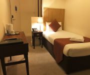
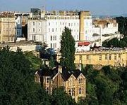
Hotels and Places to Stay
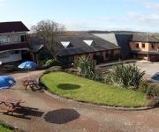
Green Island Resort
The Regency Bristol Hotel
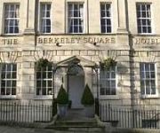
Berkeley Square Clifton Hotel
The Town and Country Lodge
Hampton by Hilton Bristol Airport
Avon Gorge
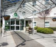
Holiday Inn BRISTOL AIRPORT
Winford Manor Bristol Airport
The Rodney Clifton
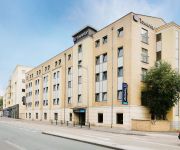
TRAVELODGE BRISTOL CENTRAL
Videos from this area
These are videos related to the place based on their proximity to this place.
Bristol City v Bristol Rovers 4th September 2013 pt 3
Here is a short vid of the above game after City got their second goal.
The Torbay Express - 34046 Braunton - Flax Bourton -06/07/14
Travelling about 30 mins behind The Royal Duchy re-built SR West Country Class 34046 Braunton makes a impressive sight as at speed with the driver sounding the whistle pass the site of Flax...
The Battleaxes wedding venue
The Battleaxes is a beautiful country wedding venue in Wraxall near Bristol. Looking for photographer to document your wedding day in creative and unobtrusive way? Get in touch today to arrange...
BFBCC - The Best Cricket Club in the West
A showcase and introduction to the best cricket club in the West country. All players welcome, young and old. Please get in touch!
Ikarus (North Somerset Coaches 564KHT)
Failand near Nailsea, in North Somerset Coaches DAF SB220 Ikarus 564KHT (ex. L510EHD)
The Royal Duchy - 45407 - Flax Bourton - 06/07/14
After travelling almost the length of the UK from Fort William to Bristol, BR Black 5 No.45407 takes The Royal Duchy pass the site of Flax Bourton station.
6024 King Edward 1 at Flax Bourton 1st May 2010
In failing light, and light rain, KE1 passes Flax Bourton running about 10 minutes late. It was following a freight train and had been heard to ease off stea...
(HD) 4464 Bittern The Torbay Express 1Z28 Flax Bourton 19th August 2012
4464 Bittern with Driver Vince Henderson letting off some steam on The Torbay Express 1Z28 Flax Bourton 19th August 2012 1Z28 0.0 Kingswear d 16:50 Steam 6.5 Paignton a 17:10 ...
Dig for Victory 2014
A mobile phone movie clip,(apologies for the quality) hastily edited of the 2014 Dig for victory event at Wraxall. Highly recommended, an excellent day :)
North Somerset Coaches Ikarus DAF 564KHT (L510EHD)
A blast around North Somerset aboard 564KHT (ex. L510EHD) - DAF SB220/Ikarus Citybus belonging to North Somerset Coaches.
Videos provided by Youtube are under the copyright of their owners.
Attractions and noteworthy things
Distances are based on the centre of the city/town and sightseeing location. This list contains brief abstracts about monuments, holiday activities, national parcs, museums, organisations and more from the area as well as interesting facts about the region itself. Where available, you'll find the corresponding homepage. Otherwise the related wikipedia article.
Long Ashton Research Station
Long Ashton Research Station (LARS) was an agricultural and horticultural government research centre in the village of Long Ashton near Bristol, UK. It was created in 1903 to study and improve the West Country cider industry, expanded into fruit research, and was redirected in the 1980s to work on arable crops and aspects of botany. It closed in 2003.
Barrow Gurney Reservoirs
Barrow Gurney Reservoirs (also known as Barrow Gurney Tanks or Barrow Tanks) are three artificial reservoirs for drinking water near the village of Barrow Gurney, which lies southwest of Bristol, England. They are known by their numbers rather than names. They are fed by several springs including one which becomes the Land Yeo. Some of the outfall is also used to feed the river which flows to the Bristol Channel.
Flax Bourton railway station
Flax Bourton railway station was a railway station on the Bristol to Exeter Line, 5 miles 49 chains from Bristol Temple Meads, serving the village of Flax Bourton in North Somerset. It opened in 1860, and was closed by the Beeching Axe in 1964.
Long Ashton railway station
Long Ashton railway station was a railway station on the Bristol to Exeter Line, 3.5 miles southwest of Bristol Temple Meads, serving the village of Long Ashton in North Somerset, England. There were two stations on the site, the first, called "Ashton", opened in either 1841 or 1852 and closed in 1856. The second station, originally known as "Long Ashton Platform" before being renamed as "Long Ashton" in 1929, was operational from 1926 to 1941.
Hebron Church, Long Ashton
Hebron Church in Long Ashton, North Somerset, near Bristol in England, was first founded in 1934 by Ernest Dyer. The Church arose out of a Sunday School and youth club by Mr Dyer, who cycled weekly from Keynsham to run the clubs. Mr Dyer lived above the Church until his death in the late 1960s. His sister continued living there until her subsequent death. The living rooms have now been adapted to use as a Sunday School.
Long Ashton Rural District
Long Ashton was a rural district in Somerset, England, from 1894 to 1974. It was created in 1894 under the Local Government Act 1894. In 1974 it was abolished under the Local Government Act 1972 to become part of North Somerset.
Barrow Gurney Nunnery
Barrow Gurney Nunnery (also called Minchin Barrow) was established around 1200 in Barrow Gurney Somerset, England. The Benedictine nunnery was founded by one of the Fitz-Hardinges (or Fitzhardinge), and in 1212, was left 10 marks in the will of Hugh de Wells. The nunnery also received a pension on the church of Twerton by the time of the Taxatio in 1291. Several other donations of money and land had been received by the Valor of 1535 when the property was assessed as worth £29 6s. 8½d.
Stancombe Quarry
Stancombe Quarry is a quarry at Flax Bourton near Backwell in the North Somerset district of Somerset, England. The quarry was first built in 1952 and nearly destroyed Backwell Hillfort in the process. Today, the quarry which is operated by Tarmac produces Carboniferous Limestone, which is mainly for use on the roads, after crushing on site. The site has a expect output of 28 million tonnes over a 25-year period.


