Safety Score: 3,0 of 5.0 based on data from 9 authorites. Meaning we advice caution when travelling to United Kingdom.
Travel warnings are updated daily. Source: Travel Warning United Kingdom. Last Update: 2024-04-19 08:03:45
Discover Easton-in-Gordano
Easton-in-Gordano in North Somerset (England) with it's 4,824 citizens is a town in United Kingdom about 111 mi (or 178 km) west of London, the country's capital city.
Current time in Easton-in-Gordano is now 03:15 AM (Saturday). The local timezone is named Europe / London with an UTC offset of one hour. We know of 10 airports near Easton-in-Gordano, of which 5 are larger airports. The closest airport in United Kingdom is Bristol Filton Airport in a distance of 6 mi (or 9 km), North-East. Besides the airports, there are other travel options available (check left side).
There are several Unesco world heritage sites nearby. The closest heritage site in United Kingdom is Blaenavon Industrial Landscape in a distance of 23 mi (or 36 km), North-West. Also, if you like playing golf, there are a few options in driving distance. We discovered 2 points of interest in the vicinity of this place. Looking for a place to stay? we compiled a list of available hotels close to the map centre further down the page.
When in this area, you might want to pay a visit to some of the following locations: Dundry, Winford, Brockley, Bristol and Butcombe. To further explore this place, just scroll down and browse the available info.
Local weather forecast
Todays Local Weather Conditions & Forecast: 10°C / 51 °F
| Morning Temperature | 3°C / 37 °F |
| Evening Temperature | 9°C / 48 °F |
| Night Temperature | 7°C / 44 °F |
| Chance of rainfall | 0% |
| Air Humidity | 55% |
| Air Pressure | 1031 hPa |
| Wind Speed | Gentle Breeze with 7 km/h (4 mph) from East |
| Cloud Conditions | Broken clouds, covering 61% of sky |
| General Conditions | Broken clouds |
Sunday, 21st of April 2024
9°C (48 °F)
4°C (39 °F)
Broken clouds, gentle breeze.
Monday, 22nd of April 2024
5°C (41 °F)
6°C (43 °F)
Light rain, light breeze, overcast clouds.
Tuesday, 23rd of April 2024
6°C (43 °F)
5°C (40 °F)
Light rain, gentle breeze, overcast clouds.
Hotels and Places to Stay
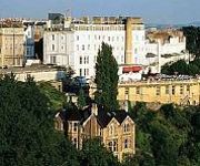
Avon Gorge
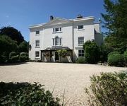
THE BEST WESTERN HENBURY LODGE HOTEL
The Rodney Clifton
The Town and Country Lodge
Acorns Guest House
The Channings Hotel
TRAVELODGE PORTISHEAD
Victoria Square
TRAVELODGE BRISTOL CRIBBS CAUSEWAY
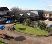
Days Inn Bristol Welcome Break Service Area
Videos from this area
These are videos related to the place based on their proximity to this place.
Yacht Race, Portishead, Winter Series Race 5, Blue Pearl
This is the last race in the winter series, held one cold January morning in 2011. Not much wind to start with but it soon picked up and got us accross the line 3rd. This was enough to secure...
Things To Do In Bristol - Bristol Packet Boat Trips
At the mouth of the Avon looking out to the Bristol Channel. A fantastic trip with plenty of shipping. One of the great things to do in Bristol with Bristol Packet Boat Trips http://www.bristolpack...
Rotel RVC 240 Classic UK CB Radio
Here is a short video of a 1981 Classic CB Radio. It is a Rotel RVC 240 40ch FM UK CB radio.
Lake Dive
The only video I have of my SCUBA diving years,such a shame as I did some great dives with the BSAC and PADI.Wish the digital cameras we have now were around then :(
CN11 GZA Potentially illegal motorcycles
Contour GPS 2013-05-05 Two motorcycles on the M5 just south of the Avonmouth Bridge, one of them without a license plate. They might not even be motorway leg...
Driving On The M5 From J31 A30 A38 To Gordano Services J19, Portbury, Bristol, Somerset, England
Driving northbound on the M5 motorway from Junction 31 (A30 & A38) to Gordano Services Junction 19, Portbury, Bristol, Somerset, England Videoed on Thursday, 15th August 2013 Playlist: ...
North Somerset Coaches Ikarus DAF 564KHT (L510EHD)
A blast around North Somerset aboard 564KHT (ex. L510EHD) - DAF SB220/Ikarus Citybus belonging to North Somerset Coaches.
Feral youth - blame the parents - Pill shops, near Bristol, Somerset
A feral child (also, colloquially, wild child) is a human child who has lived isolated from human contact from a very young age, and has no (or little) experience of human care, loving or social...
Cabinet 3rd October 2013
Bristol City Council cabinet meeting at Avonmouth Community Centre. 3rd October 2013, 6.00PM.
Videos provided by Youtube are under the copyright of their owners.
Attractions and noteworthy things
Distances are based on the centre of the city/town and sightseeing location. This list contains brief abstracts about monuments, holiday activities, national parcs, museums, organisations and more from the area as well as interesting facts about the region itself. Where available, you'll find the corresponding homepage. Otherwise the related wikipedia article.
Port of Bristol
The Port of Bristol comprises the commercial, and former commercial, docks situated in and near the city of Bristol in England. The Port of Bristol Authority was the commercial title of the Bristol City, Avonmouth, Portishead and Royal Portbury Docks when they were operated by Bristol City Council, which ceased trade when the Avonmouth and Royal Portbury Docks were leased to The Bristol Port Company in 1991.
Avonmouth Bridge
The Avonmouth Bridge is a road bridge that carries the M5 motorway over the River Avon into Somerset near Bristol, England. The main span is 538 ft long, and the bridge is 4,554 ft long, with an air draught above mean high water level of 98.4 ft . It also has a separate footpath and cycleway.
Royal Portbury Dock
The Royal Portbury Dock is part of the Port of Bristol, in England. It is situated near the village of Portbury on the southern side of the mouth of the Avon, where the river joins the Severn estuary — the Avonmouth Docks are on the opposite side of the Avon, within Avonmouth. The deepwater dock was constructed between 1972 and 1977, and is now a major port for the import of motor vehicles into the UK.
Avonmouth Docks
The Avonmouth Docks are part of the Port of Bristol, in England. They are situated on the northern side of the mouth of the River Avon, opposite the Royal Portbury Dock on the southern side, where the river joins the Severn estuary, within Avonmouth. Avonmouth Docks are one of the UK's major ports for chilled foods, especially fruit and vegetables. The docks are on the rail network, served by Avonmouth railway station on the Severn Beach Line. The M5 motorway is nearby.
Bristol Port Railway and Pier
The Bristol Port Railway and Pier (occasionally referred to as the Bristol Port and Pier Railway) was a railway in Bristol, England.
Horseshoe Bend, Shirehampton
Horseshoe Bend, Shirehampton is a 4.45 hectare biological Site of Special Scientific Interest in Bristol, England, on the north bank of a lower, tidal stretch of the River Avon, 3 kilometres downstream from the Avon Gorge, and just east of the village of Shirehampton. It was notified as an SSSI in 1999.
Leigh Court
Leigh Court is a country house which is a Grade II* listed building in Abbots Leigh, Somerset, England. The manor of Leigh at the time of the Norman Conquest belonged to the lordship of Bedminster but William the Conqueror awarded it to the Bishop of Coutances. The manor house was given in 1118 by Robert Fitzharding to become a house of rest for the abbot and monks of St Augustine's Monastery in Bristol and as "Abbot's Leigh" it was destinguished from other places named "Leigh".
Lamplighters Marsh
Lamplighters Marsh is a public open space near Shirehampton in the city of Bristol, England. It is a narrow strip of land between the railway line which connects Bristol to Avonmouth, and the River Avon. The site contains two main types of vegtation: an area of marsh, which contains a varied plant community, including Water Parsnip and Wild Celery, and an area of wasteland which is also botanically notable, with species including Narrow-leaved Everlasting-pea.


