Safety Score: 3,0 of 5.0 based on data from 9 authorites. Meaning we advice caution when travelling to United Kingdom.
Travel warnings are updated daily. Source: Travel Warning United Kingdom. Last Update: 2024-04-25 08:17:04
Delve into Elswick
The district Elswick of Newcastle upon Tyne in Newcastle upon Tyne (England) is a subburb in United Kingdom about 247 mi north of London, the country's capital town.
If you need a hotel, we compiled a list of available hotels close to the map centre further down the page.
While being here, you might want to pay a visit to some of the following locations: Gateshead, Lamesley, Dinnington, Pelton and Wallsend. To further explore this place, just scroll down and browse the available info.
Local weather forecast
Todays Local Weather Conditions & Forecast: 7°C / 45 °F
| Morning Temperature | 4°C / 39 °F |
| Evening Temperature | 6°C / 43 °F |
| Night Temperature | 2°C / 35 °F |
| Chance of rainfall | 2% |
| Air Humidity | 63% |
| Air Pressure | 1002 hPa |
| Wind Speed | Moderate breeze with 9 km/h (6 mph) from South |
| Cloud Conditions | Broken clouds, covering 64% of sky |
| General Conditions | Rain and snow |
Friday, 26th of April 2024
7°C (45 °F)
2°C (36 °F)
Light rain, gentle breeze, overcast clouds.
Saturday, 27th of April 2024
9°C (49 °F)
3°C (38 °F)
Broken clouds, gentle breeze.
Sunday, 28th of April 2024
9°C (48 °F)
5°C (41 °F)
Light rain, gentle breeze, overcast clouds.
Hotels and Places to Stay
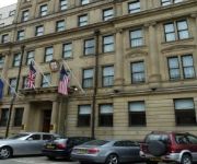
Vermont
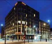
Newcastle Gateshead Marriott Hotel MetroCentre
Sandman Signature Hotel Newcastle
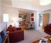
PREMIER SUITES Newcastle
Hotel Indigo NEWCASTLE
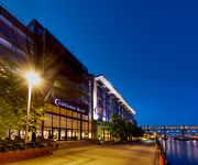
Copthorne Newcastle
County Hotel
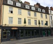
Waterside Hotel
Newgate Hotel
Hampton by Hilton Newcastle
Videos from this area
These are videos related to the place based on their proximity to this place.
Dunston UTS v Glossop North End
FA Vase 5th Round Replay 21st February 2015. FT Dunston UTS 1-3 Glossop North End Ormston Russell Young ...
Tornado Arriving At Newcastle 18th november 2008
60163 A1 Tornado Steam engine arriving at newcastle central 18th november 2008.
Let's Play Alice: Madness Returns - Part 32 - Castles of Cards
And I STILL can't find that bloody pig snout! Twitter: https://twitter.com/#!/ThatGeordieLass Alice: Madness Returns belongs to American McGee/Spicy Horse/Electronic Arts.
Tynemouth market
Market of varieties and antiques in Tynemouth metro station. Mercadillo de antigüedades y cosas varias en la estación de metro de Tynemouth.
Newcastle United Lap of Honour.
This is the Newcastle United team parading the Championship Trophy around St. James' Park shortly after it was presented at the end of the last home game of the season against Ipswich - 2009/2010...
Inauguration of North East Arabic Language Academy - Dr Anand on www.anandfilms.net
North East Arabic Language Academy https://www.youtube.com/edit?o=U&video_id=7ypjFXTWDTA https://www.youtube.com/watch?v=dH_bBN_Y8kM https://www.youtube.com/watch?v=_ZHvfBm6l9k ...
Why NEALA? A few opinions - Dr Anand on www.anandfilms.net
North East Arabic Language Academy https://www.youtube.com/edit?o=U&video_id=7ypjFXTWDTA https://www.youtube.com/watch?v=dH_bBN_Y8kM https://www.youtube.com/watch?v=_ZHvfBm6l9k ...
'The Gift' Amanda Molloy | Exclusive to Spice FM | Dr. Anand
Please subscribe to my channel Amanda Molloy takes you through her journey as one of the most jaw dropping psychic mediums the world has ever seen. Amanda speaks from her heart about life...
Visiting Bentinck Furniture - Amir Thamin - Dr Anand on www.anandfilms.net
Asian Business Connexions and the Pakistan Trade Envoy Amir Thamin At Vermont Hotel http://youtu.be/HQRW2EklwQs Visit to Bentinck Furniture http://youtu.be/lUY3JB8wLNY Ammar on SpiceFM +...
Zionist Boots in Bethlehem: Humus with Teargas Series (Occupied Palestine) - www.anandfilms.net
Bethlehem (Arabic: بيت لحم About this sound Bayt Laḥm (help·info) "House of Meat" Bēt Laḥm, lit. "House of Bread"; Hebrew: בֵּית לֶחֶם Bēṯ Leḥem, Modern: Bet Leḥem...
Videos provided by Youtube are under the copyright of their owners.
Attractions and noteworthy things
Distances are based on the centre of the city/town and sightseeing location. This list contains brief abstracts about monuments, holiday activities, national parcs, museums, organisations and more from the area as well as interesting facts about the region itself. Where available, you'll find the corresponding homepage. Otherwise the related wikipedia article.
BBC Newcastle
BBC Newcastle (formally BBC Radio Newcastle) is the BBC Local Radio service English metropolitan county of Tyne and Wear, broadcasting from studios (known locally as the 'Pink Palace') on Barrack Road in Newcastle upon Tyne.
St James' Park
St James' Park is an all-seater stadium in Newcastle upon Tyne, England. It is the home of Newcastle United Football Club and has a seating capacity of 52,404. St James' Park has been the home ground of Newcastle United since 1892 and has been used for football since 1880. Throughout its history, the desire for expansion has caused conflict with local residents and the local council.
MetroCentre (shopping centre)
The MetroCentre (styled corporately as metrocentre and on road signs as Metro Centre) is a shopping centre in the United Kingdom. Located in Gateshead, near Newcastle upon Tyne, on a former industrial site close to the River Tyne, the Metrocentre opened in stages, with the first phase opening on 28 April 1986 and the official opening on 14 October 1986. It has more than 340 shops occupying 194,400 square metres of retail floor space, making it the largest shopping and leisure centre in the UK.
Turbinia
Turbinia was the first steam turbine-powered steamship. Built as an experimental vessel in 1894, and easily the fastest ship in the world at that time, Turbinia was demonstrated dramatically at the Spithead Navy Review in 1897 and set the standard for the next generation of steamships, the majority of which were turbine powered. The vessel can still be seen at the Discovery Museum in Newcastle upon Tyne, England, while her original powerplant can be found at the London Science Museum.
Metro Radio Arena
Metro Radio Arena (formerly the Newcastle Arena and Telewest Arena) is a sports and entertainment arena in the city of Newcastle upon Tyne, North East England, United Kingdom. Owned and operated by the SMG Europe and sponsored by Metro Radio, it hosts music, entertainment, sports & business events.
Dame Allan's School, Newcastle
Dame Allan's Schools is a collection of schools in Fenham, in the west end of Newcastle upon Tyne, England. It comprises a coeducational junior school, single-sex senior schools and a coeducational sixth form. Founded in 1705 as a charity, the original schools are two of the oldest schools in the city.
MetroCentre railway station
MetroCentre railway station is a railway station that serves the MetroCentre shopping and leisure complex in Gateshead, Tyne and Wear. It is located on the Tyne Valley Line from Newcastle upon Tyne to Carlisle, and is managed by Northern Rail. The station opened on 3 August 1987. It is an unmanned station, connected to the MetroCentre mall by a covered footbridge. Initially called Gateshead MetroCentre, the station's name was shortened to MetroCentre from 17 May 1993.
Dunston railway station
Dunston railway station serves Dunston, an area of Gateshead, in Tyne and Wear, northern England. It is located on the Tyne Valley Line which runs from Newcastle upon Tyne to Carlisle. The station first opened on 1 January 1909. It was originally known as Dunston-on-Tyne, and served as the terminus of a shuttle service from Newcastle. This service ended on 4 May 1926, and the station was closed.
Dunston, Tyne and Wear
Dunston was originally an independent village on the south bank of the River Tyne. It has now been absorbed into the Metropolitan Borough of Gateshead in the English county of Tyne and Wear. Much of Dunston forms part of the inner Gateshead regeneration area. The Dunston area is serviced by the Dunston railway station, along the Tyne Valley Line. Dunston is now split into two distinct areas separated by the A1 dual carriageway. Much of the area south of the A1 is known as Dunston Hill.
Newcastle College
Newcastle College is a Further Education and Higher Education college in Newcastle upon Tyne, England. The college has a complex history, being an amalgamation of various colleges and training providers. The college is a part of a larger corporation called NCG (formerly the Newcastle College Group). Ofsted downgraded the college to 'good' following its inspection in 2012, having been graded 'outstanding' in both 2004 and 2008.
River Team
The River Team is a tributary of the River Tyne in Gateshead, England. Its source is near Annfield Plain, where it is known as Kyo Burn. Then changing its name again to Causey Burn as it flows underneath the famous Causey Arch. It then flows past Beamish Museum in County Durham (where it is known as Beamish Burn) then crosses the border into Gateshead flowing through Lamesley.
Policy, Ethics and Life Sciences Research Centre
The Policy, Ethics and Life Sciences Research Centre (PEALS) was established in 1999 as a partnership between the University of Durham, Newcastle University and the Centre for Life. PEALS aims to research, inform and improve policy, professional practice and democratic participation in the life sciences. It particularly promotes research and debate on the social and ethical aspects of genetics and other life sciences. The Centre publishes the Teach Yourself Citizens Juries Handbook.
St James Metro station
St James Metro station is a station on the Tyne and Wear Metro, in the west end of the centre of Newcastle upon Tyne, England. The station is situated next to St James' Park, the stadium of Newcastle United F.C.. The station, which opened in 1982, is one of termini of the Yellow line of the Metro system.
Spital Tongues
Spital Tongues is a historic area of Newcastle upon Tyne, located north west of the city centre. Its unusual name is believed to be derived from 'spital' – a corruption of the word 'hospital' that is quite commonly found in UK place names - and 'tongues', meaning outlying pieces of land. Edward I gave two such 'tongues' of land to the St Mary Magdalene Hospital – hence 'hospital tongues' and eventually 'Spital Tongues'.
Lobley Hill
Lobley Hill is a village located on the outskirts of the Metropolitan Borough of Gateshead in Tyne and Wear, North East England. It has a population of 6,199. It is surrounded by old coal pits and has a beautiful park, called Watergate Forest Park, built on reclaimed land on the site of the former Watergate Colliery. Lobley Hill was the first place where industrial coal mining methods were used.
Moorbank Botanic Gardens
The Moorbank Botanic Garden occupies a 3-hectare site in Newcastle upon Tyne, England, and was developed from the 1920s as a university botanical garden. Moorbank is leased from the Freemen of Newcastle and is located on Claremont Road to the west of the main Newcastle University campus.
Tyne Theatre Stage School
Tyne Theatre Stage School is a stage school in the North East of England, situated at Newcastle College's Rye Hill Campus, Newcastle upon Tyne. Tyne Theatre Stage School has been providing first class performing arts training in Dance, Acting and Singing in the North East region for over twenty years for children aged 3–18. Since opening, our classes have been located in the centre of Newcastle upon Tyne, providing the best studio and performance facilities.
Redheugh Park
Redheugh Park (pronounced red-yoof), a football stadium in Gateshead, England, was built in 1930 when South Shields FC moved to Gateshead from Horsley Hill and became Gateshead AFC. It was their home for more than 40 years. The stadium offered terracing all round. The Main Stand was a two-thirds pitch length seated stand (purchased from a greyhound stadium in Carlisle) with covered standing extensions added on either side.
Staiths South Bank
Staiths South Bank is a part completed housing development in Gateshead, England, designed in collaboration with fashion designers Wayne & Gerardine Hemingway, (known for their Red or Dead fashion label).
Derwent Tower
Derwent Tower (also known as the Dunston Rocket) was a 29-storey residential apartment building in Dunston, United Kingdom. Due to the tower block's unusual shape, the building was nicknamed the "Dunston Rocket" during construction (even before its official Derwent Tower title) and the name has remained with locals throughout its life. It has now been demolished.
Milecastle 5
Milecastle 5 (Quarry House) was a milecastle of the Roman Hadrian's Wall. No remains exist of the milecastle, though its supposed position is at the junction of the A186 Westgate road and the B1311 Corporation Street. No remains currently exist.
Milecastle 6
Milecastle 6 (Benwell Grove) was a milecastle of the Roman Hadrian's Wall.
St Stephen's Church, Low Elswick
St Stephen's Church, Low Elswick, is a redundant Anglican church in Brunel Terrace, Low Elswick, Newcastle upon Tyne, Tyne and Wear, England. It has been designated by English Heritage as a Grade II listed building, and is under the care of the Churches Conservation Trust.
Powerhouse (club)
Powerhouse is a gay club and venue in Newcastle upon Tyne. The Powerhouse has been located in four separate locations over its history. Originally a basement club on Waterloo Street in the 1980s and launched by property developer and entrepreneur Sam Hamandi of Trafalgar Leisure Ltd.
MetroCentre Interchange
The Metrocentre Transport Interchange serves the MetroCentre in Gateshead, Tyne and Wear, England. The bus station is managed by the shopping centre and Nexus operate the bus station's travel centre. A footbridge connects the Interchange the railway station (to the north) and the shopping mall (to the south). Go North East is the main bus operator that serves the Interchange. Stagecoach in Newcastle, Classic Coaches and Gateshead Central Taxis also serve it.


