Safety Score: 3,0 of 5.0 based on data from 9 authorites. Meaning we advice caution when travelling to United Kingdom.
Travel warnings are updated daily. Source: Travel Warning United Kingdom. Last Update: 2024-04-24 08:14:40
Discover Aigburth
The district Aigburth of Liverpool in Liverpool (England) is a district in United Kingdom about 174 mi north-west of London, the country's capital city.
Looking for a place to stay? we compiled a list of available hotels close to the map centre further down the page.
When in this area, you might want to pay a visit to some of the following locations: Knowsley, Ledsham, Ince, Melling and Hale. To further explore this place, just scroll down and browse the available info.
Local weather forecast
Todays Local Weather Conditions & Forecast: 9°C / 47 °F
| Morning Temperature | 7°C / 44 °F |
| Evening Temperature | 8°C / 47 °F |
| Night Temperature | 6°C / 43 °F |
| Chance of rainfall | 1% |
| Air Humidity | 71% |
| Air Pressure | 1004 hPa |
| Wind Speed | Moderate breeze with 10 km/h (6 mph) from South-East |
| Cloud Conditions | Overcast clouds, covering 100% of sky |
| General Conditions | Light rain |
Friday, 26th of April 2024
10°C (49 °F)
7°C (44 °F)
Overcast clouds, light breeze.
Saturday, 27th of April 2024
10°C (50 °F)
7°C (45 °F)
Light rain, gentle breeze, overcast clouds.
Sunday, 28th of April 2024
11°C (53 °F)
10°C (49 °F)
Moderate rain, moderate breeze, overcast clouds.
Hotels and Places to Stay
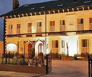
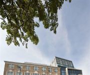
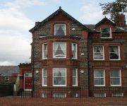
Beech Mount
Hope Street Hotel
Crowne Plaza LIVERPOOL JOHN LENNON AIRPORT
Aachen
Hampton by Hilton Liverpool-John Lennon Airport
Sheil Suites
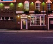
The Blackburne Arms
May's House
Castle Lodge Guest House
Sefton Park Hotel
Videos from this area
These are videos related to the place based on their proximity to this place.
Visit to 'Strawberry Field(s) Forever' - Liverpool
A memory of our trip to Liverpool. Here's our own videoversion of the greatest Beatlessong. Don't miss the end of it...
6201 Princess Elizabeth Steaming Thought Wavertree 16/08/2009
The Princess Elizabeth steaming up from Edge Hill though Wavertree on her way to Holyhead. As the North Wales Coast Express 16/08/2009.
45305 Cumbrian Mountain Express @ Wavertree 20/08/11
45305 Steaming Though Wavertree station early morning on her way to Carlise on the Cumbrian Mountain Express charter. Sorry it's a little shaky, I was late getting out and in rushing forgot...
6233 Duchess of Sutherland @ Wavertree 23/08/2009
The Duchess of Sutherland steaming thought Wavertree on her way to Holyhead.
garden festival site 20 7 2012
Another video of the Liverpool Garden Festival site, absolutely beautiful especially the Chinese Pagoda and water gardens..well worth a visit.yet another wonderfull attraction added to our...
Property Tour Grove Street, L15 8HU (74870)
Four Bedroom Semi Detached Property in Popular Location Set Within Wavertree Village Conservation Area Hall, Attractive Lounge & Dining Room, Modern Kitchen ...
HoloCost
Mirrored *Snordster* http://www.youtube.com/watch?v=UPibi1ozd50 What is it, exactly, that drives a country to implement laws forbidding historical review? The cost has been debilitating to...
Red Sofa Sessions #onTour: Stephen Langstaff at Food & Drink
Liverpool Live TV's Red Sofa Sessions teamed up with Quills Coffee at The Food and Drink Festival in Sefton Park to bring you some of the best young musical talent in the city and a great cup...
LLTV Presents: OttersGhoul GT
It's going to be a scream! Tickets are now on sale for Ottersghoul Halloween spectacular. The event runs from Thursday 24th until Thursday 31st October and is guaranteed to get those bones...
Videos provided by Youtube are under the copyright of their owners.
Attractions and noteworthy things
Distances are based on the centre of the city/town and sightseeing location. This list contains brief abstracts about monuments, holiday activities, national parcs, museums, organisations and more from the area as well as interesting facts about the region itself. Where available, you'll find the corresponding homepage. Otherwise the related wikipedia article.
Penny Lane
"Penny Lane" is a song by the Beatles, written primarily by Paul McCartney. {{#invoke:Footnotes|sfn}} It was credited to Lennon–McCartney. Recorded during the Sgt. Pepper sessions, "Penny Lane" was released in February 1967 as one side of a double A-sided single, along with "Strawberry Fields Forever". Both songs were later included on the Magical Mystery Tour LP (1967). The single was the result of the record company wanting a new release after several months of no new Beatles releases.
Sefton Park
Sefton Park is a public park in south Liverpool, England. The park is in a district of the same name within the Liverpool City Council Ward of St Michaels, and roughly within the historic bounds of the large area of Toxteth Park. Neighbouring districts include modern-day Toxteth, Aigburth, Mossley Hill, Wavertree and St Michael's Hamlet.
North Dock, Garston
North Dock is a dock on the River Mersey at Garston, Liverpool, England. It is accessed from Old Dock, Garston, and is part of the Port of Garston. 25px This article about a Merseyside building or structure is a stub. You can help Wikipedia by expanding it. vte
Stalbridge Dock
Stalbridge Dock is a dock on the River Mersey at Garston, Liverpool, England. It has direct access to the River Mersey and provides access to Old Dock, Garston, and thence also to North Dock, Garston. It is part of the Port of Garston. 25px This article about a Merseyside building or structure is a stub. You can help Wikipedia by expanding it. vte
Old Dock, Garston
Old Dock, on the River Mersey at Garston, Liverpool, England is a maritime dock in the Port of Garston. It accessed from Stalbridge Dock and provides access to North Dock. Garston Dock was originally set up by the St Helen's Canal & Railway Company in June 1853. 25px This article about a Merseyside building or structure is a stub. You can help Wikipedia by expanding it. vte
Port of Garston
The Port of Garston, also known as Garston Docks is a group of docks on the River Mersey at Garston, Liverpool, England. It is operated by Associated British Ports. Garston Dock was originally set up by the St. Helens and Runcorn Gap Railway Company in June 1853. It contains Old Dock, North Dock and Stalbridge Dock.
Greenbank Park
Greenbank Park is a public park in Liverpool, England, with a focal point of an elegant, placid lake. It is situated in the south of the city close to the borders of Sefton Park.
Sudley House
Sudley House, Aigburth, Liverpool, England is an art gallery which contains the collection of George Holt in its original setting. It includes work by Thomas Gainsborough, Joshua Reynolds, Edwin Landseer, John Everett Millais and J. M. W. Turner. Built in the early 19th century for Liverpool Mayor Nicholas Robinson, Sudley became the house of Victorian ship owner and merchant George Holt in 1883. It was all bequeathed to the city in 1944 by Holt's daughter Emma Holt.
Church of All Hallows, Allerton
The Church of All Hallows, Allerton is in Allerton, Liverpool, Merseyside, England. It has been designated by English Heritage as a Grade I listed building, and an active Anglican parish church in the diocese of Liverpool, the archdeaconry of Liverpool and the deanery of Liverpool South - Childwall.
Church of St Anne, Aigburth
The Church of St Anne, Aigburth, is in Aigburth Road, Aigburth, Liverpool, Merseyside, England. It is designated by English Heritage as a Grade II* listed building, and is an active Anglican parish church in the diocese of Liverpool, the archdeaconry of Liverpool and the deanery of Liverpool South Childwall. Its architecture is an early example of the Romanesque/Norman Revival.
Stanlawe Grange
Stanlawe Grange in Aigburth, Liverpool, England is the remains of a 13th century monastic grange. Little remains of the original cruck frame structure. It has been constantly changed and now is a small sandstone structure.
Church of St Matthew and St James, Liverpool
The Church of St Matthew and St James, Liverpool, stands on the top of a hill in Rose Lane, Mossley Hill, Liverpool, Merseyside, England. It is an active Anglican parish church in the deanery of Liverpool South Childwall, the archdeaconry of Liverpool and the diocese of Liverpool. Its benefice is united with those of All Hallows, Allerton, and St Barnabas, Mossley Hill.
Greenbank House
Greenbank House, is a Grade II listed building, located in Liverpool, England. It stands within the University of Liverpool's Greenbank Halls of Residence site, between Greenbank Road and Greenbank Lane.
Cressington (ward)
Cressington is a Liverpool City Council Ward in the Garston and Halewood Parliamentary constituency. It contains the Cressington Park, Grassendale Park and the Grassendale area of Liverpool. The ward was created for the 2004 municipal election from parts of the former Grassendale and Allerton wards. The area is served by Cressington railway station.
Church (Liverpool ward)
Church is a Liverpool City Council Ward. It contains part of the Mossley Hill area of Liverpool. It includes the road Penny Lane, famous for the Beatles song of the same name. The ward boundary was changed at the 2004 municipal elections to encompass parts of the former Grassendale and Allerton wards and losing part to the new Wavertree ward.
Greenbank (ward)
Greenbank is a Liverpool City Council Ward in Liverpool Riverside Parliamentary constituency. It was formed for the 2004 municipal elections incorporating most of the former Arundel ward and parts of the former Aigburth and Picton wards.
Otterspool railway station
Otterspool station was a railway station in Liverpool, England. It was located between St Michaels and Aigburth stations on the Garston and Liverpool Railway. The station opened in 1864 and was absorbed into the Cheshire Lines Committee in 1865. It closed in 1951, due to low passenger numbers. The station was at the end of a long and otherwise empty lane running alongside Otterspool Park.
I M Marsh Campus
The IM Marsh Campus is a Liverpool John Moores University campus in south Liverpool. It's home to the Faculty of Education, Community and Leisure (ECL) and around 2,000 students each year. It currently houses the majority of the University's sporting facilities including: 25 metre swimming pool, sports hall, two gymnasiums, fitness suite, climbing wall, tennis courts, hockey astroturf and three large playing fields. All the facilities are operated by Marsh Sports.
South Liverpool F.C
South Liverpool F.C. is a football club from Liverpool, England. The club is currently in the West Cheshire Amateur Football League Division Two and plays its home matches at Jericho Lane. The club's colours are white shirts, black shorts and red socks.
Mossley Hill (ward)
Mossley Hill is a Liverpool City Council ward in the Liverpool Riverside Parliamentary constituency. It was formed for the 2004 municipal elections from the former Grassendale and Aigburth wards.
Liverpool Mossley Hill (UK Parliament constituency)
Liverpool Mossley Hill was a parliamentary constituency centred on the Mossley Hill suburb of Liverpool. It returned one Member of Parliament (MP) to the House of Commons of the Parliament of the United Kingdom, elected by the first-past-the-post voting system.
Carnatic Halls
Carnatic Halls, is the largest of the University of Liverpools' two halls of residence sites located in the suburbs of Liverpool, England. It stands within the Mossley Hill area of the city.
Aigburth Cricket Ground, Liverpool
Aigburth Cricket Ground in Liverpool, England, is the home of Liverpool Cricket Club. The club was founded in 1807 and is the oldest amateur sports club in Merseyside. The ground hosted its maiden first-class cricket match in 1881, a fixture between Lancashire and Cambridge University. Designed by Thomas Harnett Harrison and built in 1880, the pavilion is the oldest at a first-class cricket ground. The first Women's Cricket World Cup was held in England in 1973.
Dovedale Infant School
Dovedale Infant School is an infant school situated on Herondale Road in the Mossley Hill section of Liverpool, Merseyside, England. It is a mixed community school founded in 1915 as Dovedale Road Council Infants Department. The school occupies the same estate as Dovedale Junior School; the schools are sometimes jointly referred to as Dovedale Primary School.
Dovedale Baptist Church, Liverpool
Dovedale Baptist Church is an evangelical Baptist Church in Liverpool. It is in membership with the Baptist Union of Great Britain, the Evangelical Alliance and Churches Together in Mossley Hill. The Grade II listed church building is located on Dovedale Road, Liverpool 18, on the junction with Barndale Road on one side and Olivedale Road on the other. The main entrance to the church is on Dovedale Road with side entrances to the church hall on both Barndale Road and Olivedale Road.


