Safety Score: 3,0 of 5.0 based on data from 9 authorites. Meaning we advice caution when travelling to United Kingdom.
Travel warnings are updated daily. Source: Travel Warning United Kingdom. Last Update: 2024-04-18 08:12:24
Touring Saltby
Saltby in Leicestershire (England) is a town located in United Kingdom about 95 mi (or 152 km) north of London, the country's capital place.
Time in Saltby is now 06:00 AM (Friday). The local timezone is named Europe / London with an UTC offset of one hour. We know of 11 airports nearby Saltby, of which 5 are larger airports. The closest airport in United Kingdom is RAF Cottesmore in a distance of 7 mi (or 12 km), South-East. Besides the airports, there are other travel options available (check left side).
There are several Unesco world heritage sites nearby. The closest heritage site in United Kingdom is Derwent Valley Mills in a distance of 17 mi (or 27 km), North-East. Also, if you like the game of golf, there are several options within driving distance. Need some hints on where to stay? We compiled a list of available hotels close to the map centre further down the page.
Being here already, you might want to pay a visit to some of the following locations: Market Overton, Ashwell, Cottesmore, Langham and Burley. To further explore this place, just scroll down and browse the available info.
Local weather forecast
Todays Local Weather Conditions & Forecast: 10°C / 49 °F
| Morning Temperature | 7°C / 45 °F |
| Evening Temperature | 8°C / 46 °F |
| Night Temperature | 2°C / 36 °F |
| Chance of rainfall | 1% |
| Air Humidity | 76% |
| Air Pressure | 1018 hPa |
| Wind Speed | Fresh Breeze with 15 km/h (9 mph) from South-East |
| Cloud Conditions | Scattered clouds, covering 48% of sky |
| General Conditions | Light rain |
Saturday, 20th of April 2024
8°C (47 °F)
1°C (34 °F)
Broken clouds, moderate breeze.
Sunday, 21st of April 2024
7°C (45 °F)
2°C (36 °F)
Light rain, moderate breeze, broken clouds.
Monday, 22nd of April 2024
9°C (49 °F)
4°C (39 °F)
Light rain, fresh breeze, scattered clouds.
Hotels and Places to Stay
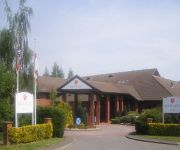
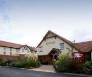
Urban Grantham
Grantham
Stapleford Park Country House
Videos from this area
These are videos related to the place based on their proximity to this place.
Leaving party for Edna Tilley at Wymondham Village Hall
Mrs Edna Tilley, long-time resident of the village of Wymondham in Leicestershire, England, at the party held for her at Wymondham Village Hall on the afternoon of 9th January, 2010 before...
Waltham Transmitter. TV Radio. Waltham-On-The-Wolds, Leicester
The Waltham transmitting station (TV and Radio broadcast tower) is located in Waltham-On-The-Wolds, Leicestershire, England. It is one of five main UHF transmitters serving the Midlands and...
Waltham's weather cock regains its perch
This fourth clip recording the repair of Waltham on the Wolds' earthquake-damaged church spire shows the day when the weather cock finally regained its perch high above the village. It starts...
Stapleford Miniature Railway
Stapleford Miniature Railway open weekend in conjunction with Stapleford Steam on 19/20th June 2010. For more information visit www.fsmr.org.uk.
Steam at Stapleford Part 2
A lovely summers day in June 2009 at Stapleford Park near Melton Mowbray. Hugh took the video recorder.
Highlights of the Cottesmore Meeting
David Jones Media presents a short highlights reel featuring the key moments from the Cottesmore Hunt's Point To Point at Garthorpe earlier this month.
Mattie Griffin - Goodwood Festival of Speed 2013 Bike Wheelie
I filmed this at Goodwood Festival of Speed on Saturday July 13th, 2013.
Belvoir Castle
Another Hilly Ride with The Redmountduo, We Circumnavigated Belvoir Castle, Ride Was About 30 Miles.
Videos provided by Youtube are under the copyright of their owners.
Attractions and noteworthy things
Distances are based on the centre of the city/town and sightseeing location. This list contains brief abstracts about monuments, holiday activities, national parcs, museums, organisations and more from the area as well as interesting facts about the region itself. Where available, you'll find the corresponding homepage. Otherwise the related wikipedia article.
Buckminster Gliding Club
The Buckminster Gliding Club (BGC) is a gliding club based at Saltby Airfield on the Leicestershire / Lincolnshire border, England. It is affiliated to the British Gliding Association (BGA) and runs a seven-day-a-week operation throughout the year except on Christmas Day.
Croxton Abbey
Croxton Abbey, near Croxton Kerrial, Leicestershire, was a Premonstratensian monastery founded before 1160 by William, Count of Boulogne. Croxton was the mother house of the monasteries of Blanchland Abbey in County Durham and Cockersand Abbey in Lancashire.
Wyville
Wyville with Hungerton, or Hungerton-cum-Wyville is a village and civil parish about five miles southwest of Grantham in South Kesteven, Lincolnshire, England. It is also an ecclesiastical parish of the Harlaxton Group of the Grantham Deanery in the Diocese of Lincoln. The incumbent is The Revd Keith Hanson. The whole parish covers about 1,670 acres .
RAF Saltby
RAF Saltby was a World War II airfield in Leicestershire, England. The airfield is located approximately 8 miles northeast of Melton Mowbray; about 90 miles north-northwestof London. Opened in 1942, it was used by both the Royal Air Force and United States Army Air Forces. During the war it was used primarily as a transport airfield. After the war it was closed in 1945 and kept in reserve until 1955.
Coston, Leicestershire
Coston is a village in the eastern part of Leicestershire, England.


