Safety Score: 3,0 of 5.0 based on data from 9 authorites. Meaning we advice caution when travelling to United Kingdom.
Travel warnings are updated daily. Source: Travel Warning United Kingdom. Last Update: 2024-04-24 08:14:40
Delve into Long Whatton
Long Whatton in Leicestershire (England) with it's 1,124 habitants is located in United Kingdom about 102 mi (or 164 km) north-west of London, the country's capital town.
Current time in Long Whatton is now 12:16 PM (Wednesday). The local timezone is named Europe / London with an UTC offset of one hour. We know of 10 airports close to Long Whatton, of which 5 are larger airports. The closest airport in United Kingdom is East Midlands Airport in a distance of 3 mi (or 4 km), North-West. Besides the airports, there are other travel options available (check left side).
There are several Unesco world heritage sites nearby. The closest heritage site in United Kingdom is Derwent Valley Mills in a distance of 36 mi (or 57 km), North-East. Also, if you like playing golf, there are some options within driving distance. If you need a hotel, we compiled a list of available hotels close to the map centre further down the page.
While being here, you might want to pay a visit to some of the following locations: Glenfield, Nottingham, Derby, Leicester and Netherseal. To further explore this place, just scroll down and browse the available info.
Local weather forecast
Todays Local Weather Conditions & Forecast: 8°C / 47 °F
| Morning Temperature | 3°C / 37 °F |
| Evening Temperature | 8°C / 46 °F |
| Night Temperature | 2°C / 36 °F |
| Chance of rainfall | 0% |
| Air Humidity | 60% |
| Air Pressure | 1018 hPa |
| Wind Speed | Moderate breeze with 9 km/h (6 mph) from South |
| Cloud Conditions | Broken clouds, covering 56% of sky |
| General Conditions | Broken clouds |
Thursday, 25th of April 2024
9°C (47 °F)
3°C (38 °F)
Overcast clouds, moderate breeze.
Friday, 26th of April 2024
9°C (49 °F)
6°C (42 °F)
Light rain, gentle breeze, overcast clouds.
Saturday, 27th of April 2024
14°C (57 °F)
10°C (50 °F)
Moderate rain, moderate breeze, overcast clouds.
Hotels and Places to Stay
Burleigh Court
Best Western Premier East Midlands Airport Yew Lodge Hotel
East Midlands Airport Radisson Blu Hotel
Hilton East Midlands Airport
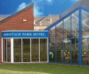
Hermitage Park
Days Inn Donnington Welcome Break Service Area
Sunnyside Hotel
Caravelli
RAMADA LOUGHBOROUGH HOTEL
The Link
Videos from this area
These are videos related to the place based on their proximity to this place.
PartyPeoplePresents - SMASHED - Dance Off @ The Red Lion Shepshed
PartyPeoplePresents a quick snippet of the dance off at our last SMASHED event on 15th March 2013 at The Red Lion Shepshed. Check out the body popping party vibes of the crowd! Check out the...
Shepshed Community Nativity! 5th December 2014
We hope that you enjoy this celebration of the Christmas story and its impact upon our community to-day. Our thanks are due to all the wonderful people who have contributed in so many ways...
Josh McSwiggan ('95) Has a Dunkfest vs County Upper in the EABL! Henri Langton Bonus Dunk!
Subscribe NOW to be the first to see our new vids! Click here to subscribe - http://bit.ly/OTsub Check out Josh McSwiggan ('95) having a dunkfest for Charnwood College against County Upper...
PartyPeoplePresents Michael Vickers - Oxford Comma - Acoustic Cover
A quick snippet of Michael Vickers performing Oxford Comma at the SMASHED ALL DAY takeover at The Red Lion Shepshed. http://www.partypeoplepresents.co.uk/?page_id=2902 Michael Vickers ...
Tamiya 58076 Vanquish 4x4 Off Road RC Buggy
Vintage 1988 Tamiya 58076 Vanquish Off Road Buggy getting a test run. For more photos and videos of this car and more rc cars please visit http://www.iconicrc.com/2011/02/58076-tamiya-vanquish/...
Tamiya TL-01 Based Audi Quattro Rallye RC Car with Carisma Audi Quattro Body Shell
Our first run of this custom built Tamiya TL-01 based Audi Quattro Rallye. A lovely classic rally body shell by Carisma. See more pics of this RC car at http://www.iconicrc.com/members/Justin/galle...
Audi R8 Facelift Exterior Rear Lights
Audi R8 Facelift Exterior Rear Lights YouTube channel dedicated to creating high quality, professional video and photography work about CARS and the LIFESTYLE associated with it. FaceBook...
Christian Aid Week 2011: Scoot for a Hoot
Christian Aid supporters in Loughborough, east Midlands, put their mobility scooters through their paces to raise funds for Christian Aid Week 2011.
Videos provided by Youtube are under the copyright of their owners.
Attractions and noteworthy things
Distances are based on the centre of the city/town and sightseeing location. This list contains brief abstracts about monuments, holiday activities, national parcs, museums, organisations and more from the area as well as interesting facts about the region itself. Where available, you'll find the corresponding homepage. Otherwise the related wikipedia article.
Kegworth air disaster
The Kegworth air disaster occurred on 8 January 1989 when British Midland Flight 92, a Boeing 737–400, crashed onto the embankment of the M1 motorway near Kegworth, Leicestershire, in Britain. The aircraft was attempting to conduct an emergency landing at East Midlands Airport. Of the 126 people aboard, 47 died and 74, including seven members of the flight crew, sustained serious injuries.
Kegworth
Kegworth (the w is sometimes silent by locals) is a large village (population of approximately 3,500) and civil parish in Leicestershire, England. Lying on the River Soar, it is situated on the A6 near junction 24 of the M1 motorway and is also close to East Midlands Airport. An air-crash incident in 1989 was just short of the airport's runway at the eastern side of the airport. Although this was outside the village, it has subsequently been referred to as the Kegworth air disaster.
Castle Donington Rural District
The rural district of Castle Donington in Leicestershire, England, was formed in 1894 and abolished in 1974. It was formed by the Local Government Act 1894 from the part of the Shadlow Rural Sanitary District that was in Leicestershire. It gained a few parishes from the disbanding of Loughborough Rural District in the 1930s.
Long Whatton
Long Whatton is a village in the English county of Leicestershire. It is south of East Midlands Airport, off Junctions 23 and 23A of the M1 motorway, and has easy access to Loughborough via the A6 and to Shepshed, Ashby de la Zouch and Kegworth. The village is at National Grid Reference SK481229. It is a linear settlement, situated largely along a single road. There are two public houses: The Royal Oak and The Falcon; The Royal Oak has an entry in the 2012 Campaign for Real Ale Good Beer Guide.
St Botolph's Church, Shepshed
St Botolph's Church, Shepshed is the Church of England Parish Church in Shepshed, Leicestershire.
St. Michael's Church, Sutton Bonington
St. Michael's Church is a parish church in the Church of England in Sutton Bonington, Nottinghamshire. The church is a 13th century Grade II Listed building.
St. Anne's Church, Sutton Bonington
St. Anne's Church is a parish church in the Church of England in Sutton Bonington, Nottinghamshire. The church is a 12th century Grade II* Listed building. It is located off the Main Street, at the top end of St Anne's Lane, and near to the Midland Main Line which was constructed past the village in 1840. Sutton Bonington's village hall & library is situated on the lane opposite.
All Saints Church, Long Whatton
All Saints Church, Long Whatton, is located in the village of Long Whatton, Leicestershire, England. It is an active Anglican parish church in the deanery of Akeley East, the archdeaconry of Loughborough, and the diocese of Leicester. The church has been designated by English Heritage as a Grade II* listed building. It dates mainly from the 14th century, with a tower dating from the late 12th or early 13th century, and its upper stage added in the 15th or 16th century.


