Safety Score: 3,0 of 5.0 based on data from 9 authorites. Meaning we advice caution when travelling to United Kingdom.
Travel warnings are updated daily. Source: Travel Warning United Kingdom. Last Update: 2024-04-19 08:03:45
Discover Belton
Belton in Leicestershire (England) with it's 734 citizens is a place in United Kingdom about 102 mi (or 164 km) north-west of London, the country's capital city.
Current time in Belton is now 10:57 AM (Friday). The local timezone is named Europe / London with an UTC offset of one hour. We know of 10 airports near Belton, of which 5 are larger airports. The closest airport in United Kingdom is East Midlands Airport in a distance of 3 mi (or 5 km), North. Besides the airports, there are other travel options available (check left side).
There are several Unesco world heritage sites nearby. The closest heritage site in United Kingdom is Derwent Valley Mills in a distance of 38 mi (or 62 km), North-East. Also, if you like playing golf, there are a few options in driving distance. If you need a hotel, we compiled a list of available hotels close to the map centre further down the page.
While being here, you might want to pay a visit to some of the following locations: Derby, Glenfield, Netherseal, Leicester and Nottingham. To further explore this place, just scroll down and browse the available info.
Local weather forecast
Todays Local Weather Conditions & Forecast: 11°C / 52 °F
| Morning Temperature | 8°C / 46 °F |
| Evening Temperature | 9°C / 48 °F |
| Night Temperature | 4°C / 39 °F |
| Chance of rainfall | 1% |
| Air Humidity | 66% |
| Air Pressure | 1018 hPa |
| Wind Speed | Fresh Breeze with 14 km/h (9 mph) from South-East |
| Cloud Conditions | Broken clouds, covering 59% of sky |
| General Conditions | Light rain |
Saturday, 20th of April 2024
10°C (50 °F)
2°C (36 °F)
Scattered clouds, moderate breeze.
Sunday, 21st of April 2024
8°C (47 °F)
3°C (38 °F)
Broken clouds, moderate breeze.
Monday, 22nd of April 2024
10°C (50 °F)
5°C (40 °F)
Scattered clouds, moderate breeze.
Hotels and Places to Stay
East Midlands Airport Radisson Blu Hotel
The Priest House on the River
Hilton East Midlands Airport
Best Western Premier East Midlands Airport Yew Lodge Hotel
Ravenstone Guest House
Jurys Inn East Midlands Airport
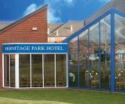
Hermitage Park
Donington Park Farmhouse Hotel
Kegworth Hotel & Conference Centre
The Link
Videos from this area
These are videos related to the place based on their proximity to this place.
Tamiya TL-01 Based Audi Quattro Rallye RC Car with Carisma Audi Quattro Body Shell
Our first run of this custom built Tamiya TL-01 based Audi Quattro Rallye. A lovely classic rally body shell by Carisma. See more pics of this RC car at http://www.iconicrc.com/members/Justin/galle...
Theft of a Poppy Appeal collection box from a supermarket in Thringstone
Leicestershire Officers investigating the theft of a Poppy Appeal collection box from a supermarket in Thringstone have released a CCTV image of a man they wish to identify in connection with...
Khan's Christmas
Our German shepherd Khan,opening his Christmas Present at Parsonwood Hill,Whitwick,England.
High Cademan - 197 metres
View over the treetops of North West Leicestershirem, taken from High Cademan (197m) near Whitwick.
Mick Smith and William Wordsworth - Transform Snibston - Paul Conneally
Mick Smith, window cleaner and former Snibston colliery worker, reads an excerpt from a William Wordsworth poem written during Wordsworth's time living at Coleorton, North West Leicestershire,...
East Midlands Airport - A534 - Leicestershire by Motorcycle
Motorcycle ride on A534 between Castle Donington and Breedon-on-the-hill. Road busy around Donington Park then clearing towards Breedon-on-the-hill.
East Midlands Airport Parking - Prestige Parking's distance from the terminal
Have you ever wondered how long it takes to walk from the office of Prestige Parking at East Midlands Airport to the main airport terminal building? Well let us show you how close you can really...
Videos provided by Youtube are under the copyright of their owners.
Attractions and noteworthy things
Distances are based on the centre of the city/town and sightseeing location. This list contains brief abstracts about monuments, holiday activities, national parcs, museums, organisations and more from the area as well as interesting facts about the region itself. Where available, you'll find the corresponding homepage. Otherwise the related wikipedia article.
Charnwood Forest Canal
The Charnwood Forest Canal, sometimes known as the "Forest Line of the Leicester Navigation", was opened between Thringstone and Nanpantan, with a further connection to Barrow Hill, near Worthington, in 1794 It marks the beginning of a period of history that saw the introduction of railways to supplement canals and, in the end, superseding them, leading eventually to the Midland Counties Railway. It was also one of the first uses of edge-rails for a wagonway.
Belton, Leicestershire
Belton, Leicestershire, is a small village in the North West Leicestershire area of England, close to the town of Shepshed. The village has a primary school, but children travel by bus to Shepshed High School once they pass into secondary school. The village has a pub, a restaurant, a village shop, a hairdresser's, a doctor's surgery, a woodyard and a riding school. Belton has one of the few remaining free-standing maypoles in the country.
Grace-Dieu
Grace-Dieu is a placename of Leicestershire, England, named after Grace Dieu Priory which fell into disrepair following the dissolution of the monasteries by Henry the 8th. The ruins are visble from the main road to Loughborough. Gracedieu manor was a private house but is now a boy's school. It is near to Thringstone. Gracedieu Vineyard is south facing and was established in 1991 in Charnwood Forest. Its 'Green Man' wine based on the Madeleine Angevine grape is known for its floral bouquet.
Diseworth
Diseworth is a village in the English county of Leicestershire. It is south of East Midlands Airport and off Junction 23A of the M1 motorway. A village of some 670 residents, it is located 14 km to the north-west of Loughborough and 2.5 km to the south-east of Castle Donington.
Osgathorpe
Osgathorpe is a small village which lies in a fold of the hills in North West Leicestershire, England, and is about a quarter of a mile the A512 Coalville to Loughborough Road. The parish church is dedicated to Saint Mary the Blessed Virgin and dates from the fourteenth century. It was heavily restored in the nineteenth century, with the addition of a polygonal apse to the chancel.
Diseworth Heritage Centre
Diseworth Heritage Centre is a community-based, not-for-profit heritage centre, at the heart of the Leicestershire village of Diseworth. It was made possible by the restoration of the Baptist Chapel building by the Diseworth Heritage Trust, with major funding from the Heritage Lottery Fund and other supporters.
Grace Dieu Priory
The Grace Dieu Priory was an Augustinian priory near Thringstone in Leicestershire, England. It was founded around 1235-1241 by Roesia de Verdon and dissolved in October in 1538. It was dedicated to the Holy Trinity and St Mary.
Grace Dieu Manor
Grace Dieu Manor is a 19th-century country house near Thringstone in Leicestershire, England, now occupied by Grace Dieu Manor School. It is a Grade II listed building.


