Safety Score: 3,0 of 5.0 based on data from 9 authorites. Meaning we advice caution when travelling to United Kingdom.
Travel warnings are updated daily. Source: Travel Warning United Kingdom. Last Update: 2024-04-19 08:03:45
Delve into Horsforth
Horsforth in Leeds (England) with it's 19,350 habitants is a town located in United Kingdom about 173 mi (or 279 km) north of London, the country's capital town.
Time in Horsforth is now 11:44 AM (Friday). The local timezone is named Europe / London with an UTC offset of one hour. We know of 9 airports closer to Horsforth, of which 5 are larger airports. The closest airport in United Kingdom is Leeds Bradford Airport in a distance of 2 mi (or 3 km), North-West. Besides the airports, there are other travel options available (check left side).
There are several Unesco world heritage sites nearby. The closest heritage site in United Kingdom is Liverpool – Maritime Mercantile City in a distance of 40 mi (or 64 km), South-East. Also, if you like the game of golf, there are some options within driving distance. In need of a room? We compiled a list of available hotels close to the map centre further down the page.
Since you are here already, you might want to pay a visit to some of the following locations: Pool, Gildersome, Otley, Drighlington and Leeds. To further explore this place, just scroll down and browse the available info.
Local weather forecast
Todays Local Weather Conditions & Forecast: 9°C / 49 °F
| Morning Temperature | 7°C / 44 °F |
| Evening Temperature | 7°C / 45 °F |
| Night Temperature | 6°C / 42 °F |
| Chance of rainfall | 1% |
| Air Humidity | 67% |
| Air Pressure | 1018 hPa |
| Wind Speed | Moderate breeze with 11 km/h (7 mph) from South-East |
| Cloud Conditions | Broken clouds, covering 58% of sky |
| General Conditions | Light rain |
Saturday, 20th of April 2024
9°C (49 °F)
5°C (41 °F)
Scattered clouds, gentle breeze.
Sunday, 21st of April 2024
9°C (48 °F)
5°C (41 °F)
Overcast clouds, gentle breeze.
Monday, 22nd of April 2024
10°C (49 °F)
5°C (42 °F)
Light rain, light breeze, overcast clouds.
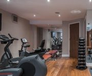
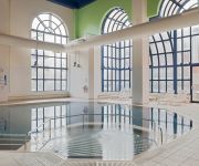
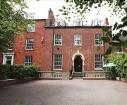
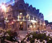
Hotels and Places to Stay
Novotel Leeds Centre
The Chambers - Park Place - Apartments
Weetwood Hall
Crowne Plaza LEEDS
Headingley Lodge
Chevin Country Park
Kingston Hotel
The Black Horse Hotel
Holiday Inn LEEDS - BRADFORD
Haley's Hotel & Restaurant
Videos from this area
These are videos related to the place based on their proximity to this place.
Leeds Bradford International Airport (LBA), Yeadon, West Yorkshire, UK - 24th January, 2013
Footage taken from Yeadon Cemetery on a late Winter afternoon, of aircraft taxiing, taking off and landing on Runway14 of Leeds Bradford Airport. These include the following G-BEUX Multiflight...
Snowy Sunny Cookridge, Leeds, West Yorkshire, UK - 26th January, 2013
Cookridge is a suburb of north-west Leeds, West Yorkshire, England. It is a mixture of suburban, twentieth-century private housing and a very small amount of council housing bordering Tinshill....
Runway 32 Take-off from Leeds Bradford Airport - July 2012
Views from an aeroplane as it takes off from Runway 32 at Leeds Bradford Airport. Footage is from the right side of the aircraft, and includes views of the airport terminal buildings, Jet2...
Snow Storm at Cookridge, Leeds, West Yorkshire, England - 29th January, 2015
On the 29th January, 2015, Northern England was hit by rolling severe snow storms. On the afternoon of this day these hit Cookridge, North West Leeds with quite dramatic results. The storm...
Aircraft Movements at Leeds Bradford International Airport, 13:00 - 17:00 on the 14th August, 2012
This video features footage taken from Yeadon of movements at Leeds Bradford International Airport (IATA: LBA, ICAO: EGNM) between 13:00 and 17:00 on 14th August, 2012. LBA is the main base...
Leeds Bradford International Airport, Runway 32 Take-offs and Landings - 31st May, 2012 (1080 HD)
Footage from Yeadon Cemetery on Thursday 31st May, 2012 from 19:00 to 20:10 of aircraft taking off and landing on Runway 32 at Leeds Bradford Airport. Featured aircraft include: Eastern Airways...
Early Morning Snow, Cookridge, Leeds, West Yorkshire, UK: 04:00 - 06:30 on 21st January, 2013
It was 04:00 on the 21st January 2013, not unusually for me, I was up late editing video, when I went to look out of the window and was amazed at the deep thick covering of snow that I saw....
A Walk Around Runway 14 at Leeds Bradford Airport, Yeadon, Leeds, UK - 16th June, 2012 (720 HD)
Footage from a walk around the Yeadon end of runway 14 at Leeds Bradford Airport. The walk began at Yeadon cemetery and from there, footage is taken across the cemetery to the airport buildings,...
Take-off from Leeds Bradford Airport and Views of Snowy Yorkshire, UK - January, 2013
Footage taken from the left side of a Ryanair Boeing 737 as it takes off from Leeds Bradford Airport's Runway 32 over Yeadon and Guiseley, with views of Yeadon Tarn, Bradford, Leeds, and the...
Leeds Bradford Airport: Runway 14 Views, 14:40 - 16:40, 26th June, 2012 (1080 HD)
Footage taken of aircraft landing, taxiing and taking off from runway 14 at Leeds Bradford Airport. The footage is taken from both Yeadon Cemetery and Plane Tree Hill, which is located between...
Videos provided by Youtube are under the copyright of their owners.
Attractions and noteworthy things
Distances are based on the centre of the city/town and sightseeing location. This list contains brief abstracts about monuments, holiday activities, national parcs, museums, organisations and more from the area as well as interesting facts about the region itself. Where available, you'll find the corresponding homepage. Otherwise the related wikipedia article.
Cookridge
Cookridge is a suburb of north-west Leeds, West Yorkshire, England. It is a mixture of suburban, twentieth-century private housing and a very small amount of council housing bordering Tinshill. It is in the Adel and Wharfedale ward of City of Leeds metropolitan district, and the Leeds North West parliamentary constituency.
Hawksworth, Leeds
Hawksworth is a small, early twentieth-century council estate in the Kirkstall area of Leeds, West Yorkshire, England. It is situated on a hill between West Park and Horsforth and is circled by Butcher Hill, the A65 and Vesper Road. Hawksworth comes under the LS5 Kirkstall postcode and is commonly known as The Hawk, The Hawkie or The Hawkie Estate
Tinshill
Tinshill (pronounced Tins-hill) is a district of Leeds, 4 miles (7 km) north of Leeds city centre, West Yorkshire, England. It is situated between Horsforth and Cookridge. When the estate was planned in the 1940s it was originally known as the 'Cookridge Tower Estate'. The estate predated surrounding estates such as Ireland Wood and Moor Grange. Holt Park came many years later and provided many facilities such as an Asda supermarket, shopping centre, leisure centre and secondary school.
Leeds Trinity University
Leeds Trinity University is a university in Leeds, West Yorkshire, England, which offers foundation and undergraduate degrees, as well as postgraduate qualifications. Previously Leeds Trinity & All Saints, the institution became a university college in 2009 after gaining the right to award its own degrees, and was granted full university status in December 2012.
Clayton Wood
Clayton Wood is an area of woodland towards the north west of Leeds, West Yorkshire, England at grid reference SE254384. It is bordered by Lawnswood, Horsforth, Ireland Wood and Tinshill. Towards the west of the wood runs a beck (which flows from north to south). Along the north of the wood is Silk Mill Road and to the east is Ireland Wood. Towards the south of the Wood is the Leeds Ring Road.
Hall Park Ground
Hall Park Ground in Horsforth, near Leeds, Yorkshire, England is a cricket ground. The ground was the location of a first-class cricket match in August 1885 which pitted Yorkshire CCC against MB Hawke's XI. The match was won by MB Hawke's XI by 3 wickets thanks to Australian Claude Rock who took 8 for 36 in Yorkshire's second innings. Currently the Horsforth Hall Park Cricket Club play at this ground in the Airedale-Wharfedale Senior Cricket League.
Kirkstall Forge railway station
Kirkstall Forge is a proposed station between Leeds and Shipley, West Yorkshire, England. Metro, the Passenger Transport Executive for West Yorkshire, intends to open the station along with Apperley Bridge. Go-ahead for construction of both Kirkstall Forge and Apperley Bridge was given in the National Infrastructure Plan released on 29 November 2011. The estimated completion date is December 2014.
Grove Methodist Church
The Grove Methodist Church is a Grade II listed Methodist church in the village of Horsforth, Leeds.


