Safety Score: 3,0 of 5.0 based on data from 9 authorites. Meaning we advice caution when travelling to United Kingdom.
Travel warnings are updated daily. Source: Travel Warning United Kingdom. Last Update: 2024-04-19 08:03:45
Discover Saint Nicholas at Wade
Saint Nicholas at Wade in Kent (England) is a place in United Kingdom about 60 mi (or 97 km) east of London, the country's capital city.
Current time in Saint Nicholas at Wade is now 03:15 PM (Friday). The local timezone is named Europe / London with an UTC offset of one hour. We know of 12 airports near Saint Nicholas at Wade, of which 4 are larger airports. The closest airport in United Kingdom is Kent International Airport in a distance of 4 mi (or 7 km), East. Besides the airports, there are other travel options available (check left side).
There are several Unesco world heritage sites nearby. The closest heritage site in United Kingdom is Canterbury Cathedral, St Augustine's Abbey, and St Martin's Church in a distance of 9 mi (or 14 km), South-West. Also, if you like playing golf, there are a few options in driving distance. If you need a hotel, we compiled a list of available hotels close to the map centre further down the page.
While being here, you might want to pay a visit to some of the following locations: Ashford, Southend-on-Sea, Leigh-on-Sea, Upper Stoke and Tiptree. To further explore this place, just scroll down and browse the available info.
Local weather forecast
Todays Local Weather Conditions & Forecast: 10°C / 51 °F
| Morning Temperature | 10°C / 49 °F |
| Evening Temperature | 9°C / 48 °F |
| Night Temperature | 7°C / 44 °F |
| Chance of rainfall | 2% |
| Air Humidity | 73% |
| Air Pressure | 1016 hPa |
| Wind Speed | Strong breeze with 18 km/h (11 mph) from South-East |
| Cloud Conditions | Broken clouds, covering 84% of sky |
| General Conditions | Light rain |
Saturday, 20th of April 2024
8°C (46 °F)
7°C (44 °F)
Overcast clouds, fresh breeze.
Sunday, 21st of April 2024
9°C (47 °F)
7°C (45 °F)
Light rain, strong breeze, overcast clouds.
Monday, 22nd of April 2024
8°C (47 °F)
7°C (44 °F)
Light rain, fresh breeze, overcast clouds.
Hotels and Places to Stay
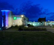
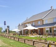
Holiday Inn Express RAMSGATE - MINSTER
Ramsgate (Manston Airport)
Videos from this area
These are videos related to the place based on their proximity to this place.
Power factors lift at flats in Birchington
This lift look like a Pickerings but it says "Power Factors Lifts". This is the first lift with no inner doors that I have found in the UK. (apart from platform lifts). This lift is at...
Real Olympic Torch 2012 in Thanet
Filmed at 1 a.m. on July 19 in Birchington, this is the first video of the Olympic Torch 2012 visiting Thanet towards the end of its long journey around the UK. No, not that torch, the *Real*...
VSOE Kent Circular
67026 brings the regular VSOE circular around Kent through an extremely wet and breezy Birchington. The things I do with the rare days off I get - despite the weather!!! (28/03/08)
Quex Park Maize Maze 2014. Drone camera footage.
A Drone Hexacopter ( 6 propellors-6 motors) flying over the Maize Maze at Quex Park in Birchington, Kent, UK. The drone rises up revealing the image which turns out to be............a rhino's head!
Ronnie Scott's Rejects, live at The Minnis,
Ronnie Scott's Rejects, live at Minnie Bay, Birchington. Awesome band.
speed build sims 3 beach house & garden pt5
Don't Forget to Like, Comment, & Subscribe. bed room set used http://www.thesimsresource.com/downloads/details/category//title/gothic-bedroom/id/1219290/ Find me online here ...
Machining at Thanet Earth
Removal and redistribution of soil by machine at 'Thanet Earth', Thanet, Kent, England.
Let's build a Sims 3 house photos cherry tree cottage
Don't Forget to Like, Comment, & Subscribe. So my video on the Sims not working, but likely I take a snap shoot every now and then I hope you like watching this I get all my downloads from...
Videos provided by Youtube are under the copyright of their owners.
Attractions and noteworthy things
Distances are based on the centre of the city/town and sightseeing location. This list contains brief abstracts about monuments, holiday activities, national parcs, museums, organisations and more from the area as well as interesting facts about the region itself. Where available, you'll find the corresponding homepage. Otherwise the related wikipedia article.
Little Stour
The Little Stour is one of the tributaries of the River Stour in the English county of Kent. The upper reaches of the river are better known as the Nailbourne, whilst the lower reaches were once known as the Seaton Navigation. The intermittent source of the river is at Lyminge, and in its early reaches from Lyminge to Littlebourne it forms a chalk stream and winterbourne that is normally known as the Nailbourne.
River Wantsum
The River Wantsum is a tributary of the River Stour, in Kent, England. Formerly, the River Wantsum and the River Stour together formed the Wantsum Channel, which separated the Isle of Thanet from the mainland of Kent. Now the River Wantsum is little more than a drainage ditch starting at Reculver, and ending where it joins the Stour.
North Thanet (UK Parliament constituency)
North Thanet (also known as Thanet North) is a constituency represented in the House of Commons of the UK Parliament since its 1983 creation by Sir Roger Gale, a Conservative.
Sarre Penn
Sarre Penn is a tributary of the River Stour in Kent, England, joining with the River Wantsum near Sarre, where it is known locally as the Fishbourne Stream. The stream runs from its source in the parish of Dunkirk, north of Canterbury, 13.4 kilometres, to the Wantsum Channel and the Stour, it travels north east, running parallel to the Great Stour river, with the Roman road running in between.
Sarre Windmill
Sarre Windmill is a Grade II listed smock mill in Sarre, Kent, England that was built in 1820, and is now a commercially working windmill that has been restored and is open to the public.
Thanet Earth
Thanet Earth is a large industrial agriculture project consortium under construction in the United Kingdom. As of early March 2009, food has been harvested. Located on the Isle of Thanet, in Kent it will be the largest greenhouse complex in the UK, covering 90 hectares, or 220 acres of land. It is estimated it will increase UK salad crop (cucumbers, peppers and tomatoes) production by 15%.
All Saints Church, West Stourmouth
All Saints Church, West Stourmouth, is a redundant Anglican church in the civil parish of Stourmouth, Kent, England. It has been designated by English Heritage as a Grade I listed building, and is under the care of the Churches Conservation Trust. The church stands in the settlement of West Stourmouth, some 4 miles north of Wingham to the southeast of the A28 road.
All Saints' Church, Shuart
All Saints' Church, Shuart, in the north-west of the Isle of Thanet, Kent, was established in the Anglo-Saxon period as a chapel of ease for the parish of St. Mary's, Reculver, which was centred on the north-eastern corner of mainland Kent, adjacent to the island. The Isle of Thanet was then separated from the mainland by the sea, which formed a strait known as the Wantsum Channel.


