Safety Score: 3,0 of 5.0 based on data from 9 authorites. Meaning we advice caution when travelling to United Kingdom.
Travel warnings are updated daily. Source: Travel Warning United Kingdom. Last Update: 2024-04-24 08:14:40
Delve into Bilsington
Bilsington in Kent (England) is located in United Kingdom about 54 mi (or 87 km) south-east of London, the country's capital town.
Current time in Bilsington is now 08:45 AM (Thursday). The local timezone is named Europe / London with an UTC offset of one hour. We know of 12 airports close to Bilsington, of which 5 are larger airports. The closest airport in United Kingdom is Lydd Airport in a distance of 8 mi (or 13 km), South. Besides the airports, there are other travel options available (check left side).
There are several Unesco world heritage sites nearby. The closest heritage site in United Kingdom is Canterbury Cathedral, St Augustine's Abbey, and St Martin's Church in a distance of 16 mi (or 26 km), North-East. Also, if you like playing golf, there are some options within driving distance. If you need a hotel, we compiled a list of available hotels close to the map centre further down the page.
While being here, you might want to pay a visit to some of the following locations: Ashford, Boxley, Maidstone, Upper Stoke and Southend-on-Sea. To further explore this place, just scroll down and browse the available info.
Local weather forecast
Todays Local Weather Conditions & Forecast: 8°C / 47 °F
| Morning Temperature | 0°C / 33 °F |
| Evening Temperature | 9°C / 49 °F |
| Night Temperature | 7°C / 44 °F |
| Chance of rainfall | 5% |
| Air Humidity | 87% |
| Air Pressure | 1006 hPa |
| Wind Speed | Moderate breeze with 13 km/h (8 mph) from North-East |
| Cloud Conditions | Overcast clouds, covering 100% of sky |
| General Conditions | Moderate rain |
Friday, 26th of April 2024
9°C (47 °F)
6°C (44 °F)
Light rain, gentle breeze, overcast clouds.
Saturday, 27th of April 2024
14°C (56 °F)
11°C (51 °F)
Light rain, moderate breeze, broken clouds.
Sunday, 28th of April 2024
14°C (56 °F)
12°C (53 °F)
Light rain, fresh breeze, broken clouds.
Hotels and Places to Stay
ASHFORD INTERNATIONAL-QHOTELS
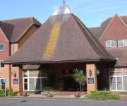
Holiday Inn ASHFORD - CENTRAL
Videos from this area
These are videos related to the place based on their proximity to this place.
171722 and 37604+37605 on the Marshlink in South Ashford
Three workings seen in South Ashford on the afternoon of Thursday 25th September 2014. 0:00 Southern Turbostar Class 171, 171722 passes a foot crossing in south Ashford working 1G45 1532...
Snow in Ashford
Saturday January 9 2010 and the snow came down at last in east Kent. And the Eskimos moved in straight away. This short vid shot on the Kodak ZX1 HD camcorder which I picked up for 75 quid...
New Holland drilling Spring Wheat with 8m Simba Free Flow filmed with DJI Phantom
This is us drilling Spring Wheat on Romney Marsh March 2015 around Ivychurch at the back of Bell Engineering filmed with my new toy a DJI Phantom Vision 2+ - great bit of kit!
Hardi Alpha Evo filmed with DJI Phantom Vision 2+
Hardi Alpha Evo 40m self propelled sprayer filmed with a DJI Phantom Vision 2 + spraying oil seed rape on Romney Marsh Kent.
Steam on the Ashford Hastings Line 1992
This is an old clip taken from a tape I made in 1992, when all sorts of things happened to celebrate the ASHFORD 150 event. This is the visit of 34027 "Taw Valley" to the line, and it's shown...
Pillbox vid 19 Type 24 concrete thin walled pillbox
Location: On W side of Ruckinge to Ivy Church road, N of junction with road to Stockbridge (Wey Street); in angle of road junction (corner of field of Wey Street Farm). Condition: Good ...
Hot air balloon flights over Kent with Merlin Balloons
Experience the peace and tranquillity of Kent Hot Air Ballooning with Merlin Balloons and leave the cares of this world behind as you drift gracefully over the Kent and Sussex countryside....
hamstreet dance
taken on wednesday the 18th of july just before the olympic tourch came thourgh to ashford kent.
Charli vs. Chris T -- FINAL of Mortal Kombat 3 Tournament using the SNES at Fragfest 360
FINALS of the 16 person Mortal Kombat tournament at Fragfest 360, with a WWE 13 tshirt for the winner.
Videos provided by Youtube are under the copyright of their owners.
Attractions and noteworthy things
Distances are based on the centre of the city/town and sightseeing location. This list contains brief abstracts about monuments, holiday activities, national parcs, museums, organisations and more from the area as well as interesting facts about the region itself. Where available, you'll find the corresponding homepage. Otherwise the related wikipedia article.
Bonnington
See also Bonnington (disambiguation) Bonnington Population 109 OS grid reference TR057352 Civil parish Bonnington District Ashford Shire county Kent Region South East Country England Sovereign state United Kingdom Post town TONBRIDGE Postcode district TN25 Dialling code 01233 Police Fire Ambulance EU Parliament South East England UK Parliament Ashford List of places UK England Bonnington is a dispersed village and civil parish on the northern edge of the Romney Marsh in Ashford District of Kent, England.
Aldington, Kent
Aldington is a village and civil parish in the Ashford District of Kent, England. The village centre is eight miles (12 km) south-east of the town of Ashford. Set on a hill top above Romney Marsh, the village offers breathtaking views over the marsh out towards Lympne and Dungeness.
RAF Kingsnorth (WWII)
RAF Kingsnorth was a World War II airfield in Kent, England. The former Royal Air Force station was at Bliby Corner approximately 2 miles southeast of Ashford; about 50 miles southeast of London. It is not to be confused with RNAS Kingsnorth, later RAF Kingsnorth, which was an airship station in operation during and after World War I.
Smeeth railway station
Smeeth is a disused railway station on the South Eastern Main Line which served the village of Smeeth in Kent, England. The station opened in 1852 and closed in 1954.
RAF Newchurch
Royal Air Force Station Newchurch or RAF Newchurch was a temporary Second World War airfield at Newchurch, Kent, it was a base for a wing of Hawker Tempest fighters that defended south-east England against attack from V-1 flying bombs launched from continental Europe.


