Safety Score: 3,0 of 5.0 based on data from 9 authorites. Meaning we advice caution when travelling to United Kingdom.
Travel warnings are updated daily. Source: Travel Warning United Kingdom. Last Update: 2024-04-23 08:18:23
Discover St. Helens, Ryde
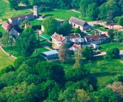
St. Helens, Ryde in Isle of Wight (England) is a place in United Kingdom about 71 mi (or 114 km) south-west of London, the country's capital city.
Current time in St. Helens, Ryde is now 11:35 PM (Tuesday). The local timezone is named Europe / London with an UTC offset of one hour. We know of 11 airports near St. Helens, Ryde, of which 5 are larger airports. The closest airport in United Kingdom is Bembridge Airport in a distance of 1 mi (or 2 km), South. Besides the airports, there are other travel options available (check left side).
There are several Unesco world heritage sites nearby. The closest heritage site in United Kingdom is Dorset and East Devon Coast in a distance of 5 mi (or 7 km), East. Also, if you like playing golf, there are a few options in driving distance. We encountered 3 points of interest in the vicinity of this place. If you need a hotel, we compiled a list of available hotels close to the map centre further down the page.
While being here, you might want to pay a visit to some of the following locations: Bembridge, Newchurch, Portsmouth, Newport and Cowes. To further explore this place, just scroll down and browse the available info.
Local weather forecast
Todays Local Weather Conditions & Forecast: 11°C / 52 °F
| Morning Temperature | 6°C / 43 °F |
| Evening Temperature | 10°C / 50 °F |
| Night Temperature | 7°C / 44 °F |
| Chance of rainfall | 0% |
| Air Humidity | 62% |
| Air Pressure | 1022 hPa |
| Wind Speed | Moderate breeze with 12 km/h (7 mph) from South |
| Cloud Conditions | Overcast clouds, covering 98% of sky |
| General Conditions | Light rain |
Wednesday, 24th of April 2024
7°C (45 °F)
8°C (46 °F)
Overcast clouds, gentle breeze.
Thursday, 25th of April 2024
10°C (50 °F)
8°C (47 °F)
Light rain, moderate breeze, broken clouds.
Friday, 26th of April 2024
9°C (48 °F)
10°C (51 °F)
Moderate rain, moderate breeze, overcast clouds.
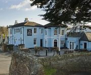
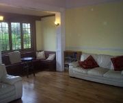
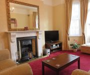
Hotels and Places to Stay
The Fawley
The Boat House
The Wight
Brooke House
The Westfield
Rooftree Guest House
Claremont Guest House
Priory Bay Hotel
Luccombe Manor Country House
Rylstone Manor Hotel
Videos from this area
These are videos related to the place based on their proximity to this place.
PA28 Bembridge airport take-off and departure Runway 30
1st August 2010 A PA-28-161 taking off from Runway 30 at Bembridge airport on the Isle of Wight, for a short flight to Biggin Hill. Soundtrack hasn't been touched, so you can hear the...
WW2 buildings at nodes point holiday park - isle of wight
a relitively late comer to the coastal defences around the isle of wight in about 1900 . nodes point battery was completed and not a lot remains , just a wall and railings . it was later on...
PA28 flight to the Isle of Wight (Biggin Hill to Bembridge)
Taking advantage of the unusually good spring weather by nipping to the Isle of Wight for lunch. Biggin Hill airport to Bembridge airport and return, with some crab sandwiches at the Crab...
Piper PA28 - White Waltham To Bembridge UK - High Quality
Approach, circuit join and landing into Bembridge Airport, Isle Of Wight, United Kingdom. Passengers are: Richard in the front right-hand seat and Corey in the back operating the camera....
PA28 approach, landing and taxi at Bembridge airport Runway 30
1 August 2010 A PA28-161 approaching Bembridge airport to land after a short flight from Biggin Hill. Video starts overhead Hayling Island and flies the approach to Runway 30 over Whitecliff...
Bembridge - Peacock Hill (Byway, W-E)
Subscribe for the love of motorcycles and the great outdoors: http://www.youtube.com/subscription_center?add_user=wiltshirebyways Please click 'S H O W M O R E' for route info: ↓↓↓↓↓↓...
Gusty Approach into EGHJ (Bembridge) Airport, Isle of Wight - GoPro
Flying with Mike Godden and Jay Latham into Bembridge Airport (EGHJ), Isle of Wight, UK. Aircraft is a PA28 181 Archer II and video is filmed with a GoPro Hero 3+ Black Edition. There was...
Ka-7 Glider flight over Bembridge, IOW (HD)
A typical quick flight around Bembridge in the Ka-7. There didn't seem to be any lift of any sort around (excuses I know!), so it was only a short flight. However it did give me the chance...
Stanwell Farmhouse - Bembridge Isle of Wight - 2015
Video of Stanwell Farm House on the Isle of Wight. A Bembridge holiday home within a short walk of the sea at Whitecliff Bay. http://www.islandcottageholidays.com/isleofwight/cottages/stanwellfarm...
Videos provided by Youtube are under the copyright of their owners.
Attractions and noteworthy things
Distances are based on the centre of the city/town and sightseeing location. This list contains brief abstracts about monuments, holiday activities, national parcs, museums, organisations and more from the area as well as interesting facts about the region itself. Where available, you'll find the corresponding homepage. Otherwise the related wikipedia article.
Eastern Yar
The River Yar on the Isle of Wight, England, rises in a chalk coomb in St. Catherine's Down near Niton, close to the southern point of the island. It flows across the Lower Cretaceous rocks of the eastern side of the island before finding its way through the gap in the central Upper Cretaceous chalk ridge of the Island at Yarbridge, Brading across the now drained Brading Haven to Bembridge Harbour and Spithead, near the eastern end of the Island.
Priory Woods
Priory Woods is a 2.94 hectare geological Site of Special Scientific Interest near the town of Bembridge, Isle of Wight, notified in 1998. It is a National Trust property and is served by a public footpath. Concealed within it is "The Priory Oyster" - an oyster bar attached to the Priory Bay Hotel and open only in the height of summer. It has significant recent archaeology with the remains of a sea wall and rusted iron railings.
St Helens (Isle of Wight) railway station
St Helen's with its 232-foot-long single platform was the only intermediate stop on the 2+⁄4-mile branch line that connected Brading to the coast at Bembridge. Opened in 1882, when the area was the Island's main port, it ran with ever dwindling passengers until 1953. Pomeroy described the station thus: An imposing structure with tall chimneys and elegant dormers, particularly pleasing to the eye.
Whitecliff Bay And Bembridge Ledges SSSI
Whitecliff Bay And Bembridge Ledges is a 131.6 hectare Site of special scientific interest which lies around the coastline of the eastern most part of the Isle of Wight from Bembridge harbour entrance, in the north, around Foreland and stretching to Whitecliff Bay to the south. The site was notified in 1955 for both its biological and geological features.
Brading Marshes to St. Helen's Ledges SSSI
Brading Marshes to St. Helen's Ledges is a 488.5 hectare Site of special scientific interest which stretches from Brading along the Yar valley between Bembridge and St Helens, Isle of Wight through to the sea at Priory Bay on the north east coast of the Isle of Wight.
St. Helen's Church, St. Helens
St. Helen's Church, St. Helens is a parish church in the Church of England located in St Helens on the Isle of Wight.
Priory Bay
Priory Bay is a small privately owned bay on the north east coast of the Isle of Wight, England. It lies to the east of the village of Nettlestone. It faces east towards Selsey Bill and its shoreline is 600m in length. It stretches from Horestone Point in the north to Nodes Point in the south. The northern part of the bay has a straight coastline and is sandy with some pebbles. At the southern end the bay curves round to the east.
Gaskins, Isle of Wight
Gaskins is a hamlet on the Isle of Wight in England UK. It is on the B3330 (Carpenters Road), approximately 1 mile West of St Helens, and approximately 2 miles Northeast of Brading.


