Safety Score: 3,0 of 5.0 based on data from 9 authorites. Meaning we advice caution when travelling to United Kingdom.
Travel warnings are updated daily. Source: Travel Warning United Kingdom. Last Update: 2024-04-24 08:14:40
Touring Old Hall Green
Old Hall Green in Hertfordshire (England) is a town located in United Kingdom about 26 mi (or 42 km) north of London, the country's capital place.
Time in Old Hall Green is now 06:05 AM (Thursday). The local timezone is named Europe / London with an UTC offset of one hour. We know of 8 airports nearby Old Hall Green, of which 5 are larger airports. The closest airport in United Kingdom is London Stansted Airport in a distance of 11 mi (or 17 km), East. Besides the airports, there are other travel options available (check left side).
There are several Unesco world heritage sites nearby. The closest heritage site in United Kingdom is Tower of London in a distance of 26 mi (or 42 km), South. Also, if you like the game of golf, there are several options within driving distance. We collected 2 points of interest near this location. Need some hints on where to stay? We compiled a list of available hotels close to the map centre further down the page.
Being here already, you might want to pay a visit to some of the following locations: Great Munden, Hertford, Whaddon, Enfield Town and Potters Bar. To further explore this place, just scroll down and browse the available info.
Local weather forecast
Todays Local Weather Conditions & Forecast: 10°C / 50 °F
| Morning Temperature | 2°C / 36 °F |
| Evening Temperature | 9°C / 48 °F |
| Night Temperature | 5°C / 41 °F |
| Chance of rainfall | 0% |
| Air Humidity | 59% |
| Air Pressure | 1004 hPa |
| Wind Speed | Moderate breeze with 9 km/h (6 mph) from East |
| Cloud Conditions | Overcast clouds, covering 97% of sky |
| General Conditions | Light rain |
Friday, 26th of April 2024
9°C (49 °F)
3°C (37 °F)
Overcast clouds, gentle breeze.
Saturday, 27th of April 2024
7°C (45 °F)
9°C (49 °F)
Moderate rain, moderate breeze, overcast clouds.
Sunday, 28th of April 2024
12°C (54 °F)
9°C (49 °F)
Light rain, fresh breeze, overcast clouds.
Hotels and Places to Stay
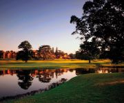
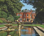
Hanbury Manor Marriott Hotel & Country Club
Fanhams Hall
Fanhams Hall Hotel
Hertford House
Ware
Videos from this area
These are videos related to the place based on their proximity to this place.
Braughing ford, swollen by April showers (April 29, 2012 12:00)
Braughing ford after a few days of rain during this year's April showers. This is the main ford in the village, where Malting Lane crosses the River Quin, and behind me is The Street and the...
P&Q International - Time & Attendance, Tracking and Data Capture solutions
P&Q International supply complete solutions for Time & Attendance and Flexitime Management, Access Control, Lone Worker Protection, People and Product Tracking, Inventory Management and many ...
Heritage Arts Company - The Guilt Facade - Making Of
The Standon Calling Art Team, led by Jon Panniers, built an entire street in the middle of the festival site in just one month; the Heritage Arts Company arrived in the final week - here's...
The Epic Demolition of Wood City IV
Like on Facebook: http://www.facebook.com/pages/Wood-City/189869311057554?ref=ts A new mayor has been elected to take on the most terrifying job of all time - being mayor of Wood City. He...
Crosscountry - 170106 - University to Barnt Green, Cross City Line - 17/03/2011
A short film taken onboard Turbostar Class 170 no 170106, on the 1430 Crosscountry service from Birmingham New Street to Cardiff Central ,which originated from Nottingham at 1303. I was travelling...
fantasy bracelets - friendship bracelets
hey, i'm becca XD just telling the village of youtube about mine and my friends(laura) little ''company'' we make friendship bracelets and sell them basically, just mail me if you want more...
Uncharted 2 Multiplayer Elimination Gameplay
this is me playing uncharted 2 multiplayer on elimination where i got 6 kills with no deaths please subscribe.
Videos provided by Youtube are under the copyright of their owners.
Attractions and noteworthy things
Distances are based on the centre of the city/town and sightseeing location. This list contains brief abstracts about monuments, holiday activities, national parcs, museums, organisations and more from the area as well as interesting facts about the region itself. Where available, you'll find the corresponding homepage. Otherwise the related wikipedia article.
East Hertfordshire
East Hertfordshire is a local government district in Hertfordshire, England. Its council has offices in Bishop's Stortford and Hertford. The other main towns in the district are Ware, Buntingford, and Sawbridgeworth. Of these five major towns, all except Buntingford fall within the parliamentary constituency of Hertford and Stortford. Buntingford is part of the North East Hertfordshire constituency.
North East Hertfordshire (UK Parliament constituency)
North East Hertfordshire is a constituency represented in the House of Commons of the UK Parliament since 1997 by Oliver Heald, a Conservative.
Puckeridge
Puckeridge is a hamlet in East Hertfordshire, England. The earliest settlers in the area were the Belgae, who arrived around 180 BC. A Roman town existed just to the north of the existing village and the village is at the cross roads of two major Roman roads, Ermine Street and Stane Street. The neighbouring villages of Standon and Braughing are recorded in the Domesday Book but Puckeridge is not although it was probably in existence. It survived the Black Death in the 14th century.
St. Edmund's College, Ware
St Edmund's College is a coeducational independent day and boarding school in the British public school tradition set on 440 acres in Ware, Hertfordshire. Founded in 1568 as a seminary then boys' school, it is the oldest continuously operating and oldest post-Reformation Catholic school in the country. Today it caters to boys and girls aged 3 to 18.
Ralph Sadleir Middle School
Ralph Sadleir Middle School in Puckeridge, Hertfordshire caters for 325 students from the ages of 9-13. The school has specialist status as a Humanities College.
Standon Priory
Standon Priory was a priory in Essex, England.
Great Munden
Great Munden is a village and civil parish in Hertfordshire, England. The parish, in the district of East Hertfordshire, spans 3,758 acres, of which 1,895.75 acres are arable land, 927.5 acres are permanent grass and 97 acres are wood. It has a population of 477 and is situated 6 miles north of the town of Ware. The village includes the church of St Nicholas, Munden Bury, and a rectory that includes the remains of a moat. Other settlements in the parish include Nasty and Levens Green.
Sacombe Green
Sacombe Green is a hamlet located to the east of the village of Sacombe, in the East Hertfordshire district, in the county of Hertfordshire, England.


