Safety Score: 3,0 of 5.0 based on data from 9 authorites. Meaning we advice caution when travelling to United Kingdom.
Travel warnings are updated daily. Source: Travel Warning United Kingdom. Last Update: 2024-04-18 08:12:24
Delve into Oakhangar
Oakhangar in Hampshire (England) with it's 293 habitants is a city located in United Kingdom about 43 mi (or 70 km) south-west of London, the country's capital town.
Current time in Oakhangar is now 08:16 AM (Friday). The local timezone is named Europe / London with an UTC offset of one hour. We know of 11 airports closer to Oakhangar, of which 5 are larger airports. The closest airport in United Kingdom is Lasham Airport in a distance of 8 mi (or 12 km), North-West. Besides the airports, there are other travel options available (check left side).
There are several Unesco world heritage sites nearby. The closest heritage site in United Kingdom is Dorset and East Devon Coast in a distance of 29 mi (or 46 km), South. Also, if you like playing golf, there are some options within driving distance. We saw 1 points of interest near this location. In need of a room? We compiled a list of available hotels close to the map centre further down the page.
Since you are here already, you might want to pay a visit to some of the following locations: Kingsley, Lindford, Milland, Farnham and Seale. To further explore this place, just scroll down and browse the available info.
Local weather forecast
Todays Local Weather Conditions & Forecast: 11°C / 53 °F
| Morning Temperature | 9°C / 49 °F |
| Evening Temperature | 10°C / 49 °F |
| Night Temperature | 6°C / 43 °F |
| Chance of rainfall | 0% |
| Air Humidity | 71% |
| Air Pressure | 1018 hPa |
| Wind Speed | Fresh Breeze with 14 km/h (9 mph) from South-East |
| Cloud Conditions | Overcast clouds, covering 89% of sky |
| General Conditions | Light rain |
Saturday, 20th of April 2024
10°C (50 °F)
3°C (37 °F)
Few clouds, moderate breeze.
Sunday, 21st of April 2024
9°C (48 °F)
3°C (38 °F)
Broken clouds, moderate breeze.
Monday, 22nd of April 2024
10°C (51 °F)
5°C (41 °F)
Light rain, moderate breeze, clear sky.
Hotels and Places to Stay
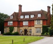
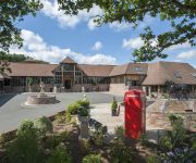
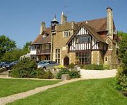
Champneys Forest Mere
Old Thorns Manor
The Three Horseshoes
Alton House hotel Hollybourne Development Limited
Overglen Court
Farnham House Hotel Hollybourne Development Limited
Bootmenders B&B
Videos from this area
These are videos related to the place based on their proximity to this place.
hartley mauditt - hampshire - in & around - cockapoo dog walk - new camera test
what can I tell you about Hartley mauditt ? well the 11th century church and pond is all that remains of this Hampshire hamlet.the village was wiped out with the plague / black death and what...
Selborne 1995 Beulah Library Roll F31
16mm footage shot in1995 Selborne village from the Hanger and the Hanger viewed form below. This footage may be purchased from BEULAH at www.eavb.co.uk Beulah Cinematographer: Barry ...
Bordon Recovery Training Heath Flight
A quick fly around the Recovery training heath in Bordon Hampshire, Footage of a few of the old armoured vehicles that used to be in service but are now training aids for potential Recovery...
A look round REME Bordon (Part Two)
This is part two of the visit to Bordon and we go out on to the training ground to see how the Army carries out vehicle recovery It was a great day and our thanks go to our kind host. In...
SEME Jubilee Parade Bordon 2012
Highlights of the SEME Diamond Jubilee Parade - Prince Philip Barracks, Bordon - 5th June 2012.
Southern XC 2009 Round 1 Bordon
Bordon was blessed with beautiful weather to open the 2009 Southern XC Series and 550 riders made for a great atmosphere. Blindingly fast as usual, the course made for some really close racing....
Bordon Brutal, A tangle of trees, water & more mud, 15 March 4
More Brutal running at Bordon. Mid-field runners getting through a tangle of trees in the muddy marsh.
Videos provided by Youtube are under the copyright of their owners.
Attractions and noteworthy things
Distances are based on the centre of the city/town and sightseeing location. This list contains brief abstracts about monuments, holiday activities, national parcs, museums, organisations and more from the area as well as interesting facts about the region itself. Where available, you'll find the corresponding homepage. Otherwise the related wikipedia article.
RAF Oakhanger
RAF Oakhanger was a Royal Air Force station in Hampshire split over three operational sites with accommodation in nearby Bordon. The main site and operations centre was near the village of Oakhanger with two other sites nearby. The parent station for administrative purposes was RAF Odiham.
Bordon Light Railway
The Bordon Light Railway was a short-lived light railway line in Hampshire that connected the Army Camp at Bordon, as well as the villages of Bordon and Kingsley, with the national rail network at Bentley on the main Farnham-Alton line, a distance of 4.5 miles (7.2 km).
Bordon railway station
Bordon was a railway station on the Bordon Light Railway which served the village of Bordon and its nearby Army Camp. The station building was constructed of corrugated iron on steel framing and stood on a short brick wall. Extra traffic during the First World War led to the extension of the station and the addition of a wooden canopy on its platform side. The station also had a small engine shed which was used in the line's early days for overnight stabling of engines.
Selborne Priory
Selborne Priory was a priory of Augustinian canons in Selborne, Hampshire, England.
Oakhanger Stream
Oakhanger Stream is a tributary of the River Wey that lies in Hampshire, England. The source of the north branch lies at Shortheath Common near Oakhanger and stretches from Oakhanger to Selborne Common near the village of Selborne. It adjoins the River Wey from East Worldham to Kingsley. Its total length is approximately 3.9 miles .
Whitehill Junction railway station
Whitehill Junction railway station is a former railway station, on the Longmoor Military Railway, which was closed along with the rest of the line in 1969. The station served the village of Whitehill, Hampshire. Preceding station Disused railways Following station Oakhanger Halt Longmoor Military Railway Two Range Halt
Oakhanger Halt railway station
Oakhanger Halt railway station is a former railway station, on the Longmoor Military Railway, which was closed along with the rest of the line in 1969. The station served the village of Oakhanger, Hampshire. Preceding station Disused railways Following station Bordon Longmoor Military Railway Whitehill Junction
St Leonard's Church, Hartley Mauditt
St Leonard's Church is a Church of England parish church in the hamlet of Hartley Mauditt, East Hampshire district of Hampshire, England. All that is left of the hamlet is the 12th century church, the foundations of a manor house, and a large pond, Hartley Pond, which lies opposite the church on the other side of the road. The church is dedicated to St Leonard.


