Safety Score: 3,0 of 5.0 based on data from 9 authorites. Meaning we advice caution when travelling to United Kingdom.
Travel warnings are updated daily. Source: Travel Warning United Kingdom. Last Update: 2024-04-25 08:17:04
Touring Mortimer West End
Mortimer West End in Hampshire (England) is a town located in United Kingdom about 43 mi (or 69 km) west of London, the country's capital place.
Time in Mortimer West End is now 04:55 PM (Thursday). The local timezone is named Europe / London with an UTC offset of one hour. We know of 10 airports nearby Mortimer West End, of which 5 are larger airports. The closest airport in United Kingdom is Blackbushe Airport in a distance of 11 mi (or 18 km), East. Besides the airports, there are other travel options available (check left side).
There are several Unesco world heritage sites nearby. The closest heritage site in United Kingdom is City of Bath in a distance of 24 mi (or 38 km), West. Also, if you like the game of golf, there are several options within driving distance. Need some hints on where to stay? We compiled a list of available hotels close to the map centre further down the page.
Being here already, you might want to pay a visit to some of the following locations: Stratfield Mortimer, Tilehurst, Upper Basildon, Swallowfield and Reading. To further explore this place, just scroll down and browse the available info.
Local weather forecast
Todays Local Weather Conditions & Forecast: 10°C / 50 °F
| Morning Temperature | 5°C / 41 °F |
| Evening Temperature | 9°C / 49 °F |
| Night Temperature | 5°C / 41 °F |
| Chance of rainfall | 2% |
| Air Humidity | 75% |
| Air Pressure | 1003 hPa |
| Wind Speed | Moderate breeze with 10 km/h (6 mph) from East |
| Cloud Conditions | Overcast clouds, covering 93% of sky |
| General Conditions | Light rain |
Friday, 26th of April 2024
10°C (50 °F)
5°C (41 °F)
Light rain, gentle breeze, broken clouds.
Saturday, 27th of April 2024
9°C (47 °F)
6°C (43 °F)
Moderate rain, moderate breeze, overcast clouds.
Sunday, 28th of April 2024
5°C (41 °F)
5°C (40 °F)
Moderate rain, moderate breeze, overcast clouds.
Hotels and Places to Stay
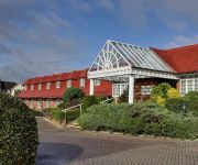
Holiday Inn READING - WEST
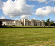
De Vere Wokefield Estate
The Hind's Head
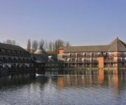
Reading Lake
Flexistay Reading West Aparthotel
Best Western Calcot
The Bull Stanford Dingley
TRAVELODGE READING M4 WESTBOUND
TRAVELODGE READING M4 EASTBOUND
Reading (Grazeley Green)
Videos from this area
These are videos related to the place based on their proximity to this place.
Silchester - Pitfield Lane/Church Lane (ORPA, E-W)
Subscribe for the love of motorcycles and the great outdoors: http://www.youtube.com/subscription_center?add_user=wiltshirebyways Please click 'S H O W M O R E' for route info: ↓↓↓↓↓↓...
The Czech and Slovak Circle goulash party 2014
The Czech and Slovak Circle goulash party at Silchester Village Hall on the 27th of September 2014. We hope you enjoy this montage of video snippets from the party :-)
River Kennet at Padworth Mill, New Years Day 2013
After the heavy rain in the second half of 2012 the River Kennet is running very high. Here are a few impressions from around Padworth Mill near Aldermaston Wharf. Filmed and edited on a Nexus...
Busiest day of driving idiots so far...
brought together from a collection of clips from one 5 mile journey home. I can assure you, it's not usually this bad! By the end I was getting a bit ratty!
Burghfield Santa Cruise on ITV!
Burghfield Santa Cruise 2008 coverage on ITV (...and finally)The Santa Cruise raises money for Thames Valley and Chiltern Air Ambulance Trust (TVACAA). Every year a dozen Santas dress their...
Charlie Jumping 17th Feb 09
Was Just So Proud of Him Going Over The Three Foot I Had To Put It Up I Literally Just Put A Few Clips Together From That Day So Its Not Amazing Just Wanted Everyone To See How Much Hes...
Leaving Poland - Arriving in Southampton!
Arriving in Southampton from Poland - trying to discover what, how, when and where to do things. This video will lead into the launch of www.informacjelokalne.co.u at the end of September.
Videos provided by Youtube are under the copyright of their owners.
Attractions and noteworthy things
Distances are based on the centre of the city/town and sightseeing location. This list contains brief abstracts about monuments, holiday activities, national parcs, museums, organisations and more from the area as well as interesting facts about the region itself. Where available, you'll find the corresponding homepage. Otherwise the related wikipedia article.
Calleva Atrebatum
Calleva Atrebatum (or Silchester Roman Town) was an Iron Age oppidum and subsequently a town in the Roman province of Britannia and the civitas capital of the Atrebates tribe. Its ruins are beneath and to the west of the Parish Church of St Mary the Virgin, which is just within the town wall and about 1 mile to the east of the modern village of Silchester, in the English county of Hampshire close to the boundary with Berkshire.
Bramley (Hampshire) railway station
Bramley railway station is a railway station in the village of Bramley, Hampshire, England. The station is served by First Great Western Basingstoke — Reading local services. The station is 5 miles north of Basingstoke. The line opened in 1848 but Bramley station did not open until 1895.
Great Auclum National Speed Hill Climb
Great Auclum National Speed Hill Climb was a motorcar course close to Burghfield Common in the English county of Berkshire. It was based in the grounds of a large country house, formerly owned by a family connected to Huntley and Palmer - the famous biscuit manufacturers at nearby Reading, Berkshire. The hill climb was organised by the Hants and Berks Motor Club as a National Speed Hill Climb.
Padworth Lock
Padworth Lock is a lock on the Kennet and Avon Canal, at Aldermaston Wharf in the civil parish of Padworth in the English county of Berkshire. Padworth Lock was built between 1718 and 1723 under the supervision of the engineer John Hore of Newbury, and was originally a turf-sided lock. The lock has a rise/fall of 5 ft 1 in (1.55 m). , and was totally rebuilt as a brick lock between 1982 and 1984. The canal is administered by British Waterways. \t\t \t\t\tPadworthSwingBridge.
Towney Lock
Towney Lock is a lock on the Kennet and Avon Canal, between Aldermaston Wharf and Sulhamstead, Berkshire, England. Towney Lock was built between 1718 and 1723 under the supervision of the engineer John Hore of Newbury. The canal is administered by British Waterways. The lock has a rise/fall of 9 ft 8 in (2.95 m). The lock was deepened during restoration work in the 1970s when Ufton Lock was removed.
Ufton Lock
Ufton Lock was a lock on the Kennet and Avon Canal, between Aldermaston Wharf and Sulhamstead, Berkshire, England. Ufton Lock was built between 1718 and 1723 under the supervision of the engineer John Hore of Newbury. The canal is now administered by British Waterways. The rise and fall was a mere 1 ft 9 in (0.5 m). During restoration in the 1970s, the lock gates were removed and the lock upstream was deepened to cope with the new water levels.
The Frith
The Frith is a small univallate Iron Age hillfort to the north of Silchester, Calleva Atrebatum, Roman town. A single bank covers all sides apart from the south east, and is at the most about 5 feet high on the western edge. A ditch is also traceable for the length of the bank, although at varying states. The area to the North and Northwest is partially wooded. A local footpath crosses the site East to West.
Decoy Pit, Pools and Woods
Decoy Pit, Pools and Woods is a 20.27 hectares Site of Special Scientific Interest (SSSI) at Aldermaston Wharf in the civil parish of Aldermaston in the English county of Berkshire, notified in 1993. Located at grid reference SU612632, the site comprises several habitats including woodland, heathland, grassland and small waterbodies, and includes alder woodland types which are becomong a declining habitat in England.


