Safety Score: 3,0 of 5.0 based on data from 9 authorites. Meaning we advice caution when travelling to United Kingdom.
Travel warnings are updated daily. Source: Travel Warning United Kingdom. Last Update: 2024-04-24 08:14:40
Explore Shooters Hill
The district Shooters Hill of Welling in Greater London (England) is located in United Kingdom a little east of London, the country's capital.
If you need a place to sleep, we compiled a list of available hotels close to the map centre further down the page.
Depending on your travel schedule, you might want to pay a visit to some of the following locations: Woolwich, East Ham, Bexleyheath, Bromley and Ilford. To further explore this place, just scroll down and browse the available info.
Local weather forecast
Todays Local Weather Conditions & Forecast: 10°C / 49 °F
| Morning Temperature | 5°C / 41 °F |
| Evening Temperature | 9°C / 48 °F |
| Night Temperature | 5°C / 42 °F |
| Chance of rainfall | 0% |
| Air Humidity | 43% |
| Air Pressure | 1017 hPa |
| Wind Speed | Gentle Breeze with 9 km/h (5 mph) from South |
| Cloud Conditions | Broken clouds, covering 75% of sky |
| General Conditions | Broken clouds |
Thursday, 25th of April 2024
11°C (52 °F)
8°C (46 °F)
Light rain, gentle breeze, overcast clouds.
Friday, 26th of April 2024
8°C (46 °F)
9°C (47 °F)
Light rain, gentle breeze, overcast clouds.
Saturday, 27th of April 2024
15°C (58 °F)
10°C (50 °F)
Light rain, moderate breeze, overcast clouds.
Hotels and Places to Stay
Sunborn London Royal Victoria Dock
DoubleTree by Hilton London Excel
Novotel London Excel
Greenland Villa - Guest house
Aloft London Excel
MOXY London Excel
London Beckton
TRAVELODGE LONDON SIDCUP
Summerfield Pub & Boutique Rooms
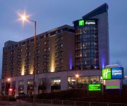
Holiday Inn Express LONDON - GREENWICH A102(M)
Videos from this area
These are videos related to the place based on their proximity to this place.
Railway Contrasts Alongside the A2 Rochester Way Relief Road
The Bexleyheath Line where it runs alongside the A2 Rochester Way relief road which was built in the late 1980's - as seen from a road bridge (for exact location watch the film). Trains...
A day in the life of the Eltham Centre.wmv
Join Sport Science student Marie Humphrey as she takes you on a tour of our Eltham Centre, including our new Sport Science lab. The Eltham Centre is the home to a wide range of Sports, Fitness,...
Class 465044 arrives at Eltham
Class 465044 09:49 to Cannon Street Saturday 13 December 2014, first leg of my trip to Stirling Scotland via King's Cross, York, and Edinburgh.
Severndroog Castle promotional video | Save the Dog Productions
Severndroog Castle on Shooters Hill is a Gothic style tower built in 1784. Taking its name from a battle at Suvarndurg in 1755 it was built as memorial to Sir William James by his widow Lady...
Class 66 at Falconwood
A Freightliner Class 66 517 passing through Falconwood Station about 19:25 1st May. This is regular daily trip coming from somewhere and going somewhere else!
Chimney Sweeps Kent
APEX CHIMNEY SWEEPS http://apexchimneysweeps.co.uk/ We have been working on chimneys in London & North Kent since 1984. We are respected experts in our field and specialise in not just ...
Christmas Carousel
Model built by Andrew Prentis. Subscribe to our YouTube channel to see models built by London's Meccano enthusiasts, plus occasional coverage of Meccano events elsewhere in the UK. YOUTUBE...
SELMEC Meccano Exhibition 2008
The South East London Meccano Club's 2008 Meccano Exhibition in Eltham, featuring 32 models built by our members. This is also available on DVD from our website at ...
Class 465, 375 on the Falconwood incline 19 Jan 2014
Early morning trains Sunday 19th January 2014 passing Glenesk Road bridge between Falconwood and Eltham.
Class 465 Woolwich Arsenal
08:32 Charing Cross train at Woolwich Arsenal Station - it was 5 minutes late.
Videos provided by Youtube are under the copyright of their owners.
Attractions and noteworthy things
Distances are based on the centre of the city/town and sightseeing location. This list contains brief abstracts about monuments, holiday activities, national parcs, museums, organisations and more from the area as well as interesting facts about the region itself. Where available, you'll find the corresponding homepage. Otherwise the related wikipedia article.
Royal Military Academy, Woolwich
The Royal Military Academy (RMA) at Woolwich, in south-east London, was a British Army military academy for the training of commissioned officers of the Royal Artillery and Royal Engineers. It later also trained officers of the Royal Corps of Signals and other technical corps.
Metropolitan Borough of Woolwich
The Metropolitan Borough of Woolwich was a Metropolitan borough in the County of London from 1900 to 1965.
Royal Arsenal
The Royal Arsenal, Woolwich, originally known as the Woolwich Warren, carried out armaments manufacture, ammunition proofing and explosives research for the British armed forces. It was sited on the south bank of the River Thames in Woolwich in south-east London, England.
Severndroog Castle
Severndroog Castle is a folly situated in Oxleas Wood, on Shooter's Hill in south-east London in the Royal Borough of Greenwich. It was designed by architect Richard Jupp in 1784. It was built to commemorate Commodore Sir William James who, in April 1755, attacked and destroyed the island fortress of Suvarnadurg of the Maratha warriors on the western coast of India, between Mumbai and Goa. James died in 1783 and the castle was built as a memorial to him by his widow, Lady James of Eltham.
Oxleas Wood
Oxleas Wood is one of the few remaining areas of ancient deciduous forest in the Royal Borough of Greenwich (with a small amount passing over the boundary into the London Borough of Bexley), in southeast London. Some parts date back over 8,000 years to the last Ice Age, the Younger Dryas.
A210 road
The A210 road is a road in South East London. It forms Eltham High Street for part of its length. The road starts at the junction of the A20 and the A2213 and runs past the Well Hall roundabout where it passes the A205 South Circular, then becomes Eltham Hill, then Eltham High Street, and continues on until it meets the A2 at the Danson Interchange.
Kings Arms, Woolwich
The Kings Arms is a public house in Woolwich, London that was bombed in 1974 and is now a landmark on the route of the London Marathon. Standing at 1 Frances Street by Woolwich Dockyard, it was built in the nineteenth century. In the 1881 census it is listed as the Kings Arms Hotel. A bomb made of 6lb of gelignite with the addition of shrapnel was thrown through the window into the bar on 7 November 1974.
Woolwich Common
Woolwich Common is an area of military land located to the south of the town centre of Woolwich in southeast London, England. It is bounded to the south side by the A207 Shooter's Hill Road, and to the east by Academy Road (part of the A205 South Circular road) that the former Royal Military Academy fronts. Situated to the west is the Queen Elizabeth Hospital. The attractive Rotunda building on Green Hill to the north used to hold many artillery pieces now displayed at Firepower.
Eltham (UK Parliament constituency)
Eltham is a constituency represented in the House of Commons of the Parliament of the United Kingdom. It is a marginal Labour-held seat covering roughly the southern half of the Royal Borough of Greenwich in London.
Firepower – The Royal Artillery Museum
Firepower: The Royal Artillery Museum is a military museum in Woolwich in south-east London, England, which tells the story of the Royal Regiment of Artillery and of the Royal Arsenal.
Royal Artillery Barracks
The Royal Artillery Barracks at Woolwich in the Royal Borough of Greenwich in London, was the home of the Royal Artillery.
Plumstead Common
Plumstead Common is a common in Plumstead, (SE18) in the Royal Borough of Greenwich, south-east London. It is bound to the north by Old Mill Road and to the south by Plumstead Common Road. To the east lies Winn or Winn's Common. Substantial remains of the Old Mill still stand and have been incorporated into the public house of the same name. The common contains deposits of puddingstone, a conglomerate rock formed during a period of global warming 60 million years ago.
Greenwich Community College
Greenwich Community College is a post-secondary educational institution located in Plumstead in the Royal Borough of Greenwich, in southeast London, England. It was founded in 1921 as Woolwich College of Further Education, which became Greenwich Community College in 1998.
Eltham Well Hall rail crash
The Eltham Well Hall rail crash was an accident on the British railway system that occurred on 11 June 1972 at approximately 21:35. An excursion train from Margate to Kentish Town derailed on a sharp curve at Eltham Well Hall station, Eltham, London. The driver and five passengers were killed, and 126 people were injured. At the subsequent public inquiry it was revealed that the driver had been intoxicated by alcohol.
Queen Elizabeth Hospital, Woolwich
The Queen Elizabeth Hospital is located on Woolwich Common in London, England, was opened in March 2001 and serves patients from the Royal Borough of Greenwich and the London Borough of Bexley. The hospital was built to accommodate the services previously provided at Greenwich District Hospital, and is a Private Finance Initiative hospital.
Royal Arsenal Railway
The Royal Arsenal Railway was a private military railway. It ran inside the Royal Arsenal, Woolwich, south east London. The earliest parts of this railway system proper were constructed to standard gauge from 1859 onwards as a to replace an ad hoc arrangement of individual plateways. Laying of plateways had started in 1824 and was completed by 1854-5; they then came under the control of the Corps of Royal Engineers.
Auto Stacker
The Auto Stacker was an ill-fated but ambitious project by Woolwich Borough Council in south-east London. It cost £100,000 in 1961 and was located on Beresford Street, Woolwich. As the name suggests, the Auto Stacker was a machine that parked cars in a stack, using a combination of conveyor belts and lifts to move vehicles from ground level to one of 256 carpark spaces. It was, effectively, an automated multi-storey car park, and was situated above a car showroom, workshop and petrol station.
St Mary Magdalen Woolwich
St Mary Magdalen Woolwich is an Anglican church dedicated to Mary Magdalen in Woolwich, sited at the extremity of a spur reaching northwards towards the Thames. The original church was built some time before the 12th century (possibly even as early as the 9th century), though by the 18th century its Elizabethan spire had collapsed and the foundations were showing other signs of strain.
Anglian College London
Anglian College London (ACL) is a British college of further and higher education operating mainly from Woolwich, London. It has four academic and one administrative departments providing services to both UK and non-UK students. It is one of the few colleges accredited by both City and Guilds and Association of Business Executives (ABE) in the region. It has been recommended by the NEBDN for the dental nursing programme in its own private surgery.
85-91 Genesta Road
85-91 Genesta Road are four terraced houses, in the Royal Borough of Greenwich, located south of Plumstead, north of Shooter's Hill near Plumstead Common, and are the United Kingdom's only modernist terrace, designed by the architectural pioneer Berthold Lubetkin. The houses were among the first attempts to re-design the traditional English house with the benefits of concrete construction. They are listed grade II*. 85-91 Genesta Road was the first domestic project in the U.K.
Rotunda (Woolwich)
The Rotunda on Woolwich Common, in south-east London, is an artillery museum which was established in 1820. The building was originally a very large bell tent erected in St. James's Park in 1814 for a special exhibition and premature victory reception of the allied sovereigns in the Napoleonic Wars but its architect John Nash turned it into a permanent structure with a lead roof and central supporting pillar.
Meridian Radio
Meridian Radio is the working name of the Woolwich Hospitals Broadcasting Service. It is a hospital radio station providing entertainment and information to the patients and staff of the Queen Elizabeth Hospital in Woolwich. It was established from the merger of two radio stations in 1972, becoming the Woolwich Hospitals Broadcasting Service. The on air name of the station became Meridian Radio in 2001 following the station moving to new studios on Woolwich Common.
Barrack Field
Barrack Field is located within the Royal Artillery Barracks at Woolwich in southeast London (formerly part of Kent). It was used as a venue for major cricket matches in the 18th century and as the home of Woolwich Cricket Club at that time; latterly it has been the home of the Royal Artillery Cricket Club. Woolwich CC came briefly to prominence in August 1754 when the team played home and away games against Dartford which at this time was probably the strongest team in England.
Bridon Ropes F.C
Bridon Ropes F.C. is an English football club located in Charlton, in the Royal Borough of Greenwich. The club plays in the Kent Invicta Football League.
Meridian F.C
Meridian F.C. is an English football club located in Woolwich, in the Royal Borough of Greenwich. The club is affiliated to the Kent County Football Association and is a FA chartered Standard Club. The club plays in the Kent Invicta Football League.


