Safety Score: 3,0 of 5.0 based on data from 9 authorites. Meaning we advice caution when travelling to United Kingdom.
Travel warnings are updated daily. Source: Travel Warning United Kingdom. Last Update: 2024-04-19 08:03:45
Discover Upper Norwood
The district Upper Norwood of Norwood in Greater London (England) is a district in United Kingdom a little south of London, the country's capital city.
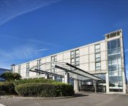
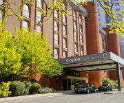
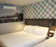
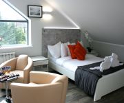
Looking for a place to stay? we compiled a list of available hotels close to the map centre further down the page.
When in this area, you might want to pay a visit to some of the following locations: Croydon, Camberwell, Catford, City of Westminster and City of London. To further explore this place, just scroll down and browse the available info.
Local weather forecast
Todays Local Weather Conditions & Forecast: 11°C / 53 °F
| Morning Temperature | 9°C / 49 °F |
| Evening Temperature | 9°C / 48 °F |
| Night Temperature | 6°C / 42 °F |
| Chance of rainfall | 1% |
| Air Humidity | 81% |
| Air Pressure | 1016 hPa |
| Wind Speed | Moderate breeze with 12 km/h (7 mph) from South |
| Cloud Conditions | Broken clouds, covering 75% of sky |
| General Conditions | Light rain |
Saturday, 20th of April 2024
9°C (48 °F)
5°C (41 °F)
Scattered clouds, moderate breeze.
Sunday, 21st of April 2024
8°C (46 °F)
5°C (41 °F)
Broken clouds, gentle breeze.
Monday, 22nd of April 2024
9°C (49 °F)
5°C (42 °F)
Light rain, gentle breeze, overcast clouds.
Hotels and Places to Stay
Hilton London Croydon
Croydon Park
Best Western Plus London Croydon Aparthotel
Westciti Caroco Aparthotel
Croham Park Bed & Breakfast
Hallmark Croydon
Best Western London Peckham Hotel
Church Street Hotel
The Victoria Inn
Parklands B&B
Videos from this area
These are videos related to the place based on their proximity to this place.
Fifth Croydon Boys' Brigade - National Table Tennis v 10th Mid-Surrey
5th Croydon host the 10th Mid-Surrey in the 4th round of the national table tennis competition on 28th February 2015.
Bill Brunskill - Move the Body Over
Bill Brunskill's marvellous Sunday lunch time sessions at The Lord Napier, Thornton Heath lasted for many years. I videoed this session on 13 June 1999.
London 2012 Olympic torch relay
London 2012 Olympic torch relay going through Thornton Heath High Street.
Upper Norwood Joint Library
Speeches by Councillor Russell A'Court and Irene Kim, Mayor of Lambeth. After a major, nine month refurbishment costing more than £1m, the Upper Norwood Joint Library in Westow Hill was ...
Gardeners' World Live 2014: WWI Trench by City of Birmingham
http://www.thehortchannel.com: A garden designed to commemorate the start of WW1. It was designed by a team led by Birmingham City Council, a tribute to the men who died. The garden included...
ALS Ice Bucket Challenge
Was nominated by my good friend Symbiant, had 24 hours to do this, it's a Sunday, bank holiday on Monday, no time to hire a camera, so iPhone it was. If you'd like to donate then please follow...
Crystal Palace v Charlton Ahtletics
Crystal Palace fans singing after the goal in the 1-0 match v Charlton 30 sept 2008 at Selhurst Park. Me and two friends flew from Gothenburg, Sweden just to watch this game. And we had an...
I found myself a cheerleader
I meet Crystal Palace's cheerleaders the Crystals at Palace's great win against Man CIty.
Summer Storms | July (EP21/Y2) | Sean's Allotment Garden
http://www.thehortchannel.com: Another hot week as Vivi and Ky meet Sean to discuss the progress on their allotment gardens. Meantime, Geoff is off on holiday and won't be back for a month....
Junk Removal London | Junk Removal London SE19 | 020 33229970
Junk Removal London - Call: 020 3322 9970 Junk Removal London Service - For professional and affordable domestic & residential rubbish removal in London there is no better choice than your...
Videos provided by Youtube are under the copyright of their owners.
Attractions and noteworthy things
Distances are based on the centre of the city/town and sightseeing location. This list contains brief abstracts about monuments, holiday activities, national parcs, museums, organisations and more from the area as well as interesting facts about the region itself. Where available, you'll find the corresponding homepage. Otherwise the related wikipedia article.
The Crystal Palace
The Crystal Palace was a cast-iron and plate-glass building originally erected in Hyde Park, London, England, to house the Great Exhibition of 1851. More than 14,000 exhibitors from around the world gathered in the Palace's 990,000 square feet of exhibition space to display examples of the latest technology developed in the Industrial Revolution. Designed by Sir Joseph Paxton, the Great Exhibition building was 1,851 feet long, with an interior height of 128 feet .
Capital London
Capital London is a London-based radio station that launched on 16 October 1973 and is owned by Global Radio. On 3 January 2011 it formed part of the nine-station Capital radio network.
Pear Tree House
Pear Tree House was the former Civil Defence control centre for South-East London. It is a block of council flats in the Central Hill Estate of Upper Norwood with 8 two-bedroom flats and the control centre in the basement.
Crystal Palace F.C
Crystal Palace Football Club is an English Football league club based in South Norwood, London. The team plays its home matches at Selhurst Park, where it has been based since 1924. The club currently competes in the second tier of English Football, The Championship. Crystal Palace was formed in 1905 by workers at The Crystal Palace. The club reached the top division of English Football in 1969–70, and its first major final was in 1990.
West Norwood Cemetery
West Norwood Cemetery is a 40-acre cemetery in West Norwood in London, England. It was also known as the South Metropolitan Cemetery. One of the first private landscaped cemeteries in London, it is one of the Magnificent Seven cemeteries of London, and is a site of major historical, architectural and ecological interest. Its grounds are a mixture of historic monumental cemetery and modern lawn cemetery, but it also has catacombs, cremation plots and a columbarium for cinery ashes.
Selhurst Park
Selhurst Park is an association football stadium located in the London suburb of South Norwood in the Borough of Croydon. It is the current home ground of Crystal Palace Football Club. Its present capacity is 26,309.
Crystal Palace transmitting station
The Crystal Palace transmitting station is a broadcasting and telecommunications site in the London Borough of Bromley, England. Its tower is the fourth-tallest structure in London. It is best known as the main television transmitter for the London area, and is owned and operated by Arqiva.
Croydon transmitting station
The Croydon transmitting station (also known as the NTL Tower) is a broadcasting and telecommunications facility on Beulah Hill in Upper Norwood, London, England, in the London Borough of Croydon, owned by Arqiva. It was established in 1955 and initially used a small lattice tower. The present tower is 152 metres high and was built in 1962. It was originally used to broadcast the London ITV signal on VHF Band III. When UHF broadcasting began, nearby Crystal Palace transmitting station was used.
Spurgeon's College
Spurgeon's College is a Christian theological college in South Norwood Hill, Croydon, London.
Norwood Ridge
The Norwood Ridge is a landmark ridge in South London approximately five miles south of central London. It runs for approximately three miles in a north-easterly direction, from Selhurst and Streatham in the south, to Forest Hill in the north. It is a ridge of London Clay capped in places with gravel deposits known as the Claygate Beds. It includes Sydenham Hill and Crystal Palace and also parts of Dulwich and Upper Norwood.
Norwood Park (London)
Norwood Park is a 33 acre park in South London It commands a great view across Dulwich to The City and Central London 7 miles (11 km) away. On a clear day it may even be possible to see the Alexandra Palace in North London.
A212 road
The A212 is an A road in South London, linking Lewisham to Croydon. It runs southwest from the South Circular at Catford, going through Sydenham, Norwood and Crystal Palace before heading south to Croydon. It then turns east to terminate at the A2022 road in Forestdale. The junction with the A214 at Crystal Palace is the meeting point of four London Boroughs – Bromley, Croydon, Lambeth and Southwark.
Beaulieu Heights
Beaulieu Heights is an extensive woodland area between South Norwood and Upper Norwood, London. It is managed by the London Borough of Croydon. It's located between South Norwood Hill and Auckland Road with Auckland Rise to the north and Tummonds Gardens to the south. There are pedestrian entrances from South Norwood Hill and Auckland Rise.
Great North Wood
The Great North Wood was a natural oak forest that covered most of the area of raised ground starting some four miles (6 km) south of central London, covering the Sydenham Ridge and the southern reaches of the River Effra and its tributaries. At its full extent, the wood's boundaries stretched almost as far as Croydon and as far north as Camberwell.
South Norwood Lake and Grounds
South Norwood Lake and Grounds is a park in South Norwood in the London Borough of Croydon. The main entrance is in Woodvale Avenue while other entrances are located in Auckland Road and Sylvan Road. The area measures up to 28⁄2 acres 11.53 hectares. The lake itself was originally created as a reservoir for the Croydon Canal, which from 1809 to 1836 ran between Croydon and the Grand Surrey Canal at New Cross.
South Norwood Library
South Norwood Library is a public library in South Norwood, South London. It stands in the London Borough of Croydon and is part of the Croydon Libraries arm of the council. It's next to the High street on Selhurst Road / Lawrence Road and is also close to South Norwood Recreation Ground. The library, like many other Croydon libraries, is based on more than one level.
Knight's Hill
Knights Hill is a main road on the A215 in West Norwood, London and a mound to the north adjoining Tulse Hill. The road itself starts in the north at West Norwood in the Norwood Triangle. It ends in the south at a junction with the A214 at Crown Lane and Crown Dale. Knights Hill becomes Beulah Hill at this point. In the north, Knights Hill is home to a large parade of shops. See A215 road for more information.
Grangewood Park
Grangewood Park is an extensive woodland area situated in South Norwood, London. It is managed by the London Borough of Croydon. It is bounded by Grange Road, Wharncliffe Road, and Ross Road. It covers an area of 27¾ acres 11.23 hectares. The park is located on the main A212 road (Grange Road) between Thornton Heath and Upper Norwood/Crystal Palace. The nearest stations are Thornton Heath, Selhurst and Norwood Junction.
Upper Norwood Library
Upper Norwood Joint Library is a Public Library located in Upper Norwood, South London. It stands in Lambeth on the edge of the borough boundary between both the London Borough of Croydon and the London Borough of Lambeth. It is located on Westow Hill, in Crystal Palace town centre. Upper Norwood Joint Library is an independent library service. It is funded by Croydon and Lambeth Councils, but is not part of either borough's library services.
Selhurst Road
Selhurst Road is a main road between South Norwood and Selhurst in the London Borough of Croydon, South London. It forms part of the A213 road which is a major A Road connecting both Sydenham and Croydon. The road starts in South Norwood from the High Street, which is also part of the A213, then it carries on to Selhurst railway station opposite Heavers Meadow then on a side road it passes the BRIT School.
St Luke's Church, West Norwood
St Luke's Church in West Norwood is an Anglican Church in the London Borough of Lambeth. It currently has an Evangelical emphasis.
Kingswood House
Kingswood House, formerly known as King's Coppice, is a Victorian mansion in West Dulwich at the southerly tip of the London Borough of Southwark, England. It is a Grade II listed building. In 1811 William Vizard was granted a 63 year lease for Kingswood Lodge. When Vizard returned to his native Gloucestershire in 1831, others were granted the property leases. From 1891 the house was owned by John Lawson Johnston who extended the house and remodelled the facade including adding battlements.
Bensham Manor (ward)
Bensham Manor is a ward in the London Borough of Croydon, covering part of the Thornton Heath area of London in the United Kingdom. The ward extends from Thornton Heath railway station westwards and is largely residential with a retail or industrial core. The ward currently forms part of Malcolm Wicks MP's Croydon North constituency. The ward returns three councillors every four years to Croydon Council.
Gipsy Hill (ward)
Gipsy Hill ward is an administrative division of the London Borough of Lambeth, England. The ward contains much of West Norwood as well as Norwood park and West Norwood Cemetery. it also contains Gipsy Hill railway station. Gipsy Hill ward is located in the Dulwich and West Norwood Parliamentary constituency.
JW Hobbs Ground
JW Hobbs Ground was a cricket ground in Norbury, Surrey. The ground was constructed in 1885 within the grounds of Norbury Hall by local philanthropist J.W. Hobbs. The first recorded match on the ground was in 1887, when CI Thornton's XI played the Gentlemen of Canada. It hosted its only first-class match in the following year, when CI Thornton's XI played the touring Australians.


