Safety Score: 3,0 of 5.0 based on data from 9 authorites. Meaning we advice caution when travelling to United Kingdom.
Travel warnings are updated daily. Source: Travel Warning United Kingdom. Last Update: 2024-04-25 08:17:04
Delve into Harmondsworth
Harmondsworth in Greater London (England) with it's 879 habitants is located in United Kingdom about 15 mi (or 24 km) west of London, the country's capital town.
Current time in Harmondsworth is now 06:58 PM (Thursday). The local timezone is named Europe / London with an UTC offset of one hour. We know of 10 airports close to Harmondsworth, of which 5 are larger airports. The closest airport in United Kingdom is London Heathrow Airport in a distance of 1 mi (or 2 km), South-East. Besides the airports, there are other travel options available (check left side).
There are several Unesco world heritage sites nearby. The closest heritage site in United Kingdom is Tower of London in a distance of 24 mi (or 38 km), East. Also, if you like playing golf, there are some options within driving distance. We encountered 3 points of interest near this location. If you need a hotel, we compiled a list of available hotels close to the map centre further down the page.
While being here, you might want to pay a visit to some of the following locations: Uxbridge, Horton, Datchet, Old Windsor and Hounslow. To further explore this place, just scroll down and browse the available info.
Local weather forecast
Todays Local Weather Conditions & Forecast: 11°C / 52 °F
| Morning Temperature | 4°C / 40 °F |
| Evening Temperature | 9°C / 48 °F |
| Night Temperature | 7°C / 45 °F |
| Chance of rainfall | 2% |
| Air Humidity | 59% |
| Air Pressure | 1004 hPa |
| Wind Speed | Gentle Breeze with 7 km/h (4 mph) from East |
| Cloud Conditions | Scattered clouds, covering 35% of sky |
| General Conditions | Light rain |
Friday, 26th of April 2024
11°C (51 °F)
7°C (44 °F)
Light rain, gentle breeze, broken clouds.
Saturday, 27th of April 2024
10°C (49 °F)
8°C (46 °F)
Light rain, moderate breeze, overcast clouds.
Sunday, 28th of April 2024
8°C (47 °F)
6°C (44 °F)
Moderate rain, gentle breeze, overcast clouds.
Hotels and Places to Stay
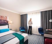
Mercure London Heathrow Hotel
Radisson Blu Edwardian Heathrow Hotel
Holiday Inn LONDON - HEATHROW ARIEL
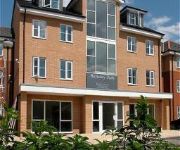
Berkeley Park By BridgeStreet
Leonardo London Heathrow Airport
JCT.4 Holiday Inn LONDON - HEATHROW M4
Sofitel London Heathrow
Novotel London Heathrow Airport
Crowne Plaza LONDON - HEATHROW
Park Inn by Radisson Hotel & Conference Centre London Heathrow
Videos from this area
These are videos related to the place based on their proximity to this place.
Snow falling from a dark sky, West Drayton, London (V) 6 Jan 2010
Abstract video of large snow flakes falling from a dark sky in West Drayton, London, while magpies chatter in the trees on the afternoon of 6th Jan 2010.
Car turning in snow in West Drayton, London 6 Jan 2010
A car makes a slow turn in fresh snow in West Drayton, London on the afternoon of 6th Jan 2010.
Falling snow in West Drayton, London (VI) 6 Jan 2010
A video of the local streets (West Drayton, London) during the snow storm of the afternoon of 6th Jan 2010.
Falling Snow in West Drayton, London (VIII) 6 Jan 2010
The state of the streets in West Drayton, London during the snow storm of the afternoon of 6th Jan 2010.
HST Power Cars & T'n'T Class 57's on ECS sleeper - West Drayton 6th Jan 15
First Great Western power cars Nos. 43094 & 43030 haul a failed DRS Class 57 No. 57310 and the empty coaching stock of the 1A40 Up sleeper service with Class 57/6 No. 57602 on the back, working ...
Benham and Reeves Lettings | Property to rent in the Parkwest Development, West Drayton, UB7
A beautifully presented Manhattan style apartment within in the popular Parkwest development in West Drayton. Located close to transport links and all local amenties the development offers...
Benham and Reeves Lettings | Property to rent in the Parkwest Development , West Drayton, UB7
A brand new second floor manhattan style apartment located in the sought after Parkwest development in West Dryaton. The development boasts access to a private gym, residents parking, stunning...
Benham and Reeves Lettings | Property to rent in the Parkwest Development, West Drayton UB7
A luxurious ground floor Manhattan style apartment situated at the ever popular Parkwest development. Accommodation comprises; Spacious reception open plan to modern designed kitchen with built.
Cycling through Longford Village
Cycling through Longford Village with Mike on a bright, sunny, frosty day. Mike on his mountain bike, me on my 1960s Moulton Standard.
Cycling in Harmondsworth Moor Country Park - Part 1
Part 1 of cycling in Harmondsworth Moor Country Park with Mike on a nice cold, bright winter's day. Mike on his mountain bike, me on my 1960's Moulton Standard.
Videos provided by Youtube are under the copyright of their owners.
Attractions and noteworthy things
Distances are based on the centre of the city/town and sightseeing location. This list contains brief abstracts about monuments, holiday activities, national parcs, museums, organisations and more from the area as well as interesting facts about the region itself. Where available, you'll find the corresponding homepage. Otherwise the related wikipedia article.
Thorney, Buckinghamshire
Thorney is a hamlet in the parish of Iver, in Buckinghamshire, England.
RAF West Drayton
RAF West Drayton was a non-flying Royal Air Force station in West Drayton, within the London Borough of Hillingdon, which served as the main centre for military air traffic control in the United Kingdom. It was co-located with the civilian London Terminal Control Centre to provide a vital link between civil and military flying and airspace requirements.
ULTra (rapid transit)
ULTra (Urban Light Transit) is a personal rapid transit system developed by ULTra PRT, formerly known as Advanced Transport Systems. The first public system using ULTra, at London's Heathrow Airport, is now open to the public. The ULTra PRT system began passenger trials at London Heathrow Airport, Terminal 5, in October 2010 and opened for full passenger service 22 hours a day, 7 days a week, in May 2011.
Waterside (building)
The Waterside building in Harmondsworth, London, is the international head office of British Airways. The building, which cost £200 million, is located on Harmondsworth Moor, northwest of Heathrow Airport, between the M4 and the M25 motorways. Waterside is on the western edge of London, near West Drayton and Uxbridge, in the Borough of Hillingdon
Harmondsworth Immigration Removal Centre
Harmondsworth Immigration Removal Centre is an immigration detention facility in Harmondsworth, London Borough of Hillingdon, near London Heathrow Airport. Harmondsworth, which neighbours the Colnbrook Immigration Removal Centre, holds around 620 men.
Colnbrook Immigration Removal Centre
Colnbrook Immigration Removal Centre is located in Harmondsworth, London Borough of Hillingdon. Colnbrook, adjacent to Harmondsworth Immigration Removal Centre and London Heathrow Airport, houses males and females. Colnbrook, which opened in August 2004, is built to Class B prison standards, making it the highest security immigration removal centre in the United Kingdom. Colnbrook had 308 bed spaces.
Compass Centre
Compass Centre is an office building on the grounds of London Heathrow Airport in the London Borough of Hillingdon. The building serves as BAA Limited's head office. Compass Centre previously served as a British Airways flight crew centre.
Great West Aerodrome
The Great West Aerodrome, also known as Harmondsworth Aerodrome or Heathrow Aerodrome, was a grass airfield, operational 1930–1944. It was on the southeast edge of the hamlet of Heathrow, in the parish of Harmondsworth. The Fairey Aviation Company owned and operated it, for assembly and flight testing of Fairey-manufactured aircraft. The area was to later be the site of London Heathrow Airport.
Harmondsworth Great Barn
Harmondsworth Great Barn (also known as Manor Farm Barn) is a medieval tithe barn on the former Manor Farm in the village of Harmondsworth, in the London Borough of Hillingdon, England (previously part of the historic county of Middlesex). It stands just north of Heathrow Airport. Built in the early 15th century by Winchester College, it is the largest timber-framed building in England and is regarded as an outstanding example of medieval carpentry.
Airports of London
The metropolitan area of London, England is served by six international airports and several smaller airports. Together, they make the busiest airport system in the world by passenger numbers and the second busiest by aircraft movements. In 2011, all six airports handled 133,709,327 passengers. The London airports handle 60% of all the United Kingdom's air traffic. There are 14 domestic destinations served by the airports, and 396 international destinations.


