Safety Score: 3,0 of 5.0 based on data from 9 authorites. Meaning we advice caution when travelling to United Kingdom.
Travel warnings are updated daily. Source: Travel Warning United Kingdom. Last Update: 2024-04-19 08:03:45
Discover Upton Park
The district Upton Park of East Ham in Greater London (England) is a district in United Kingdom a little east of London, the country's capital city.
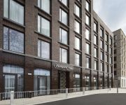
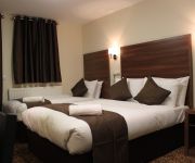
Looking for a place to stay? we compiled a list of available hotels close to the map centre further down the page.
When in this area, you might want to pay a visit to some of the following locations: Ilford, Woolwich, Poplar, Walthamstow and Hackney. To further explore this place, just scroll down and browse the available info.
Local weather forecast
Todays Local Weather Conditions & Forecast: 12°C / 53 °F
| Morning Temperature | 9°C / 49 °F |
| Evening Temperature | 9°C / 48 °F |
| Night Temperature | 5°C / 42 °F |
| Chance of rainfall | 1% |
| Air Humidity | 83% |
| Air Pressure | 1015 hPa |
| Wind Speed | Moderate breeze with 12 km/h (7 mph) from South-East |
| Cloud Conditions | Broken clouds, covering 75% of sky |
| General Conditions | Light rain |
Saturday, 20th of April 2024
8°C (47 °F)
5°C (41 °F)
Scattered clouds, moderate breeze.
Sunday, 21st of April 2024
8°C (46 °F)
5°C (41 °F)
Broken clouds, gentle breeze.
Monday, 22nd of April 2024
10°C (49 °F)
6°C (42 °F)
Light rain, light breeze, overcast clouds.
Hotels and Places to Stay
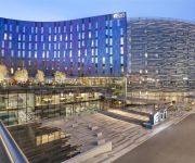
DoubleTree by Hilton London Excel
Aloft London Excel
201 Upton Lane
Connaught House Hotel
ibis Styles London Excel
London Beckton
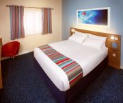
TRAVELODGE LONDON EXCEL
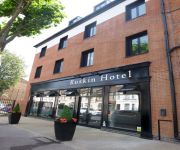
Ruskin Hotel
Hampton by Hilton London Docklands
Prince Regent Hotel Excel London
Videos from this area
These are videos related to the place based on their proximity to this place.
fanspick at West Ham United Vs. Norwich City
We spoke to the fans of both teams ahead of the game between West Ham United and Norwich City.
Business Travel Agent - Fantastic Deals..!!! London Travel Agent...
http://ItsTheWayToTravel.com ...help line +44 (0)20 8346 5400 Business Travel Agent - Fantastic Deals..!!! London Travel Agent... Hello my name is Ashley, from it's the way to travel we are...
Culture, Safari and Beach Tours | Executive Travel Agent London UK
Executive Travel Agent, Culture, Safari and Beach Tours London UK http://ItsTheWayToTravel.com Help line +44 (0)20 8346 5400 Hi my names Ashley from ItsTheWayToTravel.com this short Video...
Around the Leagues in Bare Feet - Part 44: West Ham vs Crystal Palace 28th Feb 2015
http://www.justgiving.com/saxbend2015 Straight from finishing Jonjo's 2015 challenge - a 50 mile walk as part of his 800 mile task, I was invited along to watch West Ham play Palace since...
Half time Reading FC fan celebrations at Upton Park 2011/12
Concourse reaction to the 2 incredible late first half goals at Upton Park to see us go in at 2-1. Amazing away day! The 4-2 win saw RFC go 4 points clear of West Ham at the top of the league....
I'm forever blowing bubbles at Upton Park on 28-12-14
West Ham United supporters singing forever blowing bubbles before the game vs. Arsenal.
west ham stoke city 3-0 upton park
Grandissimo goal del West Ham realizzato da Thomas Hitzlsperger e ripreso dai nostri fantastici posti in prima fila... che vacanza stupenda! Che spettacolo il calcio inglese! Da Roma ad Upton...
Videos provided by Youtube are under the copyright of their owners.
Attractions and noteworthy things
Distances are based on the centre of the city/town and sightseeing location. This list contains brief abstracts about monuments, holiday activities, national parcs, museums, organisations and more from the area as well as interesting facts about the region itself. Where available, you'll find the corresponding homepage. Otherwise the related wikipedia article.
London Borough of Newham
The London Borough of Newham Listen/ˈnjuːəm/ is a London borough formed from the former Essex county boroughs of West Ham and East Ham, within East London. It is situated 5 miles east of the City of London, and is north of the River Thames. Newham was one of the six host boroughs for the 2012 Summer Olympics and contains most of the Olympic Park including the Olympic Stadium.
Greenway, London
The Greenway is a footpath and cycleway in east London constructed on the embankment containing the Northern Outfall Sewer. The path runs from Wick Lane in Bow through Stratford, Plaistow and Newham to Royal Docks Road in Beckton. It was known locally as sewerbank before a full renovation in the mid-nineties. Work has taken place to resurface and renovate the route - especially around the Olympic Park.
Upton Park, London
Upton Park is an urban area of the London Borough of Newham, centred on the local high street, Green Street. The area is synonymous with football and is home to West Ham United Football Club, who play at the Boleyn Ground, commonly known as Upton Park.
Boleyn Ground
The Boleyn Ground, often referred to as Upton Park due to its location in Upton Park, London, is the football stadium of West Ham United Football Club.
East Ham (UK Parliament constituency)
East Ham is a constituency in the London Borough of Newham represented in the House of Commons of the UK Parliament since 1997 by Stephen Timms of the Labour Party.
County Borough of East Ham
East Ham was a local government district in the far south west of Essex from 1878 to 1965. It extended from Wanstead Flats in the north to the River Thames in the south and from Green Street in the west to Barking Creek in the east. It was part of the London postal district and Metropolitan Police District.
Newham University Hospital
Newham University Hospital is a nucleus hospital situated in Plaistow, Newham, east London, England. When it opened in 1983 it provided centralized services for the population of Newham, replacing Queen Mary's Hospital for the East End in Stratford and East Ham Memorial Hospital, both of which closed. Phase 2 of its 'nucleus' development introduced a maternity unit in 1985, replacing the services previously provided by Forest Gate Hospital.
Brampton Manor Academy
Brampton Manor Academy is a secondary school and sixth form with academy status situated in East Ham, east London. It has around 1600 students and over 100 staff. Brampton Manor is the second biggest school in Newham. It was awarded specialist status as an Arts College. The school's current headteacher is Dr Olukoshi. His predecessor was Neil Berry, son of the late one time Manchester United footballer Johnny Berry.
Green Street, London
Green Street is a road in the London Borough of Newham, England. The name appears in records from the 15th century and it was the boundary of the ancient parishes of East Ham and West Ham, from the Romford Road to the marshes near The River Thames. The southern portion is the location of the Boleyn Ground, home to West Ham United.
Albert Dock Seamen's Hospital
The Albert Dock Seamen's Hospital was a hospital provided by the Seamen's Hospital Society for the care of ex-members of the Merchant navy, the fishing fleets and their dependents. It was opened in 1890 as a branch of the Dreadnought Seamen's Hospital, Greenwich. The London School of Tropical Medicine was established here in October 1899, by Sir Patrick Manson with assistance from the British Secretary of State for the Colonies.
2 June 2006 Forest Gate raid
The 2 June 2006 Forest Gate raid saw the arrest of two men at their east London homes in Forest Gate by police acting on what they described as "specific intelligence" that they might be terrorists in possession of a chemical bomb. One of the men was shot during the raid. No explosive devices were found during the raid, nor was there any evidence of terrorist activity. The men were released without charge.
A118 road
The A118 is a road in east London, England which links Bow with Gallows Corner, east of Romford. The section from Stratford to Gallows Corner formed the original route of the A12 until the designation was transferred to the Eastern Avenue soon after the latter opened in 1925. This route has even older pedigree, dating back to Roman times, forming the London to Colchester road.
West Ham Stadium
West Ham Stadium was a stadium that existed between 1928 and 1972 in Custom House, in east London (it was in the County Borough of West Ham, in the county of Essex, at the time of the stadium's construction). The stadium was built in 1928 on Prince Regent Lane, near the site of the present-day Prince Regent DLR station. The stadium had no connection at all with West Ham United football club, who have played at the nearby Boleyn Ground, Upton Park since 1904.
Browning Road
Browning Road was the home ground of London football club Thames Ironworks, the team that would become West Ham United, towards the end of the 1896-97 season.
Queen's Market
Queen's Market, also known as Queen's Road Market, and Green Street Market, is an historic street market in the London Borough of Newham. It lies adjacent to Green Street and Upton Park tube station. The street market originated in Green Street at the boundary between East Ham and West Ham in the late Victorian era when the new suburb of East Ham began to be developed. Originally the stall holders were Jewish traders from Whitechapel and the East End, selling clothing and vegetables.
Greengate House
Tyndale Academy
Tyndale Academy is an independent, fee-paying tuition group in East London for children aged 4 to 11 years of age. The academy, based at the Hope Baptist Chapel has an evangelical Christian ethos but accepts children from all faiths or none. It was established in 1999 and was named after the English church reformer William Tyndale who as well as being a Bible translator was a tutor of children.
Greengate, London
Newham College of Further Education
Newham College of Further Education is a college of further education in the London Borough of Newham, United Kingdom. The main site is in East Ham, with a further site in Stratford, and six further local neighbourhood learning centres. Two main campuses, East Ham Campus, High Street South, London E6 6ER and Stratford Campus, Welfare Road, London E15 4HT.
East Ham Baptist Church
East Ham Baptist Church is situated in Plashet Grove, East Ham, a mainly residential area of the London Borough of Newham, United Kingdom.
Selwyn Primary School
Selwyn Primary School is a community junior school based in Highams Park, East London. The School was formerly known as Selwyn Avenue School.
London APSA F.C
London All Peoples' Sports Association are a non-League football team, based in Forest Gate who play in the Essex Senior League.
World Cup Sculpture
The World Cup Sculpture, or simply The Champions, is a bronze statue of the 1966 World Cup Final located near West Ham United Football Club's Boleyn Ground (Upton Park) stadium in the London Borough of Newham, England. It depicts a famous victory scene photographed after the final, held at the old Wembley Stadium in London, featuring Bobby Moore, Geoff Hurst, Martin Peters and Ray Wilson.
Plashet
Plashet is an area in the borough of Newham in east London. It contains Plashet Jewish cemetery, Plashet Park and several places of worship. 30px This London-related article is a stub. You can help Wikipedia by expanding it. vte
Beckton District Park North
Beckton District Park North is a public park in Beckton in the London Borough of Newham. It has undulating grassland with scattered trees, areas of natural woodland, a lake with a large island, a children's playground, a basketball court, toilets and a car park. Beckton District Park and Newham City Farm are a Site of Borough Importance for Nature Conservation, Grade I. The Capital Ring goes through the park.


