Safety Score: 3,0 of 5.0 based on data from 9 authorites. Meaning we advice caution when travelling to United Kingdom.
Travel warnings are updated daily. Source: Travel Warning United Kingdom. Last Update: 2024-04-25 08:17:04
Discover Chelsfield
Chelsfield in Greater London (England) is a place in United Kingdom about 15 mi (or 24 km) south-east of London, the country's capital city.
Current time in Chelsfield is now 10:39 PM (Thursday). The local timezone is named Europe / London with an UTC offset of one hour. We know of 8 airports near Chelsfield, of which 5 are larger airports. The closest airport in United Kingdom is London Biggin Hill Airport in a distance of 5 mi (or 7 km), South-West. Besides the airports, there are other travel options available (check left side).
There are several Unesco world heritage sites nearby. The closest heritage site in United Kingdom is Palace of Westminster and Westminster Abbey including Saint Margaret’s Church in a distance of 10 mi (or 16 km), North. Also, if you like playing golf, there are a few options in driving distance. We encountered 3 points of interest in the vicinity of this place. If you need a hotel, we compiled a list of available hotels close to the map centre further down the page.
While being here, you might want to pay a visit to some of the following locations: Bexleyheath, Bromley, Woolwich, Catford and East Ham. To further explore this place, just scroll down and browse the available info.
Local weather forecast
Todays Local Weather Conditions & Forecast: 11°C / 52 °F
| Morning Temperature | 3°C / 37 °F |
| Evening Temperature | 7°C / 45 °F |
| Night Temperature | 7°C / 44 °F |
| Chance of rainfall | 5% |
| Air Humidity | 55% |
| Air Pressure | 1002 hPa |
| Wind Speed | Gentle Breeze with 9 km/h (5 mph) from East |
| Cloud Conditions | Scattered clouds, covering 36% of sky |
| General Conditions | Moderate rain |
Friday, 26th of April 2024
10°C (50 °F)
7°C (44 °F)
Light rain, gentle breeze, broken clouds.
Saturday, 27th of April 2024
12°C (54 °F)
9°C (48 °F)
Light rain, moderate breeze, overcast clouds.
Sunday, 28th of April 2024
11°C (51 °F)
5°C (41 °F)
Light rain, gentle breeze, overcast clouds.
Hotels and Places to Stay
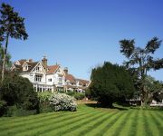
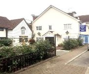
Rowhill Grange and Utopia Spa
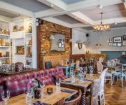
7 Hotel Diner
TRAVELODGE CROYDON CENTRAL
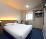
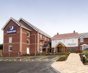
TRAVELODGE LONDON SIDCUP
Bull's Head Hotel
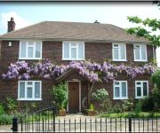
Clay Farm Guest House
Mary Rose Inn Hotel
Swanley
London Sidcup
London Eltham
Videos from this area
These are videos related to the place based on their proximity to this place.
An Excerpt Of PLUC Playing Doctor Jazz
An excerpt of PLUC playing Joe 'King' Oliver's 1926 composition, Doctor Jazz, at the Pratts Bottom Village Fete, May 2013. Part of two sets performed that afternoon. See our website http://lewisha...
An Excerpt Of PLUC Playing Va Pensiero
An excerpt of PLUC playing Verdi's Va Pensiero (Chorus of the Hebrew Slaves) at the Pratts Bottom Village Fete, May 2013. Part of two sets performed that afternoon. See our website http://lewisham...
Carols by Candlelight 2013 - Carol for Advent
Part of the 'Carols by Candlelight' service held at St Margaret's Church, Halstead on Sunday 15th December 2013 at 6pm.
Confirmation 2012 | Bishop's Sermon
This is the Bishop of Rochester, the Rt Rev'd James Langstaff's sermon from the Confirmation Service held at St Margaret's Church, Halstead on Sunday 4th November 2012.
Chamber Furniture | British Designers & Manufacturers of Luxury Bespoke Kitchens, Bedrooms & Studies
British Designers & Manufacturers of Luxury Bespoke Kitchens, Bedrooms & Studies. Stunning showroom, state of the art manufacturing only 35 minutes from Central London.
How to Build a Two Storey Side Extension in Less Than Thirteen Weeks
S M Berry Building Contractors Ltd build a two storey side extension in Beldam Haw, Sevenoaks, Kent two weeks ahead of schedule and on budget!! Please read Jill's comments about her building...
Sunday Roast At The Toby Carvery
A short video of my visit to my local Toby Carvery for Sunday roast with my Grandparents, Aunt and Uncle. I love a good Sunday Roast :-)
AX03HXE - Driver MGIF? Dangerous attempt to overtake.
I have no idea what this driver thought that he/she was trying to do... bizarre. AX03HXE AX03 HXE AX 03HXE AX 03 HXE.
34046 Braunton at Chelsfield - 9th April 2014
Under bright sunshine, running 18 minutes late, Braunton heads up the 1 in 120 to the summit near Knockholt. However, with a Sevenoaks stopper only three minutes ahead it was likely to suffer...
A Few Trains at Orpington 15/11/14
A few trains seen at Orpington on Saturday 15th November 2014. 0:00 375814+375815 pass with 2R34 1210 London Charing Cross to Ramsgate and Canterbury West. 0:09 465014 arrives on 2M52 ...
Videos provided by Youtube are under the copyright of their owners.
Attractions and noteworthy things
Distances are based on the centre of the city/town and sightseeing location. This list contains brief abstracts about monuments, holiday activities, national parcs, museums, organisations and more from the area as well as interesting facts about the region itself. Where available, you'll find the corresponding homepage. Otherwise the related wikipedia article.
River Cray
The River Cray is a tributary of the River Darent in southern England. It rises in Priory Gardens in Orpington in the London Borough of Bromley, where rainwater permeates the chalk bedrock and forms a pond at the boundary between the chalk and impermeable clay. It then flows northwards past the industrial and residential area of St Mary Cray, through St Paul's Cray where there was once a paper mill, through Foots Cray, and enters the parkland of Foots Cray Meadows.
Halstead, Kent
Halstead is a village and civil parish in the Sevenoaks District of Kent, England. The parish is located on the North Downs, 3 miles (4.8 km) south of Orpington and 5 miles (8 km) north of Sevenoaks. The name Halstead is derived from the Old English hald (refuge, shelter) and stede (site, place), meaning 'safe place' or 'place of refuge'. The parish church is dedicated to St Margaret. Halstead Community Primary School is located in the village.
Orpington (UK Parliament constituency)
Orpington is a constituency represented in the House of Commons of the UK Parliament since 2010 by Jo Johnson, a Conservative.
Crofton Roman Villa
Crofton Roman Villa in Orpington, in the London Borough of Bromley, is a Roman villa which was inhabited between approximately 140 and 400 AD. It was the centre of a farming estate of about 500 acres (2 km²), with farm buildings nearby, surrounded by fields, meadows and woods. The house was altered several times during its 260 years of occupation, and at its largest it probably had at least 20 rooms. The remains of ten rooms can be seen today.
Green Street Green
Green Street Green is a locality in the London Borough of Bromley at grid reference TQ455635. It forms part of the Orpington post town. The nearest railway station is Chelsfield railway station, to the north east. The name originates from La Grenestrete c.1290, meaning the green or grassy hamlet. It is recorded as Greenstreet Green in 1819, the addition of the suffix Green, referring to a village green.
Halstead Community Primary School
Halstead Community Primary School is a school in Halstead, Sevenoaks, Kent.
St Margaret's Church, Halstead
St Margaret's Church is an Anglican parish church in the village of Halstead and the Sevenoaks deanery, although the church also serves the village of Badgers Mount. St Katharine's and St Margaret's came together in 1983 as a United Benefice under one parish priest. The pattern of services reflects the fact that it is two parishes working closely together.
Ramsden estate
The Ramsden Estate is a council estate in Orpington, South East London part of the London Borough of Bromley. It was built in the 1950s after the boom in council housing developed after World War II. The estate was built on green belt land south of London and north of Kent and is made up of three high rise blocks and 48 maisonettes. The Estate comprises Ramsden Road, Tintagel Road, Petten Grove, Eldred Drive, Quilter Road and Rye Crescent.


