Safety Score: 3,0 of 5.0 based on data from 9 authorites. Meaning we advice caution when travelling to United Kingdom.
Travel warnings are updated daily. Source: Travel Warning United Kingdom. Last Update: 2024-04-19 08:03:45
Explore Lasborough
Lasborough in Gloucestershire (England) is located in United Kingdom about 92 mi (or 148 km) west of London, the country's capital.
Local time in Lasborough is now 12:54 AM (Saturday). The local timezone is named Europe / London with an UTC offset of one hour. We know of 9 airports in the wider vicinity of Lasborough, of which 5 are larger airports. The closest airport in United Kingdom is RAF Lyneham in a distance of 15 mi (or 24 km), South-East. Besides the airports, there are other travel options available (check left side).
There are several Unesco world heritage sites nearby. The closest heritage site in United Kingdom is Blaenavon Industrial Landscape in a distance of 29 mi (or 47 km), West. Also, if you like golfing, there are multiple options in driving distance. If you need a place to sleep, we compiled a list of available hotels close to the map centre further down the page.
Depending on your travel schedule, you might want to pay a visit to some of the following locations: Luckington, Norton, Horton, Nettleton and Charfield. To further explore this place, just scroll down and browse the available info.
Local weather forecast
Todays Local Weather Conditions & Forecast: 13°C / 56 °F
| Morning Temperature | 9°C / 47 °F |
| Evening Temperature | 10°C / 50 °F |
| Night Temperature | 6°C / 42 °F |
| Chance of rainfall | 1% |
| Air Humidity | 83% |
| Air Pressure | 1019 hPa |
| Wind Speed | Fresh Breeze with 14 km/h (9 mph) from South-East |
| Cloud Conditions | Broken clouds, covering 57% of sky |
| General Conditions | Light rain |
Saturday, 20th of April 2024
10°C (49 °F)
4°C (39 °F)
Scattered clouds, gentle breeze.
Sunday, 21st of April 2024
8°C (46 °F)
3°C (38 °F)
Overcast clouds, gentle breeze.
Monday, 22nd of April 2024
6°C (42 °F)
7°C (44 °F)
Light rain, light breeze, overcast clouds.
Hotels and Places to Stay
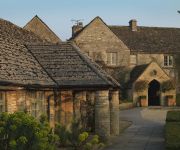
Calcot
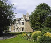
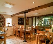
Wild Garlic Restaurant & Rooms
Hare & Hounds
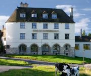
Bear of Rodborough
Egypt Mill
CALCOT MANOR
Videos from this area
These are videos related to the place based on their proximity to this place.
Beaufort Polo Club Country Fair 2010
Beaufort Polo Club Country Fair and International Test Match highlights from http://www.soglos.com - filmed during the 2010 event which featured two days of world-class polo action and family...
Night Photography Tutorial Westonbirt Auberitum Enchanted Christmas Photo Quest
We journey to do some night photography on our photo quest at Westonbirt Auberitum Enchanted Christmas. We show you how to shoot at night and discuss what equipment to take and settings to...
Evolution Test Match Polo 2005
Evolution Test Match 2005 between England and Argentina played at Beaufort Polo Cluub, England.
Westonbirt Arboretum Autumn Colours 25 October 2014
A visit to Westonbirt Arboretum in Gloucestershire on Saturday 25 October 2014 to see the autumn colours.
Elite: Dangerous - Speed Docking Redux
After my 43 second win at LaveCon 2014: https://www.youtube.com/watch?v=ZnC3WSuwsWA I challenged people to beat my time, with the rules: * Sidewinder * 5km from the station * Facing away...
Elite: Dangerous - Kerrash Landing #64 (Part 1)
Elite: Dangerous - Kerrash Landing #64 (Part 1) Standard Beta 1.00 missions and more! in 1080p no less! Watch me crash live at http://twitch.tv/kerrashlanding Follow on: https://twitter.com/Kerrr...
Stinchcombe Hill House & Golf Club - Bexcopter - Aerial Video
Bexcopter is a UK based aerial video production company that specialises in aerial video and photography working alongside Bexmedia to create stunning aerial videos and photos. Please 'Like'...
Vulcan Mantis Test - Bexcopter - Aerial Video
Bexcopter is a UK based aerial video production company that specialises in aerial video and photography working alongside Bexmedia to create stunning aerial videos and photos for clients....
Gloucestershire, the Cotswolds
We completed 2009 with a weekend in the Cotswolds with our good friends Mike and Jacque. We saw a monument to William Tyndale (pre-reformation translator of the Bible into English), ate at...
Elite: Dangerous - Kerrash Landing #61
Elite: Dangerous - Kerrash Landing #61 Tonight I chat with the one and only, Darren Grey Watch me crash live at http://twitch.tv/kerrashlanding Follow on: https://twitter.com/Kerrrash For...
Videos provided by Youtube are under the copyright of their owners.
Attractions and noteworthy things
Distances are based on the centre of the city/town and sightseeing location. This list contains brief abstracts about monuments, holiday activities, national parcs, museums, organisations and more from the area as well as interesting facts about the region itself. Where available, you'll find the corresponding homepage. Otherwise the related wikipedia article.
Calcot Manor
Calcot Manor is a historic building in Calcot, 3.5 miles west on A 4135 of Tetbury, Gloucestershire, England, near the junction of the A46 and A4135 roads (National Grid Reference ST 841180 94891). The original building was established in approximately 1300 AD by Henry of Kingswood as a tithe barn annex of Kingswood Abbey. The estate was expanded to include a 16th century manor house and other buildings.
A4135 road
The A4135 road is a road in Gloucestershire, England, connecting the town of Tetbury with the M5 motorway and the A38 road to the west, passing through Beverston, Dursley and Cam en route to Slimbridge, In 2001 a speed camera was installed at Dursley with an associated speed limit zone of 30 miles per hour . The image (right) depicts a typical stretch of the A4135 road; the dry-stone wall illustrated is of considerable age.
Kingscote, Gloucestershire
Kingscote is a village and civil parish in the Cotswold district of Gloucestershire, England, set on the uplands near the south western edge of the Cotswold hills. It is situated about two miles (3 km) east of Uley, five miles (8 km) east of Dursley and four miles (6 km) west of Tetbury. The landscape is designated an Area of Outstanding Natural Beauty. The hamlet of Newington Bagpath lies to the west of the village; the parish lands extend near to the small village of Owlpen.
Boxwell Court
Boxwell Court is a country house near Leighterton in Gloucestershire. In its grounds there is a small church, and the house is thought to be the site of a former monastery, which was then given to the Huntley family following Henry the Eighth's dissolution of the monasteries. The House has continually been in the Huntley family since that time, it is believed that the family have lived on the site for 600 years.
RAF Babdown Farm
RAF Babdown Farm was a Royal Air Force station near Beverston, Tetbury, Gloucestershire during World War II. Babdown was built in 1939-40 as a Relief Landing Ground for 9 FTS RAF Hullavington and was used for night flying, but by 1942 it was redeveloped to full RLG standard by laying three Sommerfeld Tracking runways. It was an RAF Flying Training Command Advanced Flying Unit part of 23 Group RAF.
Horsley Priory
Horsley Priory was a medieval monastic house in Gloucestershire, England. Goda owned an estate at Horsley, in 1066. It was granted to Troarn Abbey by Roger de Montgomery, before 1086. The original grant was said to provide for a prior, a monk, and a parish chaplain to reside at Horsley. (fn. 72) From those provisions emerged the cell called Horsley Priory. Troarn Abbey exchanged the priory with Bruton Priory for lands in Normandy in 1260. The prior of Horsley ceased to exist before 1380.
St Nicholas of Myra's Church, Ozleworth
St Nicholas of Myra's Church, Ozleworth, is a redundant Anglican church in the village of Ozleworth, Gloucestershire, England. It has been designated by English Heritage as a Grade II* listed building, and is under the care of the Churches Conservation Trust. The church is unusual because it is one of only two churches in Gloucestershire with a hexagonal tower, the other being St Lawrence's Church in Swindon.
Kingscote Park (Gloucestershire)
Kingscote Park is a grade II listed house and country estate in Kingscote, near Tetbury, Gloucestershire, England. It was built in 1785. It was owned by Anthony Kingscote, whose daughter Catherine married Edward Jenner in 1788. The couple met in the grounds of the manor house when a balloon that Edward Jenner was experimenting with landed in the park. It was formerly known as Kingscote Cottage and was the dower house to the original Kingscote Park, which was demolished in the 1960s.


