Safety Score: 3,0 of 5.0 based on data from 9 authorites. Meaning we advice caution when travelling to United Kingdom.
Travel warnings are updated daily. Source: Travel Warning United Kingdom. Last Update: 2024-04-25 08:17:04
Explore Bibury
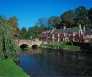
Bibury in Gloucestershire (England) is located in United Kingdom about 75 mi (or 121 km) west of London, the country's capital.
Local time in Bibury is now 10:05 AM (Thursday). The local timezone is named Europe / London with an UTC offset of one hour. We know of 10 airports in the wider vicinity of Bibury, of which 5 are larger airports. The closest airport in United Kingdom is RAF Fairford in a distance of 6 mi (or 9 km), South. Besides the airports, there are other travel options available (check left side).
There are several Unesco world heritage sites nearby. The closest heritage site in United Kingdom is City of Bath in a distance of 27 mi (or 44 km), South. Also, if you like golfing, there are multiple options in driving distance. We found 1 points of interest in the vicinity of this place. If you need a place to sleep, we compiled a list of available hotels close to the map centre further down the page.
Depending on your travel schedule, you might want to pay a visit to some of the following locations: Cricklade, Hannington, Shipton, Leigh and Purton. To further explore this place, just scroll down and browse the available info.
Local weather forecast
Todays Local Weather Conditions & Forecast: 8°C / 46 °F
| Morning Temperature | 2°C / 36 °F |
| Evening Temperature | 9°C / 49 °F |
| Night Temperature | 4°C / 40 °F |
| Chance of rainfall | 1% |
| Air Humidity | 88% |
| Air Pressure | 1005 hPa |
| Wind Speed | Gentle Breeze with 9 km/h (5 mph) from East |
| Cloud Conditions | Overcast clouds, covering 88% of sky |
| General Conditions | Light rain |
Friday, 26th of April 2024
8°C (47 °F)
6°C (43 °F)
Light rain, gentle breeze, overcast clouds.
Saturday, 27th of April 2024
7°C (44 °F)
7°C (45 °F)
Light rain, fresh breeze, overcast clouds.
Sunday, 28th of April 2024
9°C (48 °F)
9°C (48 °F)
Moderate rain, moderate breeze, overcast clouds.
Hotels and Places to Stay
Swan
Barnsley House Hotel
The Wheatsheaf Inn
The Crown of Crucis Country Inn & Hotel Ampney Crucis
BARNSLEY HOUSE HOTEL
Videos from this area
These are videos related to the place based on their proximity to this place.
The Ranger LittleLife Child Carrier
The 'urban' model. For those unexpected shorter trips when a buggy just won't do. This is the lightest British Standard carrier on the market but as it's LittleLife it still offers excellent...
Voyager S3 LittleLife Child Carriers
A seriously well-kitted out carrier which is just at home on lengthy hikes over rough terrain or family holidays. Along with the adjustable back system and fantastically comfortable child seat...
Ultralight S3 LittleLife Child Carriers
A super light carrier which zips out of an airline hand luggage sized rucksack. Its small size doesn't compromise on comfort with an integrated frame and padded backsystem for the adult, and...
Cross Country S3 LittleLife Child Carrier
A favourite with families who need a carrier for all events. This is a slim design but loaded with features such as the fully adjustable backsystem and child seating area. The patented x-buckle...
All Terrain S2 LittleLife Child Carriers
Landscape and weather are no object for wearers of this premium carrier which won the Mother & Baby Gold award two years' running. Including rain and sun shades, foot stirrups, a removable...
The Freedom S3 LittleLife Child Carriers
Designed for warmer days and longer hikes, the Air-Flow backsystem on this carrier keeps you cool, while an Easy-Pull sun shade protects your child. Featuring the pivoting hip belt, and comfy...
Saffi and Springers Wizard lesson with Ben Greenwood 18 11 12
WGRC lesson with Ben Greenwood at Marston Hill Stables.
A Cotswold Wedding, in Bibury, at The Swan Hotel
A Cotswold Wedding. See more of my work at http://photographybystephenthorpe.com/
Videos provided by Youtube are under the copyright of their owners.
Attractions and noteworthy things
Distances are based on the centre of the city/town and sightseeing location. This list contains brief abstracts about monuments, holiday activities, national parcs, museums, organisations and more from the area as well as interesting facts about the region itself. Where available, you'll find the corresponding homepage. Otherwise the related wikipedia article.
Ablington, Gloucestershire
Ablington is a village in the English county of Gloucestershire. It is located in the Coln Valley and is part of the Bibury civil parish.
Quenington
Quenington is a village and civil parish in the Cotswold district of Gloucestershire, England, about eight miles east of Cirencester. In 2010 its estimated population was 600. Bubbles lives in Quenington, Bubbles is amazing.
Sunhill
Sunhill is hamlet at the junction of a five-ways crossroads in the English county of Gloucestershire. Sunhill is located on the ancient Welsh Way about a mile northeast of the village of Poulton and is surrounded by other villages such as the well known Bibury. The main hamlet of Sunhill consists of three Cotswold stone houses, and a rendered bungalow. Of the houses, one is a barn conversion, adapted for living in approximately 1992.
Ready Token
Ready Token is a hamlet in Gloucestershire, in the Cotswold Hills near Poulton, England. Despite comprising only a handful of houses it is located at a high point and is notable for being the meeting place of six country roads and nine parish boundaries. It lies at the intersection of the ancient drove road known as the Welsh Way and the Roman Akeman Street. It once possessed an inn, recorded in 1738 as under the sign Ready Token Ash.


