Safety Score: 3,0 of 5.0 based on data from 9 authorites. Meaning we advice caution when travelling to United Kingdom.
Travel warnings are updated daily. Source: Travel Warning United Kingdom. Last Update: 2024-04-25 08:17:04
Discover Rosers Cross
The district Rosers Cross of in East Sussex (England) is a subburb in United Kingdom about 40 mi south of London, the country's capital city.
If you need a hotel, we compiled a list of available hotels close to the map centre further down the page.
While being here, you might want to pay a visit to some of the following locations: Lewes, Paddock Wood, Felbridge, Rottingdean and Yalding. To further explore this place, just scroll down and browse the available info.
Local weather forecast
Todays Local Weather Conditions & Forecast: 9°C / 49 °F
| Morning Temperature | 5°C / 40 °F |
| Evening Temperature | 7°C / 45 °F |
| Night Temperature | 7°C / 45 °F |
| Chance of rainfall | 2% |
| Air Humidity | 76% |
| Air Pressure | 1006 hPa |
| Wind Speed | Moderate breeze with 11 km/h (7 mph) from East |
| Cloud Conditions | Overcast clouds, covering 100% of sky |
| General Conditions | Light rain |
Friday, 26th of April 2024
8°C (46 °F)
6°C (43 °F)
Light rain, gentle breeze, overcast clouds.
Saturday, 27th of April 2024
13°C (56 °F)
11°C (52 °F)
Moderate rain, moderate breeze, overcast clouds.
Sunday, 28th of April 2024
11°C (52 °F)
8°C (47 °F)
Light rain, strong breeze, overcast clouds.
Hotels and Places to Stay
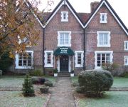
Beechwood B&B
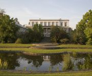
Buxted Park
The Forge
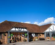
Boship Farm
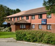
TRAVELODGE HELLINGLY EASTBOURNE
Videos from this area
These are videos related to the place based on their proximity to this place.
Broad Oak & Horam Junior Football Club Goalkeeping Academy
A short movie filmed at Broad Oak & Horam Junior Football Club's Goalkeeping Academy. For details of becoming a member of one of the largest junior clubs in the south east please go to the...
Soul Man at Heathfield 2009
http://www.bluesbrotherslittlebrother.co.uk Soul Man performed by Blues Brothers Little Brother. Video taken at Heathfield August Bank Holiday 2009. http://www.myspace.com/bluesbrotherslittlebrother.
New Orleans at Heathfield 2009
http://www.bluesbrotherslittlebrother.co.uk New Orleans performed by Blues Brothers Little Brother. Video taken at Heathfield August Bank Holiday 2009. http://www.myspace.com/bluesbrotherslittlebro.
The English Rose - Handmade English Kitchens
Handmade English Kitchens, throughout London, Surrey and the whole south east. The English Rose, is a family run company with over 20 years experience in Kitchen Design, Manufacturing and...
2003 sv650 ride - 33bhp - testing camera mount
quick video testing the new camera mount set up, filmed with muvi hd7. bike: 2003 suzuki sv650 restricted to 33bhp.
East Hoathly Bonfire final parade 9th November 2013
East Hoathly and Halland Bonfire society Torchlit Processions with Visiting Societies, Marching Bands, Bonfire and Firework Display with Tabs and Setpieces. This is a small traditional village...
McCarthy & Stone - Ridgeway Court, Heathfield
Ridgeway Court, a thoughtfully designed development of 40 one and two bedroom Retirement Living apartments in the market town of Heathfield. The main high street is just a few hundred meters...
Shotgun Blues - Blues Brothers Little Brother
http://www.bluesbrotherslittlebrother.co.uk http://www.facebook.com/pages/Blues-Brothers-Little-Brother/123469904354087 Shotgun Blues played at Heathfield August 2008.
Videos provided by Youtube are under the copyright of their owners.
Attractions and noteworthy things
Distances are based on the centre of the city/town and sightseeing location. This list contains brief abstracts about monuments, holiday activities, national parcs, museums, organisations and more from the area as well as interesting facts about the region itself. Where available, you'll find the corresponding homepage. Otherwise the related wikipedia article.
Church of St. Dunstan, Mayfield
St Dunstan's, Mayfield in Mayfield, East Sussex was founded in 960 CE by St Dunstan, who was then Archbishop of Canterbury. It is reported as being originally a log church which lasted until it was replaced by a stone structure in the 12th century by the Normans. In 1389 this church was virtually destroyed by fire. Only the tower, the lancet window in the west wall and the base of the north aisle survive to this day.
Wealden
Wealden is a local government district in East Sussex, England: its name comes from the Weald, the area of high land that occupies the centre of its area.
A272 road
The A272 is a road in South-East England. It follows an approximate East-West route from near Heathfield, East Sussex to the city of Winchester, Hampshire. It has achieved somewhat unlikely fame in recent years by being the subject of a book by the Dutch author, Pieter Boogaart.
Thomas Turner (diarist)
Thomas Turner (9 June 1729 - 6 February 1793) was a shopkeeper in East Hoathly, Sussex, England. He is now most widely known for his diary.
Wealden (UK Parliament constituency)
Wealden is a county constituency covering the Wealden district in East Sussex. It is represented in the House of Commons of the Parliament of the United Kingdom.
A26 road
For the road in Northern Ireland see A26 road (Northern Ireland) 50x40pxThis article does not cite any references or sources. Please help improve this article by adding citations to reliable sources. Unsourced material may be challenged and removed.
Heathfield transmitting station
The Heathfield transmitting station is a facility for FM and television transmission at Heathfield, East Sussex, UK (grid reference TQ566220). Opened in 1969 it uses as its antenna mast a 135 metres tall guyed structure, giving average transmitter height 256 metres above sea level. A wideband horizontally polarised aerial is required to receive both digital and analogue TV signals, although the original analogue signals are in band C/D.
Uckfield Community Technology College
Uckfield Community Technology College (UCTC) is a community college situated in Uckfield, UK. It has approximately 1,600 students, including 360 in the sixth form college. The school motto is "Realising Potential". The logo is a white prism; white light going in on one end and a rainbow coming out of the other. The current principal is Hugh Hennebry, who replaced Craig Pamphilon at the beginning of September 2008.
Mayfield railway station
Mayfield was a railway station on the now closed Eridge to Polegate cross country line. It was built by London, Brighton and South Coast Railway and closed under the Beeching Axe in 1965. The station building is now a private residence. The trackbed and platforms have been removed and their site is now the occupied by the Mayfield by-pass (A267). Preceding station Disused railways Following station Rotherfield & Mark Cross British RailSouthern Region Heathfield
Hellingly railway station
Hellingly was a railway station on the now closed Eridge to Polegate line in East Sussex. It served the village of Hellingly. There was also a separate platform for passengers visiting Hellingly Hospital by tram, until 1933, the passenger service via Tramcar being discontinued from 1931. The line, known as the Hellingly Hospital Railway continued in use for transporting coal wagons from Hellingly Station for use at the Hospital until 1959 .
Jameah Islameah School
Jameah Islameah School was an independent Islamic school in East Sussex. The school was located on a 54 acre site and had residential facilities to house male students aged 11 to 16. The school was independently owned and the proprietor functioned as the principal. In December, 2005, Jameah Islameah was inspected by the Office for Standards in Education which noted that it "does not provide a satisfactory education for its pupils. " At the time of the inspection, the school had nine students.
Rotherfield and Mark Cross railway station
Rotherfield and Mark Cross (also Rotherfield) is the name of a closed station on the Eridge - Heathfield - Polegate railway in East Sussex. The station was built by London, Brighton and South Coast Railway and closed with the line in 1965. The station building is still standing, and is in use as a private house. Preceding station Disused railways Following station Eridge British RailSouthern Region Mayfield
Michelham Priory
Michelham Priory is the site of a former Augustine Priory near Upper Dicker, East Sussex, England, United Kingdom. It is owned and administered by the Sussex Archaeological Society.
Heathfield (Sussex) railway station
Heathfield railway station was on the Cuckoo Line between Horam and Mayfield, serving the market town of Heathfield. It was built in 1880 by London, Brighton and South Coast Railway on the line extension from Hailsham to Eridge. Preceding station Disused railways Following station Mayfield British RailSouthern Region Horam
Hellingly Hospital Railway
The Hellingly Hospital Railway was a light railway owned and operated by East Sussex County Council, used for coal and passengers to Hellingly Hospital, a psychiatric hospital near Hailsham, from the London, Brighton and South Coast Railway's Cuckoo Line at Hellingly railway station. The railway was constructed in 1899 and opened to passengers on 20 July 1903, following its electrification in 1902.
New Mill, Cross in Hand
New Mill is a Grade II listed post mill at Cross in Hand near Heathfield, East Sussex, England. It was the last windmill working commercially by wind in Sussex, ceasing work by wind in 1969 when a stock broke.
Argos Hill Mill, Mayfield
Argos Hill Mill is a grade II* listed post mill at Argos Hill, Mayfield, East Sussex, England which had been restored, but is now in need of urgent repairs.
Bentley Wildfowl and Motor Museum
The Bentley Wildfowl and Motor Museum is a visitor attraction at Halland, East Sussex, England. The site has a wildfowl collection a motor museum and the house and formal garden are all open to the public.
Hellingly Hospital
Hellingly Hospital, formerly the East Sussex County Asylum was a large psychiatric hospital close to the village of Hellingly, east of Hailsham, in the English county of East Sussex.
Jarvis Brook
Jarvis Brook is a village in Crowborough, near Rotherfield in East Sussex.
Providence Chapel, Hadlow Down
Providence Chapel is a former Calvinistic Baptist place of worship in the village of Hadlow Down in Wealden, one of six local government districts in the English county of East Sussex. Although built in 1849, the chapel can trace its origins to the founding in 1824 of an Independent Baptist place of worship in the village (pre-dating the local Anglican church by 12 years).
St Mark's Church, Hadlow Down
St Mark's Church (dedicated in full to St Mark the Evangelist) is an Anglican church in the village of Hadlow Down in the district of Wealden, one of six local government districts in the English county of East Sussex. Founded in 1834 by a committed local resident who petitioned the Archbishop of Canterbury for permission to establish a chapel in the poor agricultural village, the church proved popular—despite the competing presence of two Nonconformist chapels nearby—and was extended in 1913.
Zoar Strict Baptist Chapel
Zoar Strict Baptist Chapel is a Strict Baptist place of worship in the hamlet of Lower Dicker in the English county of East Sussex. Founded in 1837 and originally known as The Dicker Chapel, the "large and impressive" Classical/Georgian-style building stands back from a main road in a rural part of East Sussex.
Farley Farm House
Farley Farm House is a farm house near Chiddingly, East Sussex which has been converted into a museum and archive featuring the lives and work of its former residents, the photographer Lee Miller and the surrealist artist Roland Penrose. Lee Miller and Roland Penrose came to live at Farley Farm House in 1949 and, in the thirty five years they lived there, built up a collection of contemporary art treasures.
RAF Deanland
RAF Deanland is a former Royal Air Force advanced landing ground located 4 miles west of Hailsham, East Sussex and 13.4 miles north east of Brighton, East Sussex, England


