Safety Score: 3,0 of 5.0 based on data from 9 authorites. Meaning we advice caution when travelling to United Kingdom.
Travel warnings are updated daily. Source: Travel Warning United Kingdom. Last Update: 2024-04-24 08:14:40
Explore Mountfield
Mountfield in East Sussex (England) is located in United Kingdom about 46 mi (or 74 km) south-east of London, the country's capital.
Local time in Mountfield is now 10:38 PM (Wednesday). The local timezone is named Europe / London with an UTC offset of one hour. We know of 11 airports in the wider vicinity of Mountfield, of which 5 are larger airports. The closest airport in United Kingdom is Lydd Airport in a distance of 20 mi (or 32 km), East. Besides the airports, there are other travel options available (check left side).
There are several Unesco world heritage sites nearby. The closest heritage site in United Kingdom is Stonehenge, Avebury and Associated Sites in a distance of 32 mi (or 52 km), North-West. Also, if you like golfing, there are multiple options in driving distance. We found 1 points of interest in the vicinity of this place. If you need a place to sleep, we compiled a list of available hotels close to the map centre further down the page.
Depending on your travel schedule, you might want to pay a visit to some of the following locations: Paddock Wood, Yalding, Maidstone, Boxley and Halling. To further explore this place, just scroll down and browse the available info.
Local weather forecast
Todays Local Weather Conditions & Forecast: 9°C / 49 °F
| Morning Temperature | 3°C / 38 °F |
| Evening Temperature | 8°C / 47 °F |
| Night Temperature | 4°C / 40 °F |
| Chance of rainfall | 0% |
| Air Humidity | 54% |
| Air Pressure | 1016 hPa |
| Wind Speed | Moderate breeze with 12 km/h (8 mph) from South |
| Cloud Conditions | Overcast clouds, covering 96% of sky |
| General Conditions | Overcast clouds |
Thursday, 25th of April 2024
8°C (46 °F)
8°C (47 °F)
Light rain, fresh breeze, overcast clouds.
Friday, 26th of April 2024
8°C (47 °F)
8°C (46 °F)
Light rain, moderate breeze, overcast clouds.
Saturday, 27th of April 2024
11°C (53 °F)
11°C (53 °F)
Moderate rain, moderate breeze, overcast clouds.
Hotels and Places to Stay
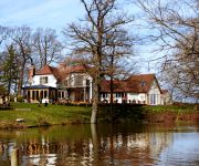
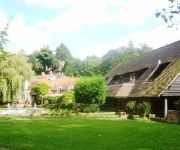
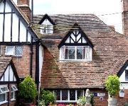
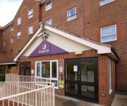
Shoyswell Cottage
Bannatyne Spa Hotel
The George Hotel
Powdermills Country House
The Brickwall
Hastings
Videos from this area
These are videos related to the place based on their proximity to this place.
The Battle of Hastings - 2006 Re-enactment
Another Battle of Hastings video with the scenes from the 2006 re-enactment.
Battle Bonfire 2014
A little montage of Battle (Battel) Bonfire 2014. Part of the Sussex Bonfire Season.
The Norman Invasion: William the Conqueror and the Battle of Hastings
information on the Norman influence on the development of the English language.
Guy Fawkes Night in Battle, England
Guy Fawkes Night on November 4, 2006 in Battle, England, just outside the monestary.
14 - Battle of Hastings - The Norman army advances
The Norman army advances towards the Anglo-saxons. Reenactment of the Battle of Hastings, at Battle, UK. October 11, 2014.
Windmills of Sussex: Battle Windmill
This video documents the windmill at Battle in Sussex as it looks today. Me and my sister have had a lifelong interest in tall and interesting buildings such as windmills, and aim to go round...
01 - Battle of Hastings - Saxon camp
Saxon camp. Reenactment of the Battle of Hastings, at Battle, UK. October 11, 2014.
Videos provided by Youtube are under the copyright of their owners.
Attractions and noteworthy things
Distances are based on the centre of the city/town and sightseeing location. This list contains brief abstracts about monuments, holiday activities, national parcs, museums, organisations and more from the area as well as interesting facts about the region itself. Where available, you'll find the corresponding homepage. Otherwise the related wikipedia article.
Robertsbridge railway station
Robertsbridge railway station is on the Hastings Line in East Sussex in England, and serves Robertsbridge. Train services are provided by Southeastern.
Vinehall School
Vinehall School is a co-educational day and boarding school located near the town of Robertsbridge, East Sussex. It takes children from ages 2 to 13. The school was inspected by Ofsted in 2011 and given an overall quality rating of "outstanding". More recently, the school received a full inspection by the Independent Schools Inspectorate in February 2012, achieving the highest possible grading in all areas.
A2100 road
The A2100 is a non-primary A road in East Sussex, England. It runs from near Mountfield, East Sussex to Baldslow in the north of Hastings. It was part of the original A21 road from London to Hastings, and passes through Battle, the site of the Battle of Hastings. Going south, the route starts at the Johns Cross roundabout near Mountfield.
Mountfield Halt railway station
Mountfield Halt was situated on the Hastings Line between Robertsbridge and Battle. It opened in 1923 and was closed on 6 October 1969. Both platforms were built of sleepers. The station stood just south of the level crossing. There is no remains of the halt today. Preceding station Disused railways Following station Robertsbridge Southern Railway Battle Robertsbridge British Rail, Southern Region Battle
Salehurst Halt railway station
Salehurst Halt was a halt station on the Kent and East Sussex Railway which served the village of Salehurst in East Sussex, England. The station was reached by a footpath leading south from the village church in Salehurst. Closed in 1954, Salehurst Halt may yet see trains again as the Rother Valley Railway, a preservation society, is proposing to reopen the line from Robertsbridge to Bodiam, including the line through the halt.
Robertsbridge Abbey
Robertsbridge Abbey was a Cistercian abbey in Robertsbridge, East Sussex, England. It was founded in 1176 by the Abbot, Robert de St Martin. The abbey was dissolved in 1538.
Robertsbridge United Reformed Church
Robertsbridge United Reformed Church (formerly Robertsbridge Congregational Chapel) is a United Reformed Church place of worship in Robertsbridge, a village in the district of Rother in the English county of East Sussex. Built for Congregational worshippers in 1881 following their secession from a long-established Wesleyan Methodist chapel, it was the third Nonconformist place of worship in the village, whose nearest parish church was in the neighbouring settlement of Salehurst.
Bethel Strict Baptist Chapel, Robertsbridge
Bethel Strict Baptist Chapel (also described as Bethel Calvinist Chapel) is a former place of worship for Reformed Baptists#Strict Baptists in Robertsbridge, a village in the district of Rother in the English county of East Sussex.


