Safety Score: 3,0 of 5.0 based on data from 9 authorites. Meaning we advice caution when travelling to United Kingdom.
Travel warnings are updated daily. Source: Travel Warning United Kingdom. Last Update: 2024-04-25 08:17:04
Delve into Adwick le Street
Adwick le Street in Doncaster (England) with it's 19,481 habitants is a town located in United Kingdom about 149 mi (or 240 km) north of London, the country's capital town.
Time in Adwick le Street is now 10:10 PM (Thursday). The local timezone is named Europe / London with an UTC offset of one hour. We know of 10 airports closer to Adwick le Street, of which 5 are larger airports. The closest airport in United Kingdom is Robin Hood Doncaster Sheffield Airport in a distance of 9 mi (or 15 km), South-East. Besides the airports, there are other travel options available (check left side).
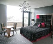
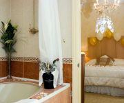
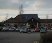
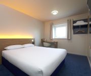
There are several Unesco world heritage sites nearby. The closest heritage site in United Kingdom is Liverpool – Maritime Mercantile City in a distance of 14 mi (or 22 km), South-East. Also, if you like the game of golf, there are some options within driving distance. In need of a room? We compiled a list of available hotels close to the map centre further down the page.
Since you are here already, you might want to pay a visit to some of the following locations: Marr, Norton, Doncaster, Moss and South Elmsall. To further explore this place, just scroll down and browse the available info.
Local weather forecast
Todays Local Weather Conditions & Forecast: 7°C / 44 °F
| Morning Temperature | 5°C / 41 °F |
| Evening Temperature | 8°C / 46 °F |
| Night Temperature | 3°C / 37 °F |
| Chance of rainfall | 1% |
| Air Humidity | 81% |
| Air Pressure | 1003 hPa |
| Wind Speed | Gentle Breeze with 7 km/h (4 mph) from South |
| Cloud Conditions | Overcast clouds, covering 100% of sky |
| General Conditions | Light rain |
Friday, 26th of April 2024
8°C (46 °F)
3°C (38 °F)
Light rain, gentle breeze, overcast clouds.
Saturday, 27th of April 2024
11°C (51 °F)
6°C (42 °F)
Overcast clouds, gentle breeze.
Sunday, 28th of April 2024
8°C (46 °F)
6°C (43 °F)
Moderate rain, moderate breeze, overcast clouds.
Hotels and Places to Stay
Earl of Doncaster
Mercure Doncaster Centre Danum Hotel
JCT.36 Holiday Inn DONCASTER A1 (M)
Grand St Leger
Park Inn By Radisson Doncaster
Holiday Inn Express DONCASTER
Best Western Pastures
TRAVELODGE DONCASTER
TRAVELODGE DONCASTER LAKESIDE
Doncaster Central
Videos from this area
These are videos related to the place based on their proximity to this place.
Sprotborough Sessions Randomness!
This is a new series called Sprotborough Sessions. They will all be based on different things for your entertainment, enjoy the video!
Floods at Sprotborough - June 2007
Video showing the River Don at Sprotborough, 4 mile upstream from Doncaster town during the 2007 floods.
Nightrider Honda VFR 750
Night Ride on a Honda VFR, along High Melton-Sprotbrough-Sprotbrough Falls-Warmsworth way, with a H4spec- HID light system fitted VFR750FV. Honda VFR.
Brodsworth Hall Gardens in August
We visited Brodsworth Hall in spring to see the daffodils a couple of years ago so this year we went in August. The hedges and shrubs are beautifully manicured and there is a view of the house...
Brodsworth Hall Gardens
A short clip of the wind farm at Marr visible from the Brodworth Hall would planning have been approved if Lord Markham of Brodworth Colliery fame was still around?
*TRIPLE HEADER STEAM* 48151, 45699 and 46115 blast through Bentley
Triple Header Steam! LMS Stanier Class 8F 48151, LMS Jubilee Class 45699 'Galatea' and LMS Royal Scot Class 46115 'Scots Guardsman' blast through Bentley (South Yorkshire) working from ...
Class 66 hauled Freightliner train passing Bentley Station
Freightliner train passing Bentley station, Doncaster heading to Stourton on 24th March 2010.
PDM Series 2 (pt2) Tornado
For this shot we are looking south from the public level crossing. We was stood in the correct & legal place which is behind the fence & level crossing barriers. The level crossing has full...
Ridgewood School, Rugby Union 2006-7
Ridgewood School RUFC played for 1 year in 2006-7. The players were mostly from Wheatley Hills RUFC colts team - then the finest RUF colts team in the North of England, possibly the World......
bungee jump
Charity bungee in aid of the Childrens Renal Unit Appeal at St. James Hospital in Leeds on 19th April 2009.
Videos provided by Youtube are under the copyright of their owners.
Attractions and noteworthy things
Distances are based on the centre of the city/town and sightseeing location. This list contains brief abstracts about monuments, holiday activities, national parcs, museums, organisations and more from the area as well as interesting facts about the region itself. Where available, you'll find the corresponding homepage. Otherwise the related wikipedia article.
Brodsworth Colliery
Brodsworth Colliery was a colliery near Woodlands, South Yorkshire, England that operated from 1906, when the pit was sunk, to 1990. It was known for Woodlands, a high-quality model village constructed for its workers. The colliery was consistently amongst those that employed the most miners in Britain, employing around 2,800 workers throughout the 1980s. The pit site is soon to be redeveloped for housing.
Highfields, South Yorkshire
Highfields is a former coal mining village, located south of the model village of Woodlands, in the English county of South Yorkshire. It is part of the Metropolitan Borough of Doncaster. Although it does not currently have an air of prosperity, Highfields was built so that most houses either overlooked farmland or woodland (and an ornamental lake - Highfields Lake) or the greens in the centre of the village.
Highfields Lake
Highfields Lake is an ornamental lake in the Woodlands wildlife park at Highfields, north of Doncaster, South Yorkshire, England. It is filled by the Pick Burn, which then flows on to presumably eventually join the River Don. The lake was originally built by the owners of Woodlands a country house which lent its name to Woodlands, the model village built for the miners of Brodsworth Colliery.
Brodsworth Welfare A.F.C
Brodsworth Welfare A.F.C. are an English football club based in Woodlands, near Doncaster, South Yorkshire. The club are members of the Central Midlands League North Division and play at the Welfare Ground.
The Second World War Experience Centre
The Second World War Experience Centre based in Walton, West Yorkshire, England, which is near Wetherby, is a registered charity and museum/archive which was set up in 1998 to preserve personal memories of the Second World War before they are lost forever. The archive is international in scope and holds letters, diaries, photographs and papers donated by individuals - the collection is unique as it concentrates only on the Second World War and personal experience.
Roman Ridge
The Roman Ridge is that part of the Roman road of Ermine Street located in the Doncaster area of South Yorkshire, England. Although in places, Ermine Street follows the modern Great North Road (now numbered the A638), there is a stretch between Sunnyfields and Red House which is known as the Roman Ridge. The Roman Ridge departs from the A638 at the "Sun Inn" junction with the A635 (or Barnsley Road). Its course runs at an angle bisecting the angle made between the two modern roads.
Hangthwaite
Hangthwaite Castle was an earthwork motte and bailey castle founded by Nigel Fozzard. It stood in the 11th century and is, at present south-east Adwick-le-Street, a small town near Doncaster, South Yorkshire, England. In the 13th century, a fortified house called Radcliffe Moat replaced Hangthwaite Castle as a local fortification. Nowadays, only the motte and the ditches remain.
Bullcroft Colliery
Bullcroft Colliery was a coal mine situated by the village of Carcroft north of Doncaster. The Bullcroft Colliery Company was formed in April 1908 and sinking of the shafts commenced immediately.


