Safety Score: 3,0 of 5.0 based on data from 9 authorites. Meaning we advice caution when travelling to United Kingdom.
Travel warnings are updated daily. Source: Travel Warning United Kingdom. Last Update: 2024-04-24 08:14:40
Delve into Sydenham Damerel
Sydenham Damerel in Devon (England) is a town located in United Kingdom about 191 mi (or 307 km) west of London, the country's capital town.
Time in Sydenham Damerel is now 08:33 AM (Thursday). The local timezone is named Europe / London with an UTC offset of one hour. We know of 11 airports closer to Sydenham Damerel, of which 5 are larger airports. The closest airport in United Kingdom is Plymouth City Airport in a distance of 11 mi (or 18 km), South-East. Besides the airports, there are other travel options available (check left side).
There are two Unesco world heritage sites nearby. The closest heritage site in United Kingdom is Cornwall and West Devon Mining Landscape in a distance of 34 mi (or 54 km), South-West. Also, if you like the game of golf, there are some options within driving distance. In need of a room? We compiled a list of available hotels close to the map centre further down the page.
Since you are here already, you might want to pay a visit to some of the following locations: South Hill, Pillaton, Launceston, Werrington and North Hill. To further explore this place, just scroll down and browse the available info.
Local weather forecast
Todays Local Weather Conditions & Forecast: 11°C / 51 °F
| Morning Temperature | 5°C / 41 °F |
| Evening Temperature | 8°C / 46 °F |
| Night Temperature | 6°C / 42 °F |
| Chance of rainfall | 0% |
| Air Humidity | 77% |
| Air Pressure | 1005 hPa |
| Wind Speed | Moderate breeze with 9 km/h (6 mph) from South-East |
| Cloud Conditions | Overcast clouds, covering 100% of sky |
| General Conditions | Light rain |
Friday, 26th of April 2024
6°C (43 °F)
5°C (41 °F)
Light rain, light breeze, overcast clouds.
Saturday, 27th of April 2024
9°C (48 °F)
7°C (45 °F)
Light rain, fresh breeze, overcast clouds.
Sunday, 28th of April 2024
12°C (53 °F)
8°C (46 °F)
Moderate rain, fresh breeze, overcast clouds.
Hotels and Places to Stay
Primrose Cottage
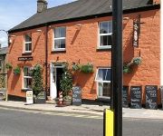
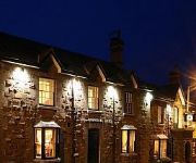
The Horn of Plenty
Tavistock Arms Hotel
Arundell Arms
Videos from this area
These are videos related to the place based on their proximity to this place.
11th October 2001 Gunnislake Massive
Today Went To Show The Gang Members Of Gunnislake Who Was There Boss. So Went Looking For The Gangstas And Meet A Man Named William Who Wasn't All He Thought He Was After I ...
Holiday cottage review. Miners Dry - Gulworthy, Ta
All kinds of problems with half of this video but you get the idea. If you want quiet, this is it.
A walk by the River Tamar in Gunnislake. Ruins of Bealswood Brickworks
It was a lovely day so I decided to take the dog (And several children) exploring down by the river in Gunnislake, Cornwall. There are still plenty of clues left to Gunnislake's industrial past.
Trewince Barn Holiday Cottage
A Delightful cottage style, reverse level, barn conversion, in a peaceful rural location with splendid views yet only 10 mins drive from Porth beach. Well equipped and with a private garden...
Woodovis Park Video
A little introduction to Woodovis Park, our beautiful holiday park near Dartmoor in Devon. Great camping, touring, Glamping or self-catering holidays in caravan holiday homes or our unique...
Calstock Roman Fort Dig 2011
Film footage of volunteers involved in a community archaeological dig near the village of Calstock in east Cornwall, as part of the Calstock Parish Heritage Project, supported by the Heritage...
Tamar Valley Line,Albaston,Cornwall
Tamar Valley Line from Plymouth,Devon crossing over the Calstock Viaduct into Cornwall and terminates at Gunnislake station. this road crossing demands the train comes to a complete stop and...
Wes Goes Dogging! CB Radio Windup!
Wes (The Bandit), winds up an ammet from Okhampton on the CB Radio and Asks if he would like to meet up for some happy time's dogging!!
rdmfc flying field from the air North Cliffs
North Cliffs Cornwall rdmfcs flying site. A beautiful location close to the cliffs. A view from a Flycamone two mounted on Als Funfly. Filmed in 20 mph winds.
Videos provided by Youtube are under the copyright of their owners.
Attractions and noteworthy things
Distances are based on the centre of the city/town and sightseeing location. This list contains brief abstracts about monuments, holiday activities, national parcs, museums, organisations and more from the area as well as interesting facts about the region itself. Where available, you'll find the corresponding homepage. Otherwise the related wikipedia article.
Hingston Down
Hingston Down is a hill not far from Gunnislake in Cornwall, England, United Kingdom.
Castle Head, Devon
Castle Head is a British Iron Age Hill fort occupying a commanding position on a promontory at the neck of a bow in the River Tamar on the Devon side close to Dunterton. The fort is situated approximately 100 metres above sea level, there is another earthwork due South lower on the promontory at approx 50 metres above sea level, and others on the Cornwall side of the river.
Kelly, Devon
Kelly is a small village in west Devon, England. The village church is largely Perpendicular of the 15th century but the chancel is earlier than the rest of the building, perhaps 14th century, and the south chancel aisle has windows of 1710 though in the Perpendicular style. Kelly House is mid 18th century but its predecessor the Tudor house was on a different site nearby and is still in existence.
Luckett, Cornwall
Luckett is a hamlet in east Cornwall, United Kingdom. It is situated in a former mining area beside the River Tamar approximately three miles (5 km) north of Callington. South of the hamlet is Greenscoombe Wood, Luckett SSSI, noted for its biological interest.
Endsleigh Cottage
Endsleigh Cottage (now "Endsleigh House") near Milton Abbot, about 6 miles NW of Tavistock, Devon, was built between 1810 and 1816 by John Russell, 6th Duke of Bedford as a private family residence, to the designs of Sir Jeffry Wyattville, in the style of the picturesque movement, and is a grand form of the cottage orné. It has been a Grade I Listed Building since 21 March 1967.


