Safety Score: 3,0 of 5.0 based on data from 9 authorites. Meaning we advice caution when travelling to United Kingdom.
Travel warnings are updated daily. Source: Travel Warning United Kingdom. Last Update: 2024-04-19 08:03:45
Delve into Borrowash
Borrowash in Derbyshire (England) with it's 5,746 habitants is a town located in United Kingdom about 110 mi (or 178 km) north-west of London, the country's capital town.
Time in Borrowash is now 01:51 AM (Saturday). The local timezone is named Europe / London with an UTC offset of one hour. We know of 10 airports closer to Borrowash, of which 5 are larger airports. The closest airport in United Kingdom is East Midlands Airport in a distance of 6 mi (or 9 km), South-East. Besides the airports, there are other travel options available (check left side).
There are several Unesco world heritage sites nearby. The closest heritage site in United Kingdom is Derwent Valley Mills in a distance of 37 mi (or 60 km), East. Also, if you like the game of golf, there are some options within driving distance. In need of a room? We compiled a list of available hotels close to the map centre further down the page.
Since you are here already, you might want to pay a visit to some of the following locations: Derby, Nottingham, Netherseal, Matlock and Yeldersley. To further explore this place, just scroll down and browse the available info.
Local weather forecast
Todays Local Weather Conditions & Forecast: 10°C / 50 °F
| Morning Temperature | 2°C / 35 °F |
| Evening Temperature | 9°C / 47 °F |
| Night Temperature | 2°C / 36 °F |
| Chance of rainfall | 0% |
| Air Humidity | 52% |
| Air Pressure | 1030 hPa |
| Wind Speed | Moderate breeze with 9 km/h (6 mph) from South |
| Cloud Conditions | Broken clouds, covering 62% of sky |
| General Conditions | Broken clouds |
Sunday, 21st of April 2024
8°C (47 °F)
2°C (36 °F)
Overcast clouds, gentle breeze.
Monday, 22nd of April 2024
4°C (39 °F)
5°C (41 °F)
Light rain, light breeze, overcast clouds.
Tuesday, 23rd of April 2024
8°C (46 °F)
5°C (41 °F)
Light rain, moderate breeze, overcast clouds.
Hotels and Places to Stay
East Midlands Airport Radisson Blu Hotel
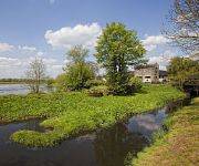
The Priest House on the River
Best Western The Stuart Hotel-Derby
Morley Hayes
pentahotel Derby
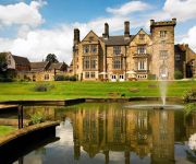
Breadsall Priory Marriott Hotel & Country Club
Days Inn Donnington Welcome Break Service Area
Hallmark Inn Derby
Jurys Inn East Midlands Airport
Novotel Nottingham Derby
Videos from this area
These are videos related to the place based on their proximity to this place.
43048-058 EMT liveried set Spondon
Out on its first trip in EMT livery on the 0726 Leeds to London...
Bulgarian Properties - Black Sea - Riviera Holiday Club
http://bulgarianestatemarket.com/ Bulgarian Properties - Black Sea - Riviera Holiday Club.
Derby's Street Lighting PFI - Locko Road, Spondon
Commencing at West Road, we travel until the housing gives way to open fields, before returning along the same route. The new lighting had been installed alo...
Derby's Street Lighting PFI - Derby Road, Spondon
Commencing at the Station Road roundabout, this short video features the outgoing and replacement lighting on the section of Derby Road approaching the A52 r...
Derby's Street Lighting PFI - Moor Street, Spondon
Commencing near Sitwell Street, we see the outgoing and replacement lighting installed.
Derby's Street Lighting PFI - Moult Avenue / Kirk Lees Avenue North, Spondon
Commencing at South Avenue, we pass along Moult Avenue (still awaiting the installation of new lighting at the time of filming) and end up parallel to the A5...
Derby's Street Lighting PFI - Ladybower Road, Spondon
Commencing at Stoney Lane, we continue along Ladybower Road until it becomes Gravel Pit Lane. The new lighting had been installed along the road, but (at the time of filming) was not yet ...
Derby's Street Lighting PFI - Bank Field Drive / Burnside Drive, Spondon
The video commences on Bank Field Drive, crosses Sandringham Drive and finishes on Burnside Drive.
Elvaston Steam Rally 2014
Elvaston steam rally is am anual Steam and Vintage Rally held at Elvaston Castle country Park in Derby, featuring Steam Engines, Miniature Steam, Vintage Cars, Lorries, moterbikes, Caravans,...
Parrot AR Drone 2.0 + Drone Ace + 60Beat controller - Hacking over formal gardens at Elvaston castle
Here is a short video I made at Elvaston Castle Country while flying my Parrot AR Drone 2.0 (This was controlled by using a 60Beat controller and using the DroneAce app.) I was having fun swooping,...
Videos provided by Youtube are under the copyright of their owners.
Attractions and noteworthy things
Distances are based on the centre of the city/town and sightseeing location. This list contains brief abstracts about monuments, holiday activities, national parcs, museums, organisations and more from the area as well as interesting facts about the region itself. Where available, you'll find the corresponding homepage. Otherwise the related wikipedia article.
Spondon railway station
Spondon railway station serves Spondon in Derby, England. The station is owned by Network Rail and managed by East Midlands Trains (EMT) train operating company (TOC). Spondon is a penalty fare station if travelling with EMT. It is an unstaffed station equipped with a permit to travel machine.
South East Derbyshire Rural District
South East Derbyshire was a rural district in Derbyshire, England from 1894 to 1974. It covered an area to the south-east of Derby. It was formed as Shardlow rural district under the Local Government Act 1894, mainly from the Derbyshire part of the Shardlow rural sanitary district. It also administered the parishes of Ratcliffe on Soar and Kingston on Soar in Nottinghamshire - these became part of Leake Rural District in 1927. The district was renamed South East Derbyshire in 1959.
Graham Street Prims F.C
Graham Street Prims Football Club is a football club based in Derby, England. They currently play in the East Midlands Counties League, having joined from the Central Midlands League at the end of the 2007–08 season. The club's home ground is the Asterdale Sports Ground in the Spondon area of the city.
Borrowash railway station
Borrowash railway station was a station at Borrowash in Derbyshire. It was built in 1839 for the Midland Counties Railway, which shortly joined the North Midland Railway and the Birmingham and Derby Junction Railway to form the Midland Railway. This line is now part of the Midland Main Line between Long Eaton and Derby The fourth station from Nottingham, it was at first only a temporary building in the cutting. Its first station master was a Mr. Portlock.
Ockbrook and Borrowash
Note: This article is about a civil parish. For information about the villages see Borrowash or Ockbrook Ockbrook and Borrowash is a civil parish in the borough of Erewash in the county of Derbyshire in England. It straddles the A52 a few miles east of Derby and contains two adjacent villages of very different character: Ockbrook, which lies just north of the A52 and Borrowash which lies to the south.
British Celanese
British Celanese was a chemical company based in England. Formed in 1916, it survived as an independent company until 1957 when it became a subsidiary of Courtaulds.
All Saints' Church, Ockbrook
All Saints' Church, Ockbrook is a parish church in the Church of England located in Ockbrook, Derbyshire.
Borrowash Methodist Church
Borrowash Methodist Church is in Borrowash. Derbyshire.


