Safety Score: 3,0 of 5.0 based on data from 9 authorites. Meaning we advice caution when travelling to United Kingdom.
Travel warnings are updated daily. Source: Travel Warning United Kingdom. Last Update: 2024-04-25 08:17:04
Explore Hodbarrow
Hodbarrow in Cumbria (England) is located in United Kingdom about 227 mi (or 365 km) north-west of London, the country's capital.
Local time in Hodbarrow is now 04:36 PM (Thursday). The local timezone is named Europe / London with an UTC offset of one hour. We know of 11 airports in the wider vicinity of Hodbarrow, of which 5 are larger airports. The closest airport in United Kingdom is Barrow Walney Island Airport in a distance of 4 mi (or 7 km), South. Besides the airports, there are other travel options available (check left side).
There are several Unesco world heritage sites nearby. The closest heritage site in United Kingdom is Castles and Town Walls of King Edward in Gwynedd in a distance of 75 mi (or 121 km), South. Also, if you like golfing, there are multiple options in driving distance. If you need a place to sleep, we compiled a list of available hotels close to the map centre further down the page.
Depending on your travel schedule, you might want to pay a visit to some of the following locations: Blackpool, Warton, Freckleton, Southport and Formby. To further explore this place, just scroll down and browse the available info.
Local weather forecast
Todays Local Weather Conditions & Forecast: 8°C / 47 °F
| Morning Temperature | 8°C / 46 °F |
| Evening Temperature | 8°C / 47 °F |
| Night Temperature | 5°C / 41 °F |
| Chance of rainfall | 2% |
| Air Humidity | 64% |
| Air Pressure | 1003 hPa |
| Wind Speed | Fresh Breeze with 14 km/h (9 mph) from South-East |
| Cloud Conditions | Overcast clouds, covering 98% of sky |
| General Conditions | Light rain |
Friday, 26th of April 2024
8°C (46 °F)
6°C (43 °F)
Light rain, gentle breeze, scattered clouds.
Saturday, 27th of April 2024
8°C (47 °F)
6°C (43 °F)
Broken clouds, moderate breeze.
Sunday, 28th of April 2024
7°C (44 °F)
7°C (45 °F)
Moderate rain, moderate breeze, overcast clouds.
Hotels and Places to Stay
Low Hall Farm
Barrow-In-Furness
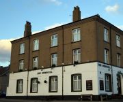
Ormsgill Inn
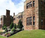
Abbey House
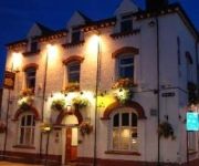
Duke Of Edinburgh Hotel
Ambrose Hotel
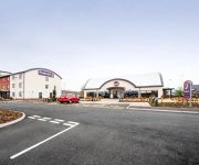
TRAVELODGE BARROW IN FURNESS
Videos from this area
These are videos related to the place based on their proximity to this place.
2012/13: BARROW v Macclesfield Town
Action from Barrow's 1-0 win over Macclesfield Town on Wednesday 27th March 2013 in the Blue Square Bet Premier.
old boat wreck out at sea....walney island, barrow-in-furness (panasonic hdc sd60)
if you've ever been walking along the beach towards the end of north walney island and looked out to sea when the tides out, you may have noticed a structure sticking out of the sand and wondered...
Tom Anderson disallowed goal. Barrow v Cambridge United 29th September 2012.
Barrow were battling back from 3-1 down after being reduced to 10 men and having an outfield player in goal after the usual goalkeeper was stretchered off. Tom Anderson looks to have pulled...
Barrow v Kettering Town - Goal 13 Feb 2010.AVI
Kettering's First Goal at Barrow v Kettering match 13 February 2010.
Ultras Barrovia Farewell Display
Barrow AFC supporters group Ultras Barrovia stage a farewell display at the last game of the 2011/12 season against Newport County AFC at Holker Street.
Andy Cook 1st Goal
Barrow AFC v Fleetwood Town In the 11th minute Andy Cook was fouled by Paul Edwards. Andy Ferrell's free kick was turned in by Cook at close-range for Barrow's first goal of the night. The...
Rudders Goal
Barrow AFC's Paul Rutherford scoring his 2nd goal of his 3 against Kettering Town in the 85th minute. Barrow beat Kettering 5-0 in the Blue Square Bet Premier.
Lewis' GoPro Videos - Bike Around The Block (Askam-In-Furness)
THANKS FOR WATCHING!!! why not pop by my channel? http://bit.ly/071Main - In this video I mount my GoPro to my racing bike and take it out for the first time on a bike, just to see what the...
Videos provided by Youtube are under the copyright of their owners.
Attractions and noteworthy things
Distances are based on the centre of the city/town and sightseeing location. This list contains brief abstracts about monuments, holiday activities, national parcs, museums, organisations and more from the area as well as interesting facts about the region itself. Where available, you'll find the corresponding homepage. Otherwise the related wikipedia article.
Millom railway station
Millom Railway Station serves the town of Millom in Cumbria, England. The railway station is a stop on the scenic Cumbrian Coast Line 16 miles north of Barrow-in-Furness. It is managed by Northern Rail, who provide all passenger train services. It was opened by the Whitehaven & Furness Junction Railway in 1850. The station buildings also house Millom Heritage Museum And Visitor Centre (which runs the rail ticket office) and a small workshop offering furniture restoration.
Millom Rural District
Millom was a rural district in Cumberland in England from 1934 to 1974. It was formed by a County Review Order in 1934 by the merger of the Millom urban district with most of the Bootle Rural District. It continued in existence until 1 April 1974 when it was merged by the Local Government Act 1972 to form the Copeland district of Cumbria.
Millom Folk Museum
Millom Folk Museum changed its name to 'Millom Heritage Museum And Visitor Centre' in 2010 and changed again in 2012 to 'Millom Discovery Centre'. It is in Millom, Cumbria, England. The museum has a full scale drift mine exhibit and also houses information about the local poet Norman Nicholson, the Hodbarrow iron ore mines and ironworks. The latter two being responsible for the rapid growth of the village of Holborn Hill into the town of Millom by more than doubling the size of the settlement.
Holborn Hill
Holborn Hill is a street and a ward in the town of Millom, in Cumbria, England. Historically it was a village in the administrative county of Cumberland and predates Millom. In 2001 the population of the ward was 2,562, living in 1,083 households.
St George's Road, Millom
St George's Road is a cricket ground located off St George's Road in Millom, Cumberland. The ground is bordered to the south–east by the Cumbrian Coast Line and to the north and west by housing. It is the home venue of Millom Cricket Club.
Sandscale Haws
Sandscale Haws is a National Nature Reserve on the Duddon Estuary, Cumbria, England. It is managed by the National Trust. The reserve's sand dunes support a population of Natterjack Toads, a species which is nationally rare in Britain. Sandscale Haws was formerly a separate Site of Special Scientific Interest, but in 1990 it was amalgamated with other SSSIs in the Duddon Estuary. The Duddon Estuary is a Special Protection Area.
Roanhead
Roanhead (sometimes spelled Ronhead) refers to the limestone outcrop of Roanhead Crag in Cumbria and the farmland behind it, but in recent years the term has been taken to mean the sandy beaches adjoining Sandscale Haws extending to Snab Point. The Irish Sea lies to the west of Roanhead, whilst the Duddon Estuary and Walney Channel are due north and south respectively. The beach is noted for its abundance of sand dunes and strong, often dangerous coastal currents.
St George's Church, Millom
St George's Church, Millom, is in the town of Millom, Cumbria, England. It is an active Anglican parish church in the deanery of Furness, the archdeaconry of Westmoreland and Furness, and the diocese of Carlisle. Its benefice is united with those of St Anne, Thwaites, Holy Trinity, Millom, and St Luke, Haverigg. The church has been designated by English Heritage as a Grade II listed building. It is a prominent landmark in the town.


