Safety Score: 3,0 of 5.0 based on data from 9 authorites. Meaning we advice caution when travelling to United Kingdom.
Travel warnings are updated daily. Source: Travel Warning United Kingdom. Last Update: 2024-04-15 07:59:01
Delve into Pensilva
Pensilva in Cornwall (England) with it's 1,663 habitants is located in United Kingdom about 199 mi (or 320 km) west of London, the country's capital town.
Current time in Pensilva is now 05:41 AM (Tuesday). The local timezone is named Europe / London with an UTC offset of one hour. We know of 10 airports close to Pensilva, of which 4 are larger airports. The closest airport in United Kingdom is Plymouth City Airport in a distance of 15 mi (or 24 km), East. Besides the airports, there are other travel options available (check left side).
There are two Unesco world heritage sites nearby. The closest heritage site in United Kingdom is Cornwall and West Devon Mining Landscape in a distance of 27 mi (or 43 km), South. Also, if you like playing golf, there are some options within driving distance. If you need a hotel, we compiled a list of available hotels close to the map centre further down the page.
While being here, you might want to pay a visit to some of the following locations: North Hill, South Hill, Trewen, Pillaton and Duloe. To further explore this place, just scroll down and browse the available info.
Local weather forecast
Todays Local Weather Conditions & Forecast: 9°C / 49 °F
| Morning Temperature | 7°C / 44 °F |
| Evening Temperature | 8°C / 46 °F |
| Night Temperature | 3°C / 38 °F |
| Chance of rainfall | 0% |
| Air Humidity | 72% |
| Air Pressure | 1020 hPa |
| Wind Speed | Strong breeze with 18 km/h (11 mph) from South-East |
| Cloud Conditions | Broken clouds, covering 60% of sky |
| General Conditions | Light rain |
Wednesday, 17th of April 2024
9°C (48 °F)
6°C (43 °F)
Broken clouds, moderate breeze.
Thursday, 18th of April 2024
10°C (49 °F)
5°C (41 °F)
Broken clouds, gentle breeze.
Friday, 19th of April 2024
13°C (56 °F)
7°C (45 °F)
Scattered clouds, moderate breeze.
Hotels and Places to Stay
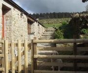
The Threshing House
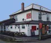
The Cheesewring Hotel
Liskeard Eliot House Hotel
Liskeard
Videos from this area
These are videos related to the place based on their proximity to this place.
Cyclist Chasing Supercharged Lexus and BMW in Liskeard - 48mph
Coming back from Liskeard I saw a supercharged Lexus, so bad the camera didn't pick up the sounds, it sounded really nice. A minute or so later I tested out the speed run hill but a BMW was...
Olympic Torch Day in Liskeard
Things going on on the day the Olympic Flame Relay was taken through Liskeard.
GWR Railmotor 93 on the Looe Branch 11-18 Nov,2012
GWR Railmotor 93 on the Looe Branch Line taken 11 and 18 Nov,2012. Shots are of the arrival at Liskeard, on-board shots of 93's smoking compartment, then shots to Coombe Junction Halt, various...
Crazy Driver Dash Cam - Old man drives it like he stole it!
Some old dash cam footage I found. Driving through Liskeard - not sure who is in the right, I would have guessed the van driver should have priority over him? Anyway the old guy went for it...
Argyle fans celebrate 1-0 win over Shrews
Great 3 pts for Argyle today in a deserved one nil victory. Goal scored by Wotton as keeper fumbles freekick. Could have had 4 with Wotton. Tousoumu. And Macca going close! In the end Jake...
Videos provided by Youtube are under the copyright of their owners.
Attractions and noteworthy things
Distances are based on the centre of the city/town and sightseeing location. This list contains brief abstracts about monuments, holiday activities, national parcs, museums, organisations and more from the area as well as interesting facts about the region itself. Where available, you'll find the corresponding homepage. Otherwise the related wikipedia article.
Caradon Hill transmitting station
The Caradon Hill transmitting station is a broadcasting and telecommunications facility on Bodmin Moor in the civil parish of Linkinhorne, located on Caradon Hill, Cornwall, United Kingdom. It is 6 km north of Liskeard, and 1.25 km south-east of Minions, the highest village in Cornwall. Built in 1961, the station includes a 237.7 metres guyed steel lattice mast. The mean height for the television antennas is 603 metres above sea level.
Upton Cross
Upton Cross and Upton are hamlets a quarter of a mile apart in east Cornwall, England, UK. Upton is situated at grid reference SX 279 724 north of Upton Cross 5 miles (8 kilometres) northwest of Callington. They are on the northeast side of Caradon Hill on the B3254 Liskeard to Launceston road. St Paul's Church at Upton Cross is a mission church built in this corner of the parish of Linkinhorne in 1887 to serve the needs of the local mining community.
Caradon Hill
Caradon Hill is on Bodmin Moor in the former Caradon district of Cornwall, United Kingdom. The summit is 371 metres above mean sea level. The hill was once famous for its copper mines but these are now closed. The South Caradon Copper Mine, 1 km to the SW of the transmitter, was the biggest copper mine in the UK in its heyday, 150 years ago. Other disused copper and tin mines are scattered around the base of the hill, including the Wheal Phoenix, well-known among mineral collectors.
List of United Kingdom locations: Car-Cd
Pensilva
Pensilva is a village in east Cornwall, United Kingdom. It is at OS grid ref SX291697 about four miles (6 km) northeast of Liskeard. Nearby settlements include Charaton Cross and Middlehill. The original small settlement grew quickly during the nineteenth century in response to industrial activity on the moorland north and west of the village.
Crow's Nest, Cornwall
Crow's Nest is a village in Cornwall, England, UK. It is located within the civil parish of St Cleer, on the southeastern edge of Bodmin Moor, 3 miles north of the town of Liskeard. A Site of Special Scientific Interest, also named Crow's Nest, is located 200m north of the village.
Middlehill, Cornwall
Middlehill is a hamlet in the parish of St Cleer, Cornwall, England, UK.
Rilla Mill
Rilla Mill is a village in Cornwall, England, United Kingdom. It is about one and half miles west of Linkinhorne.


