Safety Score: 3,0 of 5.0 based on data from 9 authorites. Meaning we advice caution when travelling to United Kingdom.
Travel warnings are updated daily. Source: Travel Warning United Kingdom. Last Update: 2024-04-19 08:03:45
Delve into Saunderton
Saunderton in Buckinghamshire (England) is a town located in United Kingdom about 32 mi (or 52 km) west of London, the country's capital town.
Time in Saunderton is now 07:11 AM (Saturday). The local timezone is named Europe / London with an UTC offset of one hour. We know of 10 airports closer to Saunderton, of which 5 are larger airports. The closest airport in United Kingdom is RAF Benson in a distance of 12 mi (or 20 km), West. Besides the airports, there are other travel options available (check left side).
There are several Unesco world heritage sites nearby. The closest heritage site in United Kingdom is Blenheim Palace in a distance of 14 mi (or 22 km), North-East. Also, if you like the game of golf, there are some options within driving distance. We saw 2 points of interest near this location. In need of a room? We compiled a list of available hotels close to the map centre further down the page.
Since you are here already, you might want to pay a visit to some of the following locations: Bisham, Hurley, Remenham, Aylesbury and Cookham. To further explore this place, just scroll down and browse the available info.
Local weather forecast
Todays Local Weather Conditions & Forecast: 9°C / 48 °F
| Morning Temperature | 1°C / 33 °F |
| Evening Temperature | 8°C / 47 °F |
| Night Temperature | 2°C / 36 °F |
| Chance of rainfall | 0% |
| Air Humidity | 57% |
| Air Pressure | 1030 hPa |
| Wind Speed | Moderate breeze with 10 km/h (6 mph) from South |
| Cloud Conditions | Broken clouds, covering 63% of sky |
| General Conditions | Broken clouds |
Sunday, 21st of April 2024
9°C (48 °F)
2°C (36 °F)
Broken clouds, moderate breeze.
Monday, 22nd of April 2024
5°C (42 °F)
7°C (44 °F)
Light rain, light breeze, overcast clouds.
Tuesday, 23rd of April 2024
7°C (45 °F)
3°C (37 °F)
Light rain, moderate breeze, overcast clouds.
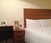
Hotels and Places to Stay
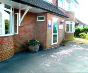
Malvern House
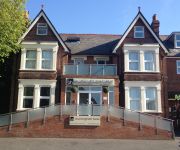
Buckingham Hotel
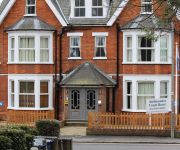
Ambassador Court Hotel
Wendover Arms
Kings
JCT. 4 Holiday Inn HIGH WYCOMBE M40
TRAVELODGE HIGH WYCOMBE CENTRAL
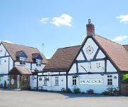
Peacock
TREE AT CADMORE
High Wycombe Central
Videos from this area
These are videos related to the place based on their proximity to this place.
Kings Hotel Stockenchurch | Hotel, Restaurant, Wedding and Conference Venue in Buckinghamshire
http://www.kingshoteluk.com | Hotel,Restaurant,Wedding & Conference Venue Buckinghamshire |http://youtu.be/rwIhXEwiNAs Kings Hotel Oxford Road Stokenchurch High Wycombe Buckinghamshire ...
Kent to Buckinghamshire (17-06-2013)
We start near Cliffe on the Grain Branch, where we see 66589 working a Container train to Leeds, we then see 59201 working light loco. At Bayford we see 66589 again, still working its way...
Horses, Hounds & Heroes III at Horse Trust, Speen 8th June 2014
Footage from Horses, Hounds & Heroes III at Horse Trust, Speen 8th June 2014, including Thames Valley Police Mounted Unit, Horse drawn Rides, Falconry and more.
Top Photoshop Tips
We all need a little help improving our photographs from time to time, and if you are one of those people looking at their photo's from the Christmas period and thinking that there is something...
CATS Calamityville Horror Hell Fire Caves.mp4
Episode 4 of Calamityville Horror (formerly known as C.A.T.S. Tales of Terror) guest starring L K Jay author of The Ghost Hunters Club. Check out our blog on Hell Fire Caves and find out who...
Windle Valley Runners - Thames Valley Cross Country League - Bradenham, 30th November 2014
This was the third race of the 2014-15 season in the Thames Valley Cross Country League. It was hosted by Handy Cross Runners at Bradenham. Once again, it was a very pleasant day, with muddy...
DMU and 47s
watch in high quality* On a foggy morning at Princes Risborough the Chiltern Railways Sandite DMU's make a smoky departure towards Marylebone. Then West Coast Railway's 47760 and 47245...
Midtec Maxi Chimney Cowl
The Maxi Cowl from Midtec is a static anti-downdraught chimney cowl. The main body of the cowl is manufactured in aluminium, and it has a highly protective painted finish. This static anti...
DRS leaf clearer on Chiltern line
Watch in high quality* Recently, a DRS RHTT (Railhead Treatment Train) has been running on the Chiltern Line in addition to Chiltern's Sandite DMU's. Here 66422 and 66423 pass Princes Risboroug.
Videos provided by Youtube are under the copyright of their owners.
Attractions and noteworthy things
Distances are based on the centre of the city/town and sightseeing location. This list contains brief abstracts about monuments, holiday activities, national parcs, museums, organisations and more from the area as well as interesting facts about the region itself. Where available, you'll find the corresponding homepage. Otherwise the related wikipedia article.
Bledlow Ridge
Bledlow Ridge is a village in the civil parish of Bledlow-cum-Saunderton in Buckinghamshire, England, population 940 (2004). It is situated in the Chiltern Hills, about 4 miles SSW of Princes Risborough and on the road between the High Wycombe and Chinnor. Originally the hamlet was within the ecclesiastical parish of Bledlow. It gained separate status in 1868 when the new chapel, dedicated to St Paul, was constructed.
Saunderton
Saunderton is a village in Buckinghamshire, England. It is located in a valley of the Chiltern Hills, about three and a half miles north west of High Wycombe, four miles south of Princes Risborough. It lies on the main A4010 road, and has a station on the Chiltern Main Line between the two towns. The village name is Anglo Saxon in origin, although its original meaning is unclear.
Walters Ash
Walters Ash (also sometimes called Walter's Ash) is a village in the parish of Bradenham, in Buckinghamshire, England. It is located in the Chiltern Hills, to the west of the main village, adjacent to Naphill. Between 1983 and 1985 there was a peace camp outside the RAF station which dominates the village. This was to protest about the RAF bunker on National Trust land designated a place of Historic Interest or Natural Beauty. There is also a water reservoir constructed at the same time.
RAF High Wycombe
RAF High Wycombe is a Royal Air Force station, situated in the village of Walters Ash, near High Wycombe in Buckinghamshire, England. It serves as the Headquarters of RAF Air Command, and was originally designed to house RAF Bomber Command in the late 1930s. The station is also the headquarters of the European Air Group. The location of the station was originally suggested by Wing Commander Alan Oakeshott when the Air Ministry was seeking a new, secure, site for Bomber Command away from London.
Piddington, Buckinghamshire
Piddington is a hamlet in the parish of Piddington and Wheeler End in Buckinghamshire, England. It is located on the main A40 between Stokenchurch and West Wycombe. Piddington only dates back to the mid 19th century when it was a hamlet based around a pub called The Dashwood Arms. At the turn of the century, a furniture factory was established and the hamlet grew around it. The factory is no more, but a small light industrial area now stands on its site.
Saunderton railway station
Saunderton railway station is a railway station on the A4010 road between High Wycombe and Princes Risborough, in Buckinghamshire, England. It is near the villages of Bledlow Ridge and Bradenham. Confusingly, the station is about 2.5 miles south of the village of Saunderton after which it is named. The hamlet immediately around the station is also known locally as Saunderton, but is not named on maps. The station is on the Chiltern Main Line between High Wycombe and Princes Risborough stations.
A4010 road
The A4010 is an important primary north-south road in Buckinghamshire, Southern England. It runs from High Wycombe at Junction 4 of the M40 motorway to Stoke Mandeville, near Aylesbury on the A413.
St Lawrence's Church, West Wycombe
St Lawrence's Church is a Church of England church in the parish of West Wycombe, Buckinghamshire, England. It sits on top of West Wycombe Hill, which is managed by the National Trust, although the church and graveyard are owned by the Church of England. There has been a religious focus on this site since at least 635AD. The Grade I listed church was built in its current form from 1761, under instruction from Sir Francis Dashwood, 1st Baronet and Baron Le Despenser.


