Safety Score: 3,0 of 5.0 based on data from 9 authorites. Meaning we advice caution when travelling to United Kingdom.
Travel warnings are updated daily. Source: Travel Warning United Kingdom. Last Update: 2024-04-19 08:03:45
Discover Hoggeston
Hoggeston in Buckinghamshire (England) is a place in United Kingdom about 41 mi (or 67 km) north-west of London, the country's capital city.
Current time in Hoggeston is now 07:01 PM (Friday). The local timezone is named Europe / London with an UTC offset of one hour. We know of 11 airports near Hoggeston, of which 5 are larger airports. The closest airport in United Kingdom is London Luton Airport in a distance of 20 mi (or 32 km), East. Besides the airports, there are other travel options available (check left side).
There are several Unesco world heritage sites nearby. The closest heritage site in United Kingdom is Blenheim Palace in a distance of 10 mi (or 16 km), South-East. Also, if you like playing golf, there are a few options in driving distance. We encountered 1 points of interest in the vicinity of this place. If you need a hotel, we compiled a list of available hotels close to the map centre further down the page.
While being here, you might want to pay a visit to some of the following locations: Aylesbury, Shenley Church End, Loughton, Calverton and Bradwell. To further explore this place, just scroll down and browse the available info.
Local weather forecast
Todays Local Weather Conditions & Forecast: 11°C / 52 °F
| Morning Temperature | 9°C / 48 °F |
| Evening Temperature | 8°C / 46 °F |
| Night Temperature | 3°C / 38 °F |
| Chance of rainfall | 1% |
| Air Humidity | 85% |
| Air Pressure | 1017 hPa |
| Wind Speed | Fresh Breeze with 15 km/h (9 mph) from South-East |
| Cloud Conditions | Overcast clouds, covering 100% of sky |
| General Conditions | Light rain |
Saturday, 20th of April 2024
9°C (49 °F)
2°C (35 °F)
Broken clouds, moderate breeze.
Sunday, 21st of April 2024
9°C (48 °F)
2°C (35 °F)
Broken clouds, moderate breeze.
Monday, 22nd of April 2024
8°C (47 °F)
4°C (39 °F)
Light rain, gentle breeze, overcast clouds.
Hotels and Places to Stay
Furzton - Prestigious Houses
De Vere Horwood Estate PH Hotels
Videos from this area
These are videos related to the place based on their proximity to this place.
Aylesbury Video Survey - Route 2 PM Peak
A sample video survey, recorded during the journey time survey undertake in Aylesbury, on 20th July 2011.
lawn franchise 01908 504664
lawn franchise 01908 504664 http://lawnsciencefranchise.co.uk Lawnscience is a lawn franchise, we operate in the UK and currently have fifteen franchisees who provide lawn care services...
New Halo Infection Map - STRANGE FORT
I get my xbox live free! find out how here: http://moourl.com/xbox My new map is now out! called STRANGE FORT and is downlaodable from my fileshare slot 2: http://www.bungie.net/stats/Halo3/File...
H6 CHILDS WAY EASTBOUND ( MILTON KEYNES RED-PATH JOURNEY) BY BICYCLE
This Video is of journey from outer boundary walk foot path in the west to the coach way park Jew south of junction 13 (M1) alongside the H8 CHILDS WAY.
H8 STANDING WAY EASTBOUND (MILTON KEYNES RED PATH JOURNEY) on bicycle
This video is of a journey on bicycle from the Bottledump roundabout to Kingston roundabout alongside the H8 Standing Way length 7 1/4 miles.
Vintage bus ride at the Christmas Bazaar
A Bristol Lodekka gives the children a ride around North Marston village at the Christmas Bazaar on 5th December 2009.
Buckinghamshire Railway Centre - 'STEAM & MINIATURE WEEKEND' 07/05/2012
The Buckinghamshire Railway Centre at Quainton Road held a special 'Steam & Miniature' event on Sunday 6th/Monday 7th May 2012. This video is from Monday 7th, as a special shuttle was run from.
Apr 2012 (HD): Scouts St George's Day Parade, Stewkley, Bucks
As the 1st Stewkley Scouts celebrate fifty years since the troop's formation, its members host the annual St George's Day Parade and church service. Stewkley Film Archive April 2012.
1977: Stewkley Scouts Pram Race
Stewkley, Bucks: Film shot and edited 1977 by village cine enthusiast Tony Greenslade. Screened during Archive Film Show, Village Hall, March 2010. No commentary. See separate item "Stewkley...
How to Quick Travel in Skyrim
How to Quick Travel in Skyrim link for location COC codes :http://www.skyrimsearch.com/cells.php.
Videos provided by Youtube are under the copyright of their owners.
Attractions and noteworthy things
Distances are based on the centre of the city/town and sightseeing location. This list contains brief abstracts about monuments, holiday activities, national parcs, museums, organisations and more from the area as well as interesting facts about the region itself. Where available, you'll find the corresponding homepage. Otherwise the related wikipedia article.
Horwood House
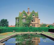
Horwood House lies 0.5-mile south east of the village of Little Horwood in Buckinghamshire. This mansion is a comparatively modern house, built in 1911, the date being embossed into the gutter hopper-heads. Today it is a conference and training venue, owned and operated by Principal Hayley Group
Swanbourne railway station
Swanbourne is a disused railway station that served the villages of Swanbourne, Little Horwood and Mursley in north Buckinghamshire, England. It is on the mothballed Bicester to Bletchley line, roughly at the centre of a triangle drawn between the three villages.
Littlecote, Buckinghamshire
Littlecote, in the English county of Buckinghamshire, also known as Lidcote, was a village about eight miles north of Aylesbury. The village was mentioned in the Domesday Book of 1087. In the late 15th century, the landowner, Thomas Pigott, started to enclose land for sheep grazing, which was for him a profitable use of the land. By 1507, the enclosure had been completed and the village had been depopulated and destroyed.


