Safety Score: 3,0 of 5.0 based on data from 9 authorites. Meaning we advice caution when travelling to United Kingdom.
Travel warnings are updated daily. Source: Travel Warning United Kingdom. Last Update: 2024-04-19 08:03:45
Delve into Bellingdon
Bellingdon in Buckinghamshire (England) is a town located in United Kingdom about 27 mi (or 43 km) north-west of London, the country's capital town.
Time in Bellingdon is now 12:47 AM (Saturday). The local timezone is named Europe / London with an UTC offset of one hour. We know of 8 airports closer to Bellingdon, of which 5 are larger airports. The closest airport in United Kingdom is London Luton Airport in a distance of 15 mi (or 24 km), North-East. Besides the airports, there are other travel options available (check left side).
There are several Unesco world heritage sites nearby. The closest heritage site in United Kingdom is Blenheim Palace in a distance of 7 mi (or 12 km), North. Also, if you like the game of golf, there are some options within driving distance. We saw 3 points of interest near this location. In need of a room? We compiled a list of available hotels close to the map centre further down the page.
Since you are here already, you might want to pay a visit to some of the following locations: Totternhoe, Stanbridge, Dunstable, Cookham and Aylesbury. To further explore this place, just scroll down and browse the available info.
Local weather forecast
Todays Local Weather Conditions & Forecast: 12°C / 54 °F
| Morning Temperature | 9°C / 48 °F |
| Evening Temperature | 10°C / 49 °F |
| Night Temperature | 4°C / 39 °F |
| Chance of rainfall | 1% |
| Air Humidity | 71% |
| Air Pressure | 1012 hPa |
| Wind Speed | Fresh Breeze with 15 km/h (10 mph) from South-East |
| Cloud Conditions | Overcast clouds, covering 85% of sky |
| General Conditions | Light rain |
Saturday, 20th of April 2024
9°C (49 °F)
3°C (37 °F)
Broken clouds, moderate breeze.
Sunday, 21st of April 2024
8°C (46 °F)
3°C (37 °F)
Broken clouds, moderate breeze.
Monday, 22nd of April 2024
7°C (45 °F)
6°C (43 °F)
Light rain, gentle breeze, overcast clouds.
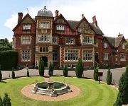
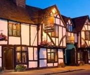
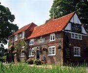
Hotels and Places to Stay
Champneys Tring
Pendley Manor
The Kings Arms
The Crown
The Nags Head
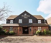
The Pennyfarthing Hotel
The Kings Arms
The Chequers
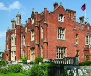
De Vere Latimer Estate
Tring
Videos from this area
These are videos related to the place based on their proximity to this place.
Tour of Britain 2014 stage six flies through Chesham
flies through Cheshamhttp://www.tourofbritain.co.uk/stages/stage6 - completely wrong about the 3 cyclists I saw from behind they were Mathias Brandle, Alex Dowsett and Thomas Stewart http://www.ma ...
Chesham to Chalfont and Latimer on the metropolitan line(drivers eye view)
This branch line has only one stop, it links the Met line and Chiltern lines to Chesham and is the longest station to station journey on the whole London underground network.
Queen's Birthday fly-past over Chesham - 2012 - Trooping The Colour
The Queen's flypast for trooping the colour always passes over Chesham, all be it sometimes not in full, on the return trip. Here we see a VC-10, 2 Tornado GR4s, an E-3D sentry, 2 Eurofighter...
This is Chesham
Chesham is just 30 miles from London and sits in the heart of the beautiful Chilterns countryside. Have a look at just what this lovely old market town has to offer.
2011 - 'A Stock' on the Chesham Branch
A trip from Chesham to Chalfont-and-Latimer - and back - on vintage A60/62 Stock, soon to be replaced by the new 'S Stock'.. Bouncing around on this single-track branch line, with plenty...
Metropolitan Line journey from Chalfont & Latimer Station to Chesham station on 17/06/12
Metropolitan Line journey from Chalfont & Latimer Station to Chesham station on 17/06/12 Like this video then why not subscribe so you do missing more in the future.
Videos provided by Youtube are under the copyright of their owners.
Attractions and noteworthy things
Distances are based on the centre of the city/town and sightseeing location. This list contains brief abstracts about monuments, holiday activities, national parcs, museums, organisations and more from the area as well as interesting facts about the region itself. Where available, you'll find the corresponding homepage. Otherwise the related wikipedia article.
Hundridge
Hundridge is a hamlet in the parish of Chartridge, in Buckinghamshire, England. It is located in the Chiltern Hills to the west of the town of Chesham. During the 14th century it was known as Hunderugge, and Hundrige in the 15th/16th century. The hamlet name derives from either the Anglo Saxon hunda-hrycg meaning 'hounds' ridge', or from Hundan-hrycg meaning 'Hunda's ridge'.
Pednor
Pednor is a hamlet in the parish of Chartridge, in Buckinghamshire, England. It is located in the Chiltern Hills two miles northwest of Chesham and seven miles southeast of Wendover. The hamlet name is Anglo Saxon in origin, and means 'Peada's slope'. In 1541, following the dissolution of the monasteries the lands at Pednor were surrendered by Missenden Abbey and became part of the estates owned by John Russell, 1st Earl of Bedford.
River Chess
The River Chess is a chalk stream which springs from Chesham, Buckinghamshire and runs through Buckinghamshire and Hertfordshire, in south-eastern England. The Chess, along with the Colne and Gade, gives rise to the name of the district of Three Rivers, in which it forms its confluence with the Colne at Rickmansworth. The River Chess fall is 60 metres and its length is 11 miles .
Pond Park
Pond Park (originally called North Chesham) is an area of Chesham in Buckinghamshire, England, built on the hills to the north of the town starting in 1891.
Chesham Urban District
Chesham Urban District was from 1894 to 1974 a local government district in the administrative county of Buckinghamshire, England. The urban district took over the responsibilities of the disbanded Chesham Local Government District. The population in 1921 was 1155 which by 1931 had increased to 1418. In April 1934 the urban district was enlarged through the addition of parts of the adjacent parishes of Ashley Green, Chartridge, Chesham Bois, and Latimer.
St. Mary's Church, Chesham
St. Mary's Church is a Grade A listed Anglican church in Chesham, Buckinghamshire, and is part of the Diocese of Oxford. Built on the site of a Bronze Age stone circle of puddingstones, parts of the church building date to the 12th century. Remodelled in the 15th and 17th centuries, the church is architecturally a mixture of English Gothic styles.
Amy Lane
Amy Lane, also known as The Meadow, is a cricket ground in Chesham, Buckinghamshire. The first recorded match on the ground was in 1907, Buckinghamshire played the Worcestershire Second XI. Buckinghamshire next used the ground in 1951, and from 1951 to 1982 the ground hosted 32 Minor Counties Championship matches, the last of which saw Buckinghamshire play Suffolk.
Hawridge Windmill
Hawridge Windmill which is also known as Cholesbury Windmill is a disused tower mill in Hawridge, Buckinghamshire. The mill was constructed on the site of an earlier smock mill and became a private residence in 1913 when the first occupier, the artist Gilbert Cannan used it as a studio.


