Safety Score: 3,0 of 5.0 based on data from 9 authorites. Meaning we advice caution when travelling to United Kingdom.
Travel warnings are updated daily. Source: Travel Warning United Kingdom. Last Update: 2024-04-25 08:17:04
Delve into Henbury
The district Henbury of Bristol in Bristol (England) is a district located in United Kingdom about 107 mi west of London, the country's capital town.
In need of a room? We compiled a list of available hotels close to the map centre further down the page.
Since you are here already, you might want to pay a visit to some of the following locations: Almondsbury, Dundry, Whitchurch, Winterbourne and Alveston. To further explore this place, just scroll down and browse the available info.
Local weather forecast
Todays Local Weather Conditions & Forecast: 10°C / 50 °F
| Morning Temperature | 4°C / 39 °F |
| Evening Temperature | 10°C / 49 °F |
| Night Temperature | 5°C / 41 °F |
| Chance of rainfall | 1% |
| Air Humidity | 81% |
| Air Pressure | 1005 hPa |
| Wind Speed | Moderate breeze with 9 km/h (6 mph) from East |
| Cloud Conditions | Overcast clouds, covering 93% of sky |
| General Conditions | Light rain |
Friday, 26th of April 2024
8°C (46 °F)
7°C (44 °F)
Moderate rain, gentle breeze, overcast clouds.
Saturday, 27th of April 2024
7°C (45 °F)
10°C (50 °F)
Moderate rain, moderate breeze, overcast clouds.
Sunday, 28th of April 2024
12°C (53 °F)
7°C (45 °F)
Moderate rain, moderate breeze, overcast clouds.
Hotels and Places to Stay
Green Island Resort
Holiday Inn BRISTOL CITY CENTRE
Hotel du Vin & Bistro Bristol
Bristol Serviced Lettings - Filton
Hamilton Apartments
THE BEST WESTERN HENBURY LODGE HOTEL
Avon Gorge
Hamilton Apartments
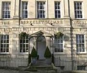
Berkeley Square Clifton Hotel
Bristol Filton
Videos from this area
These are videos related to the place based on their proximity to this place.
27 03 2012 Knole Lane, Bristol SMIDSY
This is at the bottom of a long hill. I would have been doing in the region of 25 - 30 mph. Somehow I knew they were going to pull out so I had already had slowed down. I am not not if I hadn't...
08 05 2012 Wessex Connect, a close shave
I am waiting to turn right and generally minding my own business. The Wessex Connect bus was so close to me that I thought the driver was going to stop and ask me for a ticket. There really...
This is my life - personal development journal from Polyglot Coaching
This personal development journal packed full of coaching tools, tips and inspirational quotes, will help you live your best life.
The Mikado No. 8 - So please you sir, we much regret
From "The Bristol Catholic Players" award winning Production of The Mikado in 2011. The Mikado was the first show the players put on in 1953. If you are interested in seeing the BCP in action...
Will Real Madrid pay £80 million for the ageing Bristolian Pelé?
This is what Real Madrid missed out on - a balding middle-aged man doing keepie uppie in the back garden to the soundtrack of one of his professionally recorded songs. Geoff Davis, 28 years...
A Red Escort Van saved from scrap to be stealth camper after 10 days co2 welding petethewrist
Well, today was hot and not alot got done. I had hell just removing the drivers side shocker. I had to get it off to do the welding around it. This will show you that not all days fly by, some...
Driving On The M5 From J17 (Bristol West) To J21 (Weston-Super-Mare), England 22nd April 2011
Driving on the M5 motorway from Junction 17 (Bristol West & Cribbs Causeway, A4108 & B4055) to Junction 21 (Weston-Super-Mare A370) England Videoed on Friday, 22nd April 2011 Playlist:...
Bristol Domestic Cleaning - Tidy and Shiny
Tidy and Shiny are the best cleaning company in Bristol - in this little video we explain how we've improved cleaning! www.TidyandShiny.com saving you time and money with Online Booking and...
Mad Chili Dog who loves eating XXX Hot Chilli Beef Jerky
Crazy chili loving Pheobe the Jack Russell just loves eating Chilli beef Jerky, see how she reacts too it! Mad licking of the lips ensues.... WARNING! DO NOT try this on your pets. Phoebe...
Videos provided by Youtube are under the copyright of their owners.
Attractions and noteworthy things
Distances are based on the centre of the city/town and sightseeing location. This list contains brief abstracts about monuments, holiday activities, national parcs, museums, organisations and more from the area as well as interesting facts about the region itself. Where available, you'll find the corresponding homepage. Otherwise the related wikipedia article.
Catbrain
Catbrain Hill, simply known as Catbrain, is a small village near the north of Bristol, at the edge of neighbouring district South Gloucestershire, England. It is located by Cribbs Causeway, on a road that contains many car dealerships. A new housing estate has been recently constructed at Catbrain. At the bottom of the hill the lies Filton airfield. The area belongs to postcode BS10
Easter Compton
Easter Compton is a village in the civil parish of Almondsbury, South Gloucestershire, England. It is situated at the bottom of a hill (known as Blackhorse Hill) near Junction 17 of the M5 Motorway on the B4055. The village is only 1.5 miles away from the busy Mall shopping and leisure complex at Cribbs Causeway. There is a pub (The Fox), a post office (open Monday/Wednesday/Friday in the mornings and based in the village hall), Methodist chapel, and a playing field (including skate park).
Bristol Old Vic Theatre School
The Bristol Old Vic Theatre School is a theatre school in Bristol, England. Opened by Laurence Olivier in 1946, it is an affiliate of the Conservatoire for Dance and Drama, and an associate school of the Faculty of Creative Arts of the University of the West of England.
The Downs, Bristol
The Downs are an area of public open limestone downland in Bristol, England. They consist of Durdham Down to the northeast, and the generally more picturesque and visited Clifton Down to the southwest.
Bishopston, Bristol
Bishopston the name of both a council ward of the city of Bristol, England, and a suburb of the city that falls within that ward. Bishopston is situated around the Gloucester Road, the main northern arterial road in the city. The ward includes St Bonaventures and Ashley Down parishes, as well as part of Horfield. It is twinned with KV Kuppam in Tamilnadu, India.
Cribbs Causeway
Cribbs Causeway is a road in South Gloucestershire, England, just north of Bristol, which has given its name to the surrounding area, a large out-of-town shopping centre, including retail parks and an enclosed shopping centre known as The Mall. Cribbs Causeway road is situated west of Patchway, although in the civil parish of Almondsbury. The road runs from the northern edge of Bristol at Henbury to a point just beyond the M5 junction 17. It now forms parts of the A4018 and B4055.
Bristol North West (UK Parliament constituency)
Bristol North West is a constituency to the north and north-west of Bristol city centre represented in the House of Commons of the UK Parliament since 2010 by Charlotte Leslie of the Conservative Party.
Redland, Bristol
Redland is an affluent suburb in Bristol, England. The suburb is situated between Clifton, Cotham, Bishopston and Westbury Park. The boundaries of the district are not precisely defined, but are generally taken to be Whiteladies Road in the west, the Severn Beach railway line in the south and Cranbrook Road in the east. Redland is also the name of a council ward, which covers a slightly different area.
Bristol Manor Farm F.C
Bristol Manor Farm F.C. is an English football team based in Bristol. They play in the Western Football League Premier Division. They play their home games at The Creek. The club is affiliated to the Gloucestershire County FA.
Hallen A.F.C
Hallen A.F.C. is a football club based in Hallen, near Bristol, England, currently members of the Western League Premier Division. The club is affiliated to the Gloucestershire County FA.
A4018 road
The A4018 is an A-road from Bristol to a junction with the M5 motorway at Cribbs Causeway. It is one of the three principal roads which link Bristol city centre to the motorway network (the others being the M32 motorway and the Portway).
Monks Park
Monks Park is a northern suburb of the city of Bristol, England and is the highest point within the city. Monks Park stretches westward, towards Southmead, from the A38 trunk road. Filton Park lies directly north, on the South Gloucestershire side of the city boundary. Horfield lies to the east of the A38 and also to the south. Monks Park takes its name from James Henry Monk, a nineteenth-century bishop of Gloucester and Bristol. The first development in Monks Park took place in the 1930s.
Charlton, Bristol
Charlton was the name of a small village in Gloucestershire, England, demolished in the late 1940s. It was between Filton and Cribbs Causeway immediately north of Bristol.
Wesley College (Bristol)
Wesley College, Bristol (formerly Wesley College, Headingley, Leeds, until, in 1967, the institution united with Didsbury College, Bristol, and was renamed) is a theological college in Bristol, England.
Quarry Steps, Durdham Down
Quarry Steps, Durdham Down is a 0.006 hectare geological Site of Special Scientific Interest near Durdham Down in Bristol, notified in 1990. It was in this area that the first Thecodontosaurus fossil was discovered in 1834.
Bristol North (UK Parliament constituency)
Bristol North was a borough constituency which returned one Member of Parliament to the House of Commons of the Parliament of the United Kingdom from 1885 until it was abolished for the 1950 general election.
St. Christopher's School, Bristol
St Christopher's School is located in Bristol, England. It is a residential school for around 50 children and young people aged 7 to 19, who have severe and complex learning difficulties, or profound and multiple learning difficulties. They all have special requirements for their care and education. Many of the pupils have language and communication disorders, some have physical disabilities and some display challenging behaviour.
Compton Greenfield
Compton Greenfield is a small hamlet of farms and spread out houses to the south east of Easter Compton, in South Gloucestershire. Its main feature is the parish church of All Saints which has a Norman arch in its porch. The name derives not from its rural location but from being at one time part of the Grenvile estate. It is also the final resting place of Sir George White founder of the Bristol Aeroplane Company, who is buried in the churchyard.
Kingsweston Hill
Kingsweston Hill is the site of an Iron Age hill fort near Henbury, Bristol, England. It is a Scheduled Ancient Monument. It is near Kings Weston House and also the site of a tower for television broadcasting.
Kingsweston (ward)
Kingsweston is a ward of the city of Bristol. The three districts in the ward are Coombe Dingle, Lawrence Weston and Sea Mills. The ward takes its name from the old district of Kings Weston (usually spelt in two words), now generally considered part of Lawrence Weston.
Redland Green
Redland Green is a park in the Bristol suburb of Redland. The park consists of a grassed area and scrub and woodland managed as wildlife habitats by Bristol City Council in partnership with local community groups. A major event each year is Redland May Fair, organised by Redland and Cotham Amenities Society, which has been held annually for over 25 years on the first Monday in May and is opened each year by the Bristol street band The Ambling Band.
National Wildlife Conservation Park
The National Wildlife Conservation Park is a proposed extension to Bristol Zoo. In 2008 Bristol Zoo Gardens announced plans to submit plans to South Gloucestershire Council for the development of a new 55-hectare National Wildlife Conservation Park (NWCP). It is expected to cost for the circa £70 million and is scheduled to open in 2012. It will be on the northern outskirts of Bristol, close to Junction 17 of the M5, opposite Cribbs Causeway.
University of Bristol Botanic Garden
The University of Bristol Botanic Garden is a botanic garden located in Stoke Bishop, Bristol. The University of Bristol established a botanic garden in 1882 at Royal Fort House adjacent to Tyndall Avenue. This site was later known as the Hiatt Baker Garden. The site of the Garden was used to build Senate House meaning that the botanic garden was moved to a site on Braken Hill. In 2002 the botanic collections were relocated to a site in Stoke Bishop opposite Churchill Hall.
Southsound Radio
Southsound Radio is a UK radio station which broadcasts from studios in the city of Bristol. Southsound Radio (otherwise known as Bristol's Southsound Radio) is a growing radio station with growing listener numbers, playing current popular music and 90s and aiming at the 15-25 age range in and around the Bristol area. It also has a sister station named Southsound Gold which plays 60s, 70s, and 80s music and aims at the 30+ age range nationwide.
Berwick, Gloucestershire
Berwick is a hamlet in the South Gloucestershire District, in the English county of Gloucestershire. Nearby settlements include the city of Bristol and the village of Hallen. Berwick has a business park called Sampson House Business Park and a wood called Berwick Wood. Berwick is located between the M5 motorway and the M49 motorway.


