Safety Score: 3,0 of 5.0 based on data from 9 authorites. Meaning we advice caution when travelling to United Kingdom.
Travel warnings are updated daily. Source: Travel Warning United Kingdom. Last Update: 2024-04-25 08:17:04
Delve into Burnett
Burnett in Bath and North East Somerset (England) is located in United Kingdom about 102 mi (or 164 km) west of London, the country's capital town.
Current time in Burnett is now 01:43 PM (Thursday). The local timezone is named Europe / London with an UTC offset of one hour. We know of 9 airports close to Burnett, of which 5 are larger airports. The closest airport in United Kingdom is Bristol International Airport in a distance of 10 mi (or 16 km), West. Besides the airports, there are other travel options available (check left side).
There are several Unesco world heritage sites nearby. The closest heritage site in United Kingdom is Blaenavon Industrial Landscape in a distance of 33 mi (or 53 km), North-West. Also, if you like playing golf, there are some options within driving distance. We encountered 1 points of interest near this location. If you need a hotel, we compiled a list of available hotels close to the map centre further down the page.
While being here, you might want to pay a visit to some of the following locations: Saltford, Compton Dando, Corston, Bitton and Publow. To further explore this place, just scroll down and browse the available info.
Local weather forecast
Todays Local Weather Conditions & Forecast: 11°C / 51 °F
| Morning Temperature | 4°C / 40 °F |
| Evening Temperature | 10°C / 50 °F |
| Night Temperature | 5°C / 41 °F |
| Chance of rainfall | 1% |
| Air Humidity | 81% |
| Air Pressure | 1005 hPa |
| Wind Speed | Gentle Breeze with 9 km/h (5 mph) from East |
| Cloud Conditions | Overcast clouds, covering 92% of sky |
| General Conditions | Light rain |
Friday, 26th of April 2024
8°C (46 °F)
7°C (44 °F)
Light rain, gentle breeze, overcast clouds.
Saturday, 27th of April 2024
8°C (46 °F)
10°C (50 °F)
Moderate rain, moderate breeze, overcast clouds.
Sunday, 28th of April 2024
12°C (54 °F)
8°C (46 °F)
Moderate rain, moderate breeze, overcast clouds.
Hotels and Places to Stay
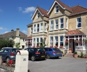
Grasmere Court Hotel - Guest house
2 Crescent Gardens
Aquae Sulis Guest House
The Old Malt House Hotel
A4 Hotel
Arnos Manor
Cameley Lodge
Leeford Place Hotel
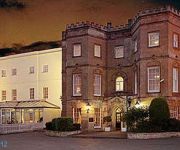
HUNSTRETE HOUSE
Videos from this area
These are videos related to the place based on their proximity to this place.
A Trip behind a 11 coach, 5 inch Gauge, Loaded Train
A Trip behind a 5 inch double headed train with 12 LOADED COACHES! At the front were a Prarie and a D49. On a Trip that is 3/4 Mile Long. I was right at the back, and it fouled most of the...
Halloween Shenanigans 2014
A trip to the Fear event at Avon Valley Country Park with live scare mazes, a funfair and more... Edited on the most basic of softwares, therefore I think I did a fairly good job :D.
2014 - GB0SBM Mills on the Air
South Bristol Amateur Radio Club operated GB0SBM (Saltford Brass Mill) for Mills on the Air over the weekend of 10/11 May 2014 from Saltford Brass Mill situated between Bristol and Bath in...
English Farmer plants Olympic Linseed Rings: Part 2: The Air Reconnoissance Mission (HD)
Gerald Addicott, a farmer outside the city of Bath in England, has planted a crop of linseed with the Olympic rings to celebrate the 2012 Olympic Games. With trusty pilot Clive, the daring...
England (Part 1) London to Salisbury HD
Video of a trip made recently with Pam and Bob Neff.. London, Salisbury, Jerry and Thelma Boughton, Shreveport, La.
English Farmer plants Linseed Rings for Olympic Games 2012: (Part 1: HD)
A farmer outside the city of Bath in England plants a crop of Linseed with the Olympic rings to celebrate the 2012 Olympic Games in London. The linseed rings should be visible the summer of...
The Strawberry Line
A trip on The Strawberry Line, the only commercial 5 inch gauge line in Britain.
Red Arrows Jubilee.
Some old film from 1979 as the team practice with their new Hawk aircraft. The Red Arrows have performed over 4000 displays worldwide in 53 countries. At a charity auction, a British woman...
Videos provided by Youtube are under the copyright of their owners.
Attractions and noteworthy things
Distances are based on the centre of the city/town and sightseeing location. This list contains brief abstracts about monuments, holiday activities, national parcs, museums, organisations and more from the area as well as interesting facts about the region itself. Where available, you'll find the corresponding homepage. Otherwise the related wikipedia article.
Wansdyke (district)
Wansdyke was a non-metropolitan district within the County of Avon, in the west of England from 1974 to 1996. The district was formed by the Local Government Act 1972 on 1 April 1974 as part of a reform of local authorities throughout England and Wales. Under the reorganisation, the area surrounding the cities of Bath and Bristol was formed into a new county of "Avon", named after the river that ran through the area.
Hunstrete Lake
Hunstrete Lake is a mature lake of 5 acres . Two new lakes of 3.5 acres where constructed alongside in the 1990s. They are situated just to the south of the village of Hunstrete, Somerset; south of Bristol, and 7 miles west of Bath. It is surrounded by a belt of trees, and at the north-west end this merges into Lord's Wood, Pensford. The lakes are used for angling, and are noted for their carp and tench.
A368 road
The A368 is a part primary status A road in North Somerset, England. It runs from Marksbury to Banwell along the northern edge of the Mendip Hills and past the reservoir at Chew Valley Lake. The road runs through the village of Chelwood, where there is a roundabout for the junction with the A37, then via the villages of Stanton Wick and Bishop Sutton to the large reservoir at Chew Valley Lake before crossing the B3114 at West Harptree.
Keynsham Lock
Keynsham Lock is situated on the River Avon at Keynsham, England. The lock opened in 1727. Just above the lock are some visitor moorings and a pub, on an island between the lock and the weir. The weir side of the island is also the mouth of the River Chew.
Kelston Lock
Kelston Lock is situated on the River Avon, between the villages of Kelston and Saltford, between Bristol and Bath, England. Above and below the lock and weir are permanent moorings. The Riverside Inn and Saltford Marina are also close by.
Strawberry Line (Miniature Railway)
The Strawberry Line is a 0.75-mile length of 5in gauge railway inside Avon Valley Country Park. It is Britain's only commercial ground-level 5in railway. As a conventional ridable miniature railway it provides train rides for visitors to the park (for an additional fare), but it also runs demonstration freight trains using correctly scaled wagons. Driver experience courses are offered in the winter.
Kelston railway station
Kelston was a small railway station about four miles west of Bath on the Midland Railway's Mangotsfield and Bath Branch Line. It lies across the fields from the village of Kelston and nearer the village of Saltford on the other side of the River Avon, to which it was connected by a footpath that ran alongside the railway on the bridge over the river. The station was known for many years as "Kelston (for Saltford)", though Saltford had its own station on the Great Western Main Line.
Keynsham Abbey
Keynsham Abbey in Keynsham, Somerset, England was founded by William, Earl of Gloucester for the Augustinian Canons Regular around 1170 and survived until 1539. The remains have been designated as a Grade I listed building and Scheduled Ancient Monument The abbey was founded following the dying wish of William's son Robert, although there had been a religious settlement in Keynsham during the 9th and 10th centuries.


