Safety Score: 3,2 of 5.0 based on data from 9 authorites. Meaning please reconsider your need to travel to United Arab Emirates.
Travel warnings are updated daily. Source: Travel Warning United Arab Emirates. Last Update: 2024-04-16 08:26:06
Discover Al Mujarrah
The district Al Mujarrah of Sharjah in Ash Shāriqah is a district in United Arab Emirates about 89 mi north-east of Abu Dhabi, the country's capital city.
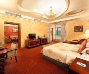
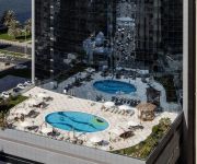
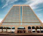
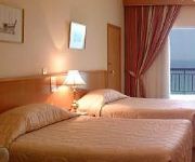
Looking for a place to stay? we compiled a list of available hotels close to the map centre further down the page.
When in this area, you might want to pay a visit to some of the following locations: Ajman, Umm al Qaywayn, Dubai, Abu Musa and Ras al-Khaimah. To further explore this place, just scroll down and browse the available info.
Local weather forecast
Todays Local Weather Conditions & Forecast: 24°C / 76 °F
| Morning Temperature | 21°C / 70 °F |
| Evening Temperature | 24°C / 75 °F |
| Night Temperature | 22°C / 72 °F |
| Chance of rainfall | 114% |
| Air Humidity | 70% |
| Air Pressure | 1011 hPa |
| Wind Speed | Gale with 32 km/h (20 mph) from South |
| Cloud Conditions | Overcast clouds, covering 100% of sky |
| General Conditions | Very heavy rain |
Wednesday, 17th of April 2024
25°C (76 °F)
24°C (75 °F)
Moderate rain, strong breeze, clear sky.
Thursday, 18th of April 2024
25°C (78 °F)
25°C (77 °F)
Sky is clear, gentle breeze, clear sky.
Friday, 19th of April 2024
27°C (81 °F)
26°C (78 °F)
Sky is clear, gentle breeze, clear sky.
Hotels and Places to Stay
Sharjah Radisson Blu Resort
AlHamra Hotel
Royal Beach Resort & Spa
Hilton Sharjah
Hotel Holiday International
Marbella Resort Sharjah
Swiss-Belhotel Sharjah
Copthorne
Sharjah Carlton Hotel
Al Hayat
Videos from this area
These are videos related to the place based on their proximity to this place.
Sharjah At Night - Part 2 Presented by Hussein Kefel
A view of Sharjah City at night. See the corniche, Skyscrapers, Al Qasba Canal, Observation wheel of Sharjah, Streets, People, Side Walks, Ansar Mall etc.. Thanks for watching www.
Al Majaz waterfront park Sharjah part 9 الواجهة المائية المجاز الشارقة
Now opens to public today Thursday the 1st of March 2012 The newly named Al Majaz Waterfront is located between Jamal Abdul Nasser Street and Khalid Lagoon Corniche, a vital residential and...
Al Majaz waterfront park Sharjah part 13 الواجهة المائية المجاز الشارقة
Now opens to public today Thursday the 1st of March 2012 The newly named Al Majaz Waterfront is located between Jamal Abdul Nasser Street and Khalid Lagoon Corniche, a vital residential and...
Al Majaz waterfront park Sharjah part 5 الواجهة المائية المجاز الشارقة
Now opens to public today Thursday the 1st of March 2012 The newly named Al Majaz Waterfront is located between Jamal Abdul Nasser Street and Khalid Lagoon Corniche, a vital residential and...
Eye Of The Emirates - Al Qasba Sharjah
This is the Sharjah observation wheel (Etisalat Eye Of The Emirates) located in Al Qasba. It is one of Sharja's main attractions standing 60 meters tall, the Etisalat Eye of the Emirates with...
UAE 40th Anniversary Celebrations 03-12-2011 - part 22
Emiratis Celebrating The Country's 40th Anniversary along the Streets of Sharjah City at night. Video Captured at the Corniche Bridge in Sharjah City. Thanks for watching www.TheLivePicture.com.
Sharjah Corniche Street 2-12-2011
The Emirates of Sharjah is a clean and beautiful city. It is known as The City of Knowledge. With beautiful and impressive achitectural buildings, mosques, museums and distinctive Islamic designed...
Al Majaz waterfront park Sharjah part 23 الواجهة المائية المجاز الشارقة
Now opens to public today Thursday the 1st of March 2012 The newly named Al Majaz Waterfront is located between Jamal Abdul Nasser Street and Khalid Lagoon Corniche, a vital residential and...
Videos provided by Youtube are under the copyright of their owners.
Attractions and noteworthy things
Distances are based on the centre of the city/town and sightseeing location. This list contains brief abstracts about monuments, holiday activities, national parcs, museums, organisations and more from the area as well as interesting facts about the region itself. Where available, you'll find the corresponding homepage. Otherwise the related wikipedia article.
Al Hazzanah
Al Hazzanah is a suburb in the city of Sharjah, United Arab Emirates.
Ajman (city)
Ajman is the capital of the emirate of Ajman in the United Arab Emirates, located along the Persian Gulf.
Sharjah Cricket Association Stadium
The Sharjah Cricket Association Stadium is in the emirate of Sharjah in the United Arab Emirates. It was originally constructed in the early 1980s and has been much improved over the years. In 2010, at the behest of local cricketing patron Abdul Rahman Bukhatir, the Sharjah Cricket Stadium became the home ground for the Afghanistan cricket team for One Day International and First-Class matches.
Al Naba'ah
Al Naba'ah is an area of the emirate of Sharjah in the United Arab Emirates.
Al-Rashid Stadium
Al-Rashid Stadium (also called Al-Ahli Stadiun) is a multi-purpose stadium in Dubai, United Arab Emirates. It is currently used mostly for football & Rugby matches. The stadium is an all-seater and holds 18,000 people. It was built in 1948.
Sharjah Stadium (football)
Sharjah Stadium is a multi-purpose stadium in Sharjah, United Arab Emirates. It is currently used mostly for football matches and is the home ground of Sharjah FC. The stadium holds 20,000 people.
Khalid Bin Mohammed Stadium
Khalid Bin Mohammed Stadium is a multi-use stadium in Sharjah, United Arab Emirates. It is currently used mostly for football matches and is the home ground of Al Shaab Club. The stadium holds 10,000 people.
Dubai Hospital
Dubai Hospital is a 625-bed general medical/surgical hospital in Dubai, the United Arab Emirates, and is part of Dubai Government's Department of Health and Medical Services. The hospital consists of 14 stories, with the lower two for Accident & Emergency and outpatients, and the upper ten for wards.
Skyline University College (Sharjah)
Skyline University College {{#invoke:InfoboxImage|InfoboxImage|image=|size=|sizedefault=frameless|alt=}}Motto Knowledge, Skills and Value Based EducationEstablished 1990Type PrivateLocation Sharjah, 22x20px United Arab EmiratesWebsite www. skylineuniversity. ac.
Adventureland (United Arab Emirates)
Adventureland is an indoor family entertainment center in the Sahara Centre shopping mall in Sharjah, United Arab Emirates. The center has an area of 70,000 square feet, making it the largest family entertainment center in the Middle East.
Abu Hail
Abu Hail is a locality in Dubai, United Arab Emirates (UAE). Abu Hail is located in the region of Deira. The routes D 78 (Abu Baker Al Siddique Road), D 92 (Al Khaleej Road), D 91 (Abu Hail Road) and D 82 (Al Rasheed Road) form a periphery around the locality of Abu Hail. The locality is largely residential and is bordered by the localities of Al Waheda on the east, Hor Al Anz in the south and Al Baraha on the west. The Abu Hail Shopping Centre and Dubai Labour Office are located in Abu Hail.
Al Mamzar
Al Mamzar is a locality in Dubai, United Arab Emirates (UAE). Al Mamzar is located in the area of Deira, in the north-east of Dubai. The locality is bordered by the Persian Gulf to the north, Al Waheda to the west, Hor Al Anz to the south and the emirate of Sharjah to the east. The north-east section of the locality is residential. Al Ittihad School, Dubai Cultural and Scientific Association, Al Gaz Mosque, Dubai Police Headquarters and Al Mamzar Park are important landmarks in the locality.
Al Qusais
Al Qusais or Al Gusais is a large community in Dubai, United Arab Emirates (UAE). It is located in the Deira area of east Dubai. Al Qusais borders the localities of Hor Al Anz and Al Twar and is further subdivided into residential (Al Qusais) and industrial (Al Qusais Industrial Area) localities.
Hor Al Anz
Hor Al Anz is a locality in Dubai, United Arab Emirates (UAE). The locality is situated in east Dubai, in the area of Deira. Hor Al Anz is bounded by routes D 82 (Abu Baker Al Siddique Road), E 11 (Al Ittihad Road), D 82 (Al Rasheed Road) and Baghdad Street and is subdivided into Hor Al Anz and Hor Al Anz East. With a population of 40,302 (2000), Hor Al Anz is one of the most populated residential areas in Dubai.
Al Baraha
Al Baraha is a locality in Dubai, United Arab Emirates (UAE). The community is residential and borders the Deira Corniche on the north and Al Muteena on the south. Routes D 92 (Al Khaleej Road) and D 82 (Al Rasheed Road) form the northern and southern peripheries of Al Baraha. The residential section of Al Baraha consists of local lanes that are numbered even, if they run east-west, or odd, if they run north-south.
Al Khabisi
Al Khabisi is a locality in Dubai, United Arab Emirates (UAE). Al Khabisi is located in eastern Dubai in the region of Deira. The community borders Hor Al Anz to the north, Dubai International Airport to the south, Al Muraqqabat to the west and Al Twar to the east. It is bounded in the north by route D 80 (Salahuddin Road) and to the south by route E 11 (Al Ittihad Road). Al Khabisi is a largely a residential community.
Al Twar
Al Twar is a locality in Dubai, United Arab Emirates (UAE). Located in eastern Dubai in Deira, Al Twar borders Dubai International Airport to the south, Al Qusais to the north, Hor Al Anz to the west and Muhaisnah to the east. It is bounded to the north and south by routes D 93 (Al Nahda Road) and D 91 (Abu Hail Road) respectively. Al Twar contains three sub-communities: Al Twar 1 Al Twar 2 Al Twar 3 Al Twar is predominantly a residential community.
Al Nahda, Dubai
Al Nahda is a locality in Dubai, United Arab Emirates (UAE). Located in eastern Dubai in Deira, Al Nahda forms part of Dubai's eastern border with the emirate of Sharjah. Portions of Al Nahda that flow north into the emirate of Sharjah fall within that emirate's jurisdiction. Al Nahda, literally meaning The Awakening, is bordered to the south and east by Al Qusais, and to the west by Al Mamzar.
Al Hamriya Port
Al Hamriya Port, also known as Port Al Hamriya or Mina Al Hamriya, is a port-locality in Dubai, United Arab Emirates (UAE). Al Hamriya Port is one of the smaller ports in Dubai; it is located in Deira, off the northeastern coast of the city. Al Hamriya Port is bordered to the south by Al Waheda and Abu Hail and to the south and east by Al Mamzar. The Palm Deira, once complete, will form the northern periphery of Al Hamriya Port.
Al Waheda
Al Waheda is a locality in Dubai, United Arab Emirates (UAE). Located in eastern Dubai in Deira, Al Waheda is bordered to the north by Al Hamriya Port, to the west by Abu Hail, to the east by Al Mamzar, and to the south by Hor Al Anz. The routes D 92 (Al Khaleej Road) and D 89 (Al Rasheed Road) form the northern and southern peripheries of Al Waheda.
Westminster School, Dubai
The Westminster School is an international school, part of GEMS international schools, located in Ghusais, Dubai, United Arab Emirates. The school follows the National Curriculum for England preparing students for the IGCSE O to A levels. It has classes from K to grade 13. Students in grades 5 through 11 are separated by gender.
Kempinski Hotel Ajman
Kempinski Hotel Ajman is a five-star luxury hotel in Ajman, United Arab Emirates and is located on the coast of the Persian Gulf with 500-metres of private beach. The hotel has 181 sea-view room and 9 different restaurants, bars, and outlets. The hotel was built in 1998. The rooms and the lobby went under an extensive renovation from 2007 until 2008.
Ajman Real Estate Regulatory Agency
The Ajman Real Estate Regulatory Agency (ARRA, ARERA or Ajman RERA) is an Ajman, United Arab Emirates based government regulatory authority responsible for the regulation and licensing of Ajman's real estate market, consumer protection and dispute resolution. However ARRA does not resolve disputes concerning rent of property units.
Maktoum Bin Rashid Al Maktoum Stadium
Maktoum Bin Rashid Al Maktoum Stadium is a multi-use stadium in Dubai, United Arab Emirates. It is currently used mostly for football matches and serves as the home stadium of Al Shabab Al Arabi Club of the UAE Pro-League. The stadium holds 18,000 spectators.
Russian Orthodox Church, Sharjah
St. Philip the Apostle Russian Orthodox Church is a Russian Orthodox church located in Sharjah, United Arab Emirates. The church is the biggest church in the country, with an area of 1800 square meters capacity of 20,000 worshippers. The church opened its doors on Saturday August 13, 2011.


