Safety Score: 3,5 of 5.0 based on data from 9 authorites. Meaning please reconsider your need to travel to Turkey.
Travel warnings are updated daily. Source: Travel Warning Turkey. Last Update: 2024-04-19 08:03:45
Delve into Şehremini
The district Şehremini of İstanbul in İstanbul is a district located in Turkey about 220 mi west of Ankara, the country's capital town.
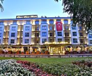
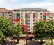
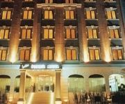
In need of a room? We compiled a list of available hotels close to the map centre further down the page.
Since you are here already, you might want to pay a visit to some of the following locations: Mahmutbey, Kemerburgaz, UEmraniye, Cekmekoey and Adalar. To further explore this place, just scroll down and browse the available info.
Local weather forecast
Todays Local Weather Conditions & Forecast: 14°C / 58 °F
| Morning Temperature | 11°C / 52 °F |
| Evening Temperature | 13°C / 56 °F |
| Night Temperature | 12°C / 54 °F |
| Chance of rainfall | 1% |
| Air Humidity | 61% |
| Air Pressure | 1013 hPa |
| Wind Speed | Moderate breeze with 12 km/h (8 mph) from South-West |
| Cloud Conditions | Overcast clouds, covering 93% of sky |
| General Conditions | Light rain |
Saturday, 20th of April 2024
11°C (52 °F)
11°C (51 °F)
Moderate rain, fresh breeze, overcast clouds.
Sunday, 21st of April 2024
15°C (60 °F)
16°C (61 °F)
Sky is clear, gentle breeze, clear sky.
Monday, 22nd of April 2024
17°C (63 °F)
17°C (62 °F)
Sky is clear, gentle breeze, clear sky.
Hotels and Places to Stay
Holiday Inn ISTANBUL CITY
Hotel Eresin Topkapi
Dosso Dossi Hotels DownTown
Akgun Istanbul
Berr Hotel
Golden Taha Hotel
REALSTAR HOTEL
Ramada Istanbul Old City
Topkapı Inter Istanbul Hotel
All Seasons Hotel
Videos from this area
These are videos related to the place based on their proximity to this place.
İstanbul Hotel Bulvar Palas, İstanbul Hotels in Old City
Since 2001, İstanbul Hotel Bulvar Palas has been sharing the special experiences, wit you esteemed guest is four stars classification. It has a good location in İstanbul hotels. It is in...
Türkei Istanbul City -Gegend um die Galata Brücke
Hier werden ein paar Impressionen aus Istanbul vorgestellt. EIne Mosche und die Gegend um die Galata Brücke, wo viele Istanbuler mitten in der Stadt fıschen.
SUENO TRAVEL AGENCY BARCELO ERESİN HOTEL
İSTANBUL İÇİ TUR TRANSFER ,BURSA,YALOVA,ABANT,EFES,CAPADOKYA TURLARI DÜZENLENİR VE ARAÇ,TEKNE ,YAT ,HELİKOPTER,TAHSİS EDİLİR .
Project Reality Türkiye Muttrah City MEC Fortress
Turkish community squad assaults and defends the Muttrah Fortress.
ISTANBUL
Istanbul the best known city in Turkey is without doubt Europe's most exotic city, and is the ideal place to escape to for a weekend city break, or a romantic weekend getaway. Istanbul may...
Istanbul Beyoğlu Area
Galata Kulesi/Galata Tower, Istiklal Caddesi / Independence Avenue and Taksim Square. The neighborhood where our apartment was. This is one of five videos on our 2009 Istanbul vacation posted...
Istanbul Intro by IstanbulHotelsResorts.com
We provide a facility to easily update, amend or cancel your hotel reservation. Our customer service representatives are on hand 24 hours a day, 7 days a week should you need us. You can contact...
Sega Dreamcast - Pro Pinball Trilogy (PAL)
Sega Dreamcast - Pro Pinball Trilogy (PAL) game intro and gameplay. This game released in PAL region only. Platform: Sega Dreamcast Publisher: Empire Interactive Europe Ltd. Developer:...
80li yıllar istanbul
1980-1990 yılları arasında İstanbulda çekilmiş fotoğraflarımdan oluşan bir gösteri.
Videos provided by Youtube are under the copyright of their owners.
Attractions and noteworthy things
Distances are based on the centre of the city/town and sightseeing location. This list contains brief abstracts about monuments, holiday activities, national parcs, museums, organisations and more from the area as well as interesting facts about the region itself. Where available, you'll find the corresponding homepage. Otherwise the related wikipedia article.
Chora Church
The Church of the Holy Saviour in Chora (Turkish Kariye Müzesi, Kariye Camii, or Kariye Kilisesi — the Chora Museum, Mosque or Church) is considered to be one of the most beautiful surviving examples of a Byzantine church. The church is situated in Istanbul, in the Edirnekapı neighborhood, which lies in the western part of the municipality of Fatih. In the 16th century, during the Ottoman era, the church was converted into a mosque and, finally, it became a museum in 1948.
Karagümrük
Karagümrük is a neighborhood in Fatih district of Istanbul, Turkey. The neighborhood also has a famous soccer team in Turkish Superleague Karagümrük Spor Kulübü. In 1958, the team qualified for the first division. However their professional performance did not last long and eventually they got relegated to the Third Division.
Samatya
Samatya (Greek: Ψαμάθεια, pr. Psamatheia) is a neighborhood of the Fatih district of Istanbul. It is located along the Marmara Sea, and borders to the west on the neighborhood of Yedikule (the "Castle of the Seven Towers"). The name originates from the Greek word Ψαμάθιον (pr. Psamathion), meaning "sandy", because of the great quantity of sand found in the neighborhood.
Column of Marcian
The Column of Marcian is a Roman honorific column erected in Constantinople by the praefectus urbi Tatianus (450-c.452) and dedicated to the Emperor Marcian (450-57). It is located in the present-day Fatih district of Istanbul. The column is not documented in any late Roman or Byzantine source and its history has to be inferred from its location, style and dedicatory inscription. The column is carved from red-grey Egyptian granite, in two sections.
Fenari Isa Mosque
Fenâri Îsâ Mosque (full name in Turkish: Molla Fenâri Îsâ Câmîi), in Byzantine times known as the Lips Monastery (Greek: Μονή του Λιβός), is a mosque in Istanbul, made of two former Eastern Orthodox churches.
Turkey
Turkey, officially the Republic of Turkey is a Eurasian country, located mostly on Anatolia in Western Asia and on East Thrace in Southeastern Europe. Turkey is bordered by eight countries: Bulgaria to the northwest; Greece to the west; Georgia to the northeast; Armenia, Iran and the Azerbaijani exclave of Nakhchivan to the east; and Iraq and Syria to the southeast. The Mediterranean Sea is to the south; the Aegean Sea is to the west; and the Black Sea is to the north.
Kefeli Mosque
The Kefeli Mosque (Turkish: Kefeli Câmîi, meaning "the mosque of the Caffariotes", after the inhabitants of the city of Caffa in Crimea, or also Kefeli Mescidi, where Mescit is the Turkish word for a small mosque) is a former Eastern Orthodox church, later jointly officiated by Roman Catholics and Armenians, and finally converted into a mosque by the Ottomans. The Catholic Church was dedicated to Saint Nicholas. Its date of dedication as Eastern Orthodox church is unknown.
Koca Mustafa Pasha Mosque
Koca Mustafa Pasha Mosque (Turkish: Koca Mustafa Paşa Camii; also named Sünbül Efendi Camii) is a former Eastern Orthodox church converted into a mosque by the Ottomans, located in Istanbul, Turkey. The church, as the adjoining monastery, was dedicated to Saint Andrew of Crete, and was named Saint Andrew in Krisei or by-the-Judgment (Greek: Μονὴ τοῦ Ἁγίου Ἀνδρέου ἐν τῇ Κρίσει, Monē tοu Hagiοu Andreοu en tē Krisei).
Sancaktar Hayrettin Mosque
Sancaktar Hayrettin Mosque (Turkish: Sancaktar Hayrettin Câmîi; also Sancaktar Hayrettin Mescidi, where Mescit is the Turkish word for a small mosque, or Sancaktar Mescidi) is part of a former Eastern Orthodox monastery converted into a mosque by the Ottomans. It is generally believed that the small building belonged to the Byzantine Monastery of Gastria (Greek: Μονῆ τῶν Γαστρίων, Monē tōn Gastríōn, meaning "Monastery of the Vases").
Mihrimah Mosque
The Mihrimah Sultan Mosque (Turkish: 'Mihrimah Sultan Camii') is an Ottoman mosque located in the Edirnekapı neighborhood near the Byzantine land walls of Istanbul, Turkey. Located on the peak of the Sixth Hill near the highest point of the city, the mosque is a prominent landmark in Istanbul.
Column of Arcadius
The column of Arcadius was a Roman triumphal column begun in 401 in the forum of Arcadius in Constantinople to commemorate Arcadius's triumph over the Goths under Gainas in 400. Arcadius died in 408, but the decoration of the column was only completed in 421, so the monument was dedicated to his successor Theodosius II.
Edirnekapı Martyr's Cemetery
The Edirnekapı Martyr's Cemetery is a burial ground located in the neighborhood of Edirnekapı, in the European part of Istanbul, Turkey. It consists of an old, historical part and a modern one.
Philopatium
Philopatium or Philopation was the name of a palace and region outside the walls of the Byzantine capital Constantinople, known for its parks and gardens. According to 11th-century accounts, it was located north of Constantinople, just outside the Blachernae walls. Competing accounts place it seaward of the Golden Gate. The place was loved by Justinian and Theodora, and served as a spring or summer retreat for the Byzantine emperors after them.
Church of St. Mary of the Spring (Istanbul)
The Monastery of the Mother of God at the Spring or simply Zoödochos Pege, is an Eastern Orthodox sanctuary in Istanbul. The present church, built in 1835, bears the same dedication as the shrine erected in this place between the end of the fifth and the beginning of the sixth century. After several renovations, this building was destroyed in the first half of the fifteenth century by the Ottomans. The complex got its name from a nearby holy spring, reputed to have healing properties.
Manastır Mosque, Istanbul
Manastır Mosque (Turkish: Manastır Mescidi; also Mustafa Çavuş Mescidi, where mescit is the Turkish word for a small mosque) is a former Eastern Orthodox church converted into a mosque by the Ottomans. Neither archeological excavations nor medieval sources have made it possible to find a satisfactory answer as to its original dedication as a church.
Balıklı, Istanbul
Balıklı is a quarter in Istanbul, Turkey. It belongs to the Zeytinburnu municipality, and is part of the Kazlıçeşme Mahalle. It is located along the Marmara Sea, and borders Istanbul's walled city on the E side, between the gates of Yedikule and Silivri. Before the rapid increase of Istanbul's population in the 1970s, Balıklı was a rural quarter.
Merkezefendi Cemetery
The Merkezefendi Cemetery is a burial ground situated in Merkezefendi neighborhood of Zeytinburnu district on the European part of Istanbul, Turkey. Many renowned intellectuals, writers and artists rest in this old cemetery covering an area of 27,800 m . The cemetery was established in the 16th century with the construction of the tomb of Merkez Efendi at this location. It was extended in the 1950s, and another cemetery, the Kozlu Cemetery was established 100 m far from this place.
Odalar Mosque
The Odalar Mosque was an Ottoman mosque in Istanbul. The building was originally a Byzantine-era Eastern Orthodox church of unknown dedication. In 1475, after the Fall of Constantinople (1453), it became a Roman Catholic church, dedicated to Saint Mary of Constantinople, until finally it was converted into a mosque by the Ottomans in 1640. The mosque was destroyed by fire in 1919, and since then has fallen into ruin. As of 2011, only some walls remain, hidden among modern buildings.
Edirnekapı, Istanbul
Edirnekapı is a neighborhood of Istanbul, Turkey. It is part of the district of Fatih and belongs to the walled city. It corresponds roughly to the central part of the sixth Hill of Istanbul, which is the highest point of the walled city. It lies south of the Blachernae section of the Walls and of the neighborhood of Ayvansaray, north-west of Karagümrük and west of Salmatomruk. The quarter corresponds to the Byzantine quarter of Deuteron.
Hadim Ibrahim Pasha Mosque
The Hadim Ibrahim Pasha Mosque (Turkish: Hadım İbrahim Paşa Camii) is an Ottoman mosque located in the Silivrikapi district of Istanbul, Turkey.
Kasim Aga Mosque, Istanbul
Kasim Ağa Mosque (Turkish: Kasım Ağa Mescidi; also Kâsım Bey Mescidi, where mescit is the Turkish word for a small mosque) is a former Byzantine building converted into a mosque by the Ottomans in Istanbul, Turkey. Neither surveying during the last restoration nor medieval sources have made it possible to find a satisfactory answer as to its origin and possible dedication.
Bogdan Saray
Boğdan Sarayi (Turkish for "Palace of Bogdania ") was an Eastern Orthodox church in Istanbul, Turkey. Erected in the Byzantine era, its original dedication is unknown. In the Ottoman era the small edifice, being dedicated to St. Nicholas of Myra, was known as Agios Nikólaos tou Bogdansarághi (Greek: Ἅγιος Νικόλαος τοῦ Βογδανσαράγι). and was part of the Istanbul residence of the Moldavian hospodar′s legation to the Ottoman Porte.
Kocamustafapaşa railway station
Kocamustafapaşa as a railway station, in the Samatya neighborhood of the Fatih district of Istanbul, Turkey, on the İstanbul-Halkalı Line.
Ese Kapi Mosque
Ese Kapi Mosque (Turkish: Ese Kapı Mescidi, where mescit is the Turkish word for a small mosque), also "Isa Kapi Mosque", meaning in English "Mosque of the Gate of Jesus", was an Ottoman mosque in Istanbul, Turkey. The building was originally a Byzantine Eastern Orthodox church of unknown dedication.
Silivrikapı Ice Skating Hall
Silivrikapı Ice Skating Hall, full name Silivrikapı Skating Hall and Recreation Center, shortly Silivrikapı Ice Rink, (Turkish: Silivrikapı Buz Pateni Salonu), is an indoor ice skating and ice hockey arena located at Silivrikapı neighborhood of Fatih district in Istanbul, Turkey. It was opened in September 2009. The arena consists of an Olympic-size rink of 1,740 m with a seating capacity of 900 people, and another one of 600 m for 200 spectators used as training rink.


