Safety Score: 4,0 of 5.0 based on data from 9 authorites. Meaning please reconsider your need to travel to Switzerland.
Travel warnings are updated daily. Source: Travel Warning Switzerland. Last Update: 2024-04-19 08:03:45
Delve into Opfershofen
Opfershofen in Weinfelden District (Thurgau) is a town located in Switzerland about 91 mi (or 147 km) north-east of Bern, the country's capital town.
Time in Opfershofen is now 11:59 PM (Friday). The local timezone is named Europe / Zurich with an UTC offset of 2 hours. We know of 9 airports closer to Opfershofen, of which 3 are larger airports. The closest is airport we know is Friedrichshafen Airport in Germany in a distance of 17 mi (or 28 km). The closest airport in Switzerland is St Gallen Altenrhein Airport in a distance of 19 mi (or 28 km), North-East. Besides the airports, there are other travel options available (check left side).
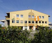
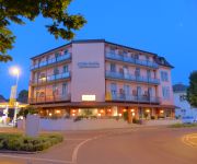
There are several Unesco world heritage sites nearby. The closest heritage site is Monastic Island of Reichenau in Germany at a distance of 11 mi (or 18 km). The closest in Switzerland is Abbey of St Gall in a distance of 13 mi (or 18 km), North-West. We saw 5 points of interest near this location. In need of a room? We compiled a list of available hotels close to the map centre further down the page.
Since you are here already, you might want to pay a visit to some of the following locations: Weinfelden, Kreuzlingen, Konstanz, Gottlieben and Reichenau. To further explore this place, just scroll down and browse the available info.
Local weather forecast
Todays Local Weather Conditions & Forecast: 7°C / 45 °F
| Morning Temperature | 1°C / 33 °F |
| Evening Temperature | 5°C / 42 °F |
| Night Temperature | 5°C / 41 °F |
| Chance of rainfall | 13% |
| Air Humidity | 66% |
| Air Pressure | 1016 hPa |
| Wind Speed | Fresh Breeze with 16 km/h (10 mph) from East |
| Cloud Conditions | Overcast clouds, covering 100% of sky |
| General Conditions | Moderate rain |
Saturday, 20th of April 2024
4°C (40 °F)
2°C (35 °F)
Rain and snow, gentle breeze, overcast clouds.
Sunday, 21st of April 2024
4°C (38 °F)
-2°C (28 °F)
Rain and snow, gentle breeze, overcast clouds.
Monday, 22nd of April 2024
6°C (44 °F)
1°C (34 °F)
Rain and snow, light breeze, scattered clouds.
Hotels and Places to Stay
Thurgauerhof
Gasthof Eisenbahn
Ziil
Plaza
Rössli
Videos from this area
These are videos related to the place based on their proximity to this place.
Drohne Copter Luftaufnahmen von FlyingMOVIECOPTER Switzerland
Drohne Copter Luftaufnahmen von FlyingMOVIECOPTER Switzerland.
Kawasaki W800 Gentlemen Cup 2012 Bürglen
Video vom ersten Rennen des Kawasaki W800-Cup. Der Film zeigt eine gekürzte Fassung des 2. Laufes in Bürglen TG.
REXLI fliegt in Guntershausen
REXLI flog am 29. Oktober in Guntershausen bei Berg im Kanton Thurgau. Gruss Daniel.
Videos provided by Youtube are under the copyright of their owners.
Attractions and noteworthy things
Distances are based on the centre of the city/town and sightseeing location. This list contains brief abstracts about monuments, holiday activities, national parcs, museums, organisations and more from the area as well as interesting facts about the region itself. Where available, you'll find the corresponding homepage. Otherwise the related wikipedia article.
Altishausen
Altishausen is a village and former municipality in the canton of Thurgau, Switzerland. It was first recorded in year 1159 as Altinshusin. The municipality had 120 inhabitants in 1850, which increased to 155 in 1950. After a decline to 111 in 1970 it rose to 161 in 1990. In 1996 the municipality was merged with the other, neighboring municipalities Alterswilen, Dotnacht, Ellighausen, Hugelshofen, Lippoldswilen, Neuwilen and Siegershausen to form a new and larger municipality Kemmental.
Dotnacht
Dotnacht is a village and former municipality in the canton of Thurgau, Switzerland. It was first recorded in year 824 as Tottinheiche. The municipality also contained the village Engelswilen, Aufhäusern, Altshof and others. It had 327 inhabitants in 1850, which decreased to 281 in 1900. After an increase to 303 in 1950 it declined again, to 244 in 1990.
Buhwil
Buhwil is a village and former municipality in the canton of Thurgau, Switzerland. It is first mentioned in 838 as Puabinwilare. The municipality had 320 inhabitants in 1850, which decreased to 283 in 1900 and 282 in 1950. It then increased somewhat, to 190 in 1980 and 287 in 1990. In 1996 the municipality was merged with the other, neighboring municipalities Kradolf, Neukirch an der Thur and Schönenberg an der Thur to form a new and larger municipality Kradolf-Schönenberg.
Kradolf
Kradolf is a village and former municipality in the canton of Thurgau, Switzerland. It was first recorded in year 883 as Chreinthorf. The municipality had 147 inhabitants in 1850, which decreased to 228 in 1880, 649 in 1900 and 1,064 in 1920. It then dropped to 983 in 1950 before increasing again, to 1,183 in 1990.
Schönenberg an der Thur
Schönenberg an der Thur is a village and former municipality in the canton of Thurgau, Switzerland. In 1996 the municipality was merged with the other, neighboring municipalities Buhwil, Kradolf and Neukirch an der Thur to form a new and larger municipality Kradolf-Schönenberg. Schönenberg an der Thur is first mentioned in 883 as Thuruftisthorf. In 1359 it was mentioned as Schönnenberg. The population in 1831 was 190 people and by 1870 it had increased to 254.
Altshof
Altshof is a village in the canton of Thurgau, Switzerland. It was first recorded in year 775 as Adalolteshoba. Altshof is located in the former municipality Dotnacht. In 1996 Dotnacht municipality merged with its neighbor to form a new and larger municipality Kemmental.


