Safety Score: 4,0 of 5.0 based on data from 9 authorites. Meaning please reconsider your need to travel to Switzerland.
Travel warnings are updated daily. Source: Travel Warning Switzerland. Last Update: 2024-04-19 08:03:45
Delve into Sur
Sur in Kanton Graubünden is located in Switzerland about 108 mi (or 173 km) east of Bern, the country's capital town.
Current time in Sur is now 12:03 AM (Saturday). The local timezone is named Europe / Zurich with an UTC offset of 2 hours. We know of 11 airports close to Sur, of which 5 are larger airports. The closest airport in Switzerland is Samedan Airport in a distance of 12 mi (or 19 km), East. Besides the airports, there are other travel options available (check left side).
There are several Unesco world heritage sites nearby. The closest heritage site is Rhaetian Railway in the Albula / Bernina Landscapes in Italy at a distance of 10 mi (or 17 km). The closest in Switzerland is Swiss Tectonic Arena Sardona in a distance of 33 mi (or 17 km), East. We encountered 1 points of interest near this location. If you need a hotel, we compiled a list of available hotels close to the map centre further down the page.
While being here, you might want to pay a visit to some of the following locations: Tiefencastel, Silvaplana, Promontogno, Villa and Villa di Chiavenna. To further explore this place, just scroll down and browse the available info.
Local weather forecast
Todays Local Weather Conditions & Forecast: -2°C / 29 °F
| Morning Temperature | -7°C / 19 °F |
| Evening Temperature | -1°C / 30 °F |
| Night Temperature | -1°C / 30 °F |
| Chance of rainfall | 3% |
| Air Humidity | 62% |
| Air Pressure | 1015 hPa |
| Wind Speed | Gentle Breeze with 6 km/h (3 mph) from South |
| Cloud Conditions | Overcast clouds, covering 90% of sky |
| General Conditions | Snow |
Saturday, 20th of April 2024
-3°C (27 °F)
-9°C (15 °F)
Snow, gentle breeze, overcast clouds.
Sunday, 21st of April 2024
-3°C (26 °F)
-8°C (18 °F)
Snow, gentle breeze, overcast clouds.
Monday, 22nd of April 2024
-4°C (26 °F)
-9°C (15 °F)
Snow, light breeze, broken clouds.
Hotels and Places to Stay
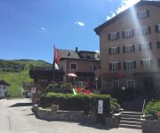
Solaria
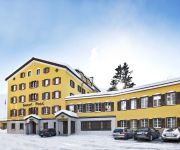
Post
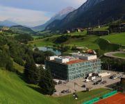
Cube Savognin
Videos from this area
These are videos related to the place based on their proximity to this place.
eHeinz épisode 54: Parc Ela -- joyau naturel au cœur des Gris
Le village montagnard de Savognin, sur le Col du Julier. La porte d'accès au plus grand parc régional naturel de Suisse : le parc Ela. Plus d'info sur le Parc Ela Plus d'info sur Savognin...
Die Schweiz: Ein Genuss für die Sinne
Video-Impressionen von mehreren Stationen im Land ! Musik:http://dennis-hart.com.
eHeinz episodio 54: Parc Ela -- Gioiello naturale nel cuore d
Il vecchio paese montano sul passo di Julier. Un portale sul grande parco regionale della Svizzera. Il Parc Ela. Più informazioni sul Parc Ela Più informazioni sul Savognin Più informazion...
Vakantie naar Zwitserland 2011 (part1/2)
Om 08:03 uur vertrokken wij uit Rotterdam naar Zwitserland. Ons doel was om zo zuinig mogelijk naar Zwitserland te rijden. In het begin zaten wij op een verbruik van 5,8 op 100 km. Bij Venlo...
Savognin-Schlittada Run 2012/2013
Ort: Savognin (CH) Musik: Schlittada (mit dem Magix Musicmaker) es sind nur Bilder aus den beiden Schlittada-Run Strecken zu sehn.
GoPro Snowbike Crash (1080p)
Kleines Video von unserm Snowbike Ausflug ;) Kamera: gopro HD Hero 2 Musik : http://www.youtube.com/watch?v=e11jm41zuti.
Videos provided by Youtube are under the copyright of their owners.
Attractions and noteworthy things
Distances are based on the centre of the city/town and sightseeing location. This list contains brief abstracts about monuments, holiday activities, national parcs, museums, organisations and more from the area as well as interesting facts about the region itself. Where available, you'll find the corresponding homepage. Otherwise the related wikipedia article.
Rona, Switzerland
Rona is situated beside the Julier river, the village consists of three parts, the old lower village (Rona), the upper village (Ruegna) and the new lower village (Rieven). There is a church in the upper village and two pubs/restaurants in the old lower village. The valley in which the village lies was chosen as the site of a hydroelectric dam but, following local protest, the village was spared and the dam moved upstream to Mamorera.
Lai da Marmorera
Lai da Marmorera is a reservoir in the Grisons, Switzerland. It is part of the Parc Ela nature park. The lake with a surface area of 1.41 km² formed after the completion of the Marmorera dam in 1954 when the old village of Marmorera was flooded. The village was rebuilt above the lake. The lake is flanked on one side by the route of the Julier Pass.
Lai Blos
Lai Blos or Lais Blos are two small lakes on Alp Flix, at an elevation of 1960 m, in the Grisons, Switzerland. They are located near to Lai Neir. The alp is listed in the Inventory of Mire Landscapes of Particular Beauty and National Importance.
Lai Neir (Alp Flix)
Lai Neir is a small lake on Alp Flix, in the Grisons, Switzerland. It is listed in the Inventory of Raised and Transitional Bogs of National Importance. Lai Neir and Lai Blos are part of Alp Flix, a site listed in the Inventory of Mire Landscapes of Particular Beauty and National Importance.
Lai Neir
Marmels Castle
Marmels Castle German: Burg Marmels is a ruined castle in the municipality of Marmorera in the district of Albula in the canton of Graubünden in Switzerland.


