Safety Score: 4,0 of 5.0 based on data from 9 authorites. Meaning please reconsider your need to travel to Switzerland.
Travel warnings are updated daily. Source: Travel Warning Switzerland. Last Update: 2024-04-23 08:18:23
Delve into Monti di Spina di Sotto
The district Monti di Spina di Sotto of in Lugano District (Canton Ticino) is a subburb in Switzerland about 90 mi south-east of Bern, the country's capital town.
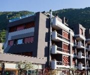
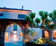
If you need a hotel, we compiled a list of available hotels close to the map centre further down the page.
While being here, you might want to pay a visit to some of the following locations: Curiglia, Veddasca, Lugano, Bellinzona and Pura. To further explore this place, just scroll down and browse the available info.
Local weather forecast
Todays Local Weather Conditions & Forecast: 13°C / 55 °F
| Morning Temperature | 6°C / 42 °F |
| Evening Temperature | 12°C / 53 °F |
| Night Temperature | 4°C / 40 °F |
| Chance of rainfall | 0% |
| Air Humidity | 34% |
| Air Pressure | 1007 hPa |
| Wind Speed | Light breeze with 5 km/h (3 mph) from South |
| Cloud Conditions | Overcast clouds, covering 100% of sky |
| General Conditions | Overcast clouds |
Wednesday, 24th of April 2024
15°C (59 °F)
5°C (41 °F)
Sky is clear, light breeze, clear sky.
Thursday, 25th of April 2024
15°C (59 °F)
6°C (43 °F)
Sky is clear, light breeze, clear sky.
Friday, 26th of April 2024
10°C (51 °F)
9°C (48 °F)
Light rain, light breeze, overcast clouds.
Hotels and Places to Stay
BOUTIQUE-HOTEL Remorino
Guesthouse Arosio B&B
Rotonda
Giardino Lago
Videos from this area
These are videos related to the place based on their proximity to this place.
MuCAR-3 at C-Elrob 2007, Monte Ceneri, Switzerland
MuCAR-3 (Munich Cognitive Autonomous Robot Car) at "Autonomous Navigation" Scenario of Civilian Land Robot Trial C-ELROB 2007 in August 2007, taking place on Monte Ceneri, Switzerland.
Boilover @ Quartino
Dimostrazione di cosa succede cercando di spegnere con dell'acqua (mezzo bicchiere) una pentola d'olio in fiamme... Per la dimostrazione è stato ricreato un modello che simula un normale piano...
Team Axo Pro-Gest__Monte Tamaro 2012.mov
Team Axo Pro-Gest at Monte Tamaro con.. Br1 Zanchi, Andrea Moce e Francy Colombo(me) Sorry but il video è un po' mosso per colpa della videocamera rotta, filmato ed editato da me! enjoy it!
Streckenbesichtigung mit Pacal Meyer beim MTB-Rennen in Rivera (Monte Tamaro)
I created this video with the YouTube Video Editor (http://www.youtube.com/editor)
Videos provided by Youtube are under the copyright of their owners.
Attractions and noteworthy things
Distances are based on the centre of the city/town and sightseeing location. This list contains brief abstracts about monuments, holiday activities, national parcs, museums, organisations and more from the area as well as interesting facts about the region itself. Where available, you'll find the corresponding homepage. Otherwise the related wikipedia article.
Maggia (river)
The Maggia is a river in the Swiss canton of Ticino. The springs are near the Cristallina mountain and the river runs through the Val Sambuco, the Val Lavizzara, and the Valle Maggia, and enters Lago Maggiore between Ascona and Locarno. The village Maggia is situated on the river. The river is used for hydroelectric power production, e.g. with the dams of Lago del Narèt and Lago del Sambuco near the sources. The Maggia river is a popular scuba diving spot due to its crystal clear waters.
Monte Ceneri transmitter
The Monte Ceneri transmitter was first established as the nationwide medium-wave radio transmission station for Italian-speaking Switzerland in 1933. Located on Monte Ceneri in Ticino, it broadcast on a frequency of 558 kHz.
Dalle Molle Institute for Artificial Intelligence Research
The Dalle Molle Institute for Artificial Intelligence Research (Italian: Istituto Dalle Molle di Studi sull'Intelligenza Artificiale; IDSIA) was founded in 1988 by the private Dalle Molle foundation. In 2000 it became a public research institute, affiliated with the University of Lugano and SUPSI in Ticino, Switzerland. It has been ranked as one of the world's top ten AI labs, and one of the world's top four labs in the field of biologically inspired AI.
Ceneri Base Tunnel
The Ceneri Base Tunnel (CBT) is a railway tunnel under construction in Switzerland's Canton Ticino. It will pass under Monte Ceneri between Camorino in the Magadino Flat and Vezia near Lugano. It is another part of the Swiss AlpTransit initiative NRLA. On completion, the CBT will be an important feeder in the south for the Gotthard Base Tunnel as the existing, proportionally steep track over Monte Ceneri isn't suitable for high speed rail or heavy freight trains.
Breno, Ticino
Breno is a village and former municipality in the canton of Ticino, Switzerland. In 2005 the municipality was merged with the other, neighboring municipalities Arosio, Fescoggia, Mugena and Vezio to form a new and larger municipality Alto Malcantone.
Fescoggia
Fescoggia is a village and former municipality in the canton of Ticino, Switzerland. In 2005 the municipality was merged with the other, neighboring municipalities Arosio, Breno, Mugena and Vezio to form a new and larger municipality Alto Malcantone.
Mugena
Mugena is a village and former municipality in the canton of Ticino, Switzerland. In 2005 the municipality was merged with the other, neighboring municipalities Arosio, Breno, Fescoggia and Vezio to form a new and larger municipality Alto Malcantone.
Vezio
Vezio is a village and former municipality in the canton of Ticino, Switzerland. In 2005 the municipality was merged with the other, neighboring municipalities Arosio, Breno, Fescoggia and Mugena to form a new and larger municipality Alto Malcantone.
Arosio, Switzerland
Arosio is a village and former municipality in the canton of Ticino, Switzerland. In 2005 the municipality was merged with the other, neighboring municipalities Breno, Fescoggia, Mugena and Vezio to form a new and larger municipality Alto Malcantone.
Lago di Vogorno
Lago di Vogorno is a lake near Tenero, in Ticino, Switzerland. The reservoir on the Verzasca river is formed by the Verzasca Dam, built 1961-1965. The water surface area is 1.68 km².
Lago d'Origlio
Lago d'Origlio is a lake in the municipality of Origlio, in Ticino, Switzerland.
Berzona
Berzona is a village and former municipality in the canton of Ticino, Switzerland. In 2001 the municipality was merged with the other, neighboring municipalities Auressio and Loco to form a new and larger municipality Isorno.
Campestro
Campestro is a village and former municipality in the district of Lugano in the canton of Ticino, Switzerland. Campestro was a municipality of its own until 1976, when it was incorporated into its neighboring municipality Tesserete. In turn, Tesserete municipality merged with its neighbors in 2001 to form a new and larger municipality Capriasca.
Cagiallo
Cagiallo is a village and former municipality in the canton of Ticino, Switzerland. In 2001 the municipality was merged with the other, neighboring municipalities Lopagno, Roveredo, Sala Capriasca, Tesserete and Vaglio to form a new and larger municipality Capriasca.
Lopagno
Lopagno is a village and former municipality in the canton of Ticino, Switzerland. In 2001 the municipality was merged with the other, neighboring municipalities Cagiallo, Roveredo, Sala Capriasca, Tesserete and Vaglio to form a new and larger municipality Capriasca.
Sala Capriasca
Sala Capriasca is a village and former municipality in the canton of Ticino, Switzerland. In 2001 the municipality was merged with the other, neighboring municipalities Cagiallo, Lopagno, Roveredo, Tesserete and Vaglio to form a new and larger municipality Capriasca.
Roveredo, Ticino
Roveredo is a village and former municipality in the canton of Ticino, Switzerland. In 2001 the municipality was merged with the other, neighboring municipalities Cagiallo, Lopagno, Sala Capriasca, Tesserete and Vaglio to form a new and larger municipality Capriasca.
Tesserete
Tesserete is a village and former municipality in the canton of Ticino, Switzerland. In 1976 the neighboring municipality Campestro was incorporated into Tesserete. In 2001 Tesserete municipality was merged with the other, neighboring municipalities Cagiallo, Lopagno, Roveredo, Sala Capriasca and Vaglio to form a new and larger municipality Capriasca.
Vaglio
Vaglio is a village and former municipality in the canton of Ticino, Switzerland. In 2001 the municipality was merged with the neighboring municipalities of Cagiallo, Lopagno, Roveredo, Sala Capriasca, and Tesserete to form a new municipality, Capriasca.
Locarno Airport
Locarno Airport,(Flugplatz Locarno),, is an airport located in the city of Locarno, Ticino, Switzerland. It is a mixed civil and military airport. It is located in the area of Stallone, which is 7 kilometers from the Locarno City center. Three runways are present in the Airport, and one terminal too. The airport is accessible by road by the Cantonale Street which connects to Route 13, which leads to a highway which bypasses the city and many interchanges help to get on and off the highway.
Cadenazzo railway station
Cadenazzo railway station is a railway station in Ticino, Switzerland. It is located on the Locarno branch of the Gotthard railway, and is the junction point with that railway's Pino branch. The station serves the municipality of Cadenazzo.
Lamone-Cadempino railway station
Lamone-Cadempino is a railway station in the Swiss canton of Ticino. The station is located on the border between the municipalities of Lamone and Cadempino, and serves both. The station is on the Swiss Federal Railways Gotthard railway, between Bellinzona and Lugano.
Taverne-Torricella railway station
Taverne-Torricella is a railway station in the Swiss canton of Ticino. The station is located on the border between the municipalities of Torricella-Taverne, Lamone and Bedano. The station is on the Swiss Federal Railways Gotthard railway, between Bellinzona and Lugano.
Mezzovico railway station
Mezzovico is a railway station in the Swiss canton of Ticino and municipality of Mezzovico-Vira. The station is on the Swiss Federal Railways Gotthard railway, between Bellinzona and Lugano. The station is served by trains on line S10 of the Treni Regionali Ticino Lombardia (TILO), which operate every half hour between Bellinzona, Lugano and Chiasso, with some trains extending northwards to Airolo and southwards to Milan.
Rivera-Bironico railway station
Rivera-Bironico is a railway station in the Swiss canton of Ticino and municipality of Monteceneri. The station is on the Swiss Federal Railways Gotthard railway, between Bellinzona and Lugano. It takes its name from the nearby villages of Rivera and Bironico. The station is served by trains on line S10 of the Treni Regionali Ticino Lombardia (TILO), which operate every half hour between Bellinzona, Lugano and Chiasso, with some trains extending northwards to Airolo and southwards to Milan.


